Nepal – Everest Base Camp
Visited: December 2025
This was our second visit to the beautiful country of Nepal. This time, we ventured further from Kathmandu with the goal of getting up close to Mount Everest. This is a day-by-day account of how we walked ourselves through the Everest region in December — sometimes following a plan, often changing it, and usually stopping for coffee whenever we could. It’s written partly as a memory for ourselves and partly for anyone curious about what it’s like to hike here in the off-season: the weather, the trails, the teahouses, and how it feels when things don’t always go quite as expected.
Day 1: Tired but in Nepal
Our first day in Nepal was simple, mainly because we were absolutely knackered from travelling. Not that the flight itself was particularly long, but by sheer coincidence we had been on a school trip to Georgia the week before. We landed back home at 23:30 the night before, didn’t leave the airport until close to 1 am because we had to dismiss all the students (thank you, Anthony, for letting us leave a bit earlier), and then had to be back at the airport again at 7 am.
Our bags had been packed before we left for Georgia, so we only needed a few last-minute adjustments. We slept for about three to four hours and then took a taxi back to the airport. We were so tired that we arrived only two hours before departure, didn’t even consider going to the lounge, and just grabbed a coffee instead. It was also the first day of the winter break, so the airport was packed.
When we arrived in Kathmandu, we sorted our visas on arrival, paid, and changed $100 to have some cash for a taxi. The current rate was 144 NPR to 1 USD, and we got 142 at the airport—with a wee commission. Because we had to wait a bit at customs, Clare was able to use a local taxi app called inDrive and arrange a cheap ride to our hotel. We stayed at Hotel Sapana Garden at the edge of Thamel, and the taxi cost us 700 rupees.
Note
Nepal has a pretty straightforward visa-on-arrival process. You can use kiosks at customs to fill out the application and then pay in cash at a counter. If you want to speed things up, you can pre-fill the application online before arrival—I think you can even pay online now. The prices were $30 for 15 days, $50 for 30 days, and $125 for 90 days.
One thing you notice very quickly in Kathmandu is how hard it is to breathe—not because of the elevation, but because of the fumes in the air. The city doesn’t look particularly dirty, and I actually quite like it, but the air can feel almost choking.
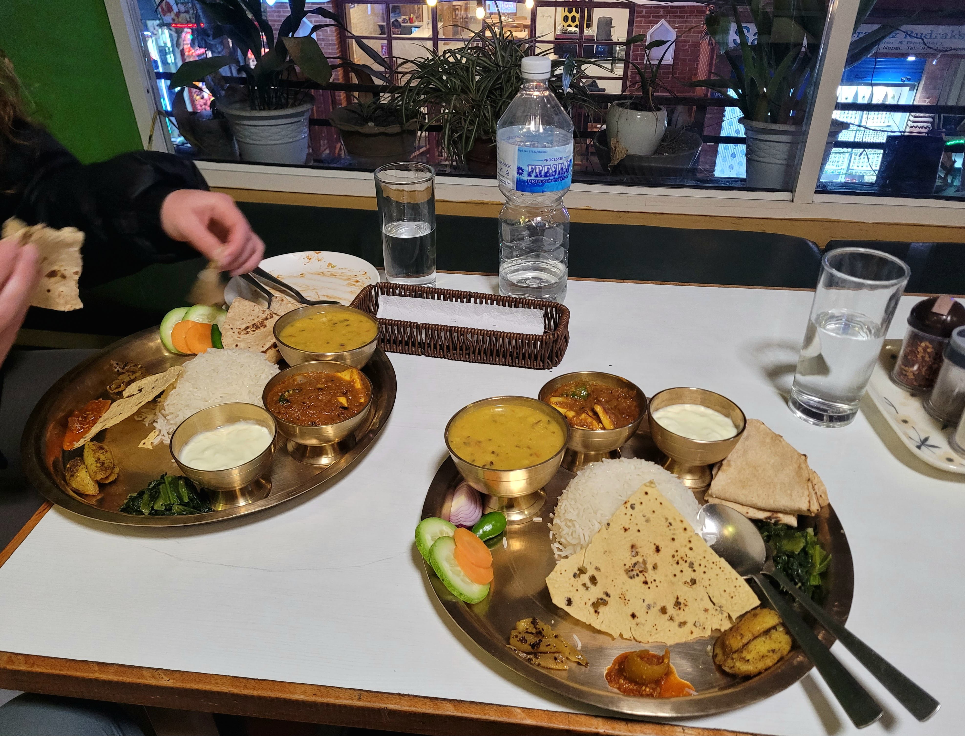
We checked in, logged onto the Wi-Fi, looked up nearby restaurants, and picked a local place just a short walk away. We really didn’t want to do anything else that night except eat. We got paneer dal bhat each and chilli momos, and ended up chatting with a fella named Michael, who was also heading out on the Everest trek on Saturday, albeit on a different flight.
Day 2: Chores in Kathmandu
We slept until after eight o’clock and luckily managed to get some last-minute scraps for breakfast. Today was fully dedicated to getting everything ready.
We started by looking for a money exchange. We spotted a slightly better rate than at the airport—142.51 rupees to the dollar with no commission—but kept walking, convinced we’d find something even better. Eventually we wandered right out of Thamel and suddenly there were no exchanges to be seen, so we had to double back. As we walked back, the rates started changing, and in some places the “good” rate had dropped to 141.87. Luckily, we still found a guy offering the old rate, so we exchanged $1200 in one go. We didn’t want to have to exchange again, needed cash for the day, and hoped the leftovers would be enough for the trek.
Next, we walked about two kilometres to the Nepal Tourism Board building to sort out trekking permits for the Everest region. There we found out that we could only get one of the two permits (the national park one) in Kathmandu, and that the second would be issued on the trail. We more or less knew this already, but wanted to be sure—last time we were in Nepal, we also needed the TIMS permit, which could only be bought there.
Note
The permits you need are the Sagarmatha National Park Entry Permit and the Khumbu Pasang Lhamu Rural Municipality Entry Permit. Each costs 3,000 NPR and must be paid in cash. Both permits can be obtained on the trail, and the TIMS permit is no longer required for the EBC trek.
Since it was still early and we didn’t have much else to do until some shopping later, we decided to visit Patan Durbar Square. It was about a five-kilometre walk, which at least gave us a chance to experience a bit more of Kathmandu—and we hadn’t been in this part of the city since 2021.
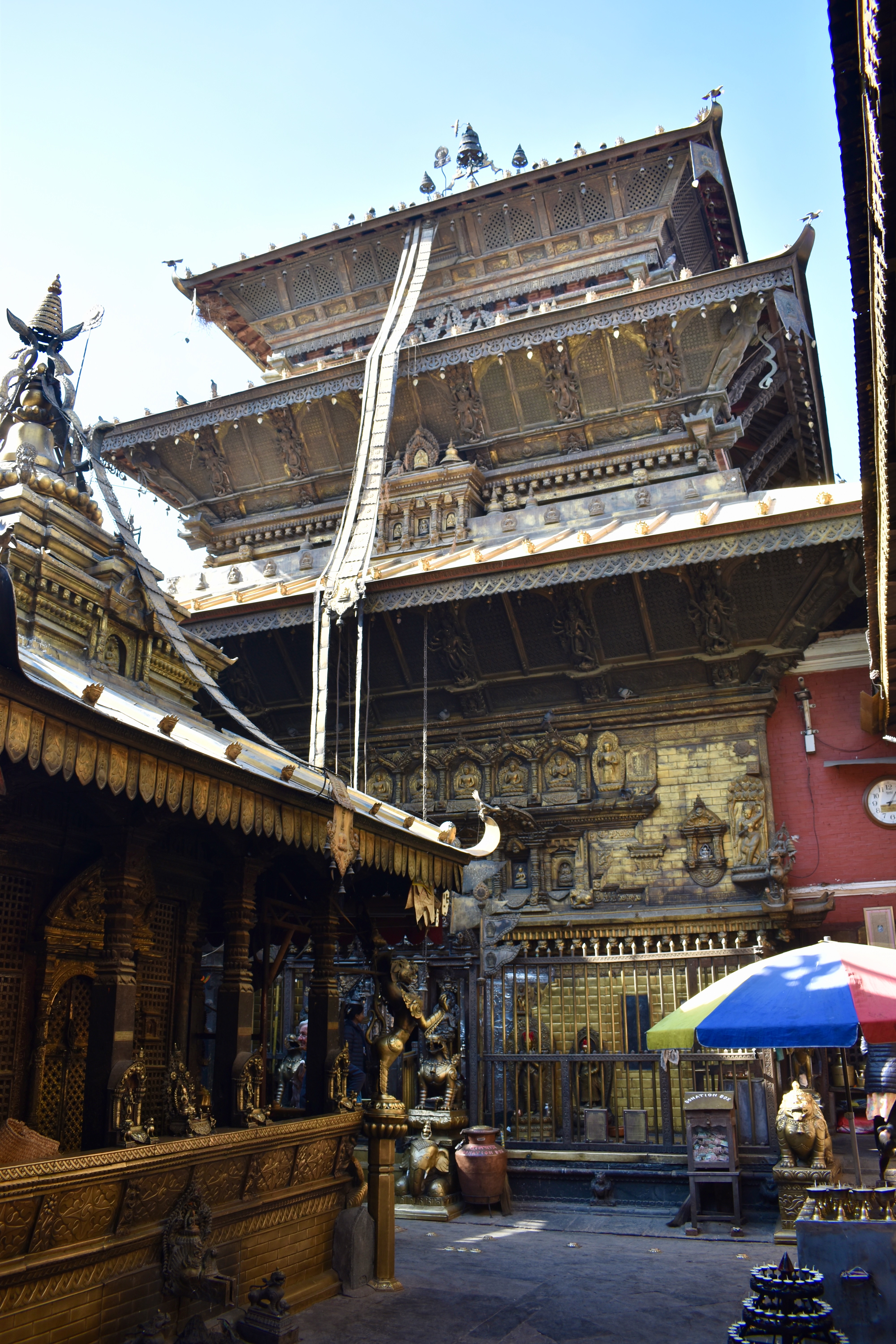
Along the way, we passed a few small temples and stopped at the Golden Temple (Hiranya Varna Mahavihar). The square advertised an entry fee of 1,000 rupees for tourists, but there was no booth or anyone asking for money. So we strolled through, took a few photos, and stopped for coffee and ice cream.
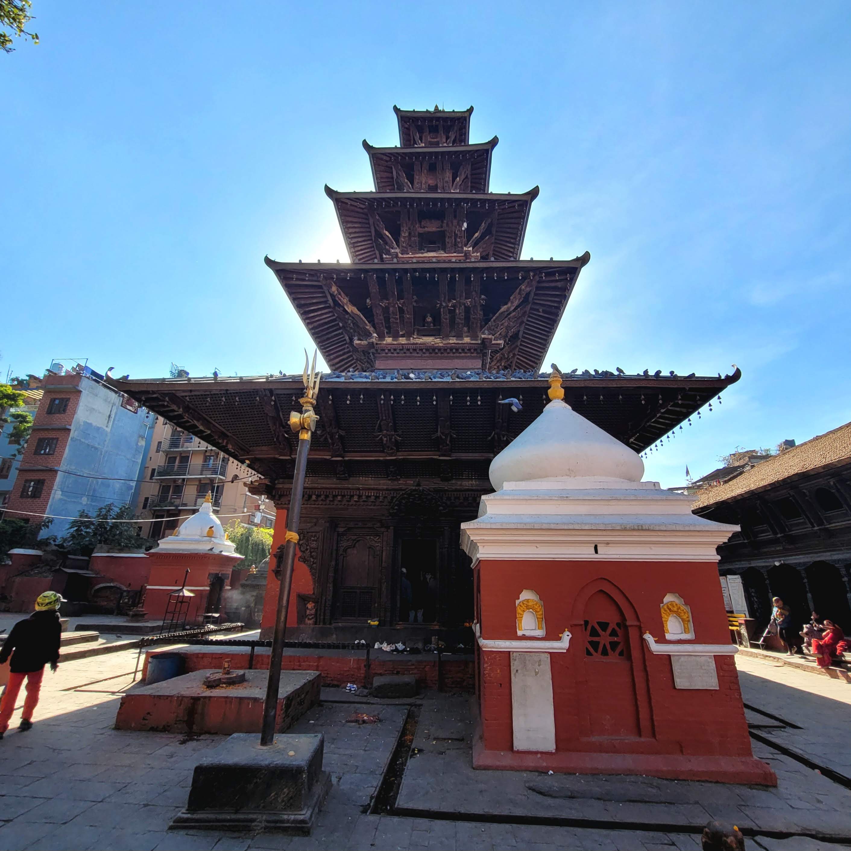
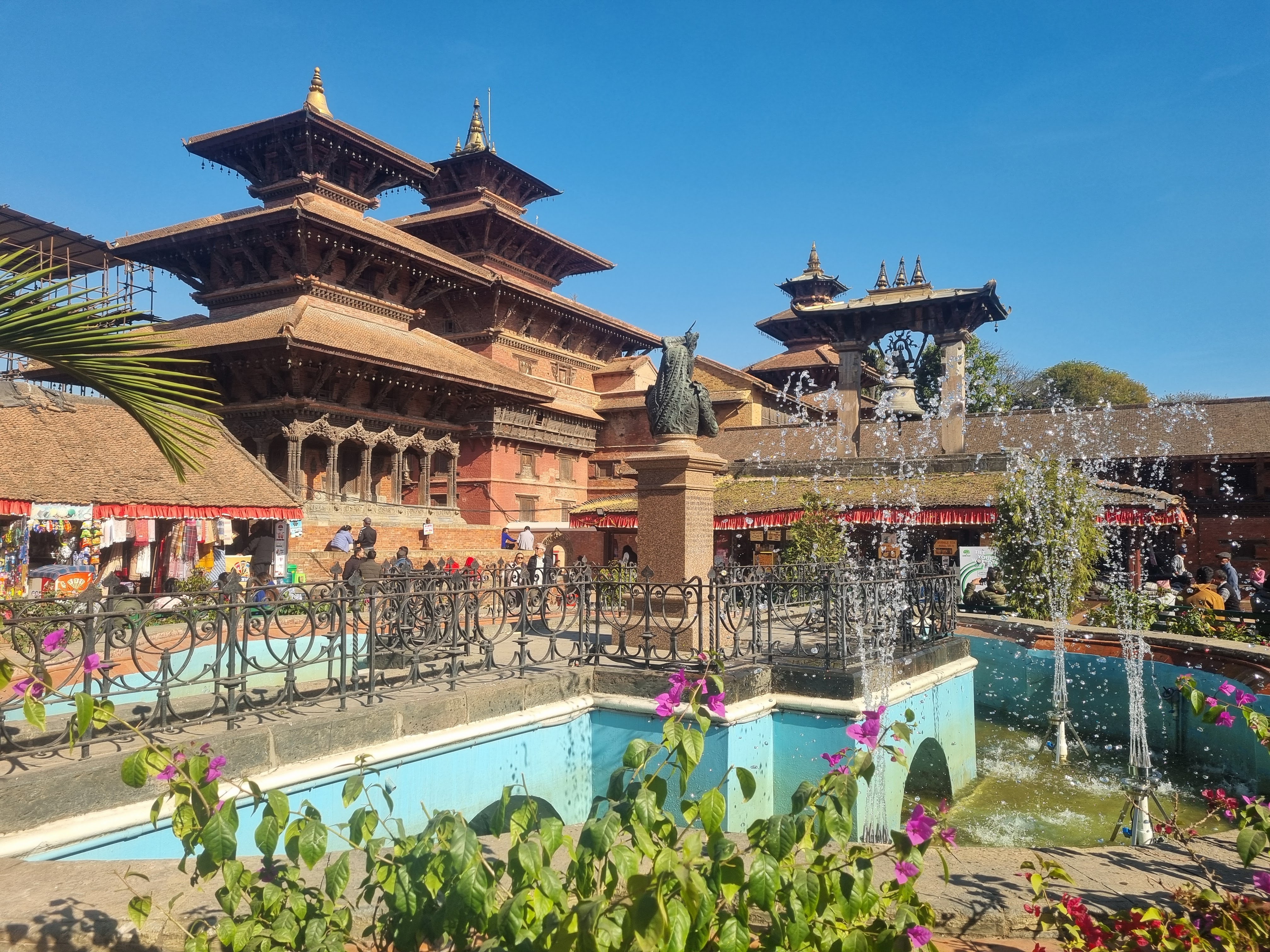
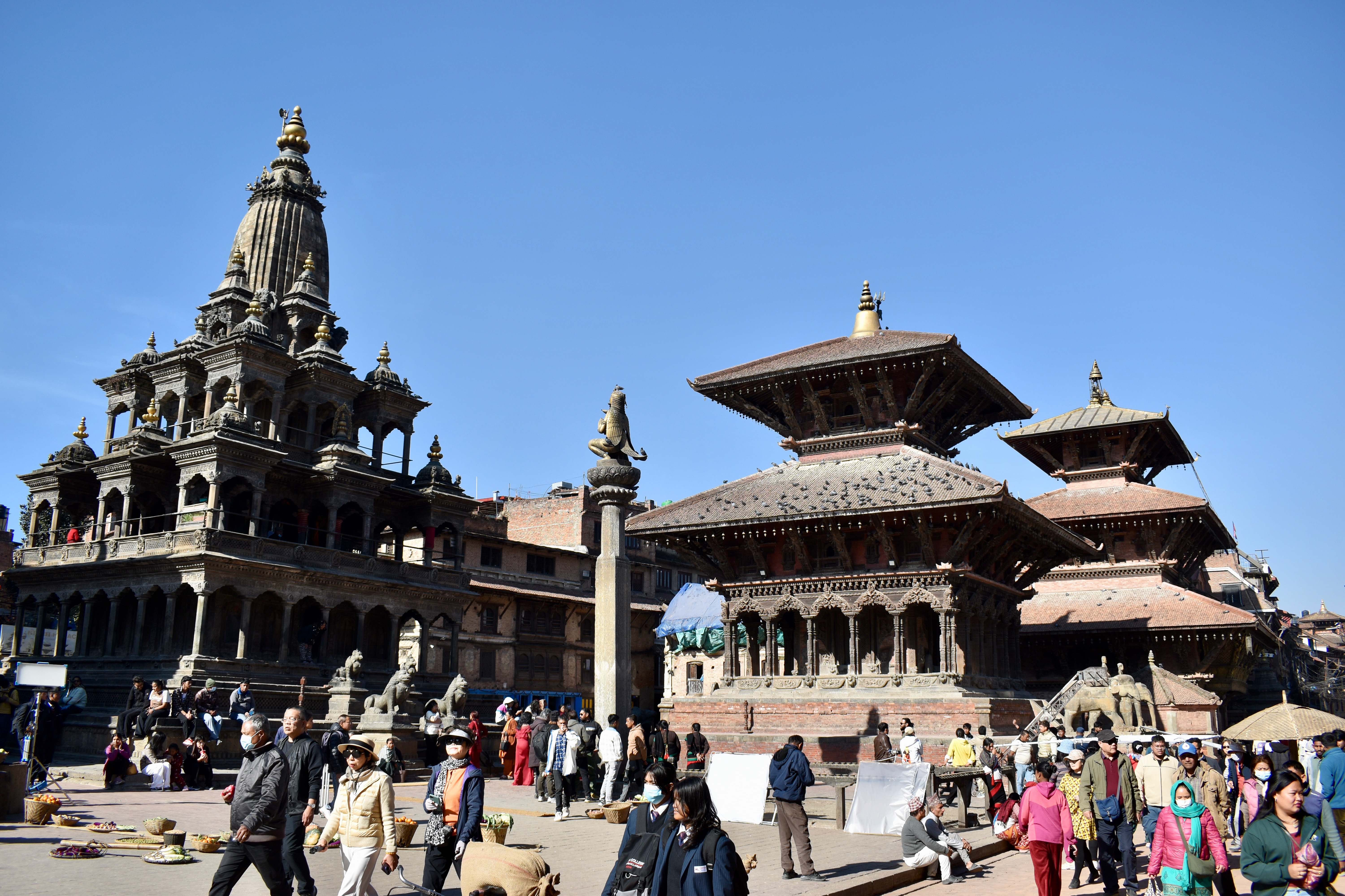
We then walked back towards Thamel, coming in from the south via Basantapur Durbar Square. Here, we were asked to pay the 1000-rupee entry fee straight away. Since we’d been there before, we turned back and walked around instead. Back in Thamel, we checked out a few shops—there’s no shortage of nice hiking gear—and made a mental note of things we might buy on the way back. The only thing we actually needed was a pair of microspikes, since I’d lost mine in Canada. We found a decent pair for about $14.
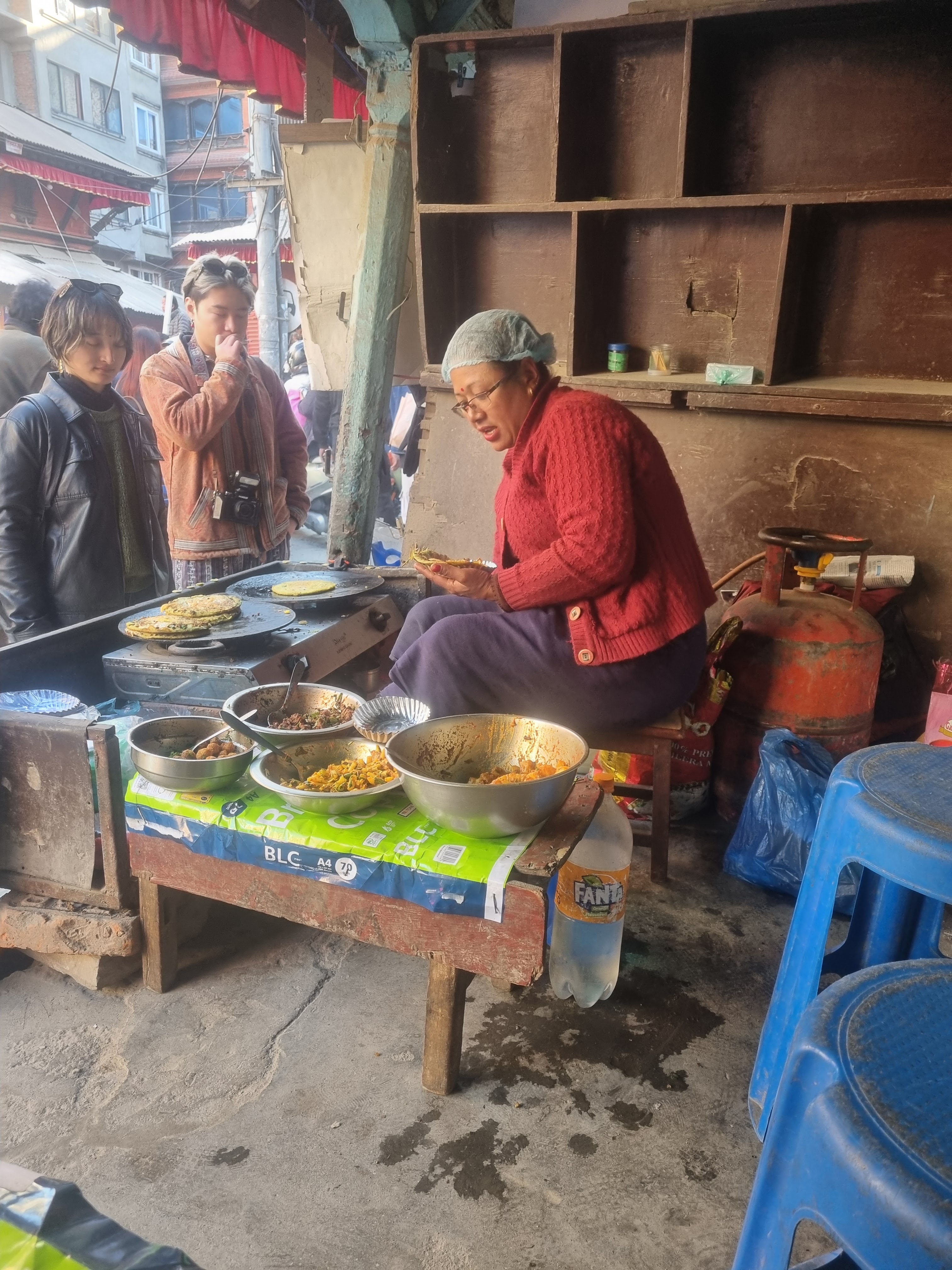
On the way back to the hotel, we picked up a small bottle of whisky for the trek and some snacks. Back in the room, we packed everything, called home to let people know we might be unreachable for a while, and then headed out for dinner. We stopped at a small corner place and ordered paneer khadai, dal makhani, chana masala, and egg biryani. It was a lot of food, and while everything tasted fairly similar, it was all generously coated in ghee.
Day 3: On the way we go!
We had an early alarm because our flight to Lukla—the entry point to the Everest region—was scheduled for 6 am.
Note
It is possible to reach the region by bus or jeep and then hike up to Lukla, but that would require an additional two to three days, which wasn’t possible for us. In peak season, due to high demand, flights to Lukla depart from Ramechhap (Manthali Airport), about a four- to five-hour drive from Kathmandu.
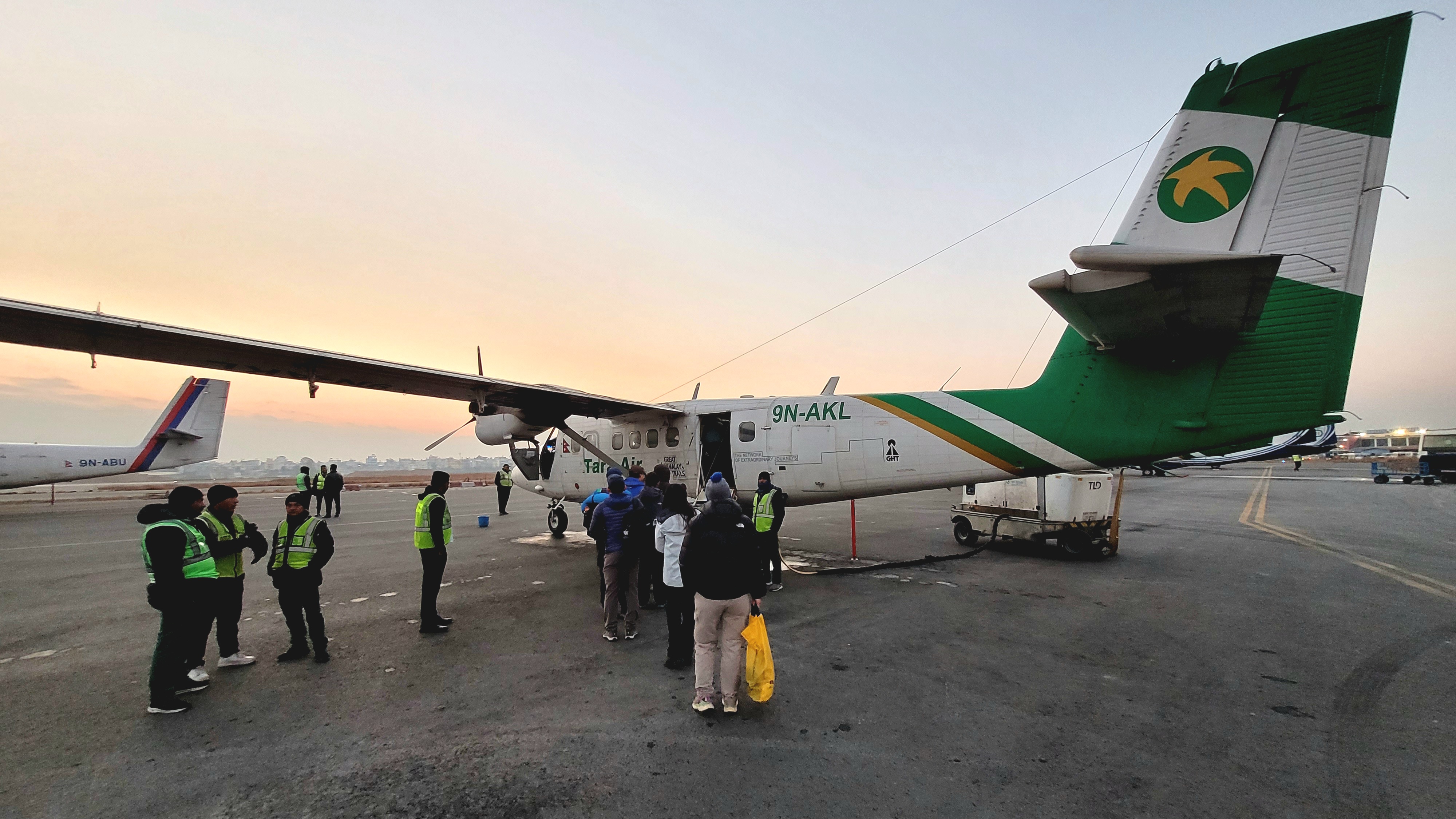
Since we were trekking in December, which is off-season in Nepal due to the cold, our flight departed directly from Kathmandu. We arrived at the airport two hours early, only to discover that we were almost the first ones there—the airport doesn’t even open until 5 am.
We were a wee bit nervous because we couldn’t find our Tara Air flight on any online platform or even on the Kathmandu airport website. Once we reached the check-in hall, though, everything went smoothly. They weighed our rucksacks but didn’t check our handbags. The allowance for the Lukla flight is 10 kg for checked luggage and 5 kg for hand luggage. The domestic terminal was actually quite nice, so we had coffee, samosas, and a brownie for breakfast. We’d also been given a packed breakfast by our hotel, which we saved for later.
Note
It’s probably not a great idea to carry much more than 10 kg anyway, since you’ll be hauling it on your back for a good number of days. Unfortunately, we are terrible at packing and had a bit more than that.
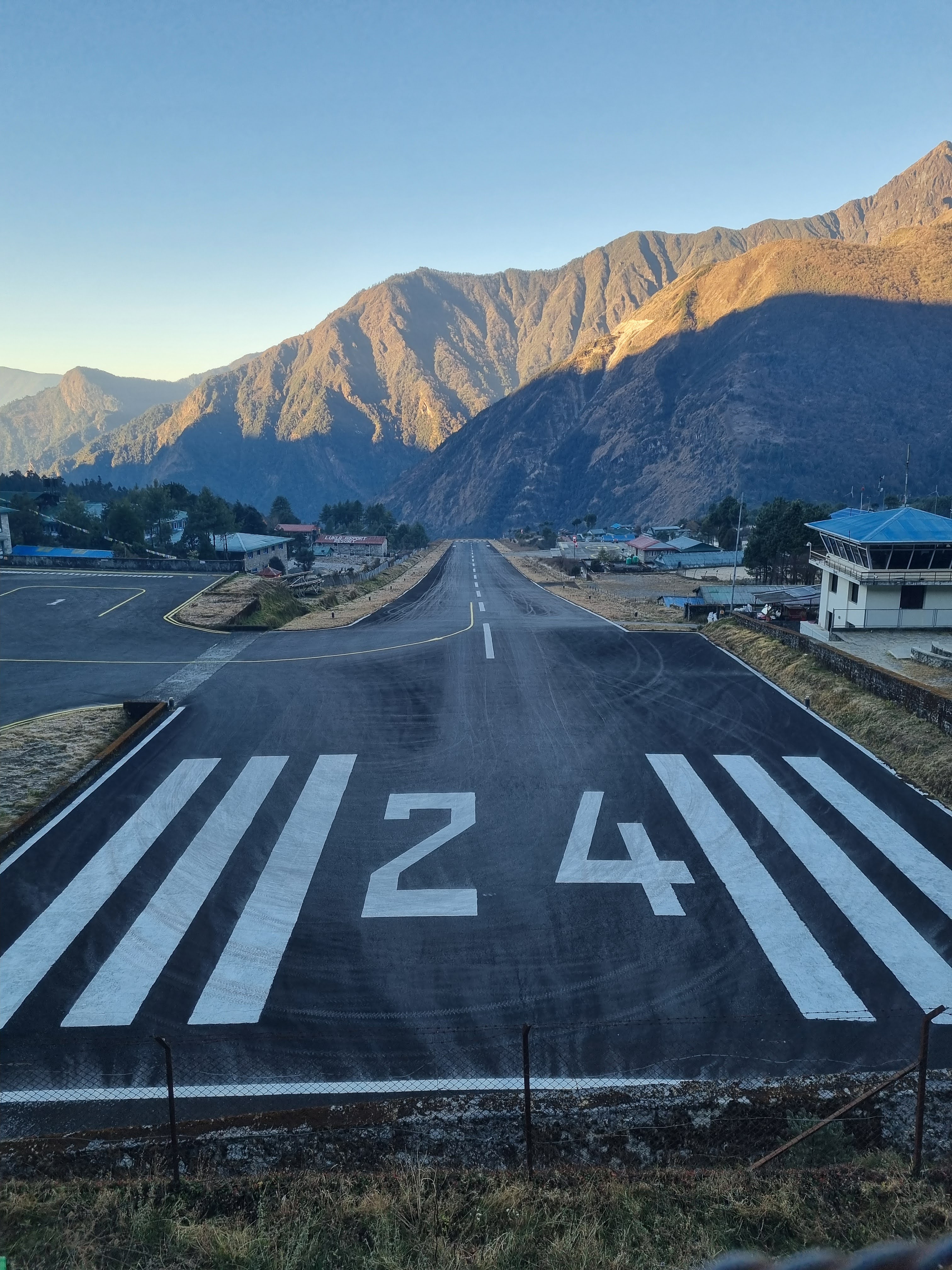
The weather was good, so we started boarding around 6:40 am. We’d been warned that flights to Lukla are often delayed or cancelled entirely due to weather, so we were happy just to be on our way. The plane was a small propeller aircraft with space for about 15 people. The best seats for views of the Himalayas are on the left side, but we stayed together on a double seat on the right. The flight got bumpier as we approached the mountains. About half an hour later, we landed—scary, but smooth. The runway is short and slopes uphill, giving the planes just enough space to slow down before the rock wall at the end.
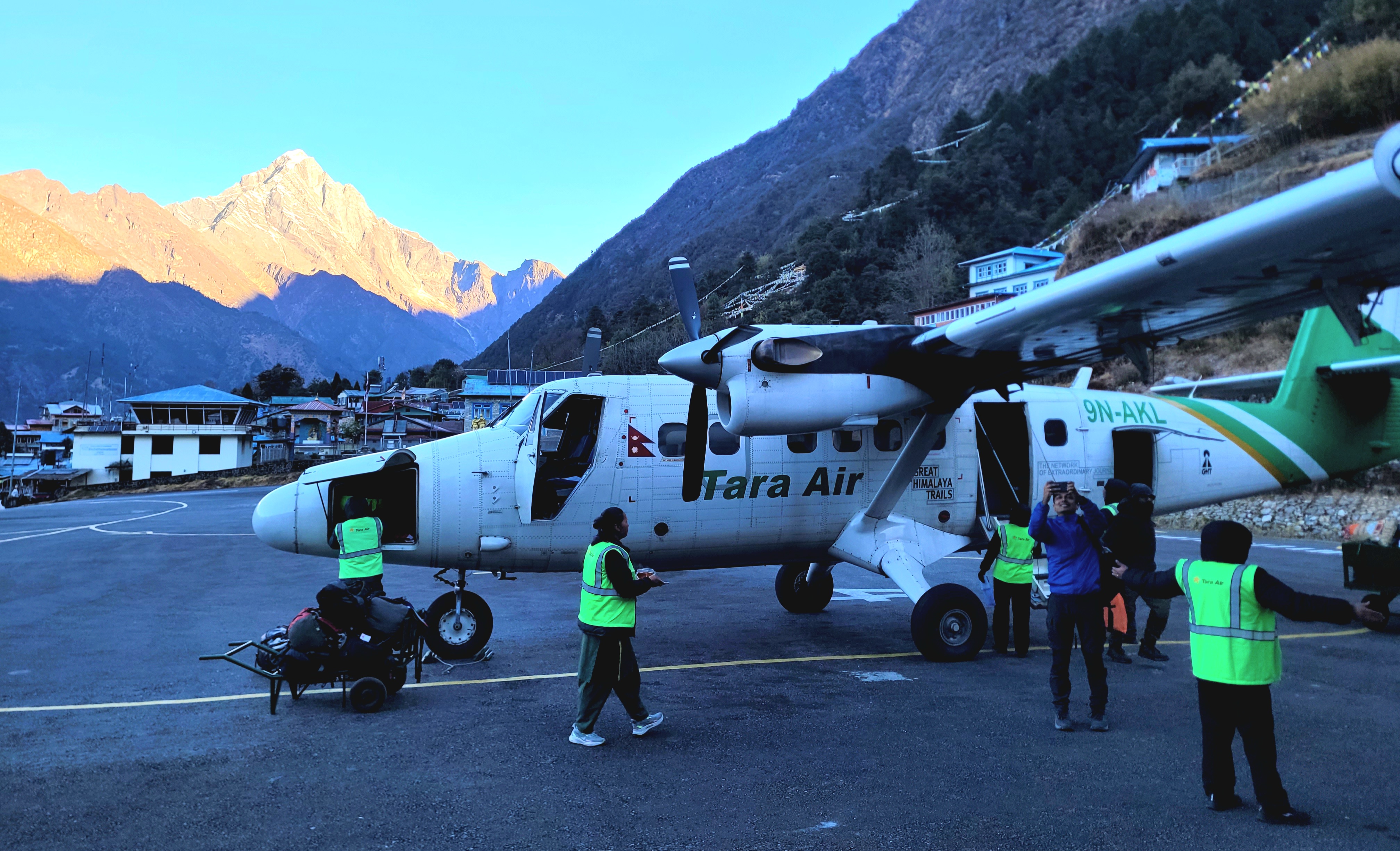
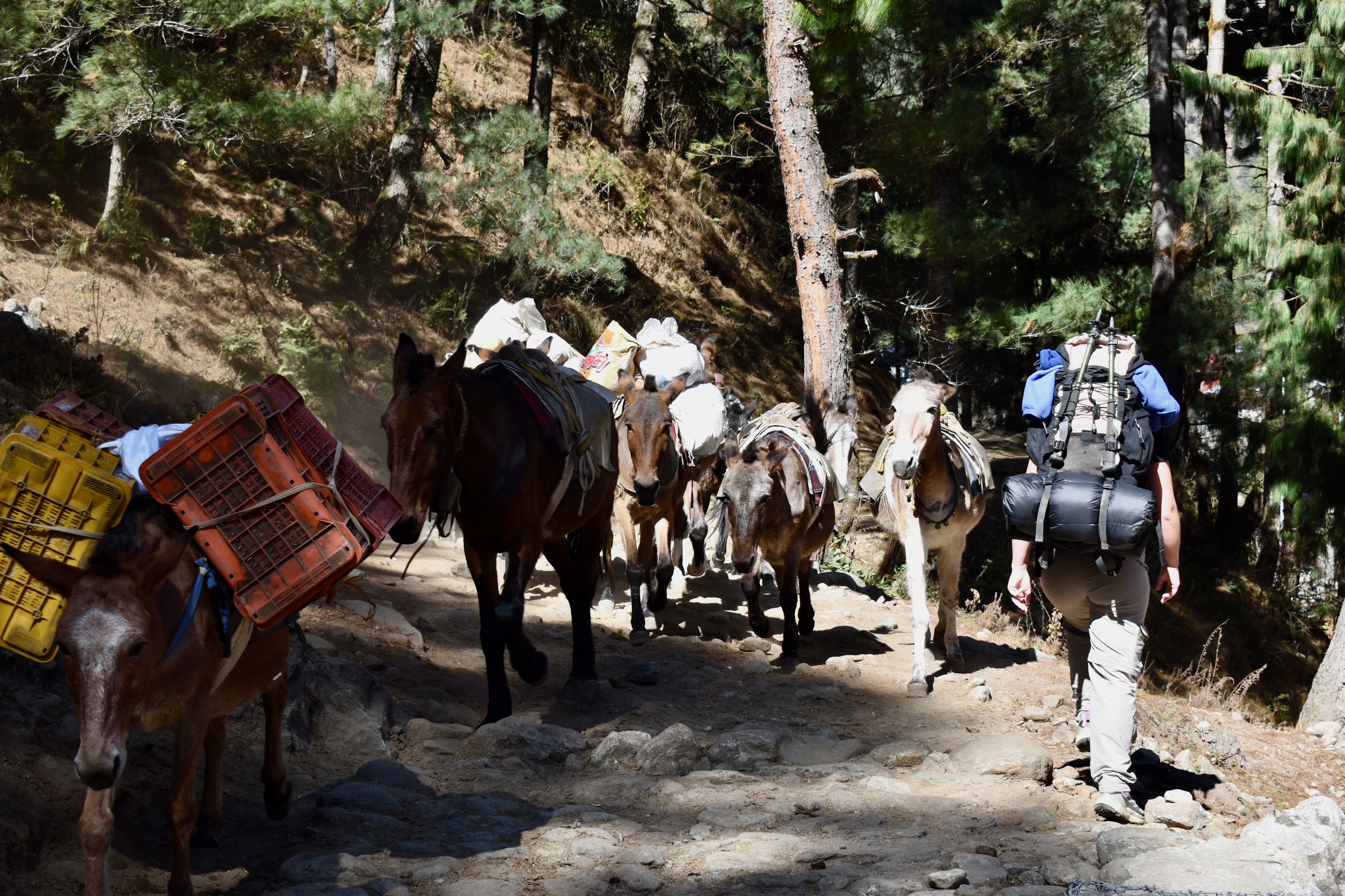
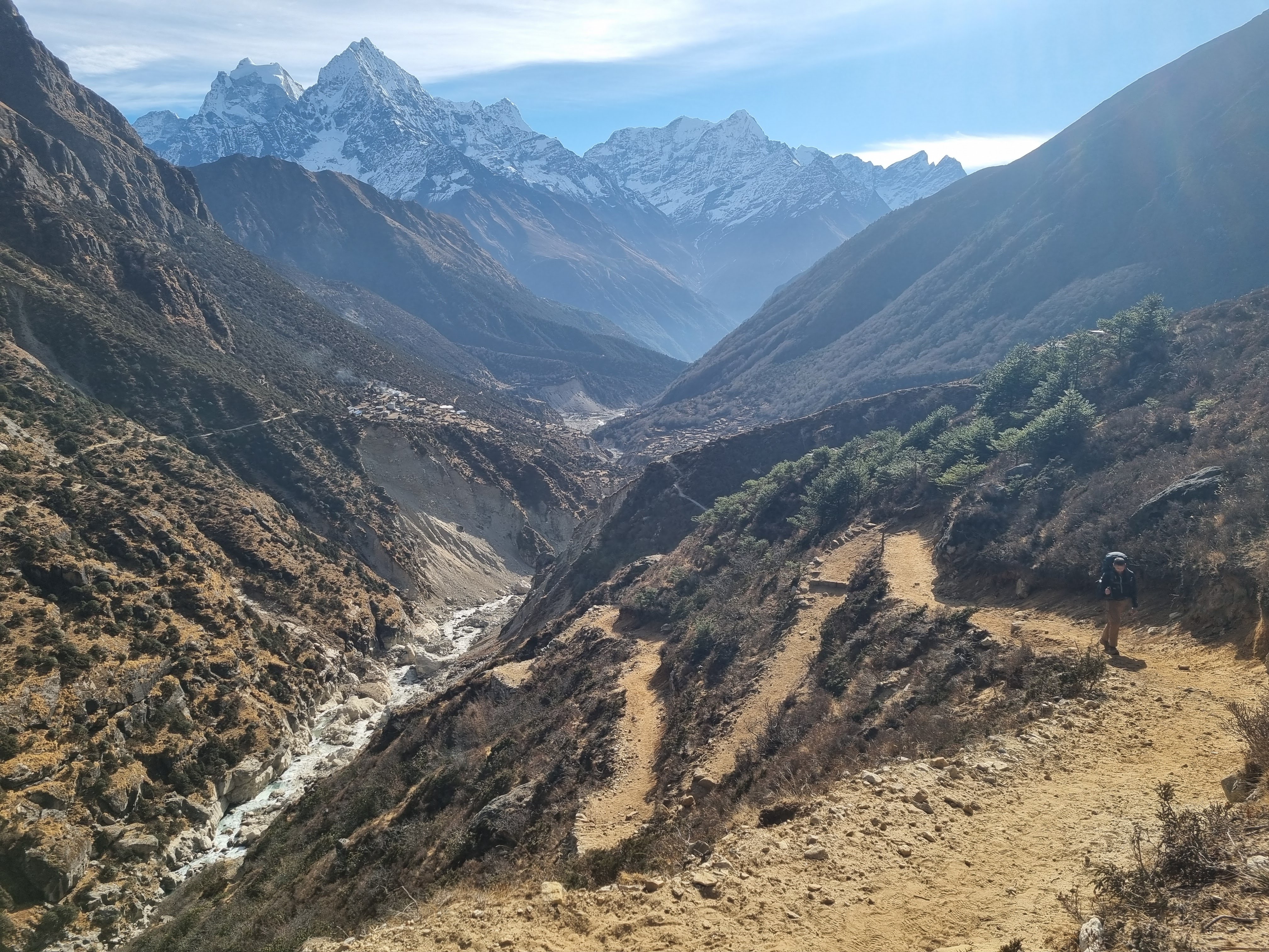
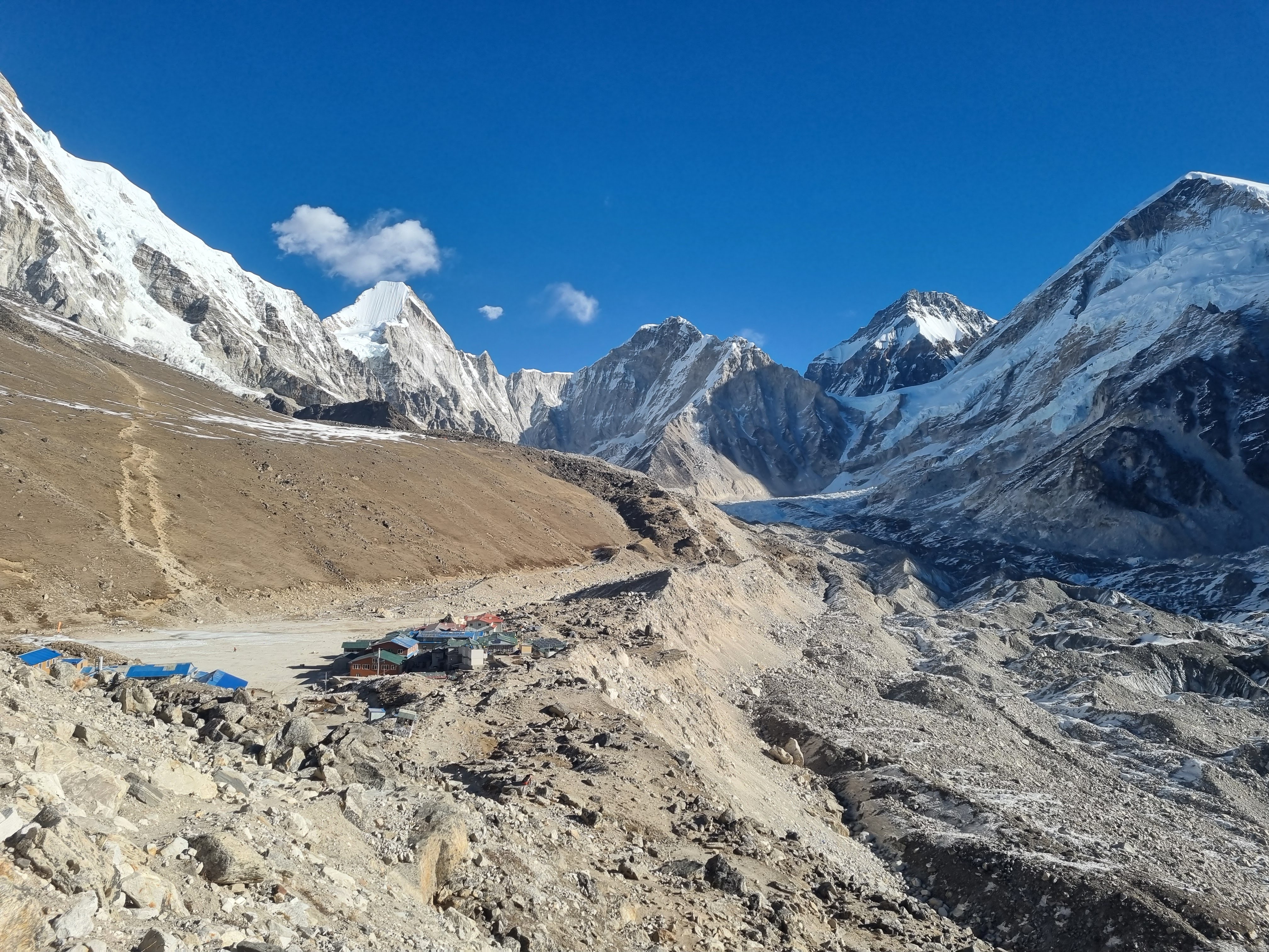
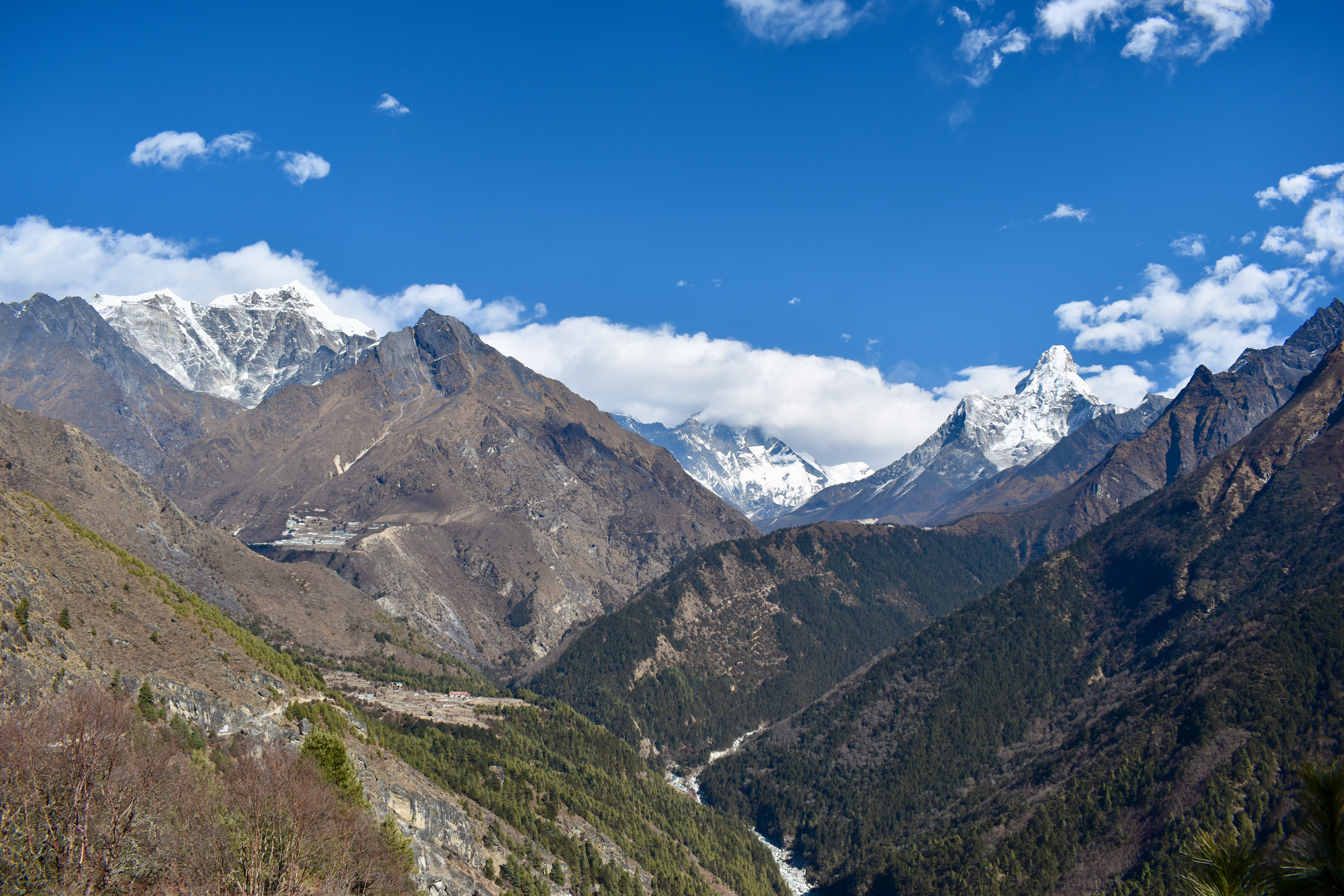
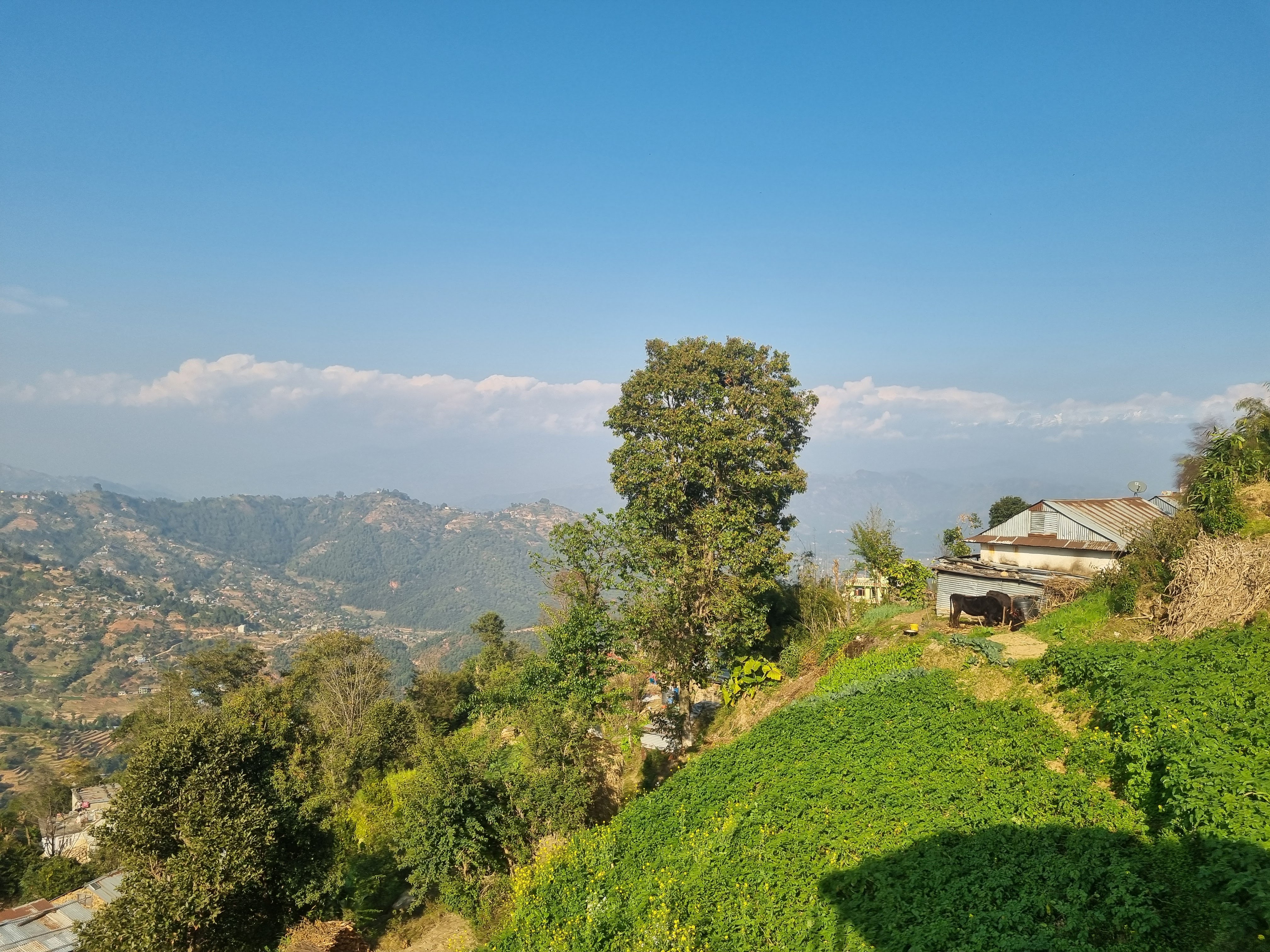
After collecting our bags, we repacked to move everything from our hands into our rucksacks—mostly expensive items we hadn’t wanted (or been able) to check in, like the camera, inReach, and power banks. Just outside the village, we bought the second permit—the Khumbu Pasang Lhamu Rural Municipality permit—for 3,000 rupees each. From there, we walked on, surprisingly mostly downhill, reaching the village of Phakding in about two hours. We stopped for a pot of coffee and took some time to figure out what to do next.
Here’s where things got complicated. Our original plan had been to follow a standard Everest Base Camp itinerary. We’d also considered adding the Gokyo Lakes and the surrounding mountain passes (the Three Passes Trek), but had ruled that out when our holidays were shortened by a week. Later, however, we read that the Gokyo Lakes and passes are far nicer than the base camp itself, so we tried to squeeze them back in. That wasn’t recommended, as it would be too fast and risky with the limited time we had. So, absolutely last minute, we changed plans again: we decided to skip EBC entirely and focus on the Renjo La Pass, the Gokyo Lakes, and possibly the Cho La Pass.
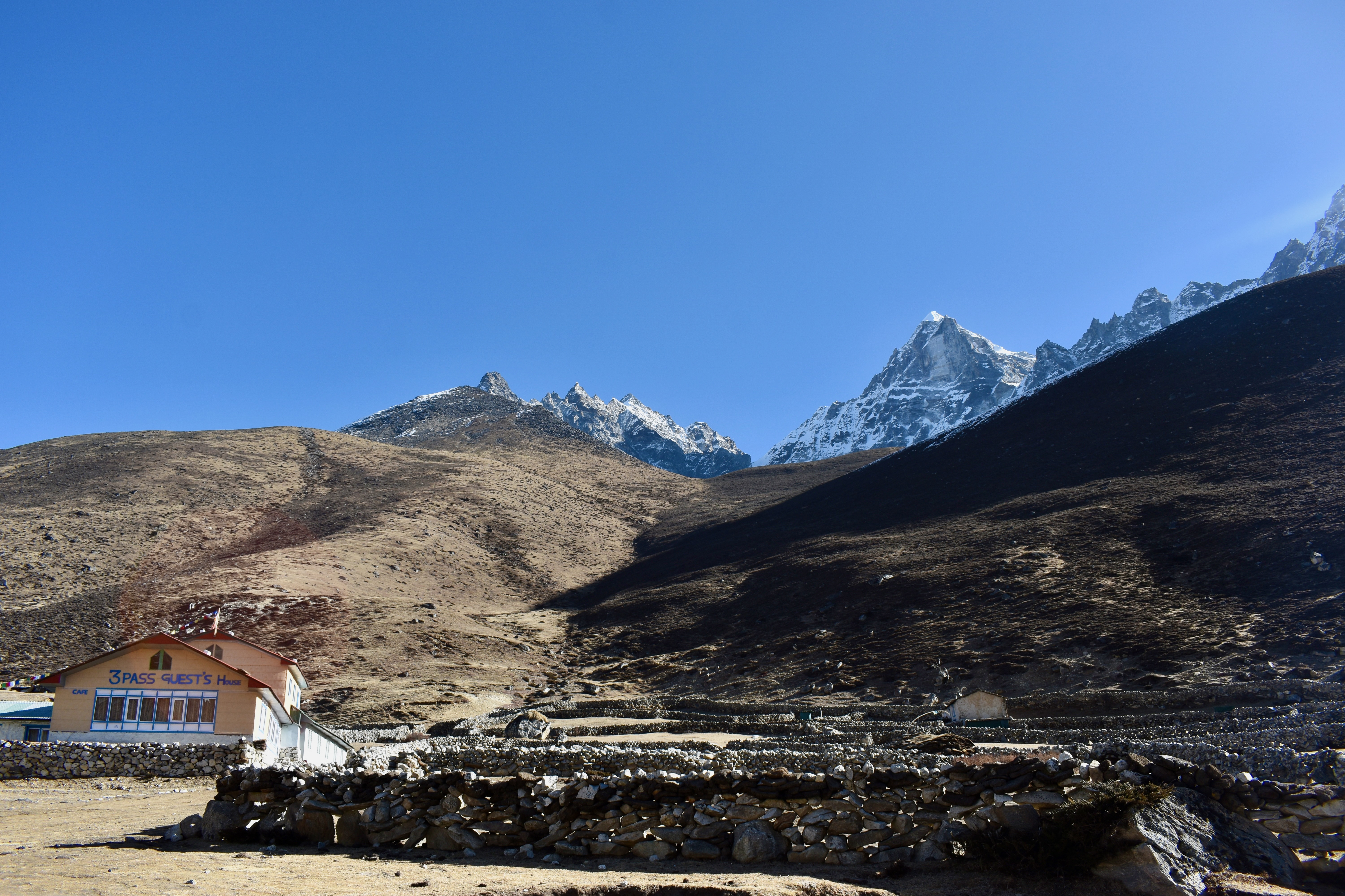
According to this revised plan—and the EBC itinerary as well—our first night was meant to be in Phakding. But it wasn’t even 11 am yet. So once again, we changed plans. After finishing our coffee, we continued on to Monjo, the last larger village before the climb up to Namche Bazaar.
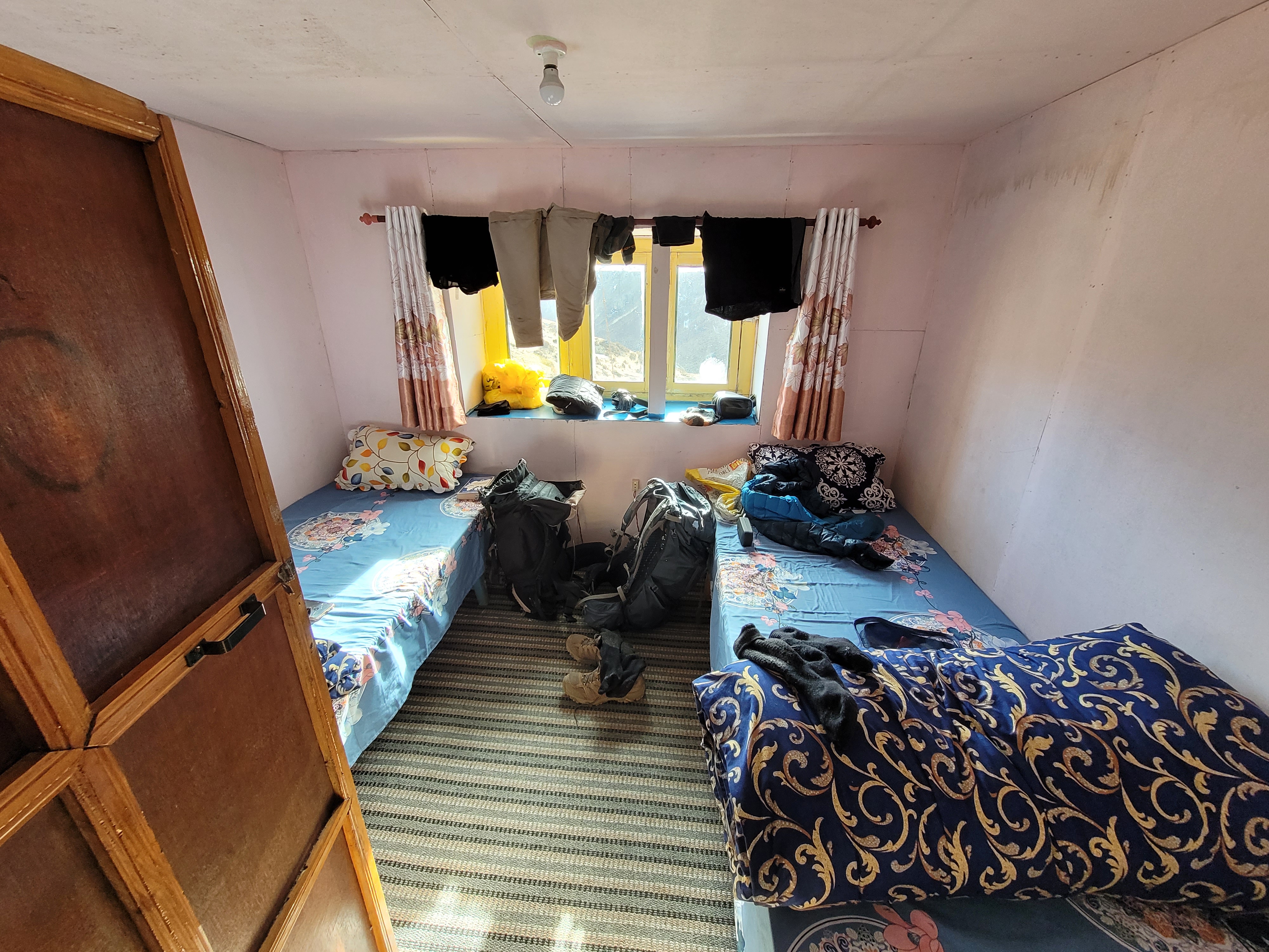
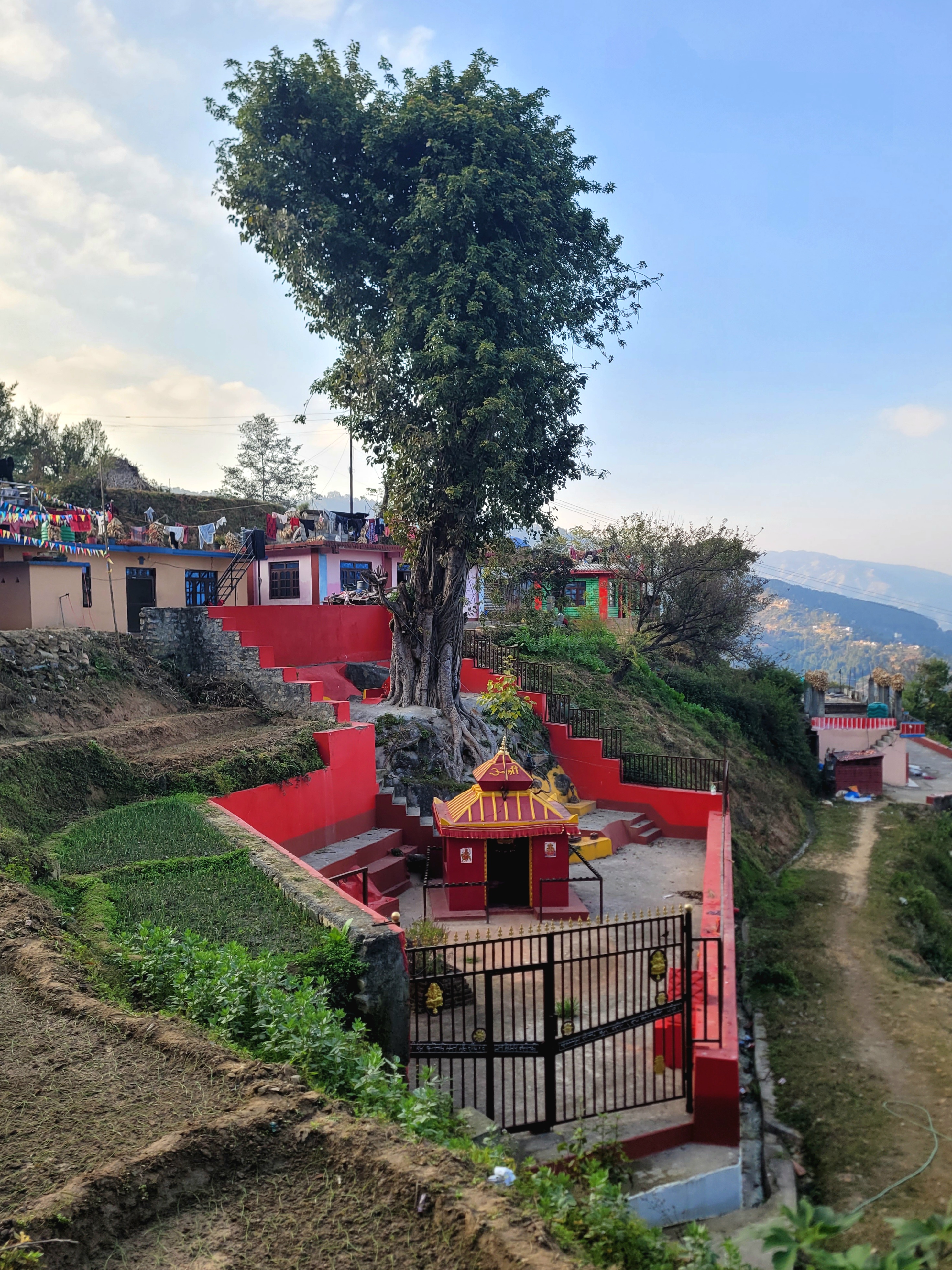
In Monjo, we found a lodge with a sunny terrace where we spent the next two to three hours reading and chatting. Because it was off-season, the owner let us stay for free, as long as we ate all our meals there. For dinner, we somehow ended up with three meals: dal bhat, egg chow mein, and egg curry. It’s customary to eat at the lodge where you stay.
Note
It's not allowed to park at the side of the lake at many locations, and where you can, you're going to be skinned alive on the parking fee.
Since Monjo is still on the main, well-populated trail, we had free Wi-Fi and could charge our phones at no extra cost. We even got lucky with a football match and spent the next two hours watching Newcastle vs Chelsea.
- Day 1: Lukla to Monjo
- Distance: 13.4 km
- Elevation change: 632 m up, 626 m down
- Time: 3:49 (not including the coffee in Phakding)
The entire trek in one wee video
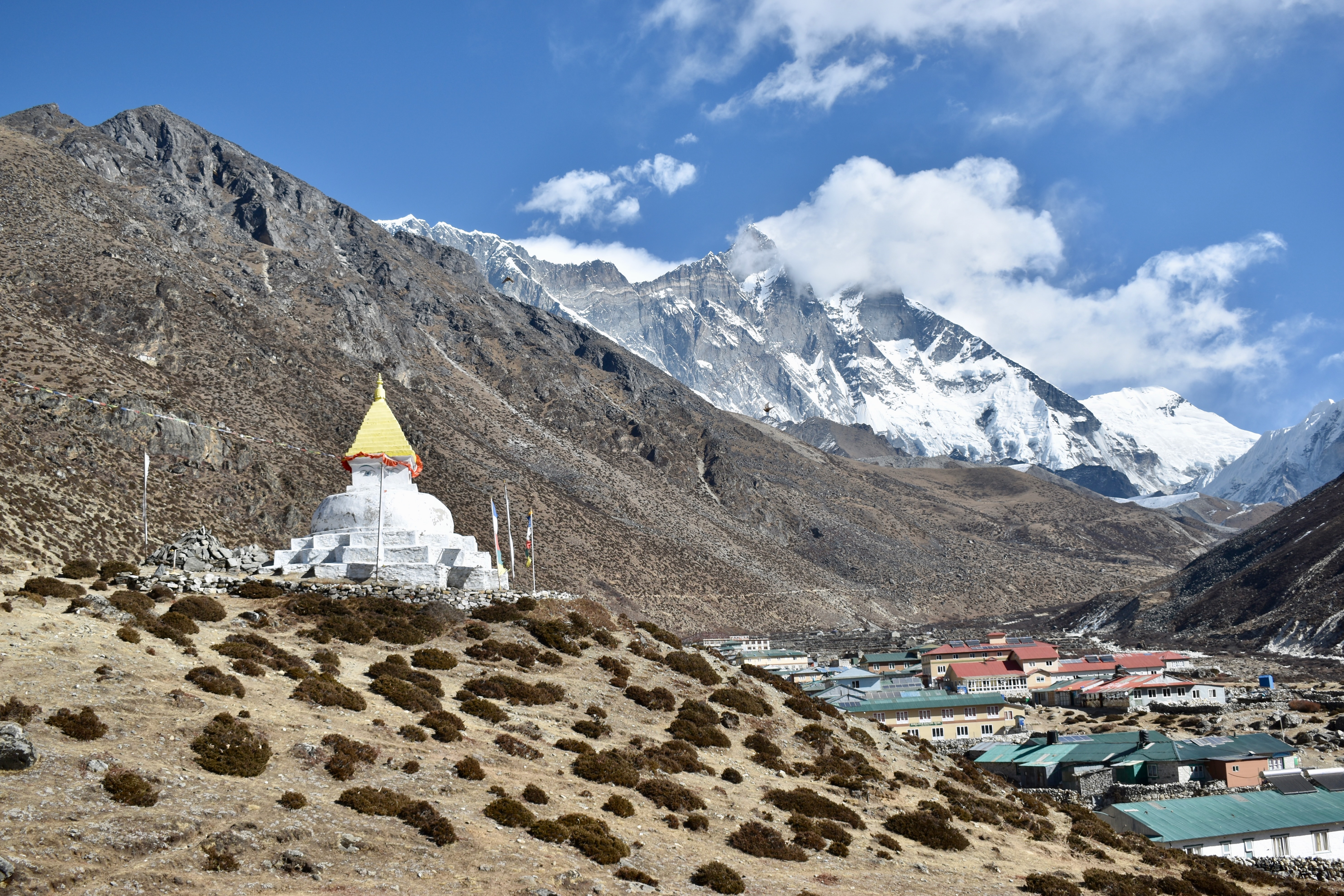
Day 4: A climb to Namche Bazaar and a night in Thamo
We got up with the sunrise around 6:45, packed up, and had a quick breakfast and coffee. Just for reference: for a pot of tea, three dinner dishes, two breakfast meals, and two cups of coffee, we paid 4,000 rupees. Prices generally increase the higher you go.
We left around 8:30 am after bandaging Clare’s ankle—she’d developed a blister, and we didn’t want it to get worse. We’ve learned that plasters alone don’t stay in place for very long.
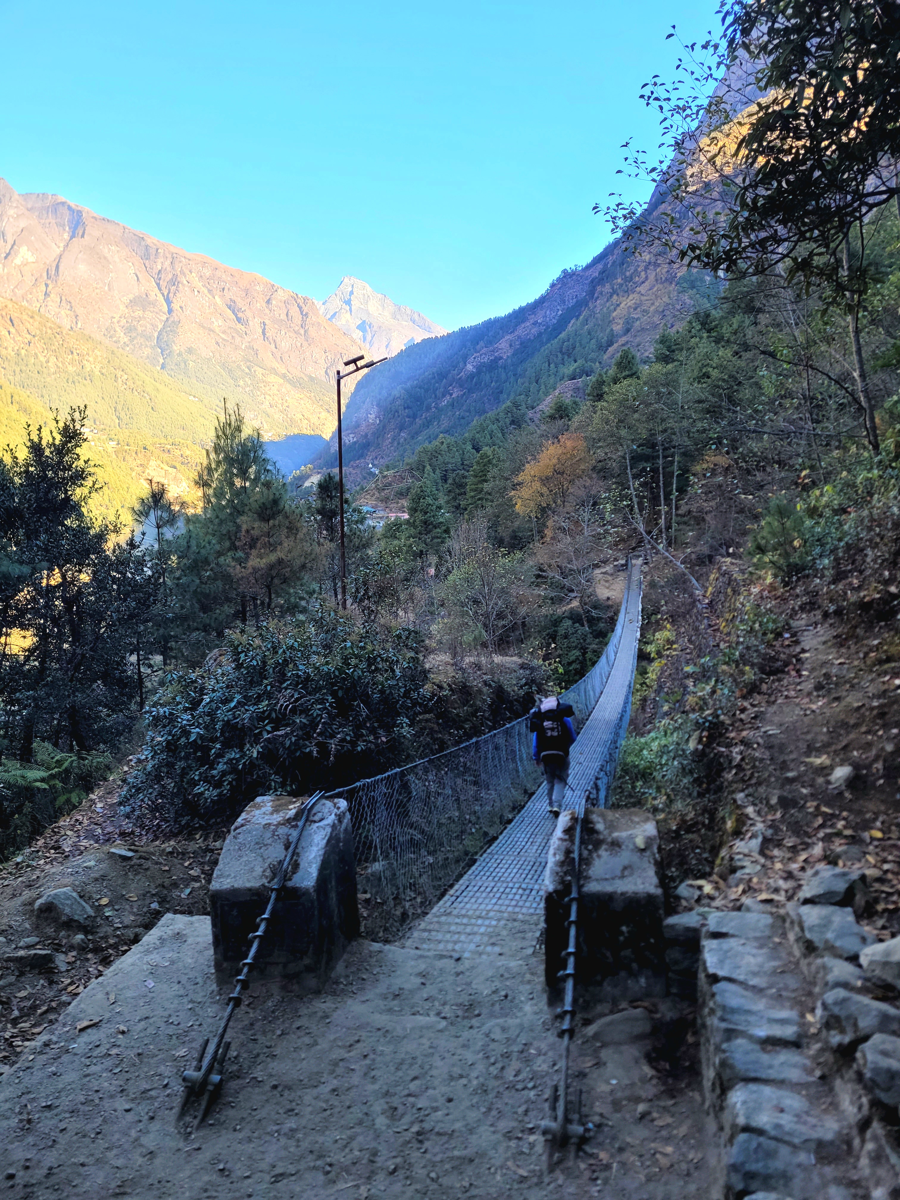
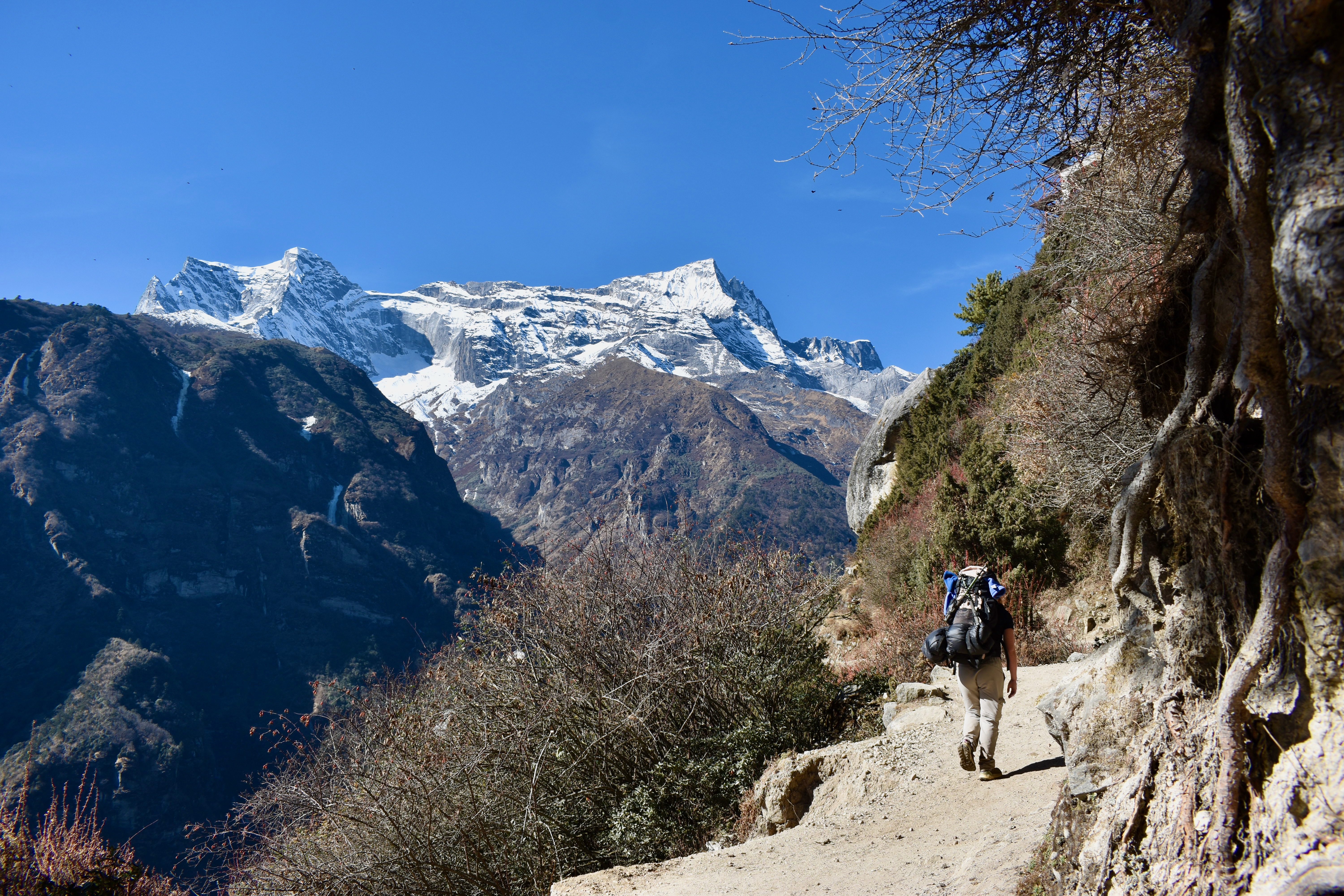
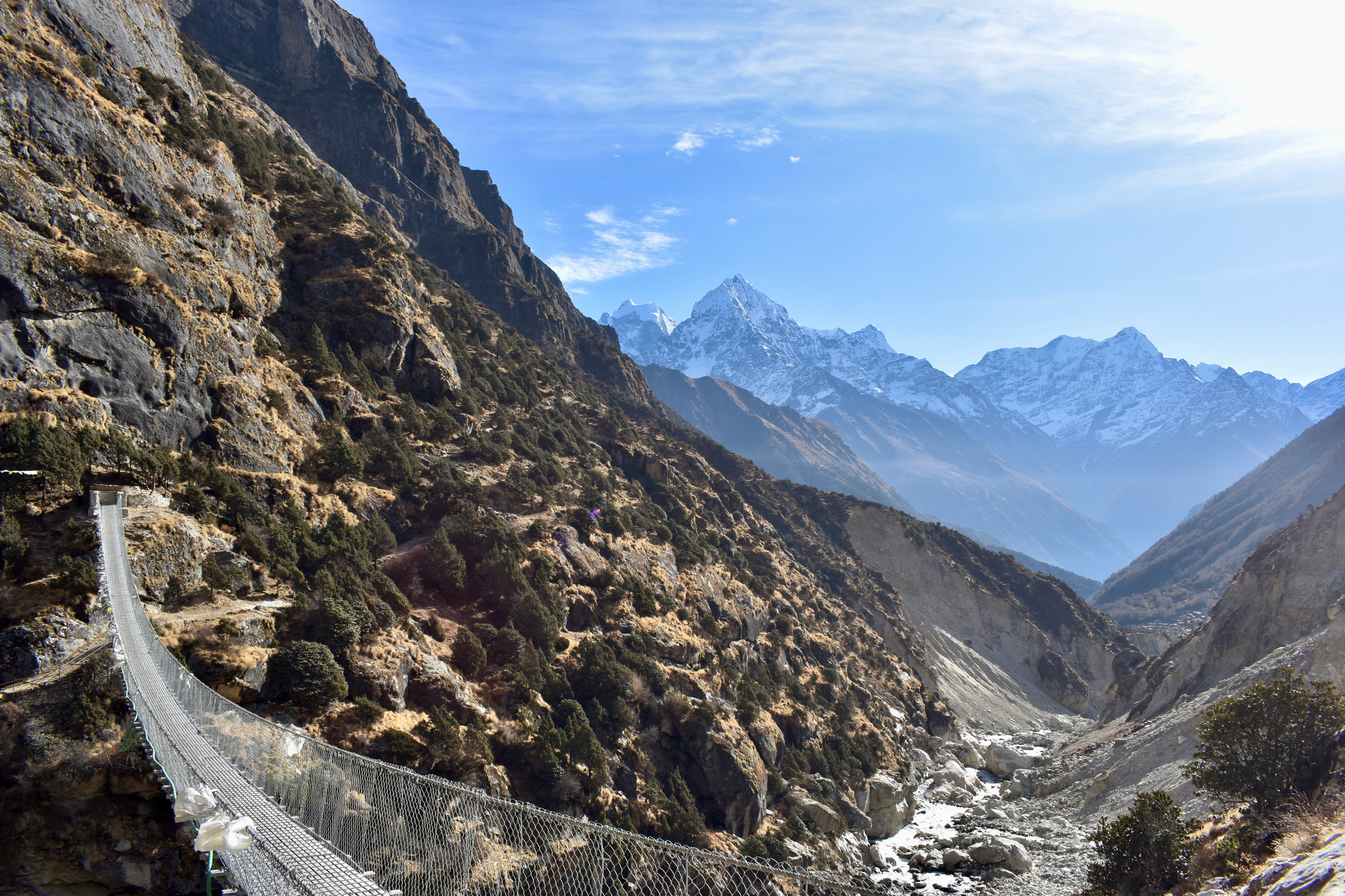
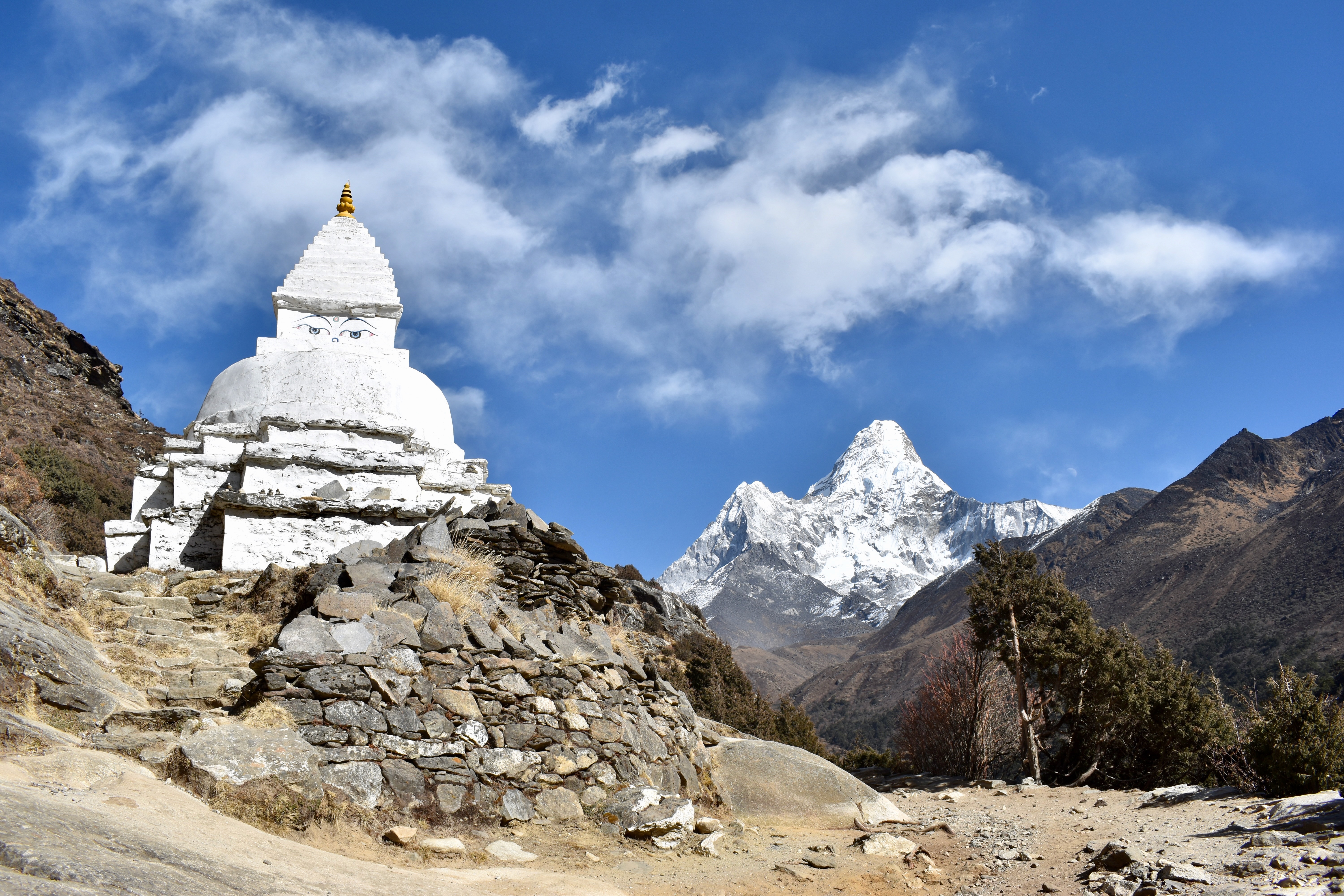
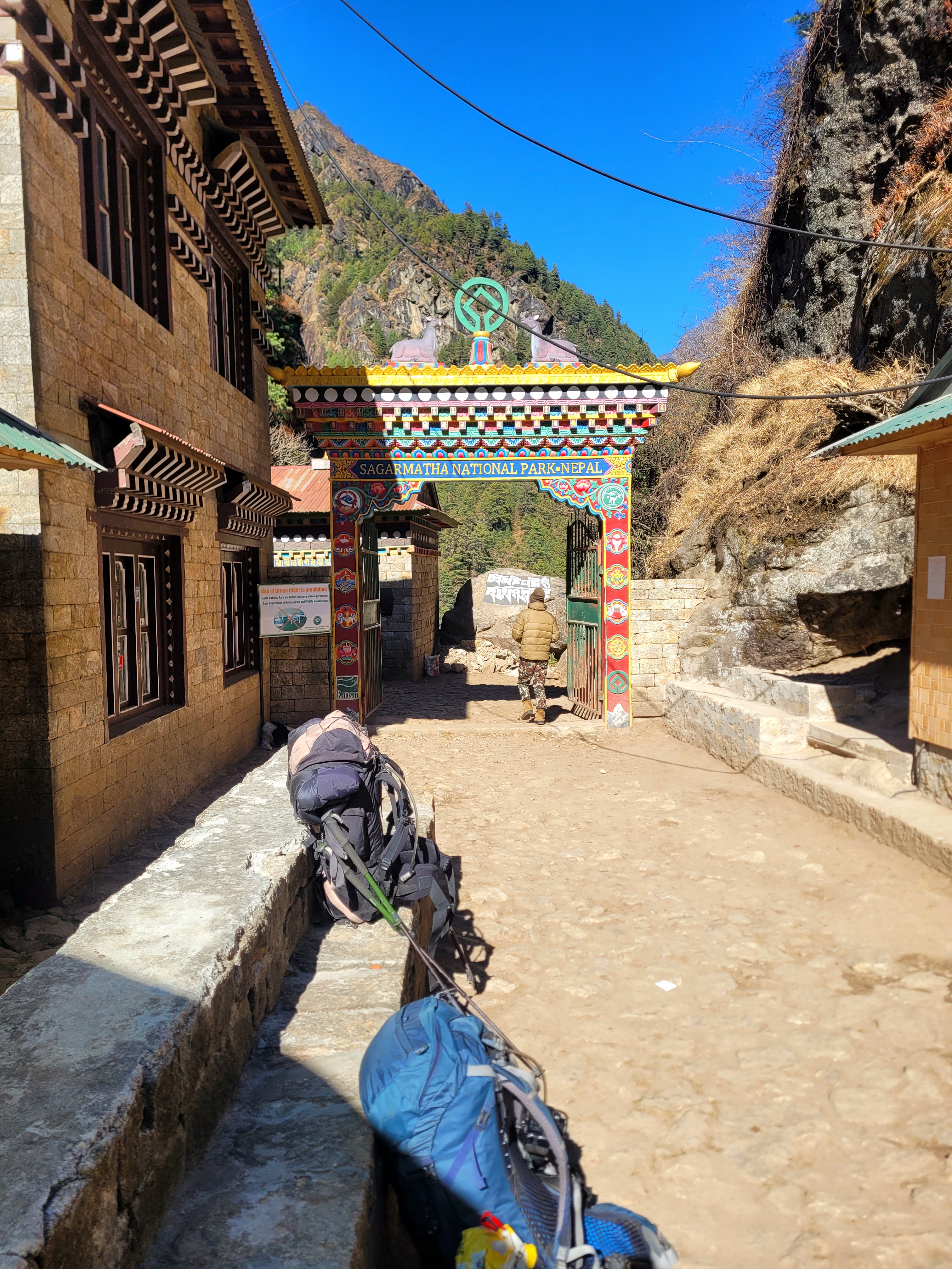
After barely 100 metres, we reached a checkpoint where we had to show both permits (you can also buy the national park permit here). The trail started out gradually before becoming much steeper around the Hillary Bridge. The climb up to the bridge and beyond was tough, with roughly 700 metres of elevation gain over just a couple of kilometres.
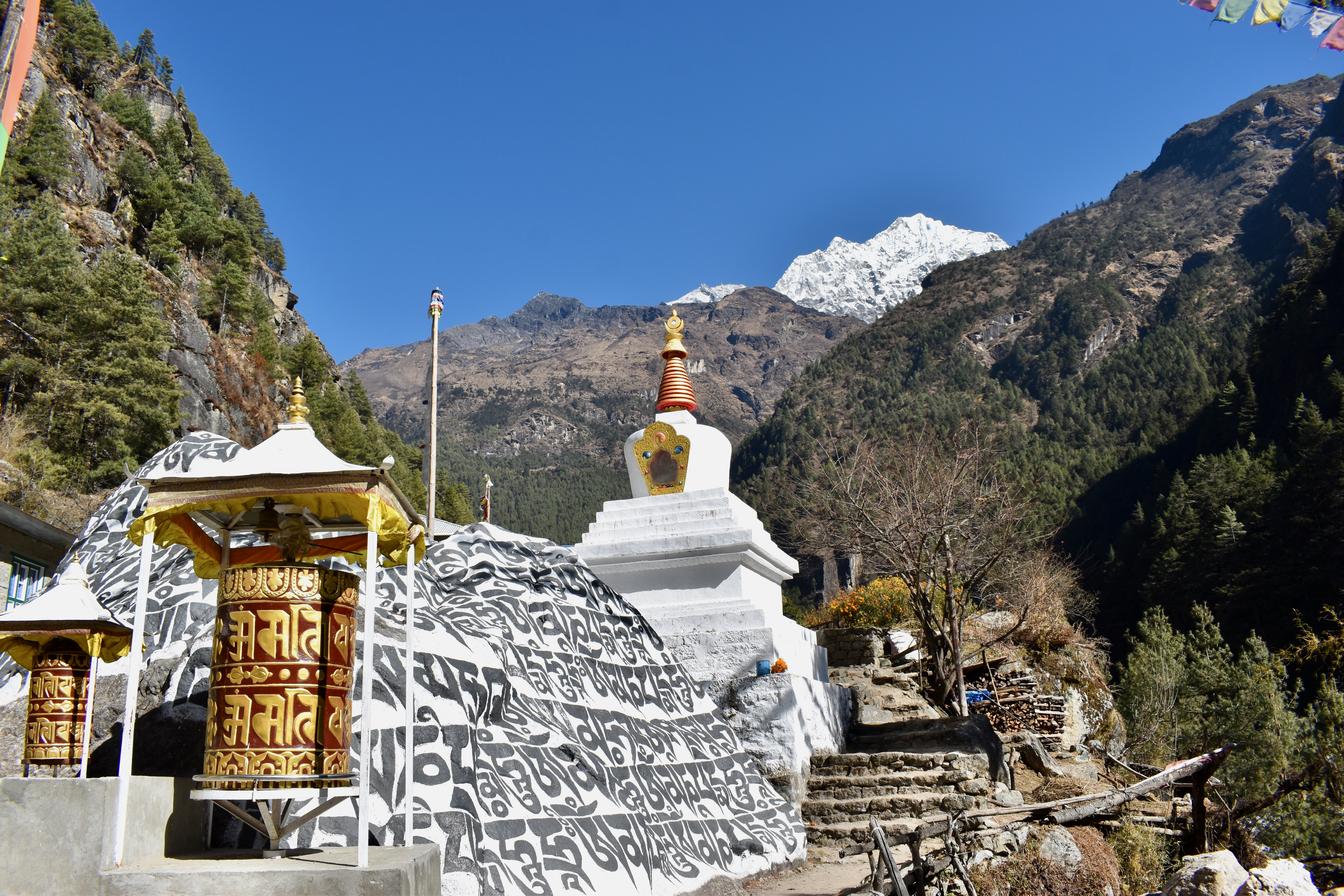
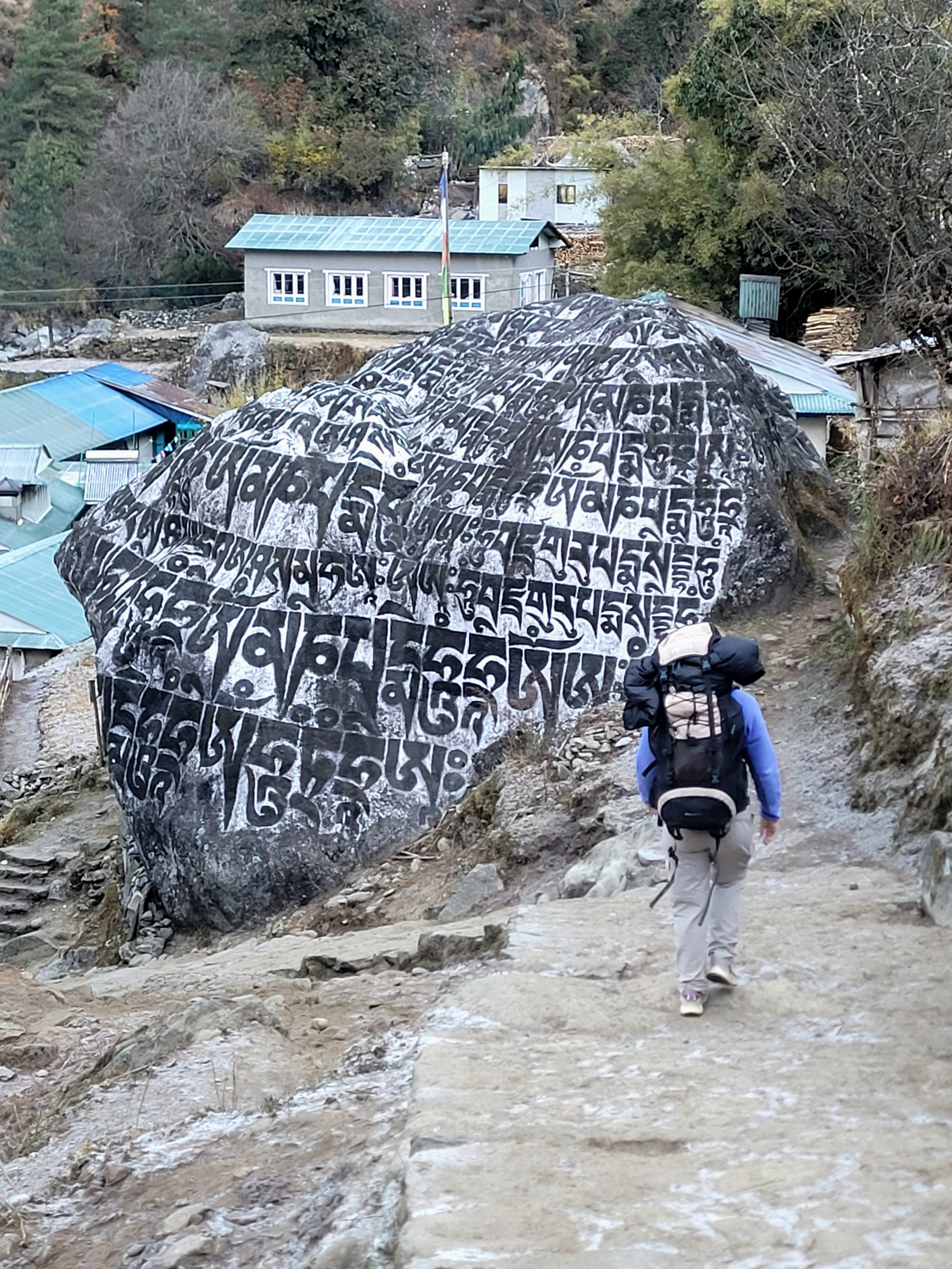
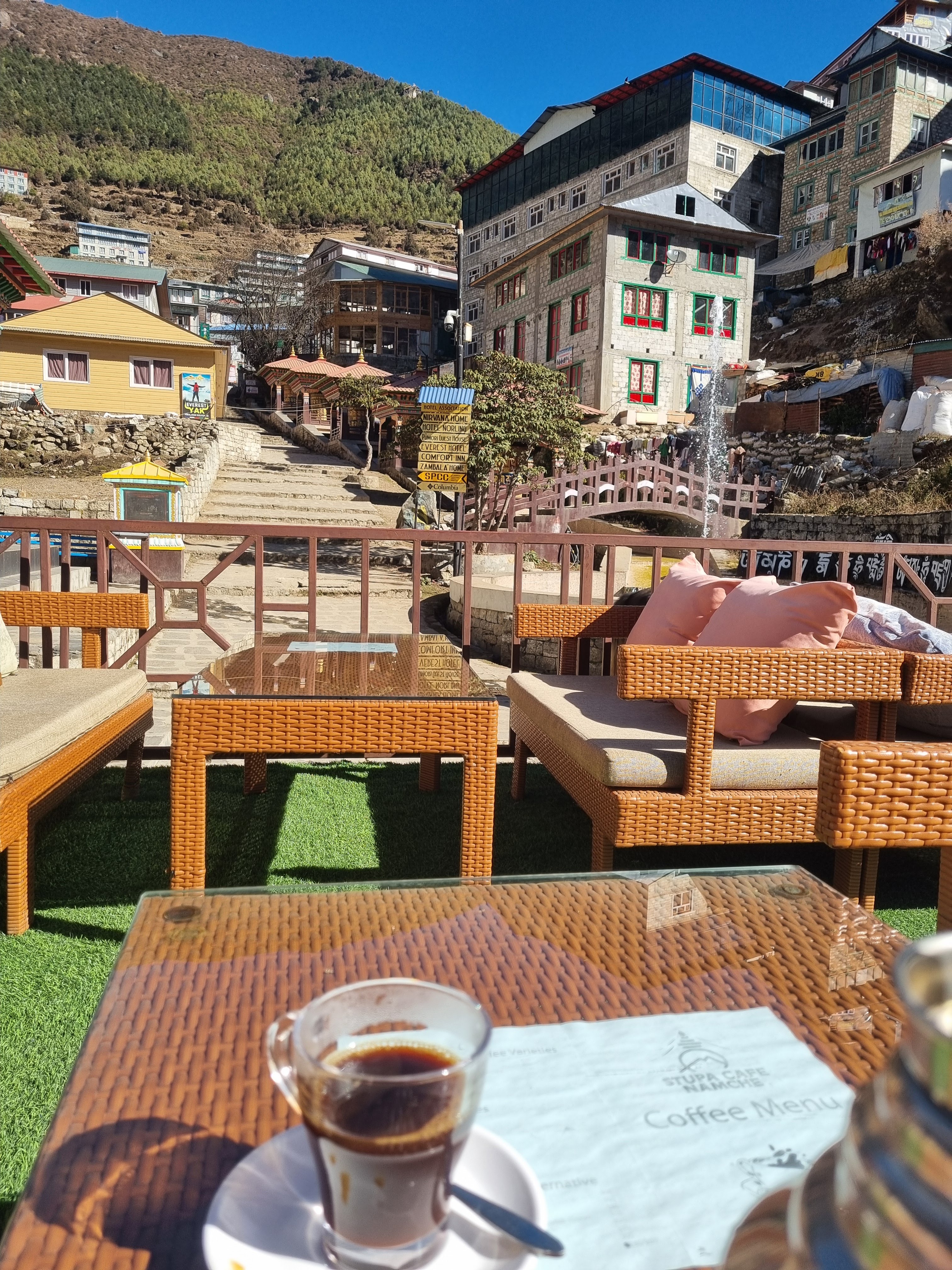
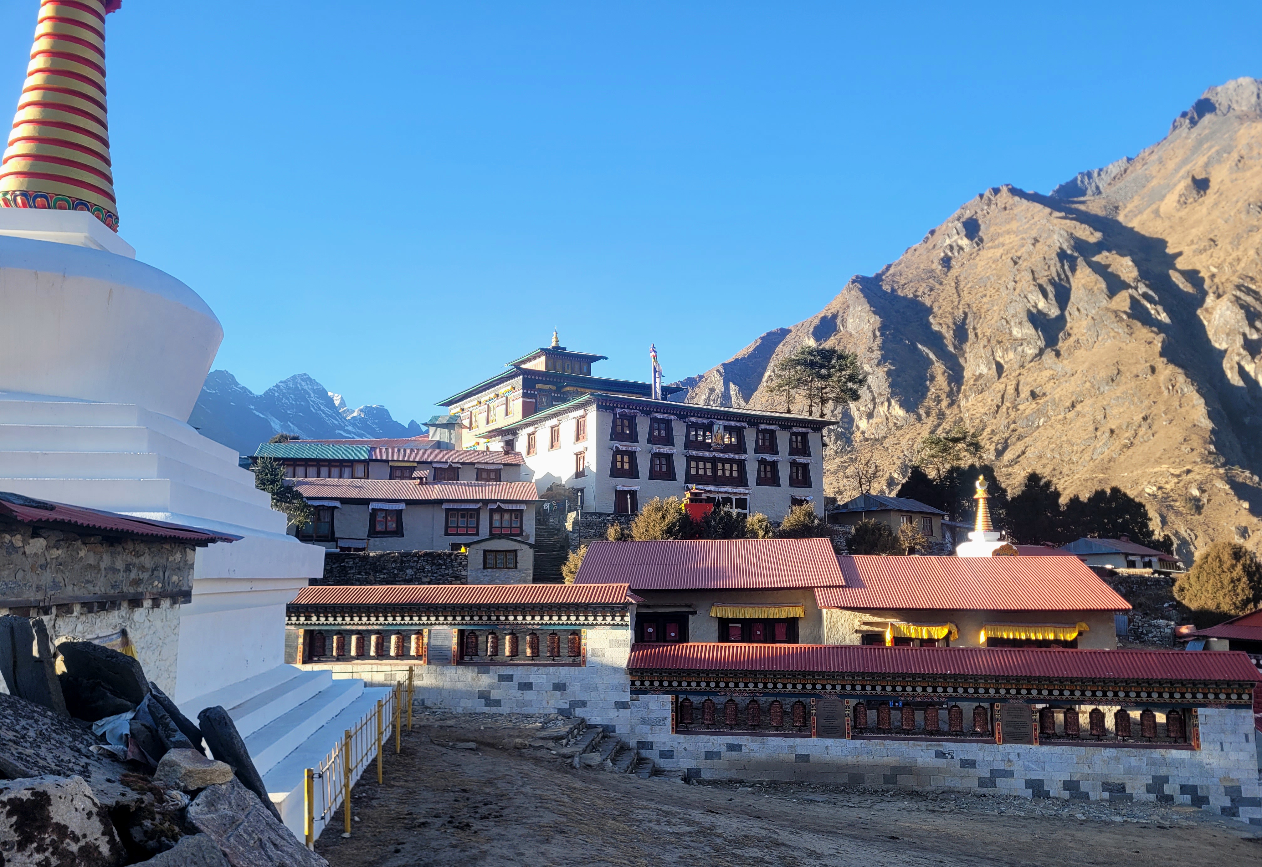
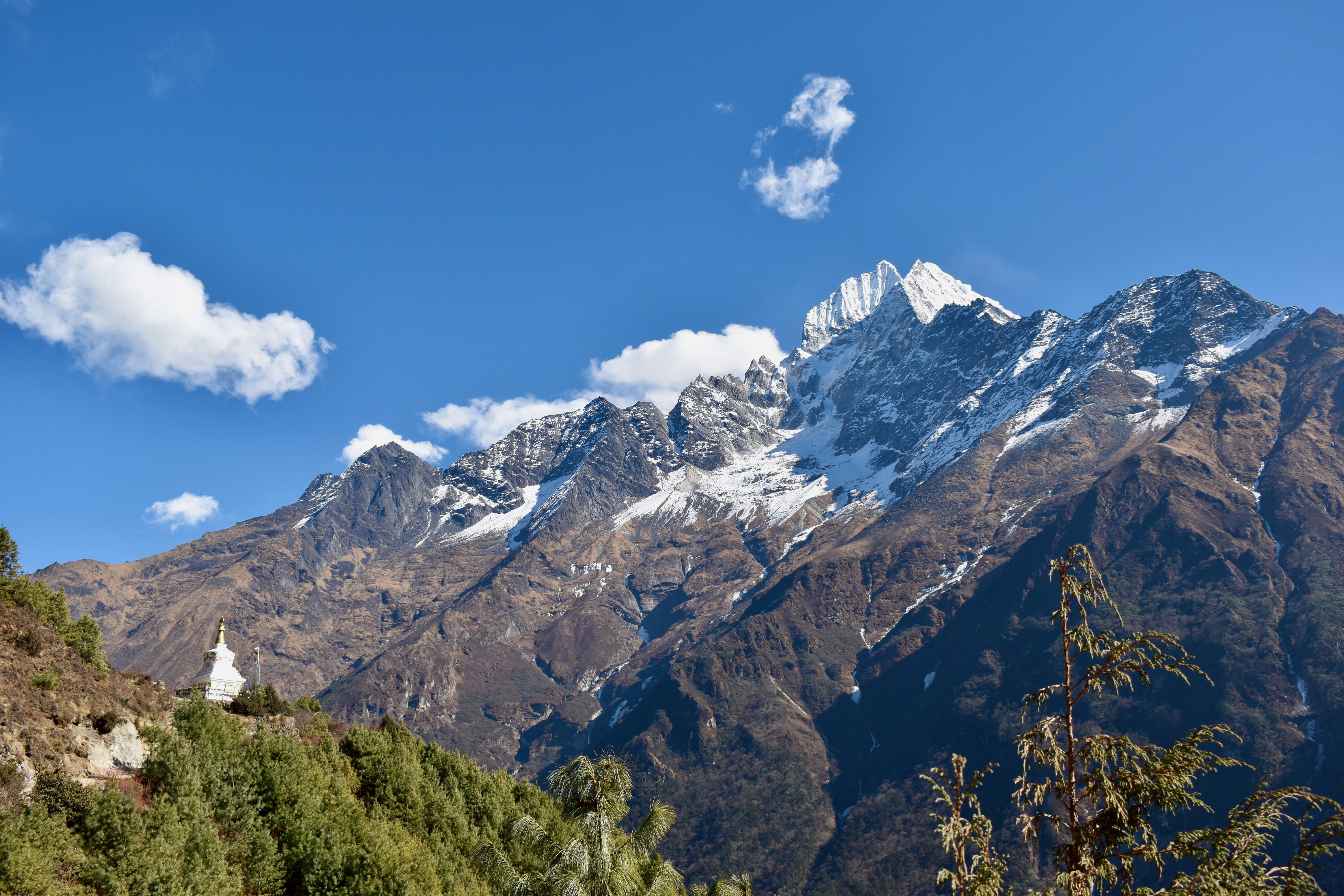
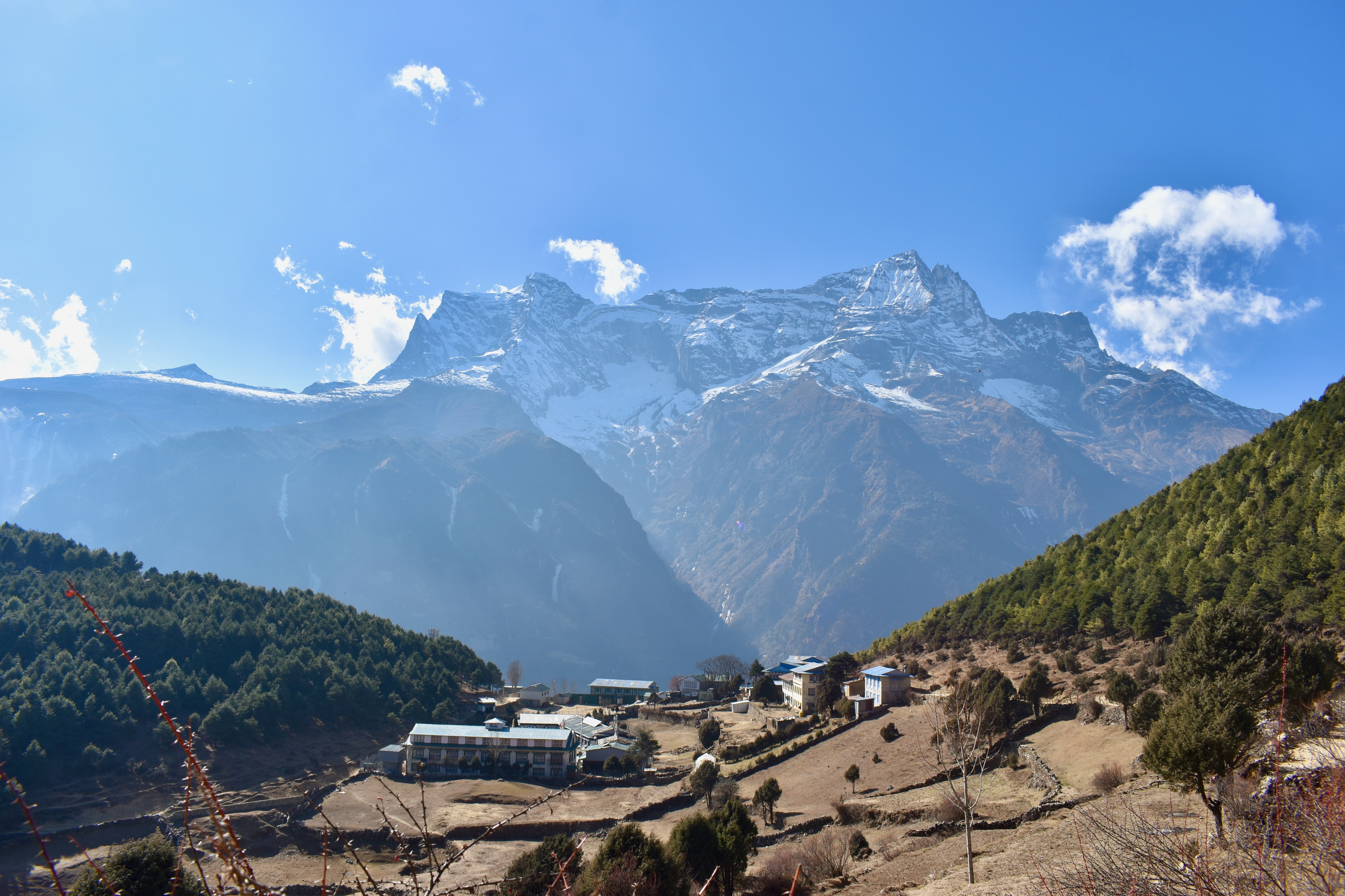
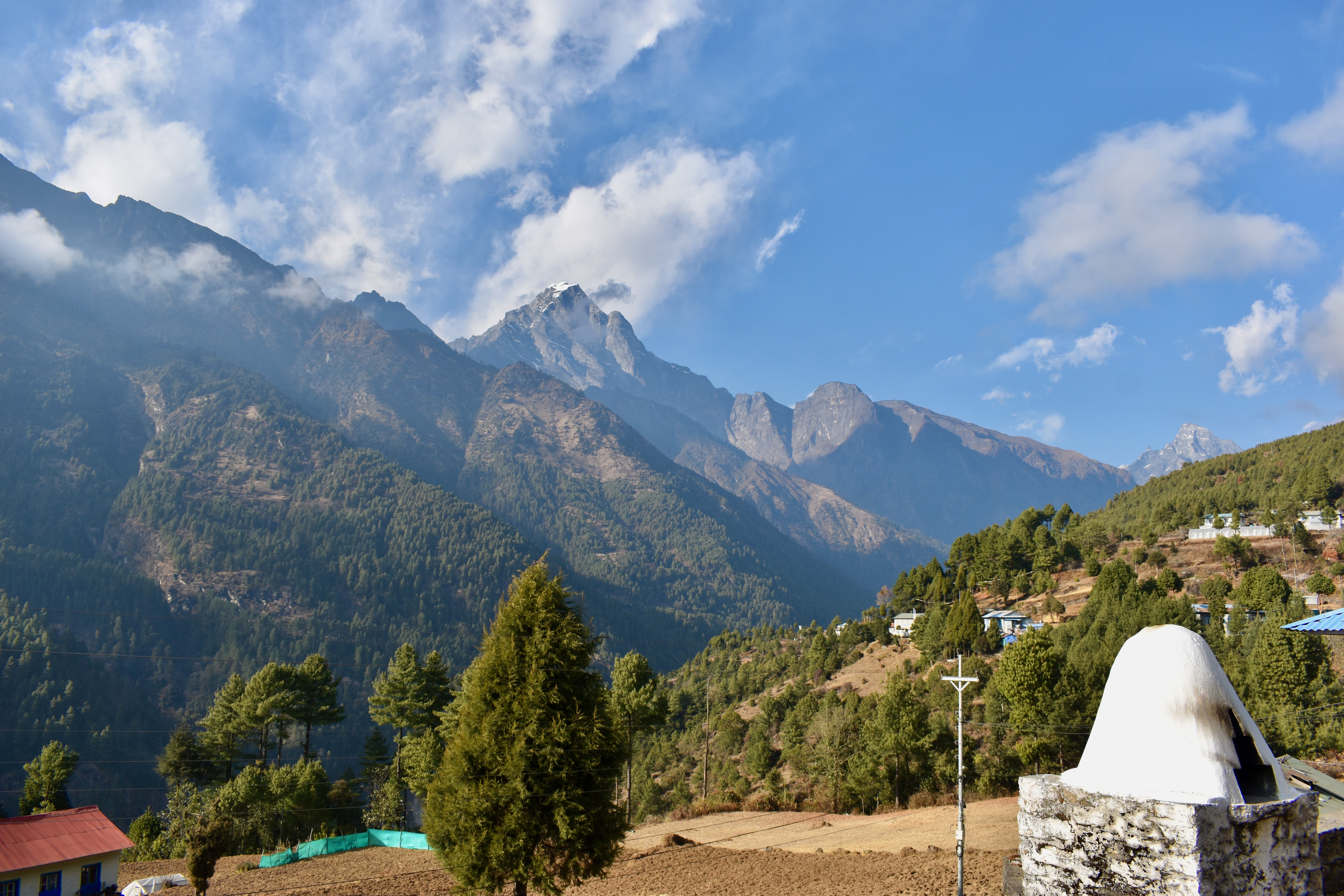
Even though it was winter, the sun was strong enough that we ended up shedding our jackets and doing the climb in T-shirts. Near the top, we passed another checkpoint where our permits were checked again. Namche wasn’t far from there, and we stopped at the first open place we saw—the Stupa Café—for a pot of coffee. It took us just over two hours to reach Namche Bazaar.
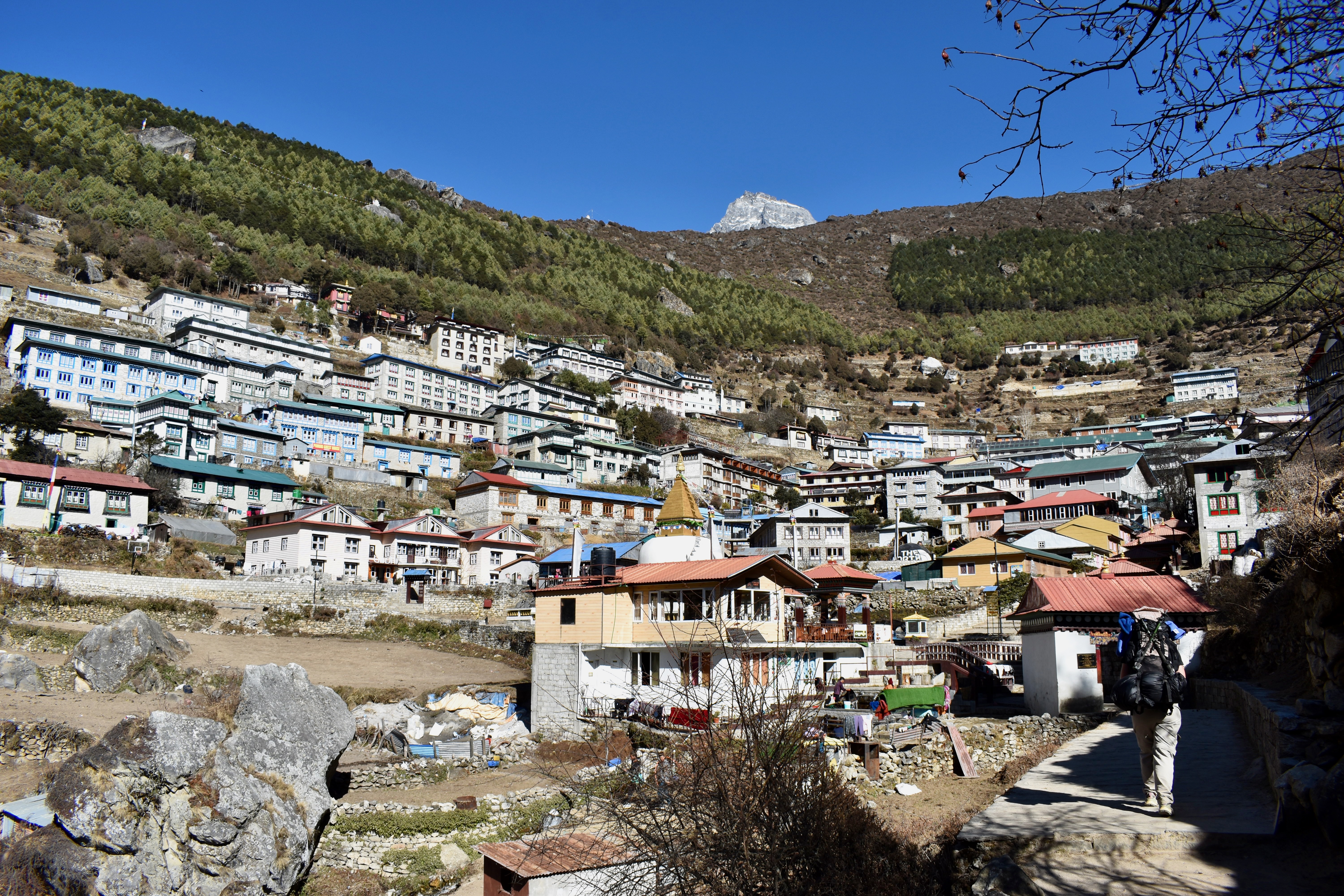
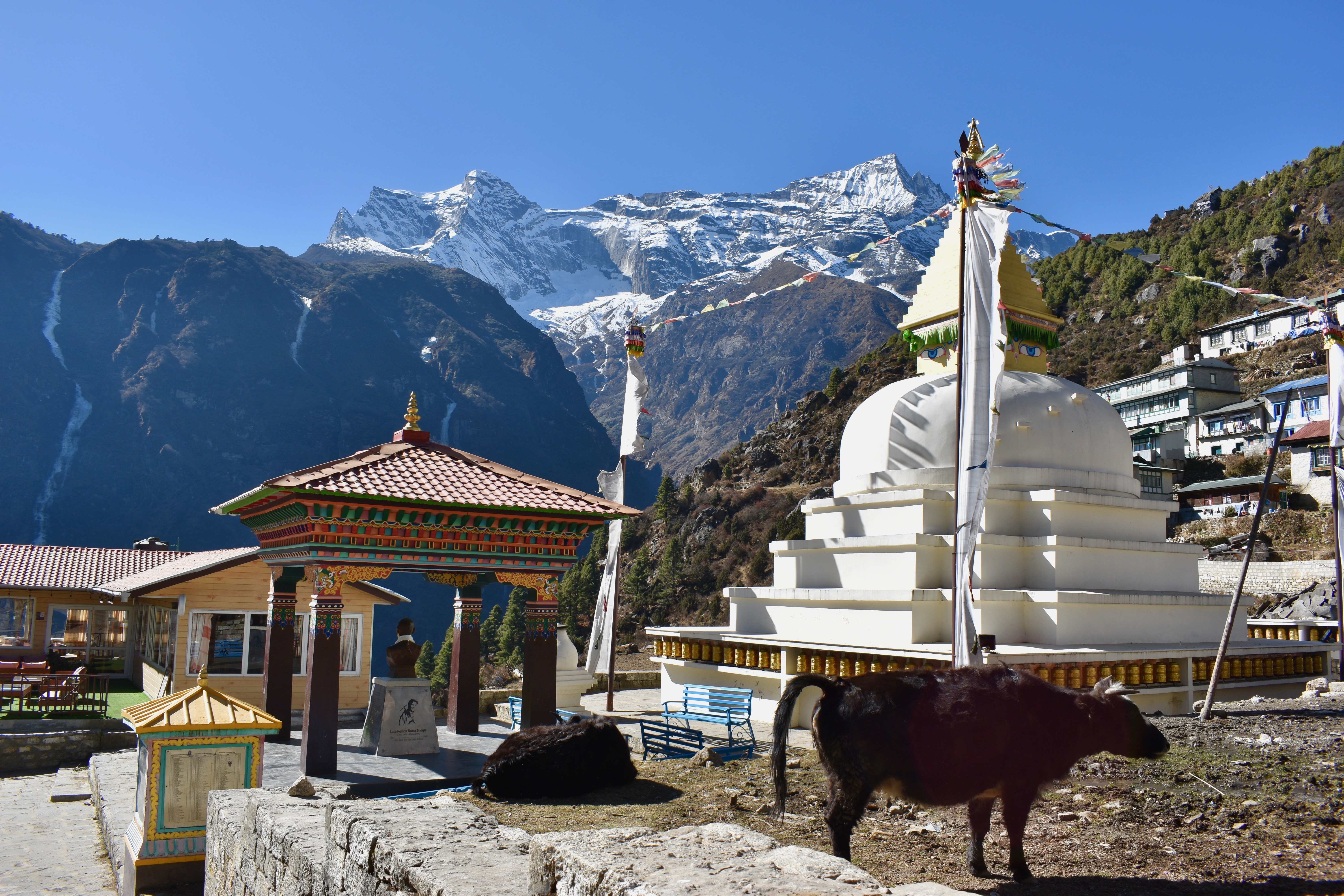
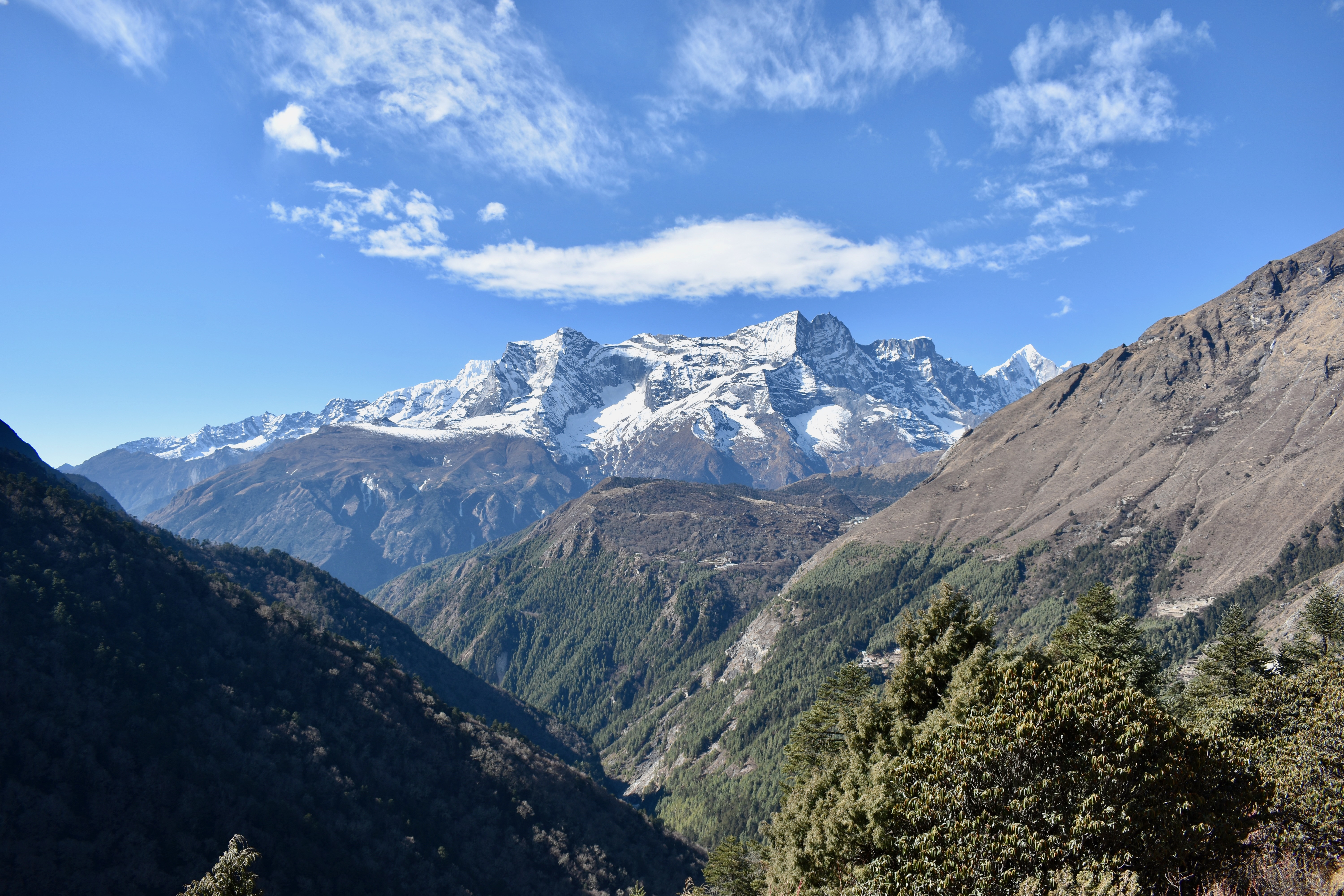
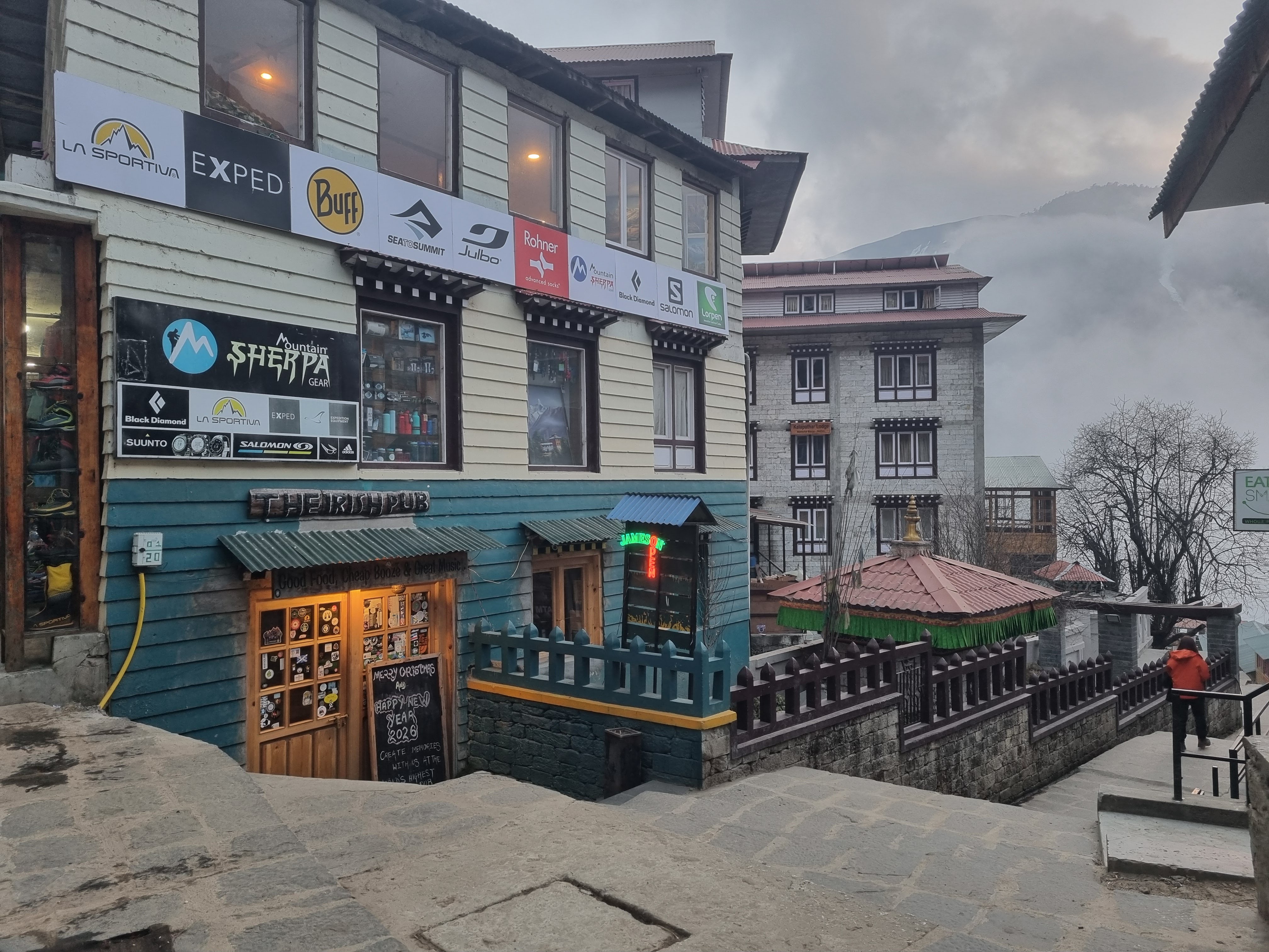
Most itineraries recommend spending a full day in Namche to acclimatise. But once again, it wasn’t even noon, and we felt good enough to continue and leave acclimatisation for the following day at a higher altitude. We left Namche around one o’clock, walking through town and noting a few places we might want to stop at on the way back. We were also on the lookout for an Irish pub we’d read about, but never managed to find it. Namche is huge and has pretty much everything you could need in case you forgot something.
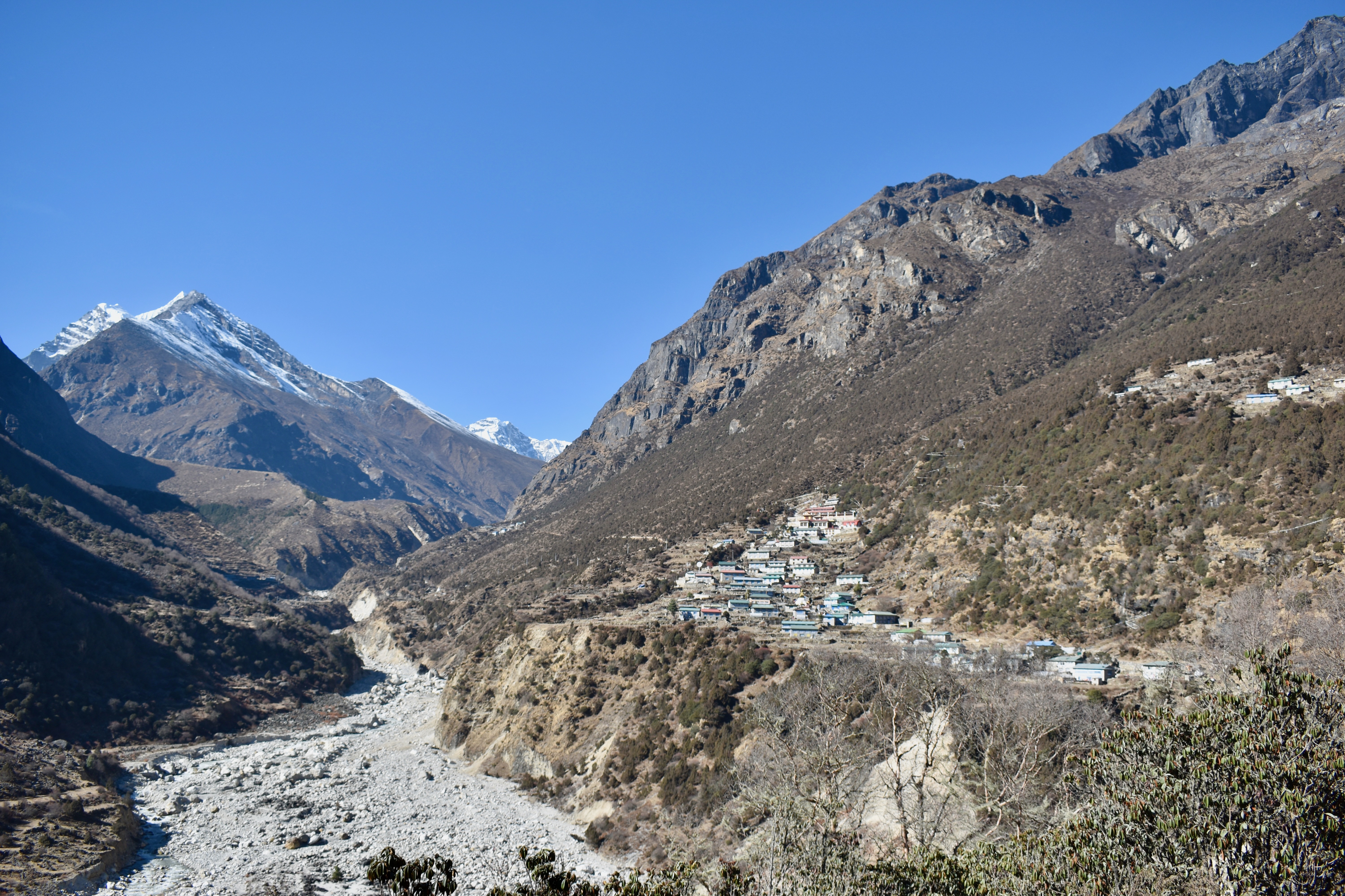
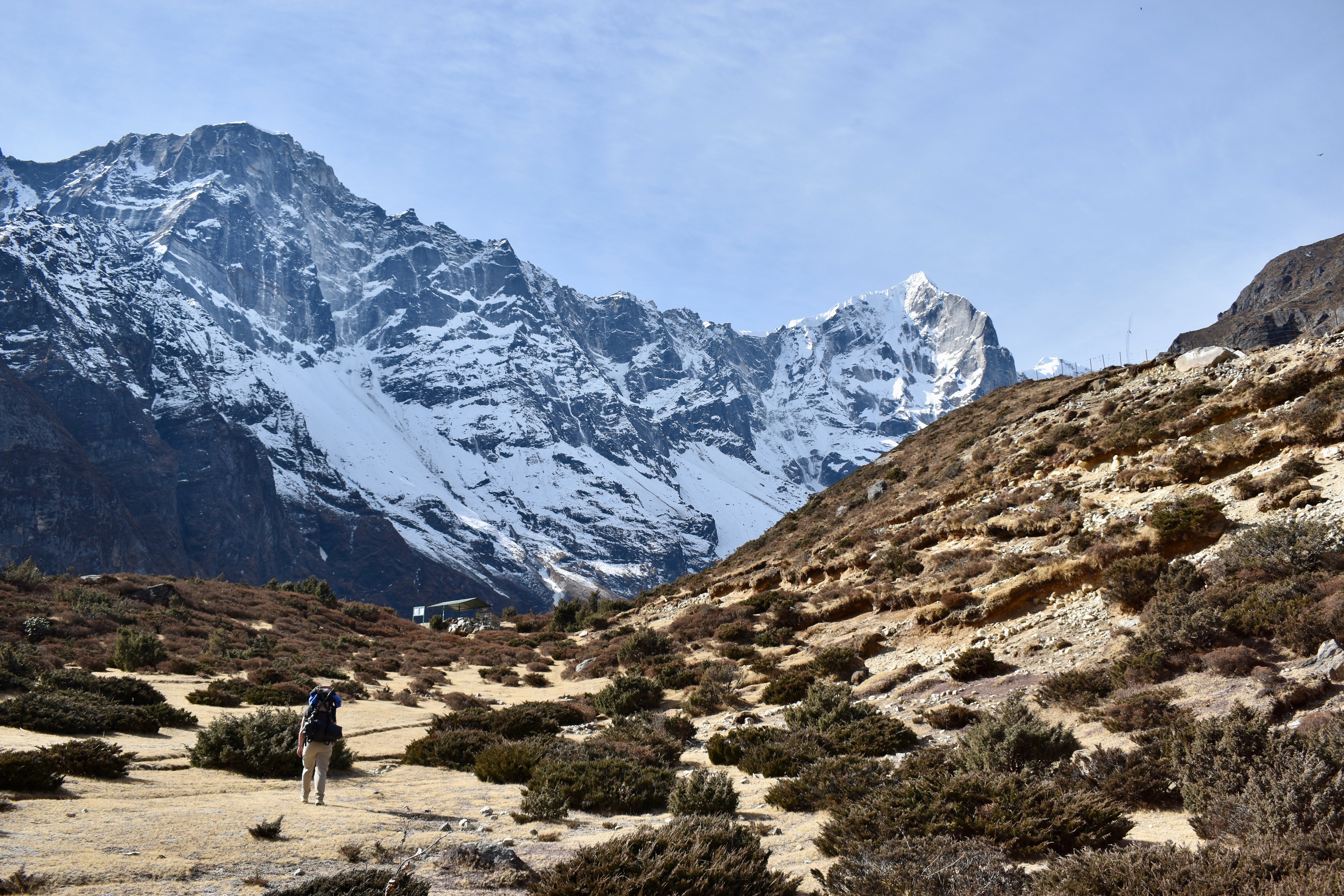
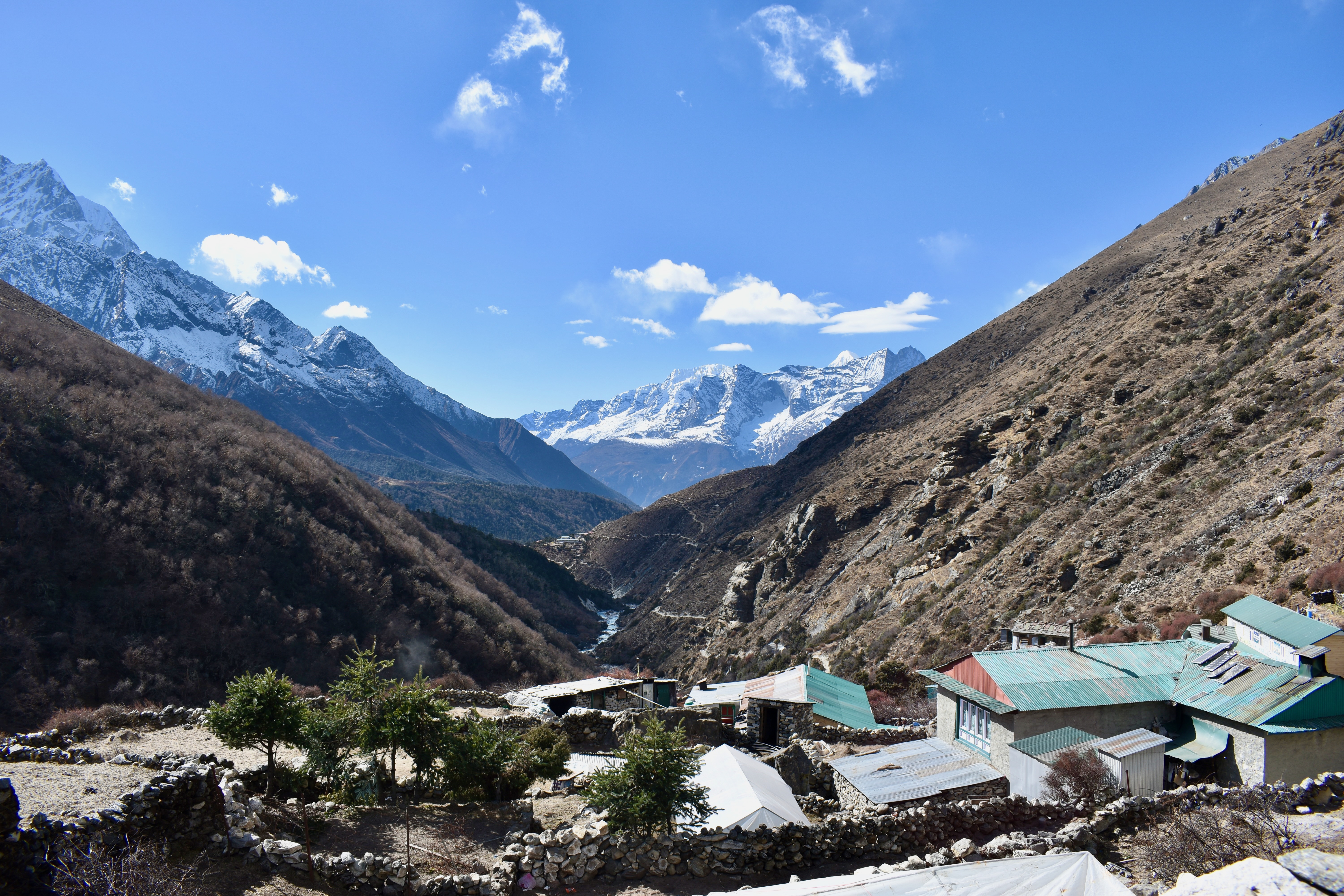
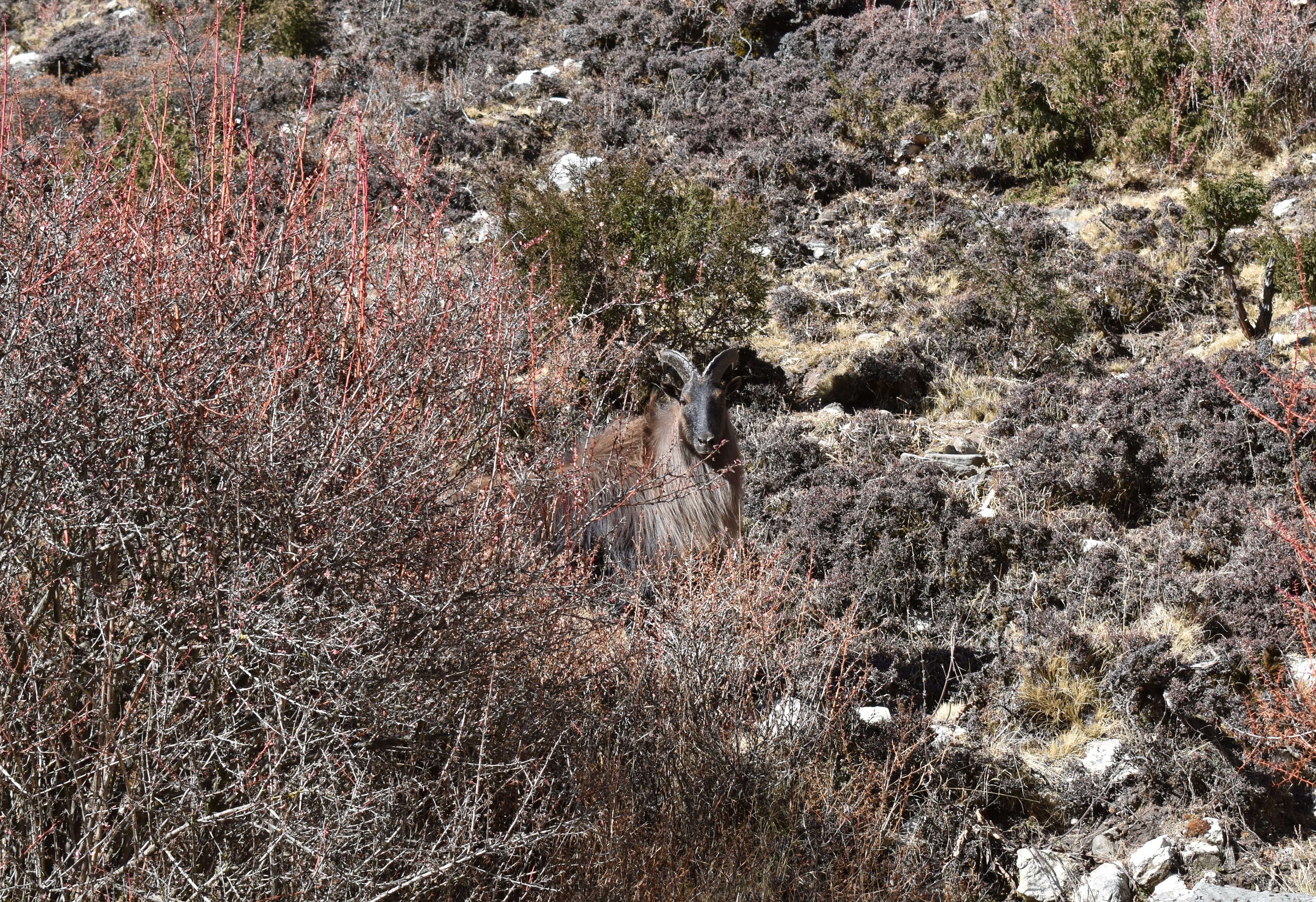
Above town, we took a left turn towards the villages of Samshing and Thamo. About an hour and a half later, we reached Thamo and got a room in a lodge just below the monastery. I was a bit nervous—this was only day two of trekking, we were already at 3,400 metres, and I could feel the altitude creeping up on me. Once we settled into the teahouse, though, I felt fine. We ordered a big pot of ginger honey tea and spent the afternoon reading.
We had planned to visit the monastery, but instead ended up having a nap. Around 6 pm, we went downstairs for dinner: dal bhat, fried vegetable momos, and a yak burger patty with chips. Everything tasted amazing. We slept well and didn’t notice the altitude again, which was a huge relief.
- Day 2: Monjo to Thamo
- Distance: 10.54 km (I forgot to turn the tracking back on, so it’s about 0.5 km short)
- Elevation change: 903 m up, 339 m down
- Time: 3:39 (excluding the break in Namche)
Day 5: A stop in Thame and up to Lungden
Since the night had gone well, we felt ready to continue another 900 metres up to the village of Lungden. For breakfast, we had omelettes, rice pudding, and the mandatory cup of coffee.
We were out again around 8:30 am. According to Mapy, the day was supposed to be a steady, gradual climb—but we were surprised by a steep descent to a bridge just before the village of Thame. We also managed to take a wrong turn and added some extra climbing for ourselves. We’d read about flooding in the region in 2024, so we assumed the trail on Mapy wasn’t fully up to date yet.
After climbing up into Thame, we stopped for coffee. It felt a bit early, but we weren’t in any rush and figured we could even stop twice. That turned out to be a good decision, because none of the other teahouses along the route were open.
The rest of the path was easy to follow and mostly gradual, passing through a few small villages. We’d hoped to stop somewhere for tea or coffee—or at least to refill our water—but had no luck. In the end, we refilled straight from the river.
We finished the day after about five hours of walking, plus another hour for breaks. The distance was 14.3 km with almost 1,100 metres of elevation gain. On paper it didn’t look too bad, but I definitely felt the altitude and couldn’t wait to be done. Clare was clearly stronger, but even she ended up lying on a stone bench after what we thought was the final push—only to realise the village was still just around the corner.
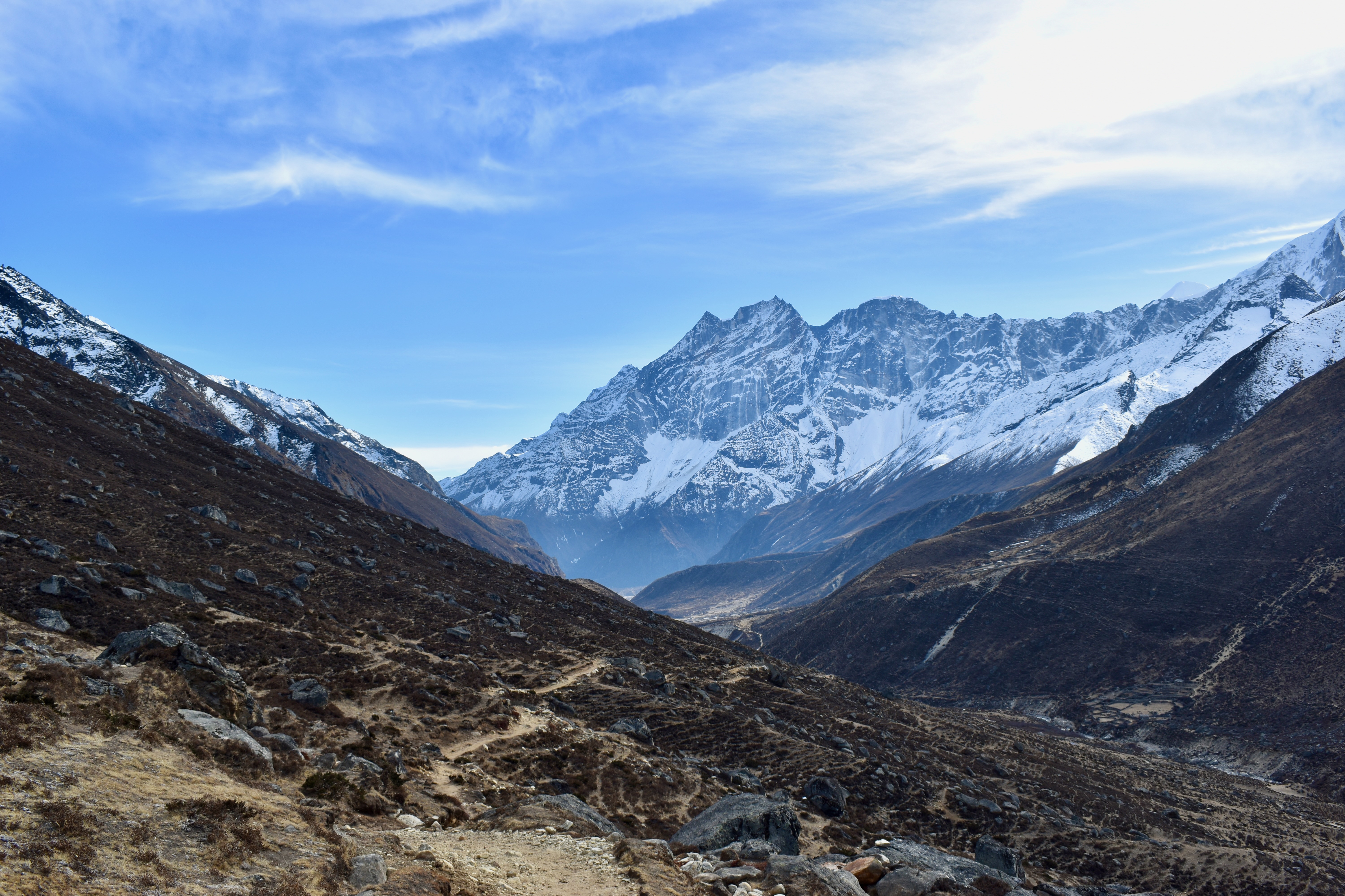
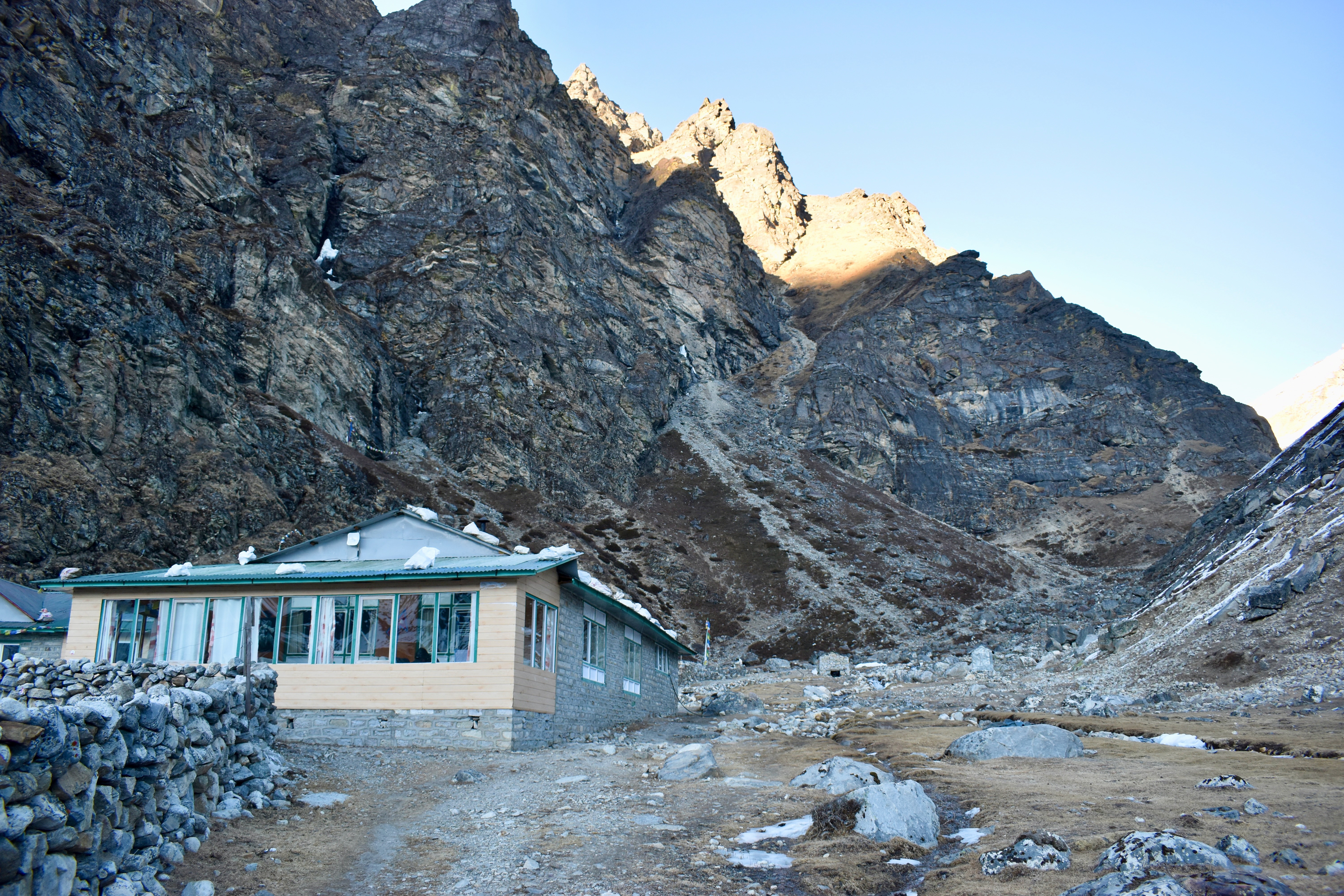
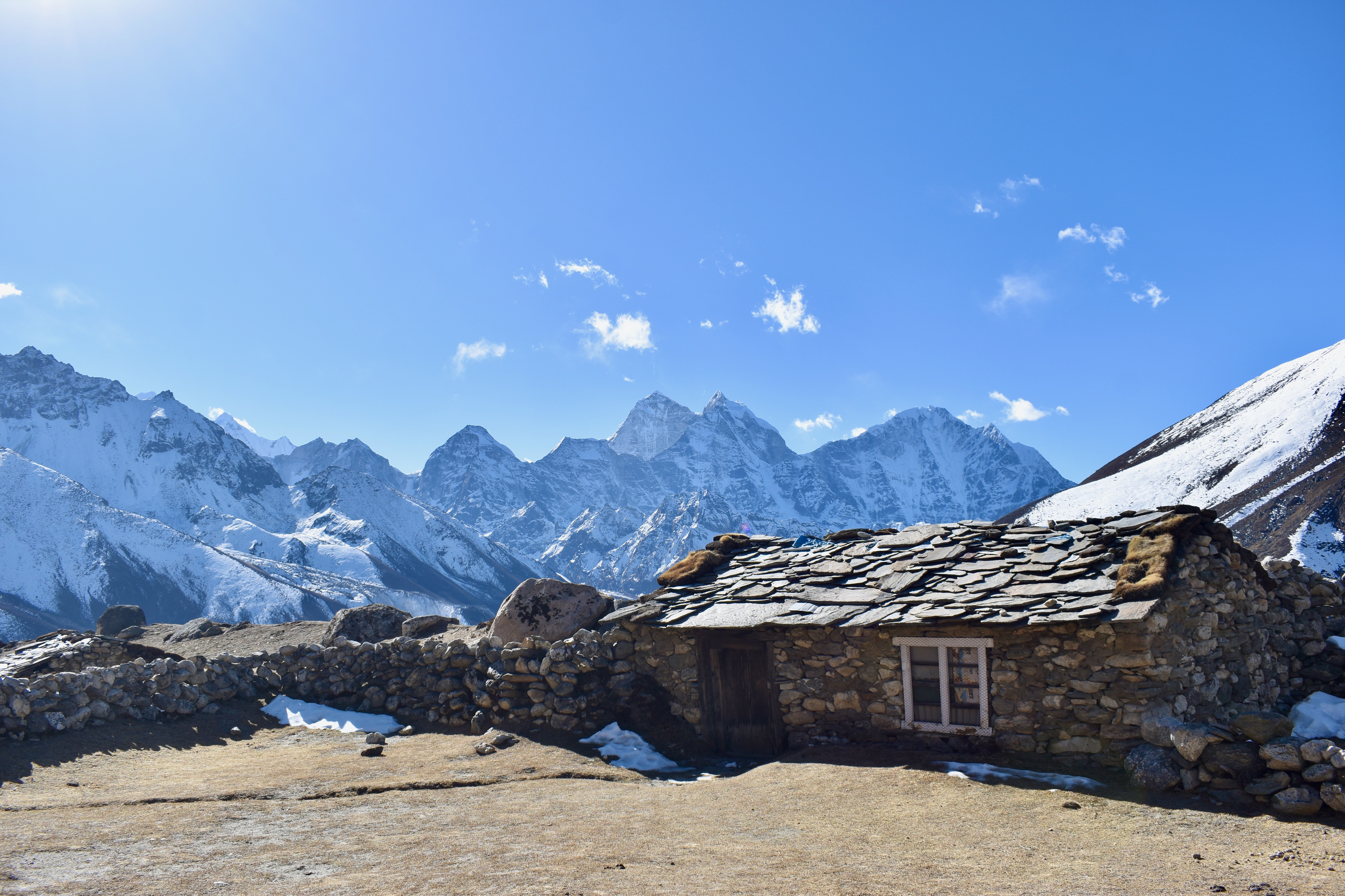
Lungden sits at 4,350 metres above sea level. We stopped at the first teahouse we saw, the Khongde Lodge, ordered a pot of ginger tea, dragged two chairs outside, and spent the rest of the afternoon soaking up the sun.
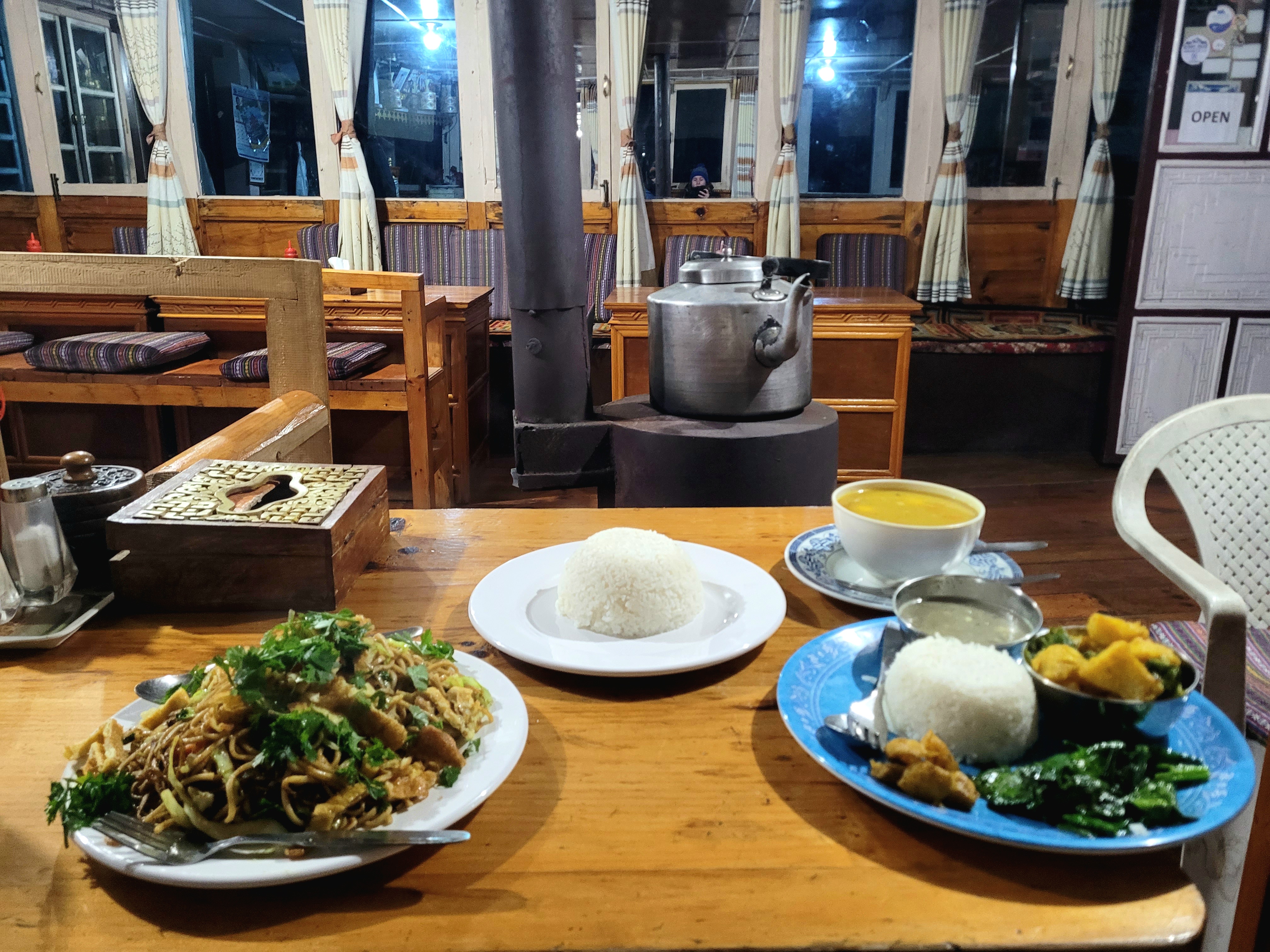
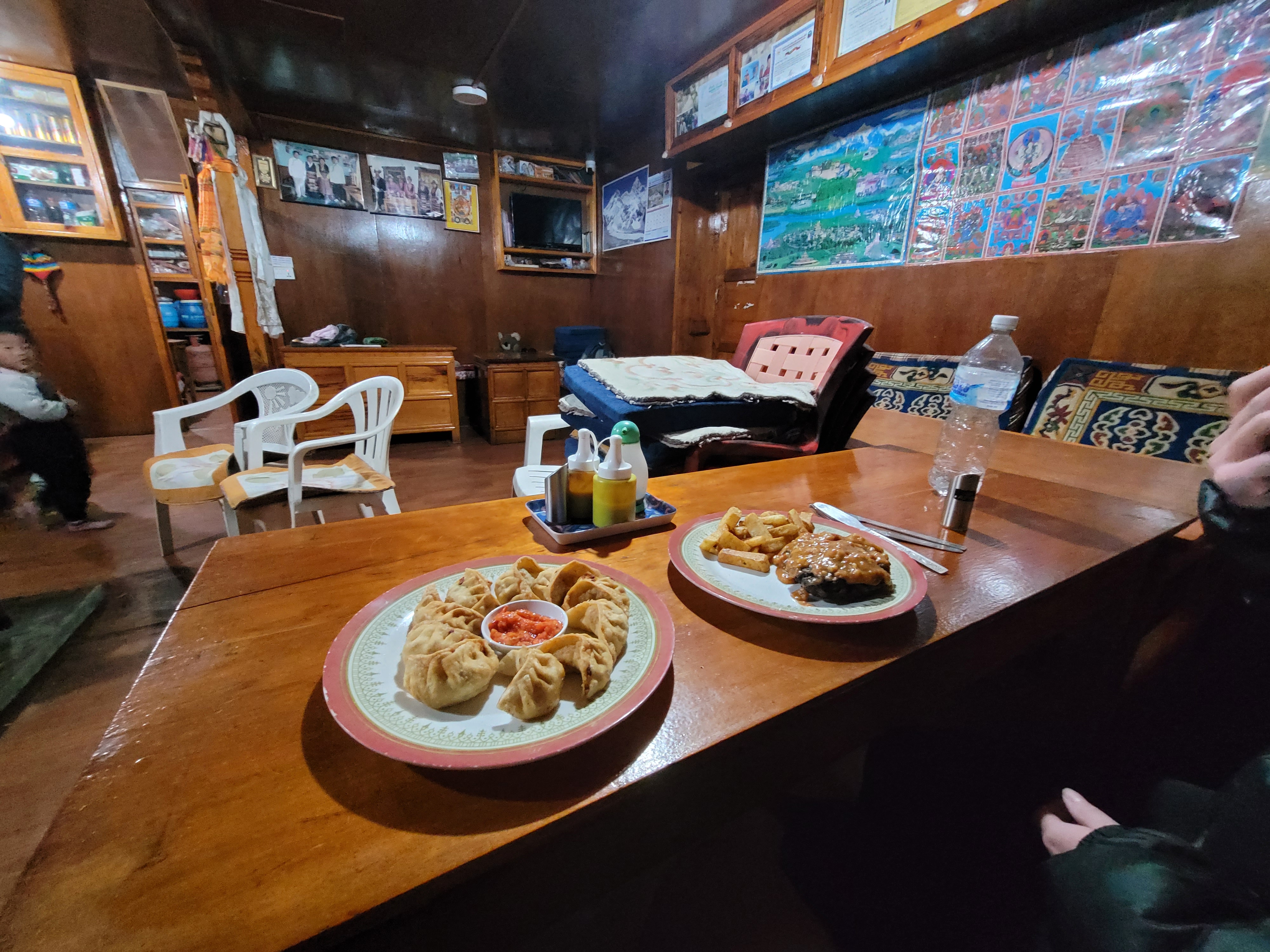
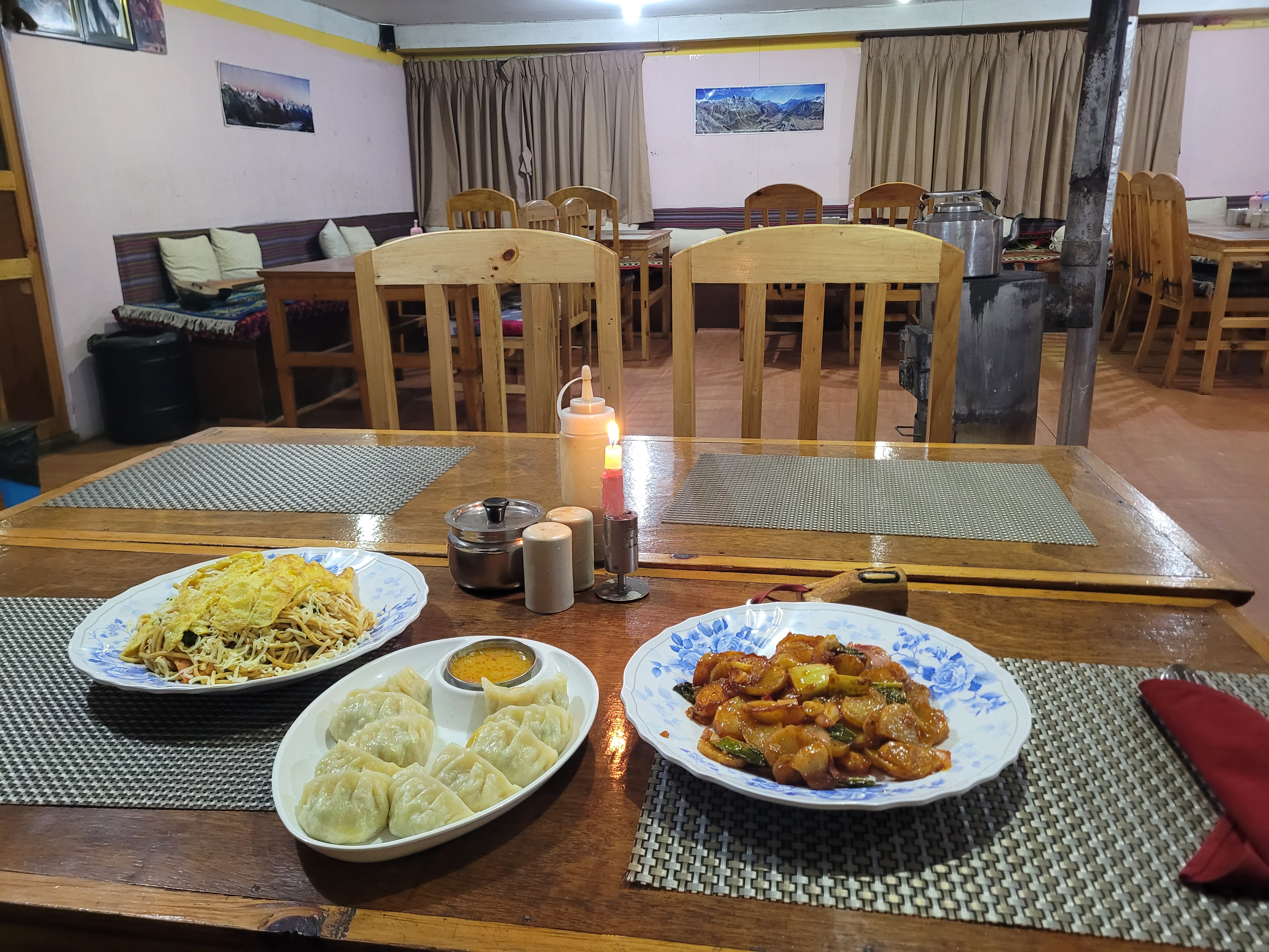
It was lovely while the sun was out, but once it disappeared behind the mountains, the cold set in quickly. We ordered dinner for 6 pm and went to lie down. The room was surprisingly warm, and we didn’t even need our sleeping bags. Dinner was egg chow mein, chilli potatoes, steamed momos, and dal bhat (a must). It was a lot of food—and easily the best we’d had so far.
We went to bed around 7 pm and watched a few shows. We felt fine the whole evening, but once we turned everything off, both our heads started spinning.
- Day 3: Thamo to Lungden
- Distance: 14.36 km
- Elevation change: 1,098 m up, 227 m down
- Time: 4:55 (excluding the break in Thame)
Day 6: Acclimatisation day in Lungden
Luckily, we had nowhere to be in the morning, as we were taking a day off hiking to acclimatise before pushing higher. We’d both had splitting headaches during the night, and Clare didn’t feel good at all. Fortunately, all we really needed was more water, and we each took two paracetamol to help us sleep.
We had breakfast at eight, along with a pot of coffee to wake us up. Afterwards, we got ready and went for an acclimatisation “walk” up the hill behind the lodge. The sun was shining, so jumpers were enough.
Note
I often mention a pot of coffee or tea. While you can order individual cups (and we often did in the mornings when we needed to move quickly), hot drinks are usually sold by the pot. They come in small (1 l), medium (2 l), and large (3 l). The coffee isn’t very strong, so even a medium pot is manageable.
I would’ve been perfectly happy with just a few metres of elevation, but Clare was leading and didn’t stop until we reached a small saddle about 400 metres above the lodge. From there, she had the idea to keep going, so we didn’t stop again until we reached 4,900 metres. Thank God for the awful wind that finally made Clare turn around. It wasn’t exactly what some people would call a relaxing walk, but it was short enough—and good acclimatisation for the pass ahead.
We headed back down, taking our time and enjoying the views. Back at the lodge, we ordered a pot of tea and spent the rest of the day reading, writing this diary, getting things ready for the next day, and napping. Dinner was amazing once again, and we had to order the chilli potatoes again—they were magnificent. We went to bed around 10 pm, with breakfast booked for 6:30 the next morning.
- Day 4: Acclimatisation hike
- Distance: 4.18 km
- Elevation change: 600 m up and back down
- Time: 2:35
Day 7: Renjo La Pass
We left the lodge around 7:30 after breakfast and getting ourselves ready. The first day we’d been alone in the lodge, but on the second day two fellas showed up—one Ukrainian and one Belarusian… quite a combo given the current political situation. The Ukrainian guy said he’d hike with us to Renjo La, but he left about 30 minutes before we did.
Once we passed the village, the path started climbing steeply and didn’t let up until we reached a mountain lake at around 4,900 metres. Here, we started encountering some snow and ice on the trail, but nothing too bad. The path then continued around the lake on the left and wrapped around onto another plateau above. This was the more gradual part of the hike, even flat at times.

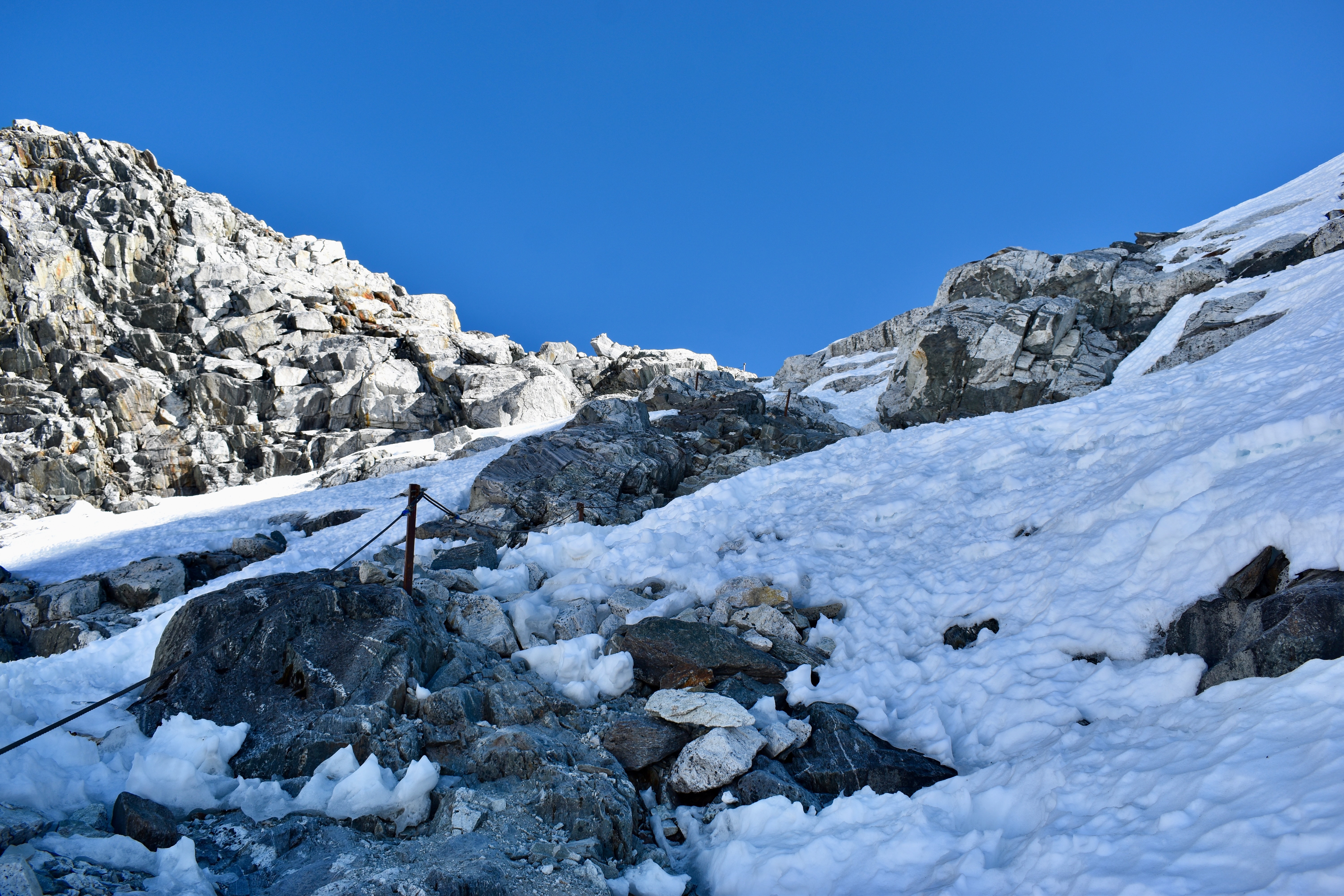
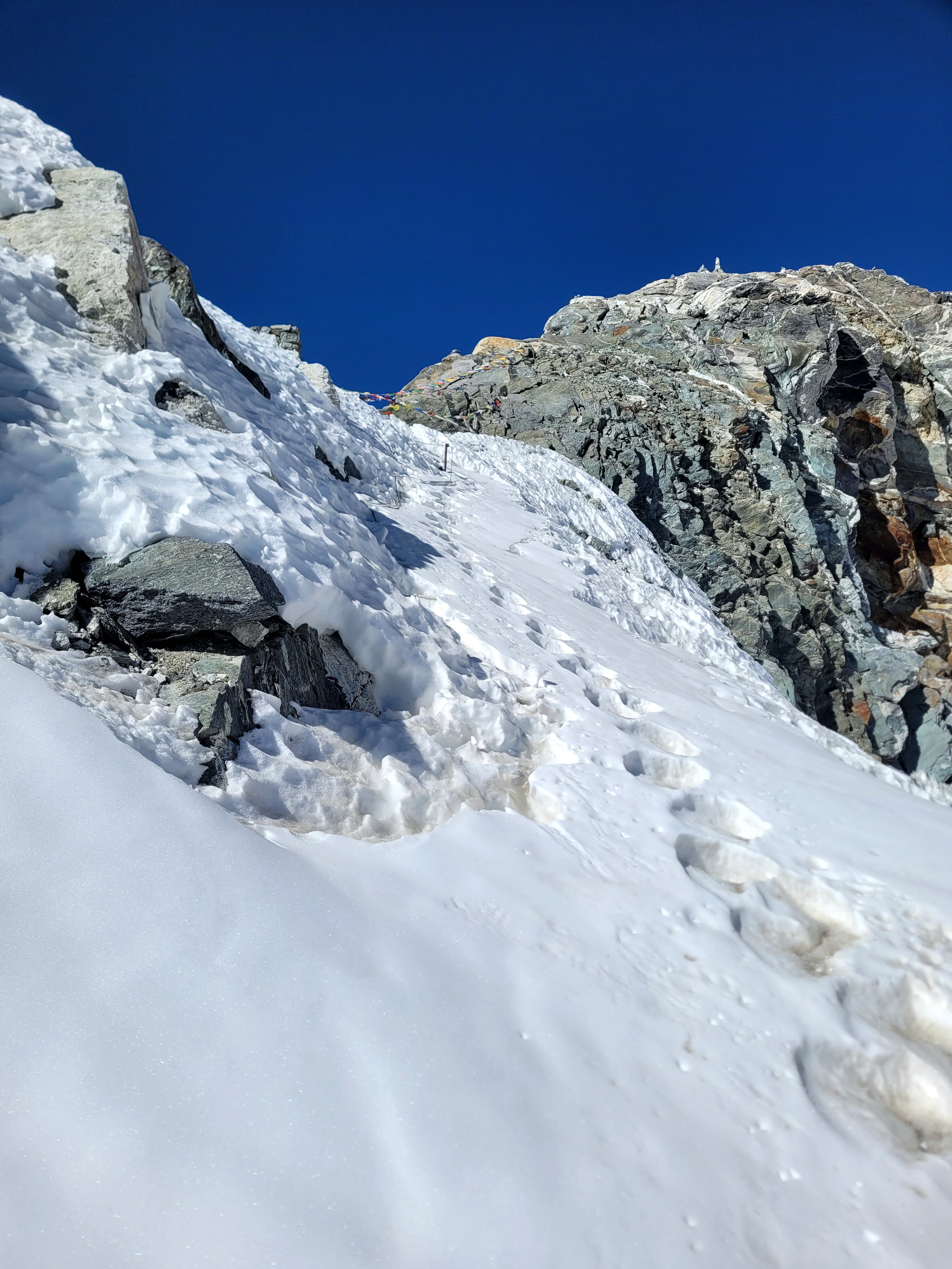
After that, it was just up and up again. There was another lake above us, and once we reached it, we were properly in ice land. This lake sat right below the pass, and for the first time we could clearly see where we were heading. The final stretch was well laid out with stone steps, but they were almost completely covered in ice and snow. I hadn’t put on my microspikes yet—they really hurt my knee—so I tried to avoid using them for as long as possible. On the way up, that still worked.
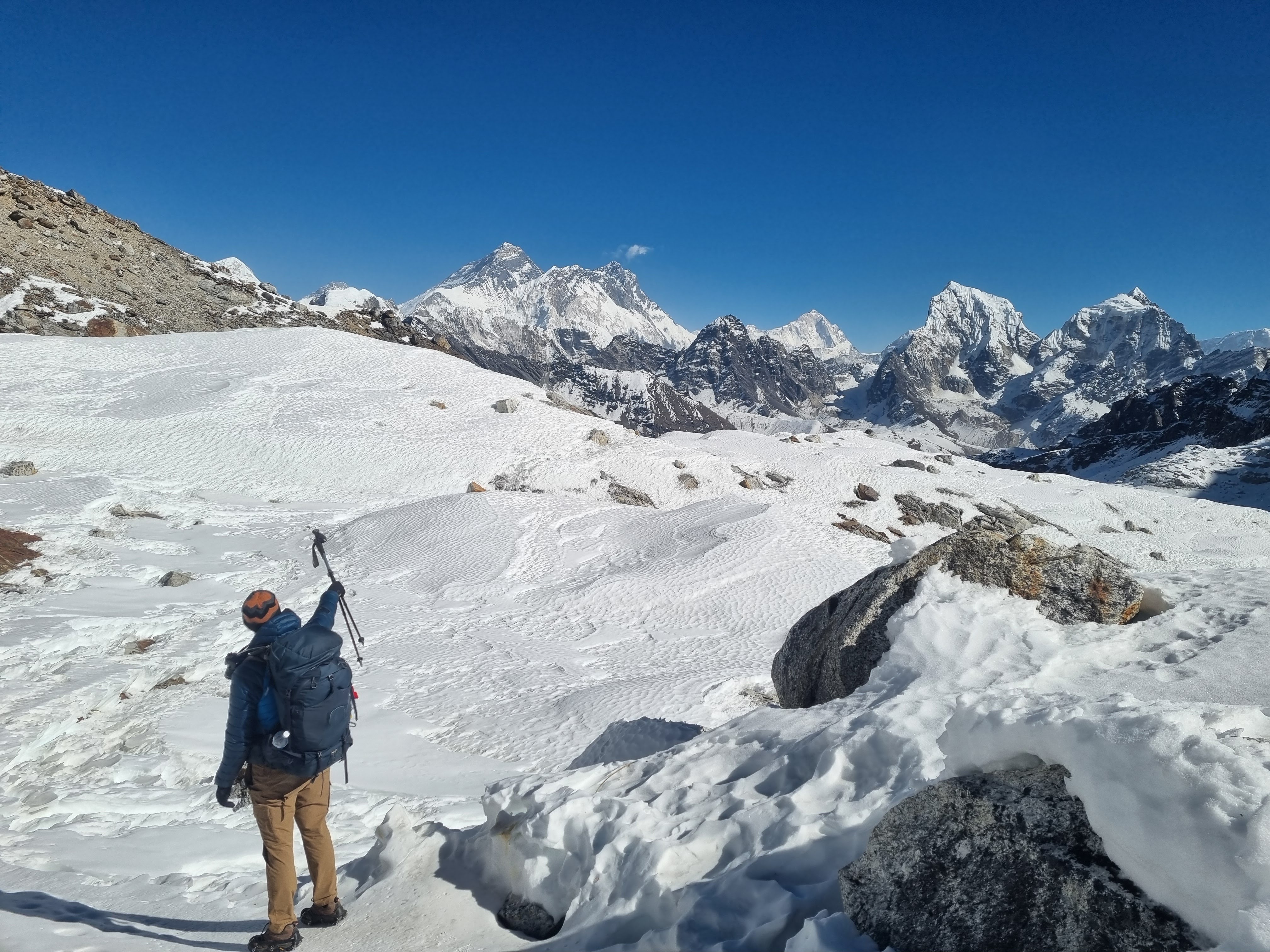
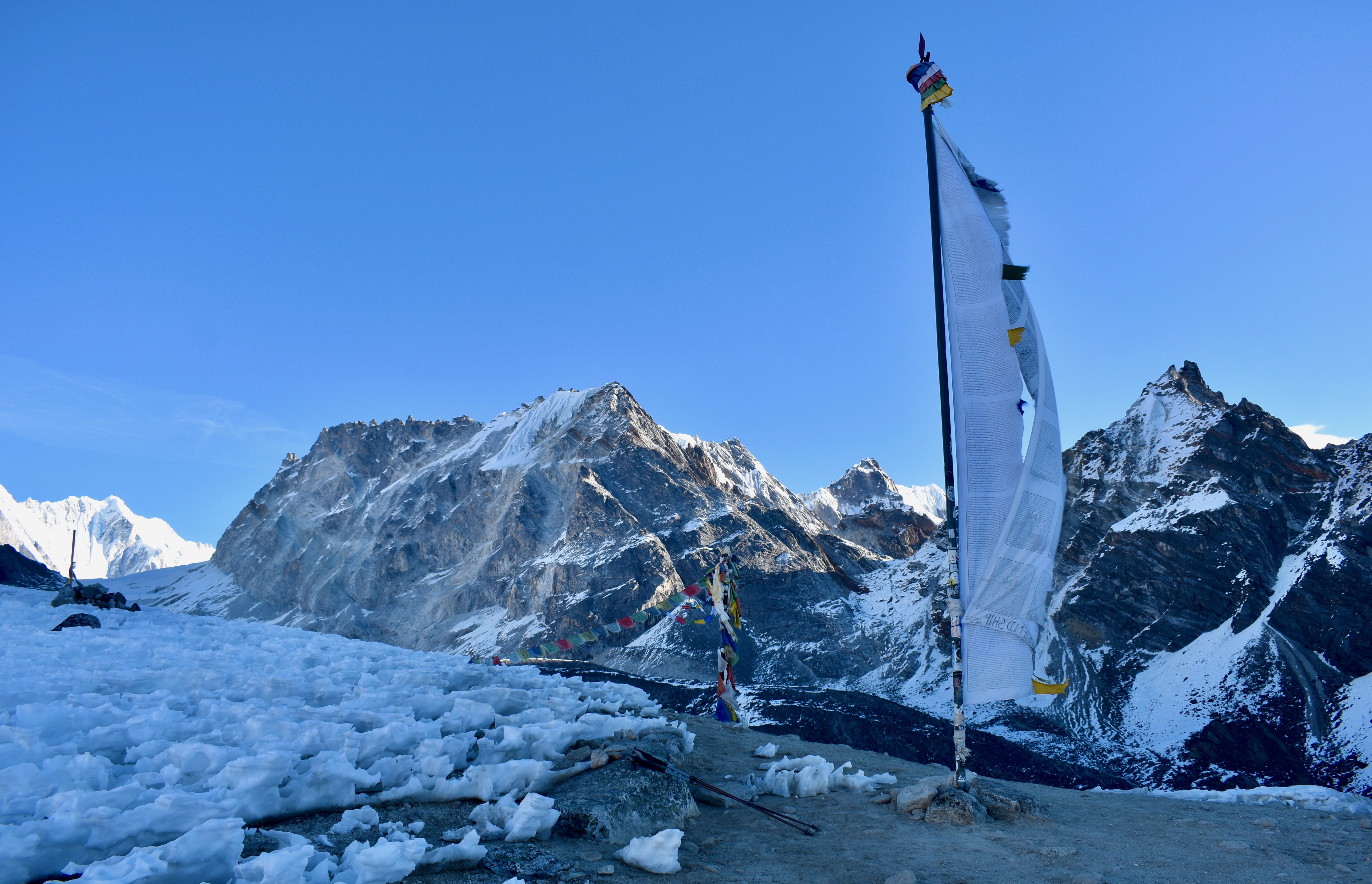
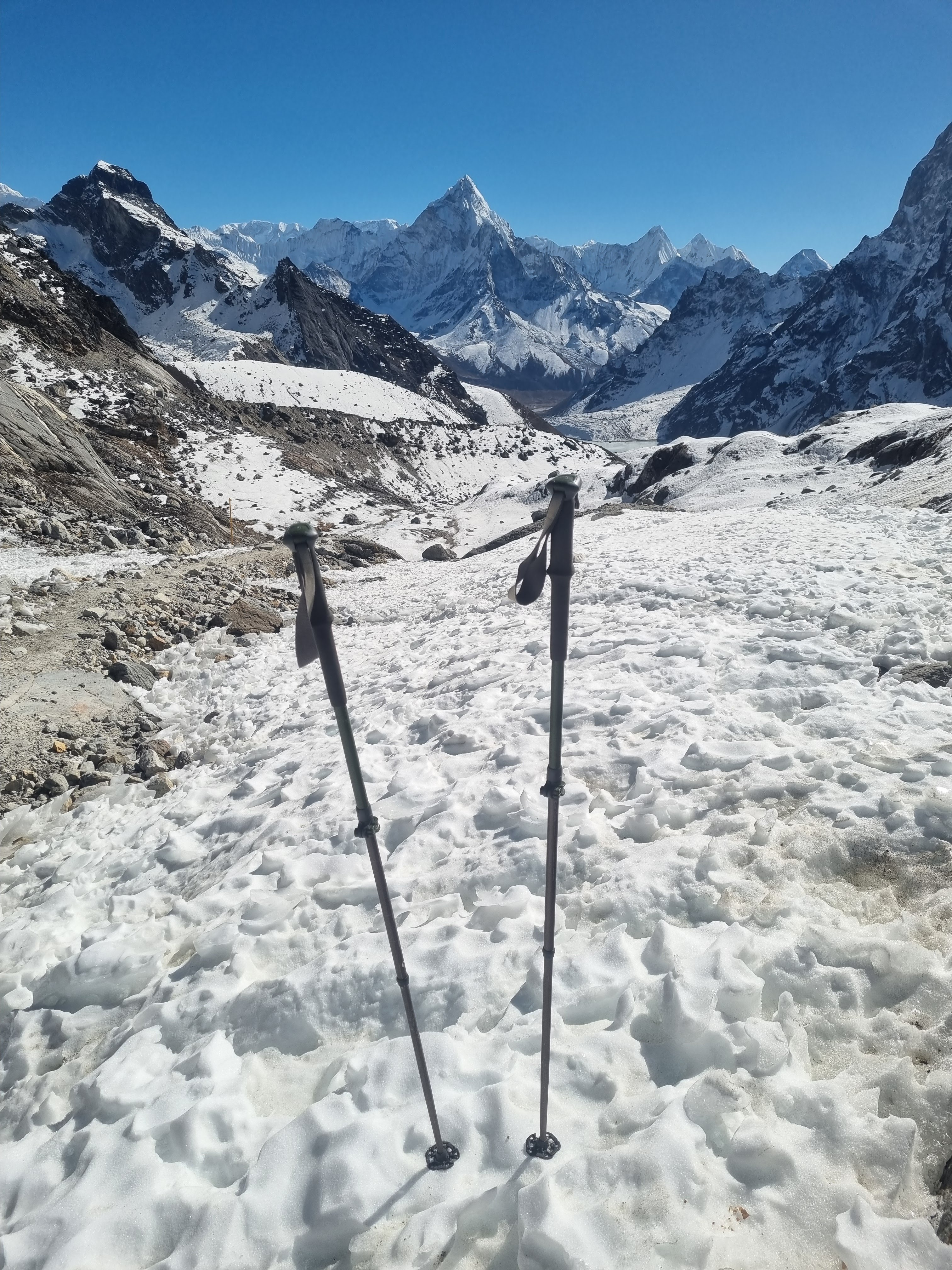
We struggled on the icy stairs and needed breaks every few hundred metres. The wind didn’t help either. After five hours of hiking, we finally reached Renjo La Pass at 5,340 metres. My watch got confused by the cold and thought we were another 100 metres higher, so I can’t really trust it for elevation gain, but from Lungden it was roughly 1,100 metres over 8 km.


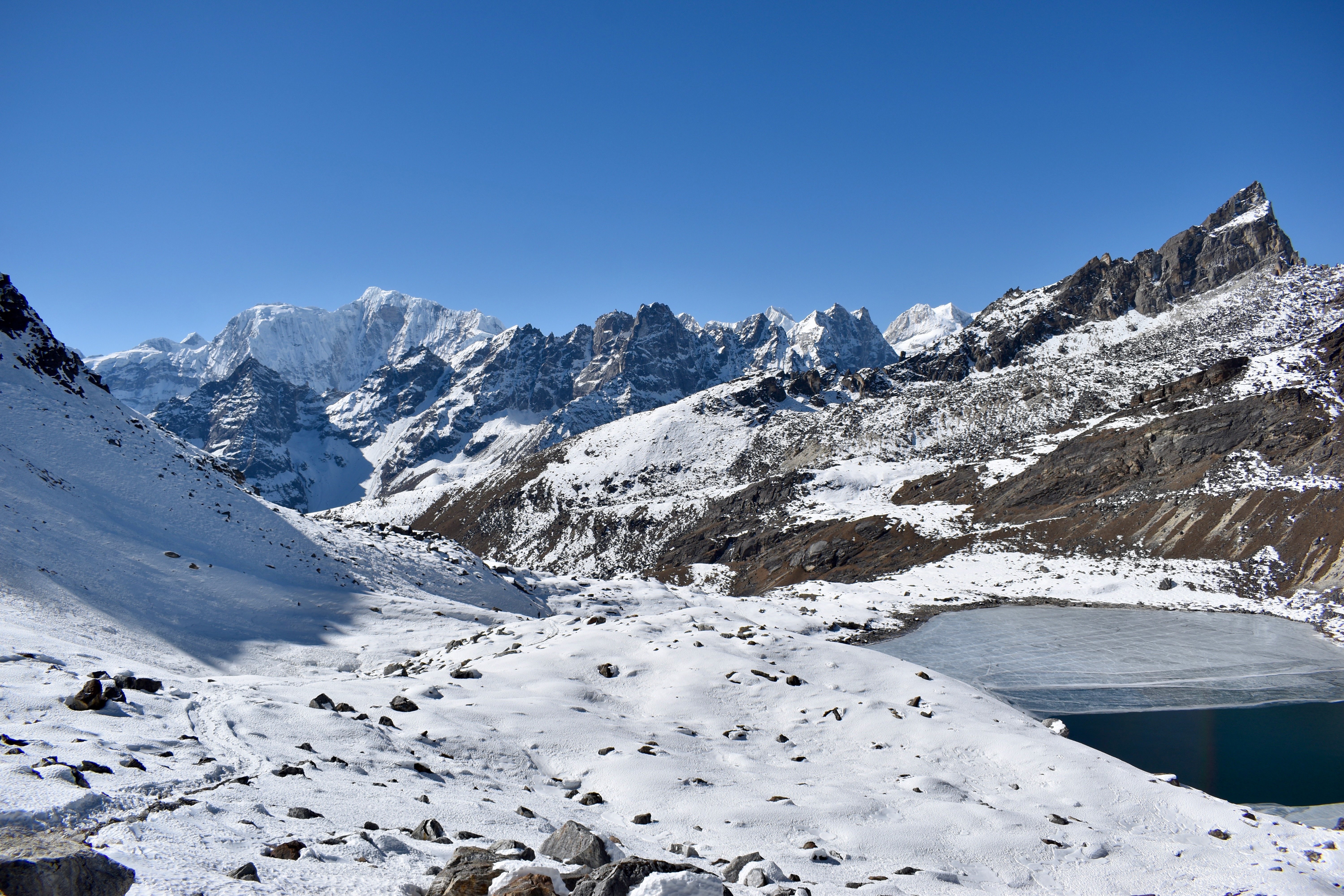

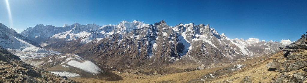
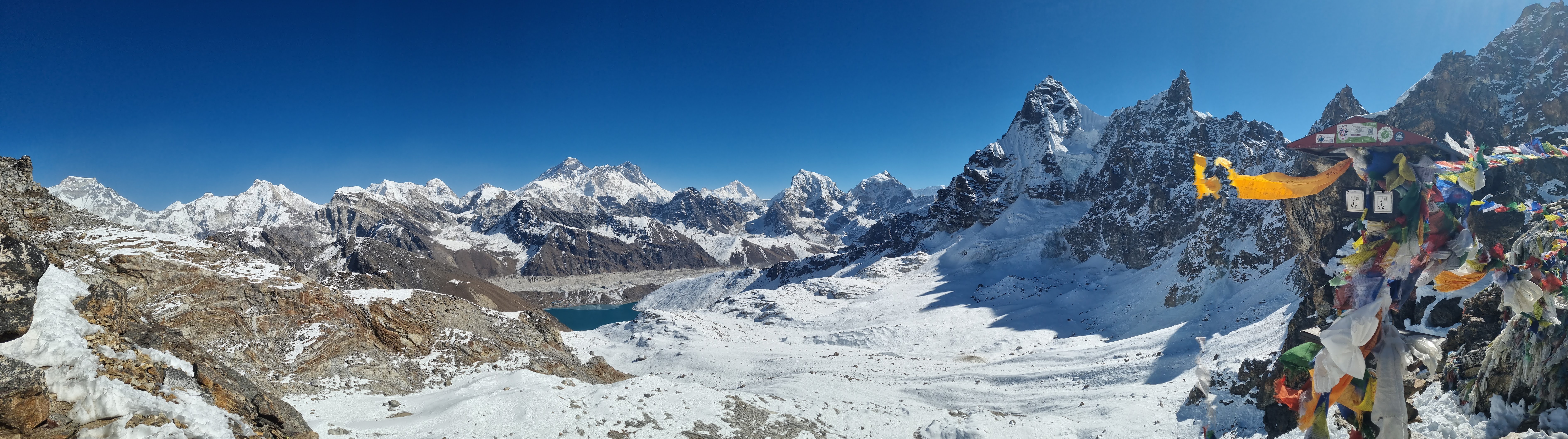
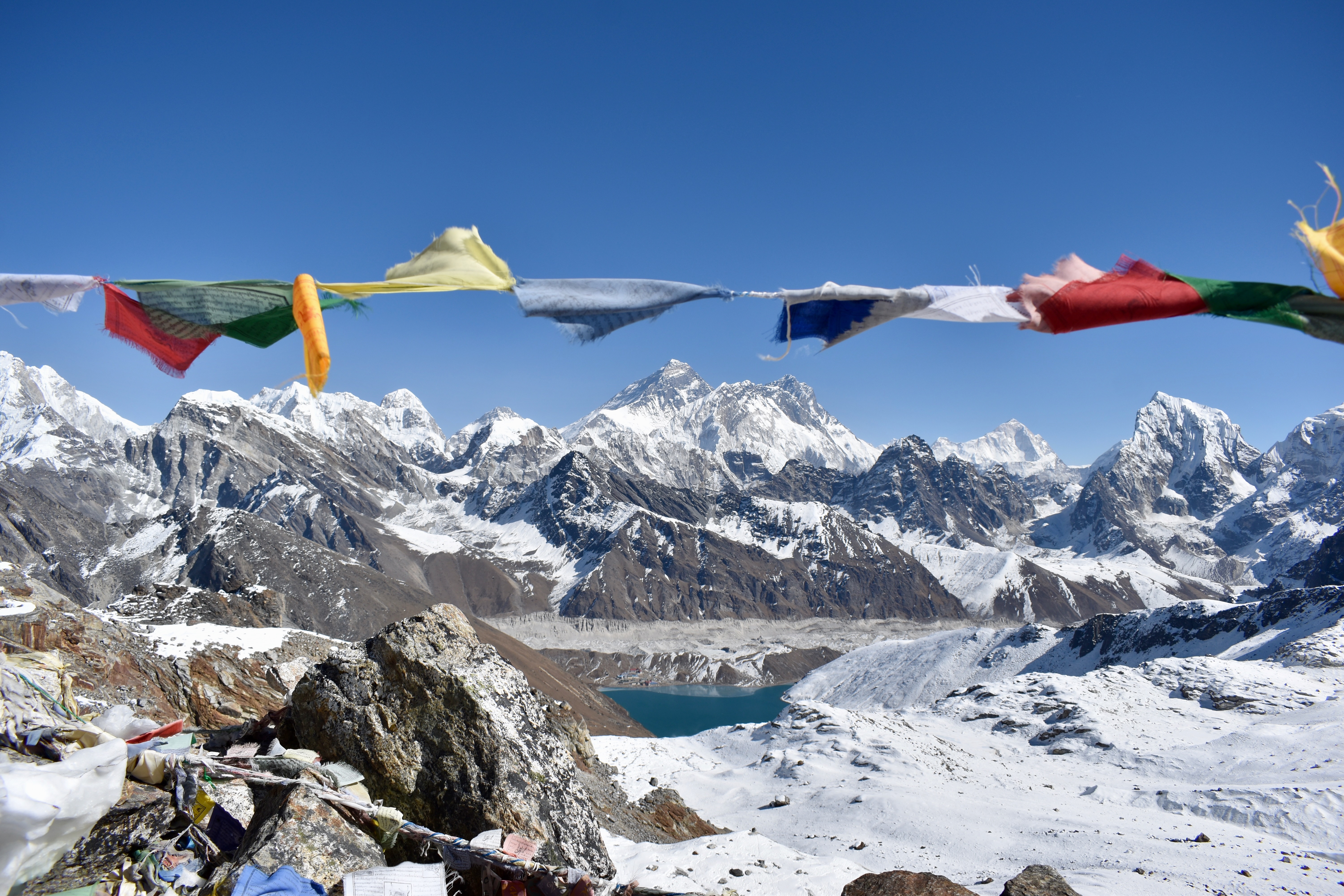
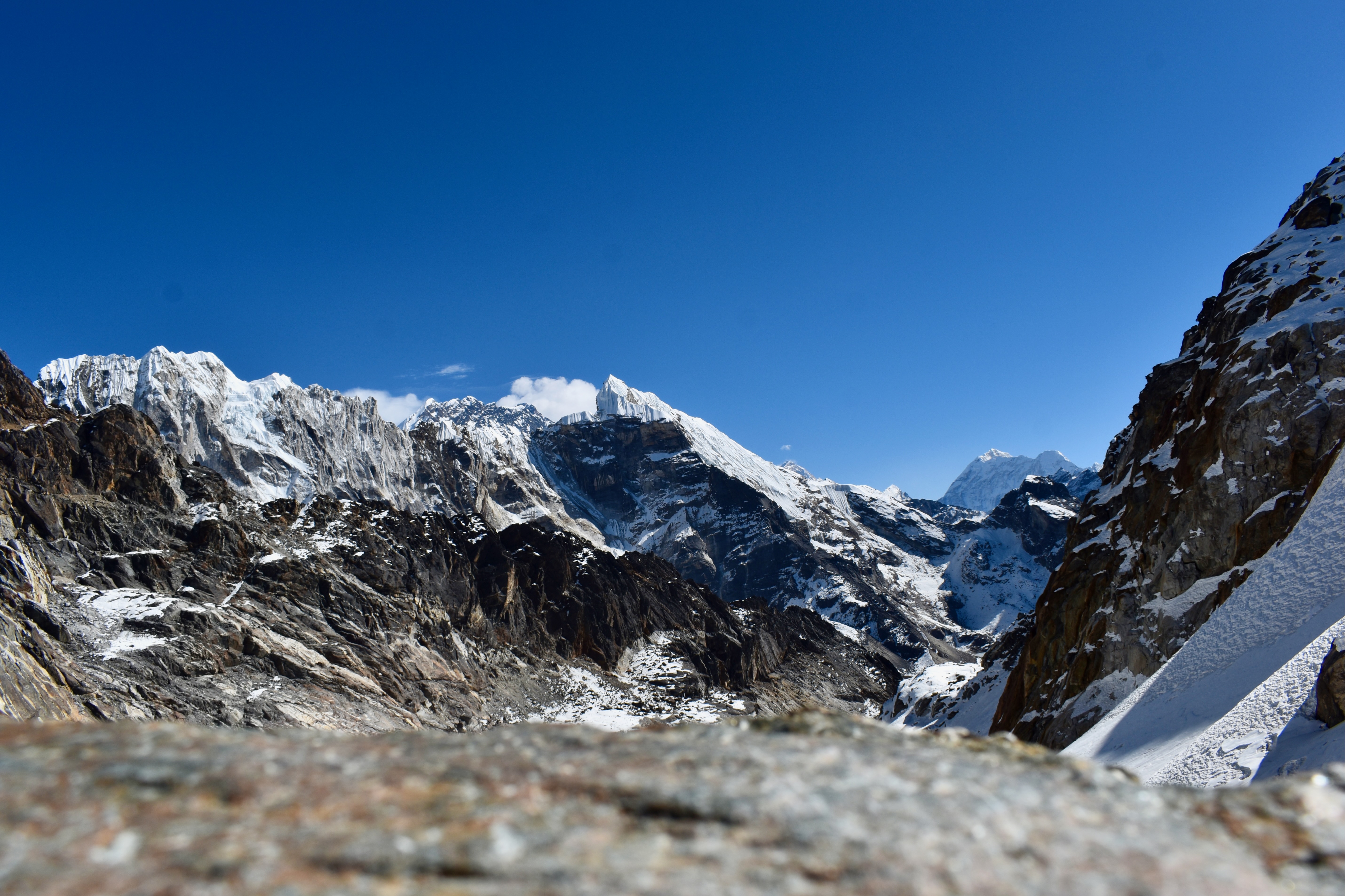
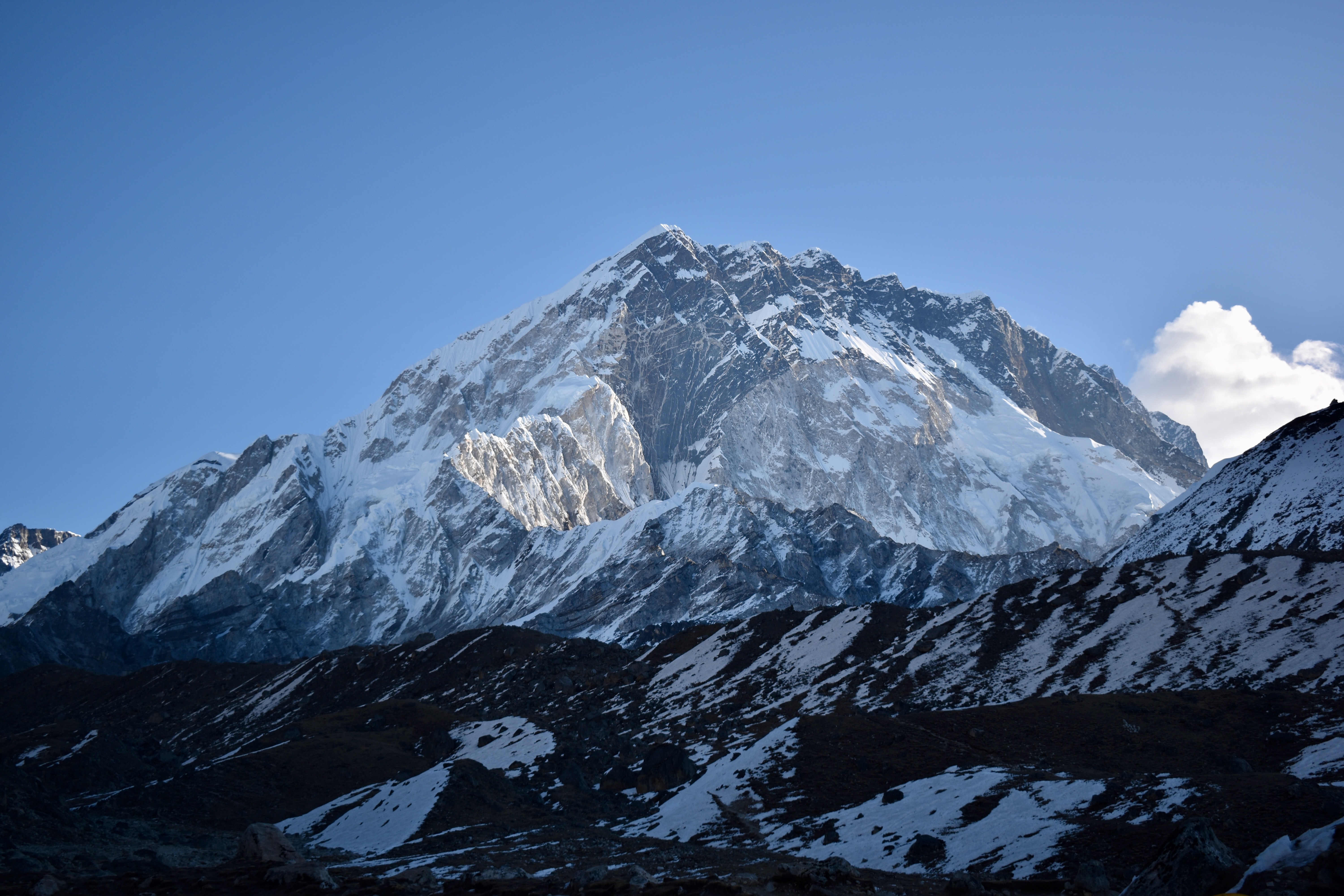
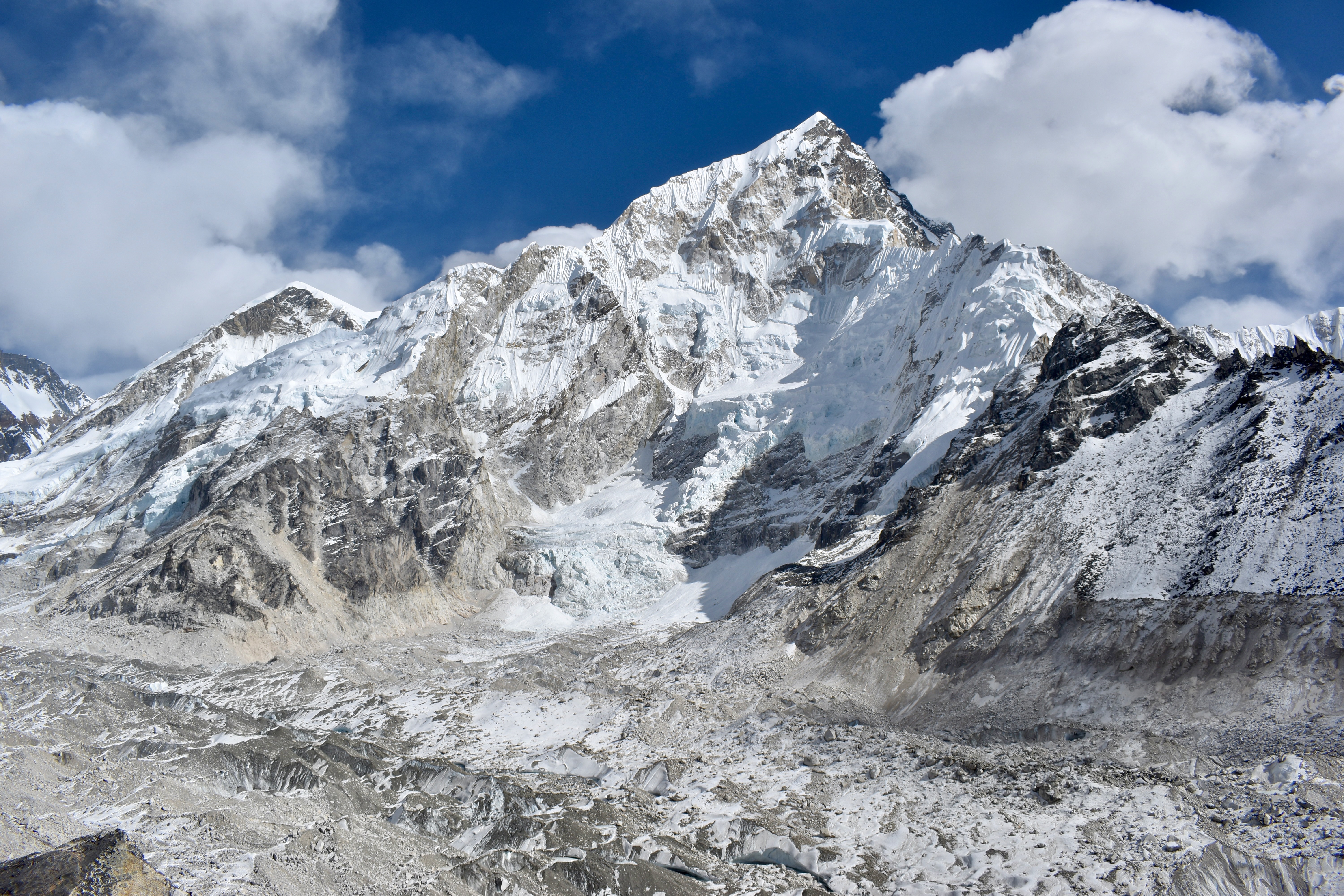
The skies were deep blue and completely clear, and the views were incredible. The euphoria of making it to the top was high, so we spent 20–30 minutes up there eating chocolate bars and taking photos. You’d think that the views of Everest, Lhotse, Gokyo Lake, and the surrounding peaks would be the highlight—but what really amazed us were the free charging sockets at 5,340 metres 😄.
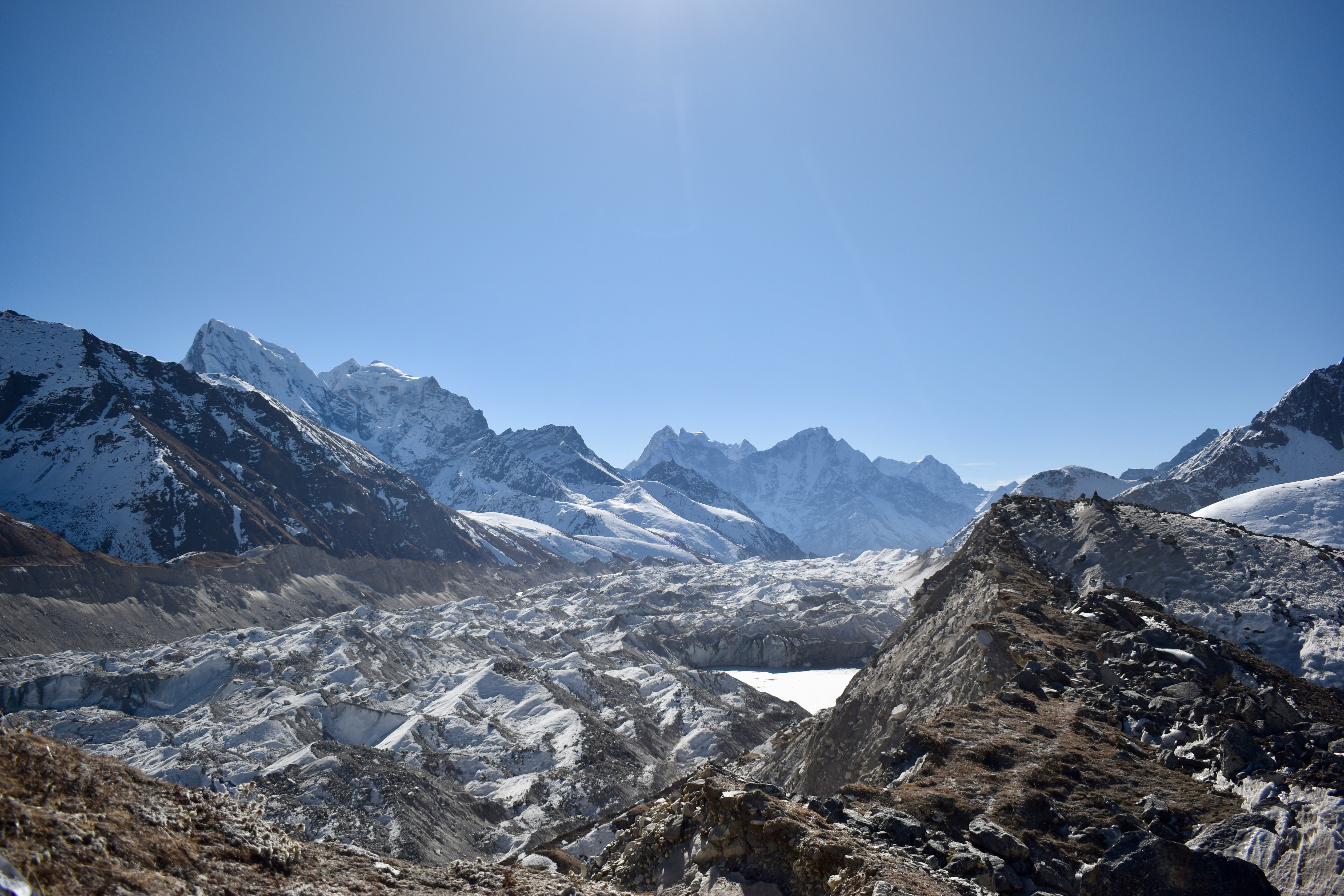
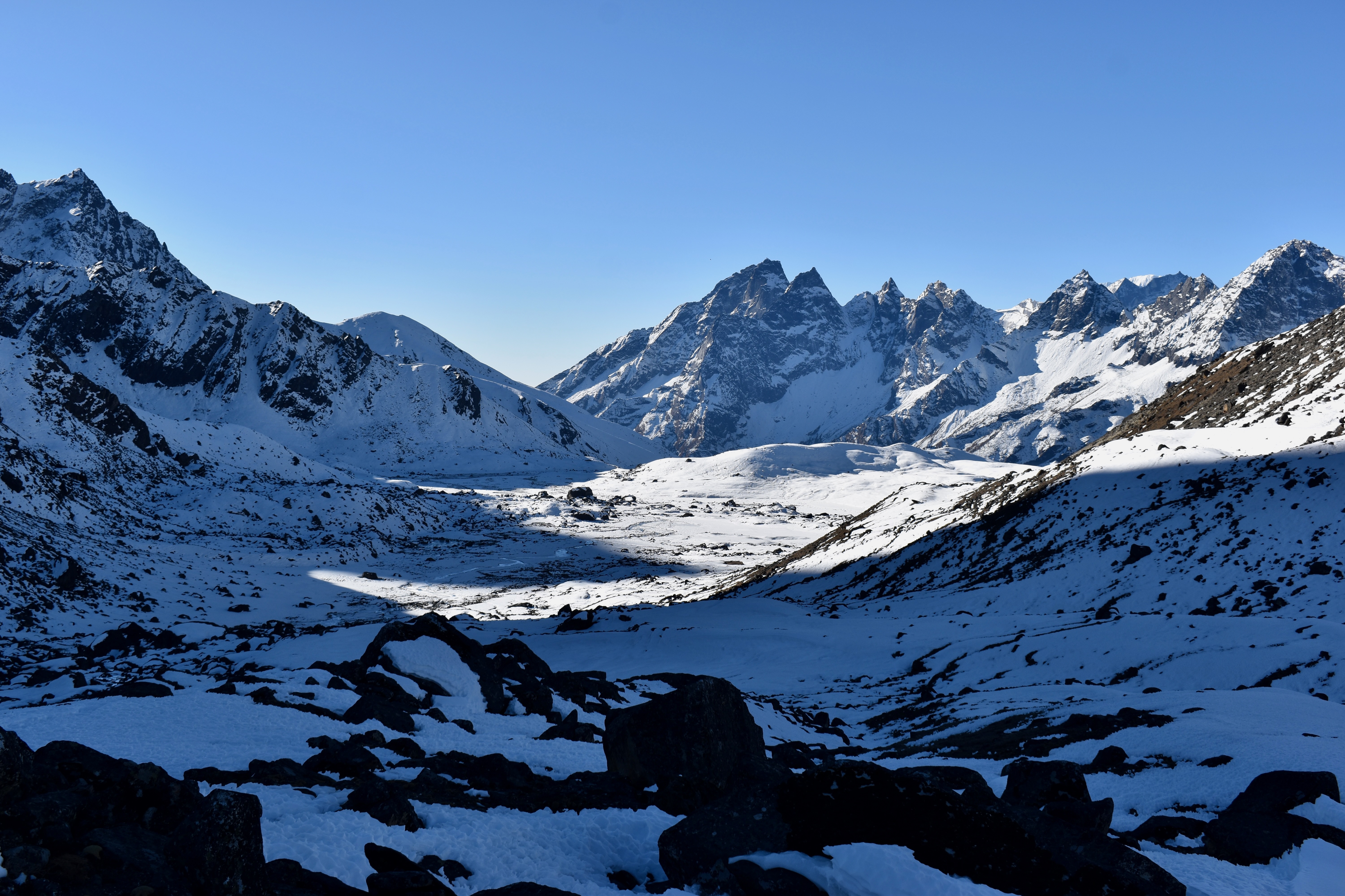
We were tired and looking forward to an easy, short descent to Gokyo village, which we could see down in the valley. We had absolutely no idea what was waiting for us.
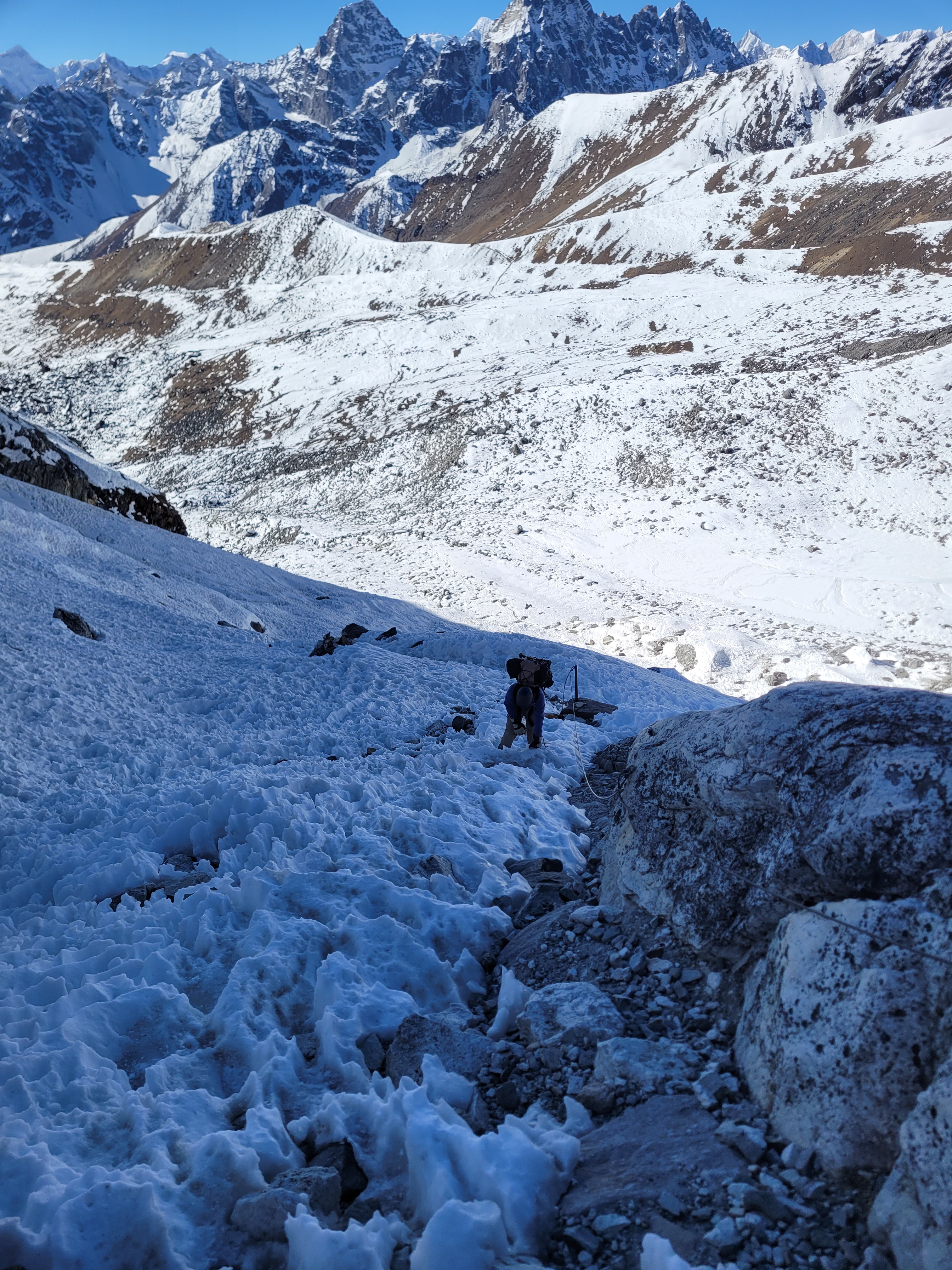
The descent started with laid-out stairs just below the pass, but we quickly had to put on our crampons as the ice became relentless and there were no steps to follow. After just 200 metres of descending, we already had no idea where the path was. The trail shown on our map must only exist in season — or no longer exists at all. We followed some footprints, but they eventually led us the wrong way.
As if the descent wasn’t challenging enough, the guy who’d started ahead of us caught up on the way down. He was clearly even more exhausted than we were. We saw him tumble once on the stairs and nearly twist his legs twice in the snow. The last thing we needed was the feeling of being responsible for someone else on the mountain.
Note
To be fair, he had made it from Lukla to Gokyo in just three days — so credit where credit is due.
At first, he took his own route down, but later came back and followed ours. Eventually, after crossing part of an ice field, we managed to find the correct path. Unfortunately, that wasn’t the end of it—the ice was followed by a steep scree section. Somehow, both our knees survived, and after more than three hours of descending, we finally reached the Gokyo Lakes.
Once we hit the flat path along the lake, a local man approached us and asked whether we’d stay at his Eco Lodge. We told him we’d been pointed to a different place by our previous lodge, but he offered us a free room, Wi-Fi, and charging. And bargaining is bargaining.
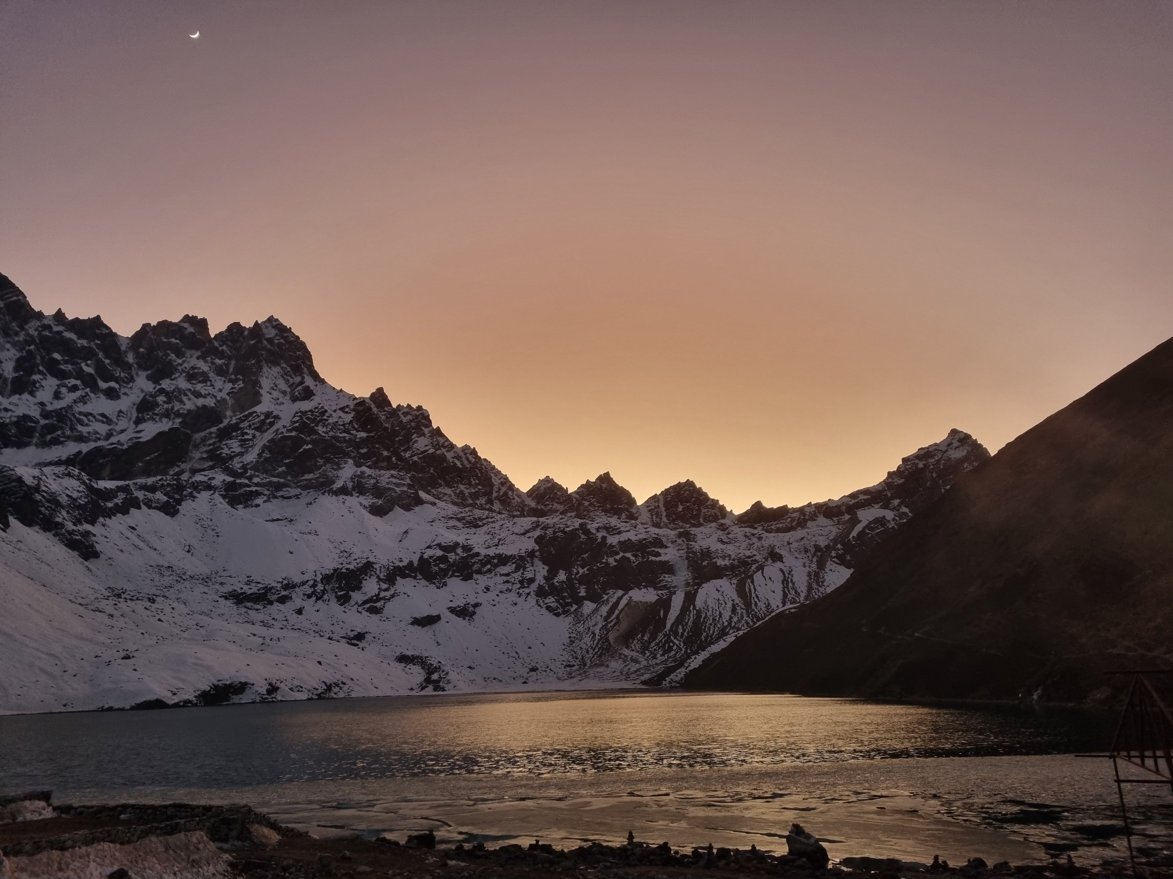
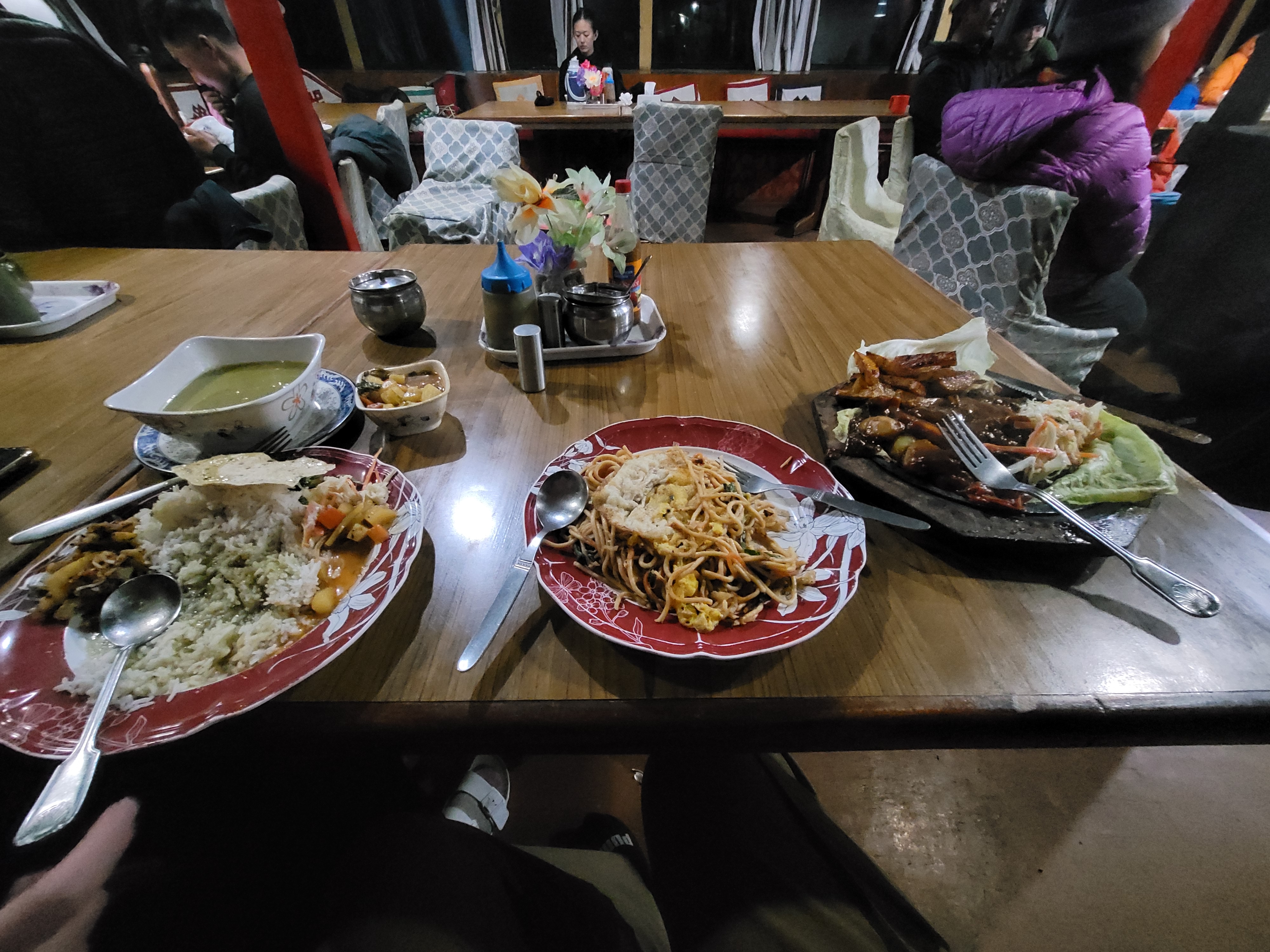
We didn’t even make it to our room before we were handed a pot of masala tea and garlic potatoes as a snack. I jumped on the Wi-Fi and called my family—it was Christmas back home in the Czech Republic. Dinner was a feast: yak sizzler, dal bhat, and veg-egg chow mein. We finished the evening playing cards and having a beer in the common room.
While the sun was out, we could walk around in jumpers. As soon as it dipped behind the mountains, the temperature dropped below –10 °C. That night, sleeping bags were very much needed.
- Day 5: Lungden to Gokyo via Renjo La Pass
- Distance: 13.04 km
- Elevation change: 1,745 m up, 1,337 m down (likely off due to the cold)
- Time: 8:27
Day 8: It was supposed to be an easy Christmas Day
We hadn’t planned much for Christmas Day, aiming for just a short walk in the morning before heading to the next village in the afternoon and attempting another mountain pass the following day.
We had breakfast at 8 am and set out around 9. Gokyo Ri is a popular option, but it’s a 500-metre climb in about 1.5 km. Since it offers very similar views to Renjo La—and because we were still pretty tired—we gave it a miss. To be honest, we just couldn’t fathom another big climb that morning with yet another one planned for the next day.
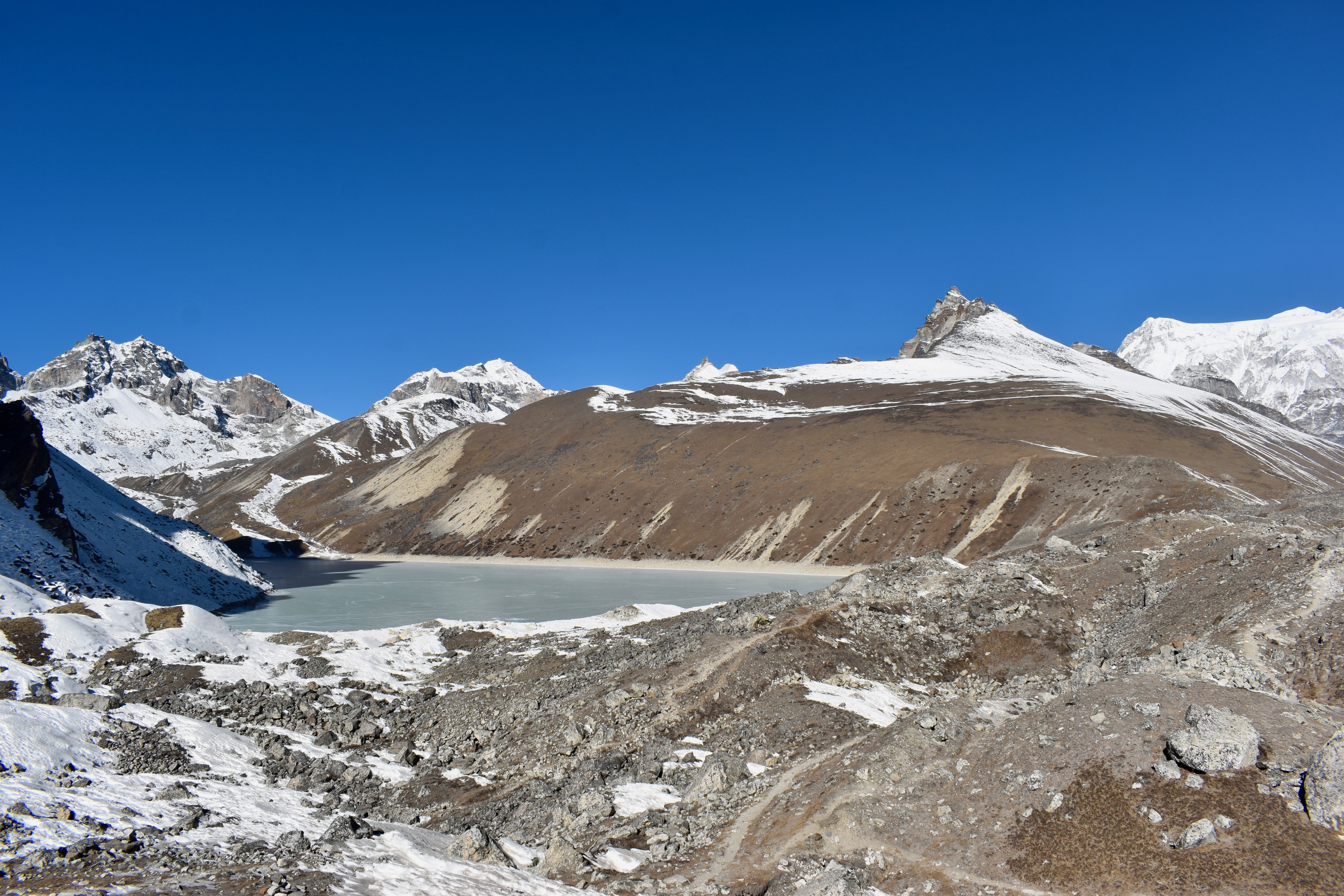
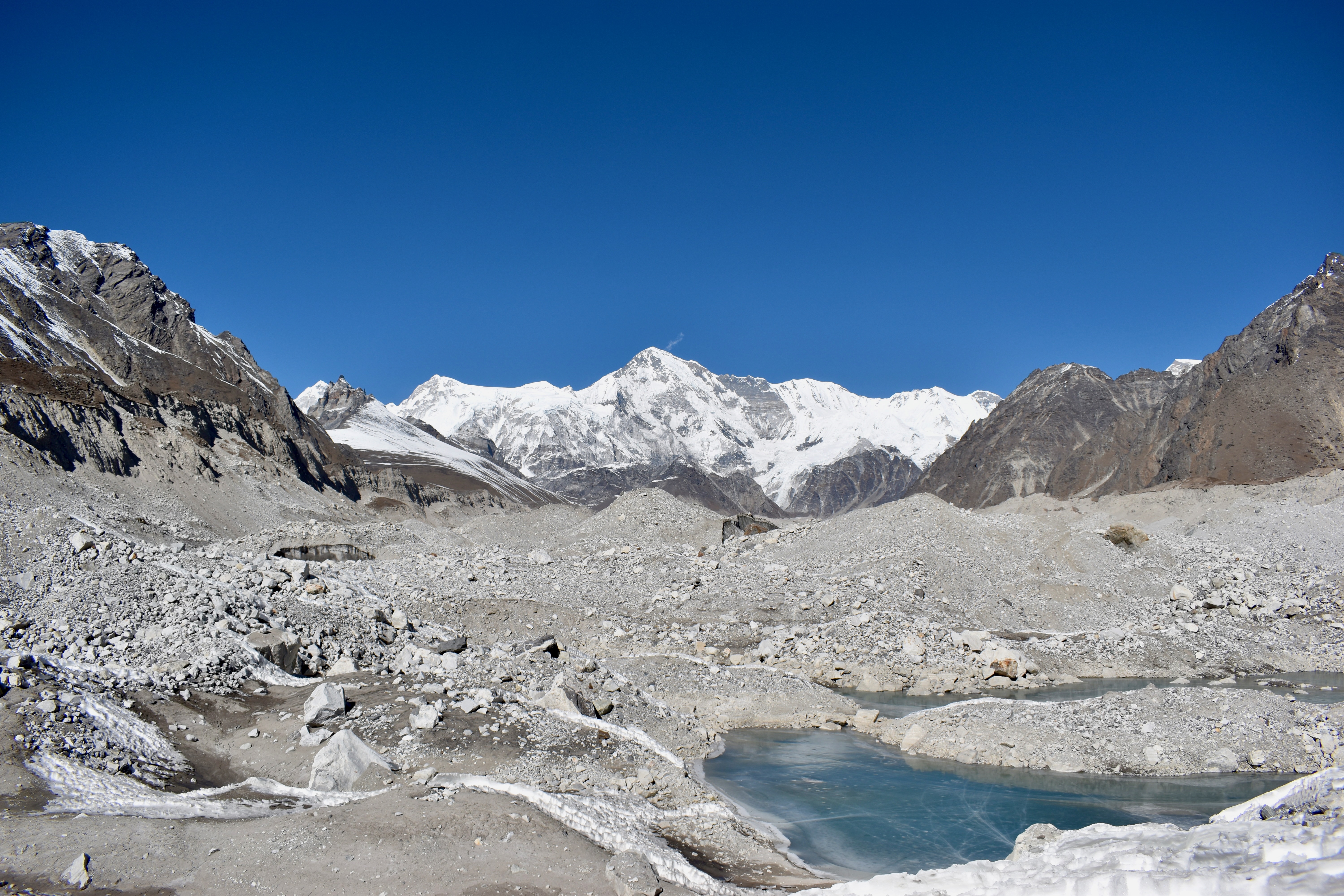
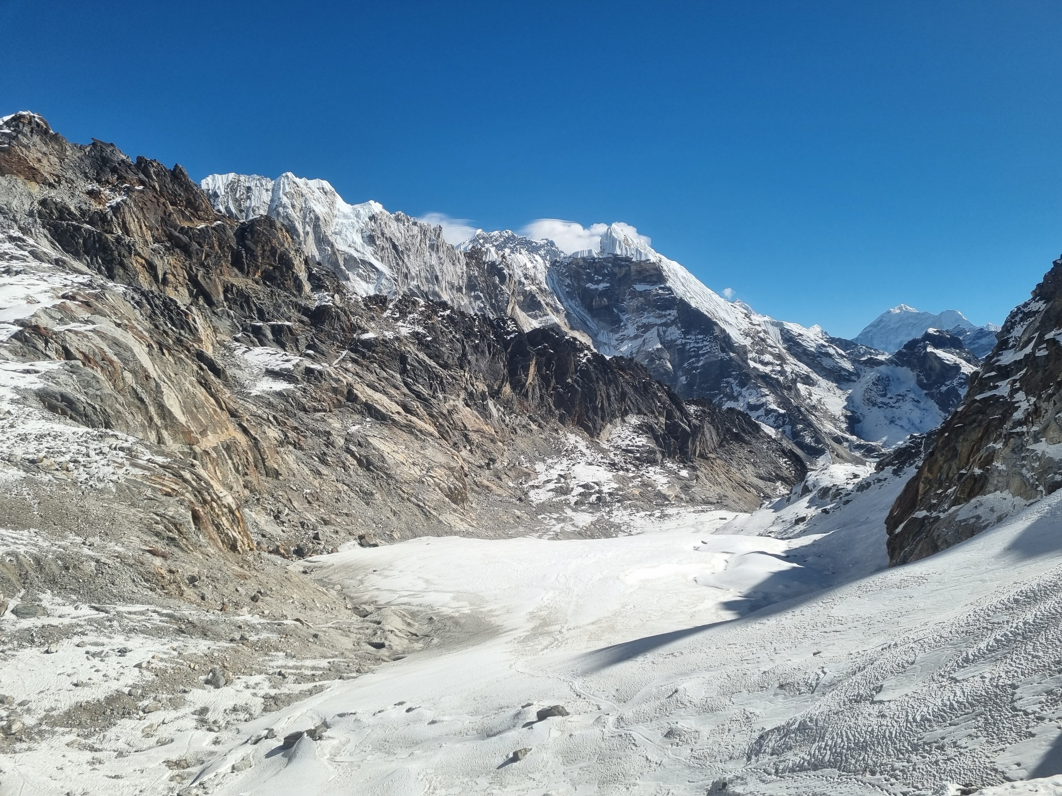
Instead, we went for a gentle stroll up the valley, following the Ngozumba Glacier towards the upper Gokyo lakes. Our goal was the fifth lake, but with several frozen sections making the path hard to follow, we turned around after about 2.5 km at the fourth lake (Thonak Tsho).

We were already packed, so we just needed to settle the bill. The lodge owner kept his promise and only charged us for what we’d eaten. We’d planned to leave him an extra 500 rupees as a thank-you, but before we could even do that, he handed us each a Mars bar as a gift. In the end, we left him nearly 1,500 rupees as a tip. He then tried to give us an extra bottle of Coke. He was incredibly friendly.
Note
A Mars bar might not sound like much, but up in the mountains they usually cost around $4–5.
We left just after 11 am for what we thought would be an easy 3 km crossing to the village of Dragnag (also shown as Thagnak on some maps). We knew we’d have to cross a glacier, but assumed it would be a straightforward, well-marked path. Oh, how wrong we were.
From the very start, the trail was covered in ice, and just getting down onto the glacier took almost an hour. That was followed by two hours of painful navigation across the glacier, constantly trying to identify the right path and follow the correct set of footprints. Since the glacier is always moving, there was no chance of relying on a map. There were many routes marked by stone cairns, but some were clearly old and no longer usable.
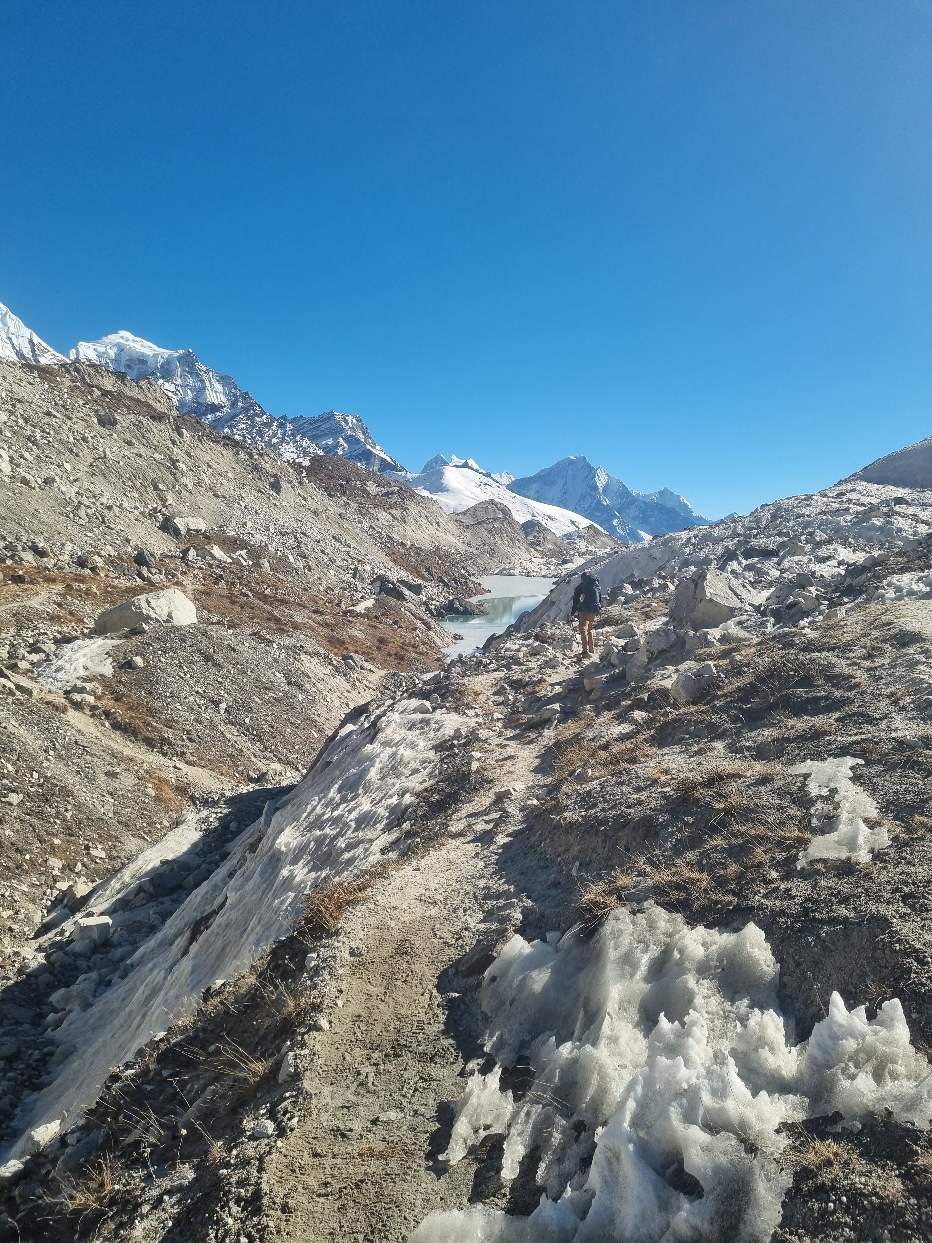
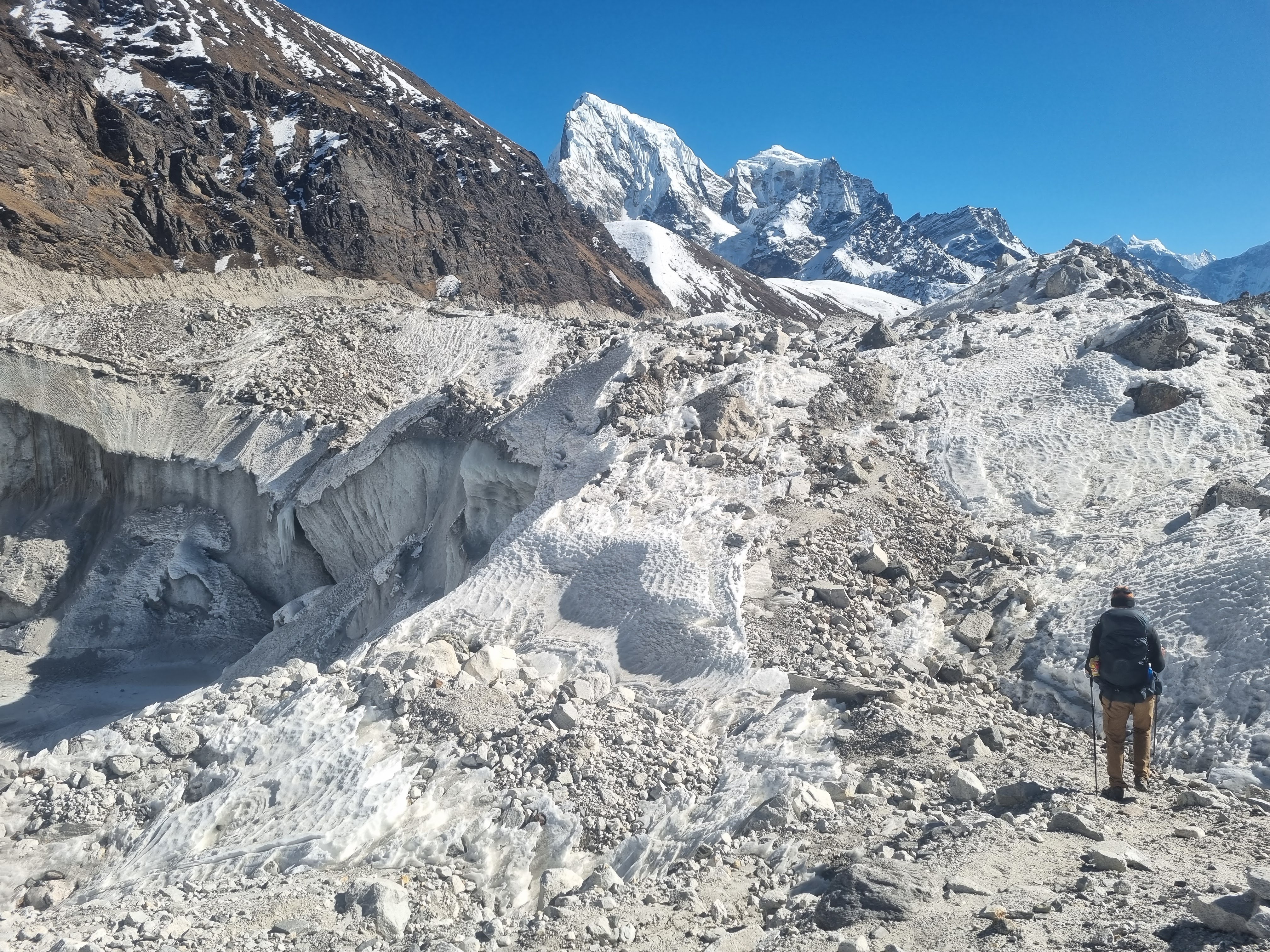
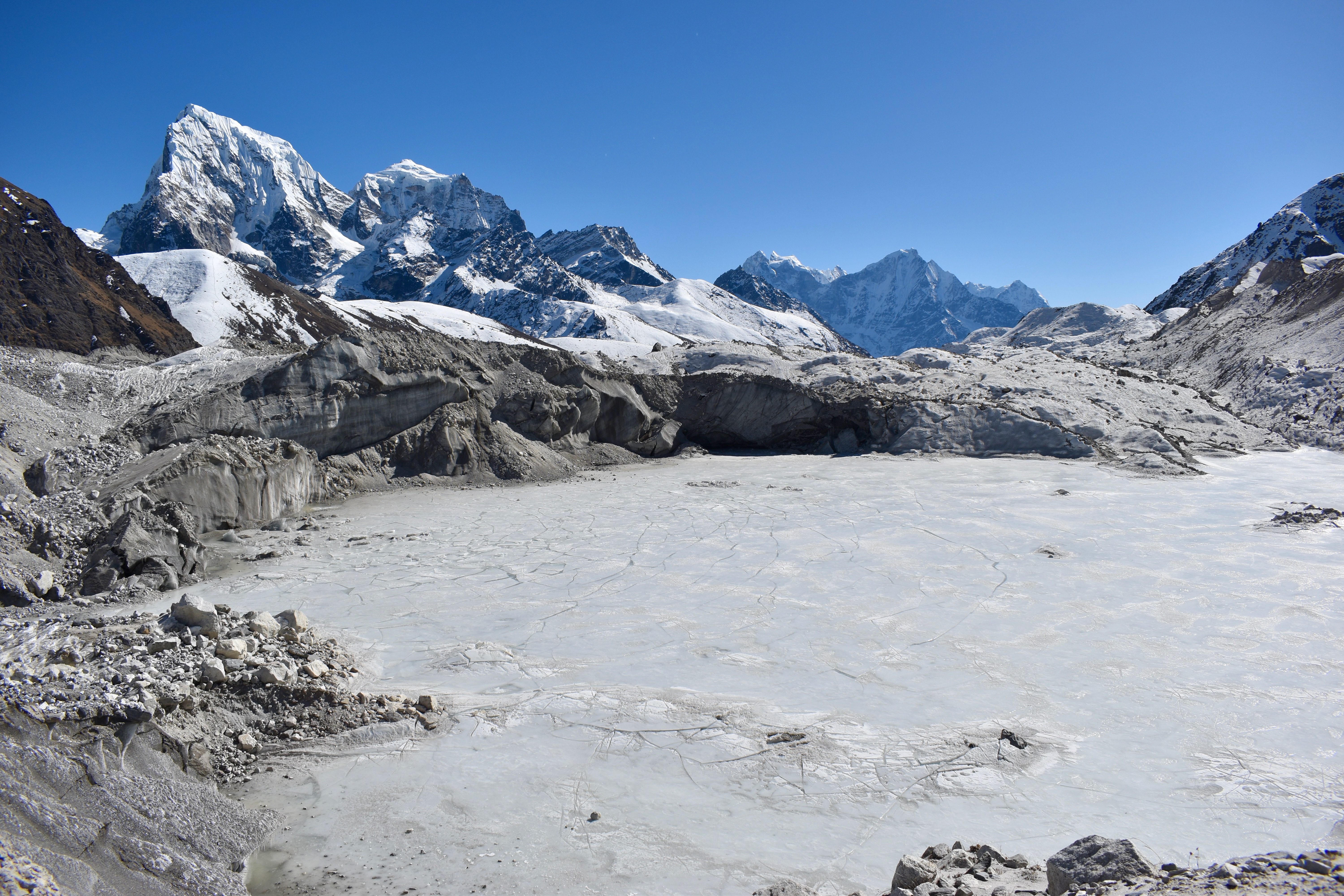
After three hours, we finally reached the other side—physically and mentally exhausted. Once we climbed up out of the glacier valley, the ice disappeared, and the final kilometre into Dragnag was thankfully easy. The man from Eco Lodge had told us to stay at Khumbi-la Lodge, and even if we’d wanted another option, it was the only teahouse open in the village.
We immediately connected to Wi-Fi so Clare could call home and wish everyone a Merry Christmas. We ordered a pot of masala tea and two portions of dal bhat for dinner.
The owner was friendly—if a bit crazy—and after chatting for a while, he offered to charge us only half price for the room (500 rupees). Even so, it ended up being the most expensive lodge we stayed in during the entire trek.
- Day 6: Gokyo to Dragnag
- Distance: 4.71 km
- Elevation change: 247 m up, 331 m down
- Time: 3:19
Day 9: Cho La Pass and a push for Lobuche
We didn’t want to leave anything to chance, so we’d almost finished packing the night before and were up just after 5 am. Another mountain pass was waiting for us—this time Cho La. We struggled a bit with breakfast and agreed that from now on we’d stick to one meal and maybe just add more coffee instead.
We set off just after 7 am, the only ones heading in this direction. We’d read that Cho La is harder when crossed clockwise, which happened to be exactly what we were doing.
The first section was a steady 2.5 km climb that didn’t let up until we reached a ridge at around 5,100 metres—about 400 metres above the village. The sun finally reached the valley, so we stopped briefly to adjust layers and rest. I also noticed a blister starting and took care of it before it became a problem.

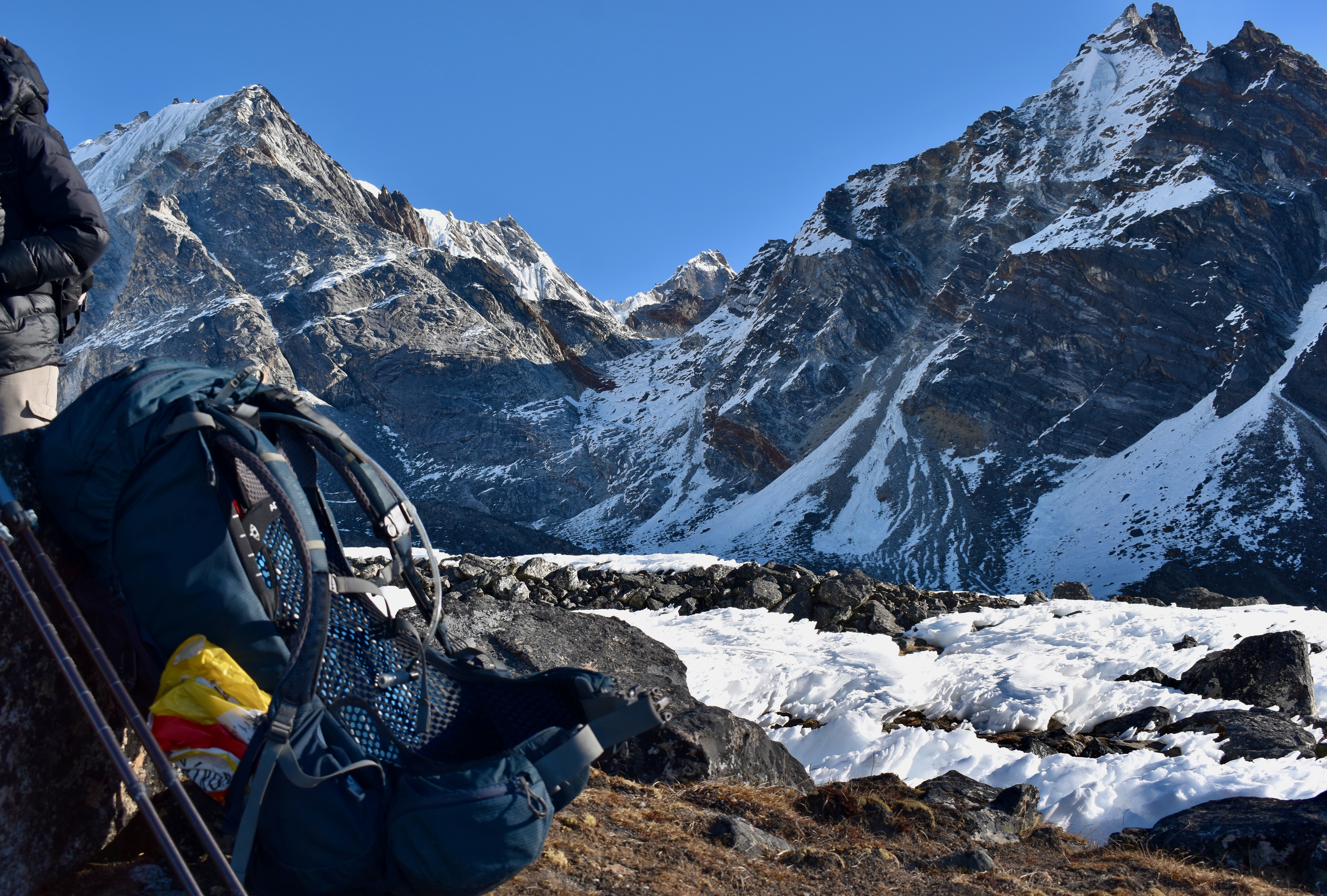
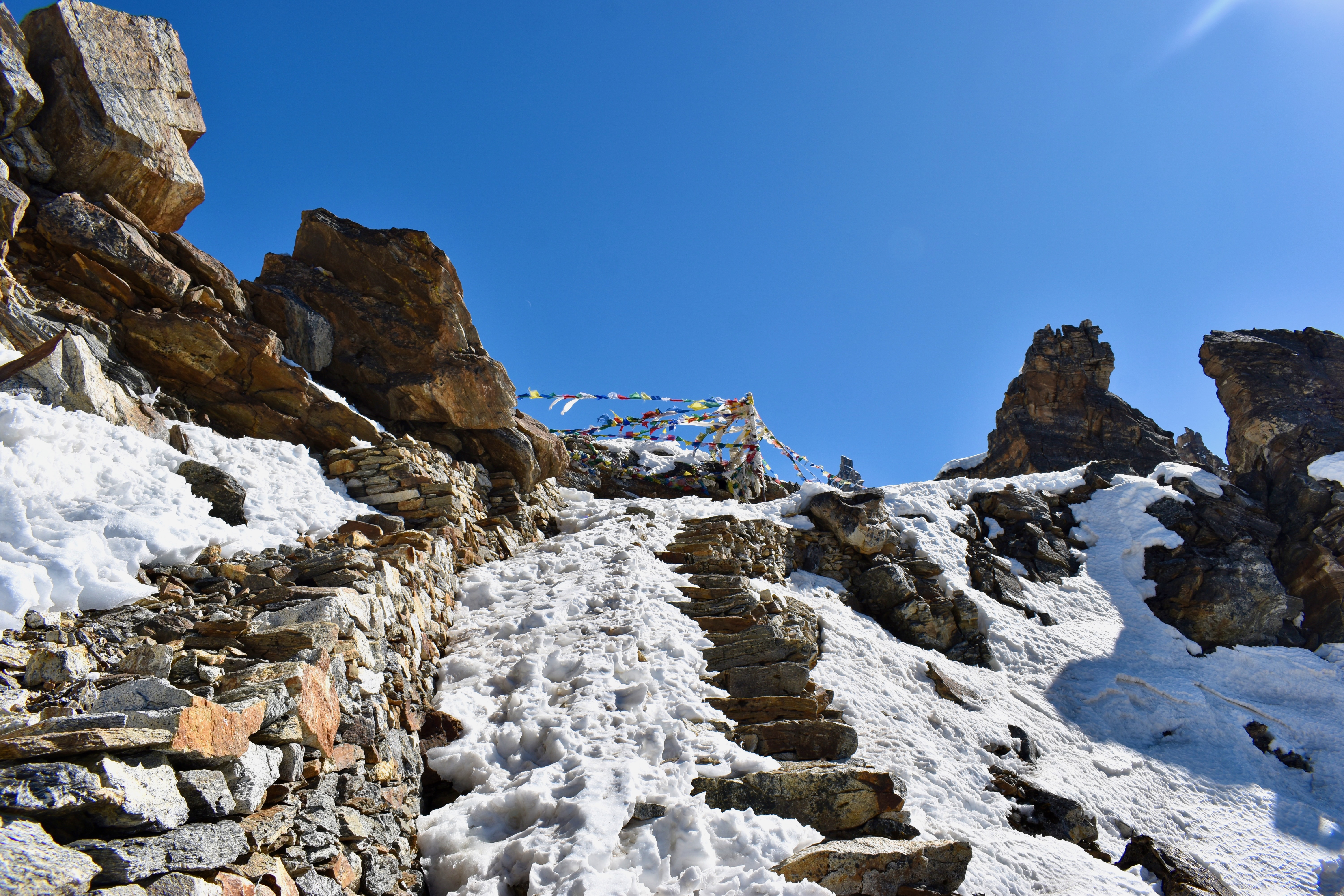
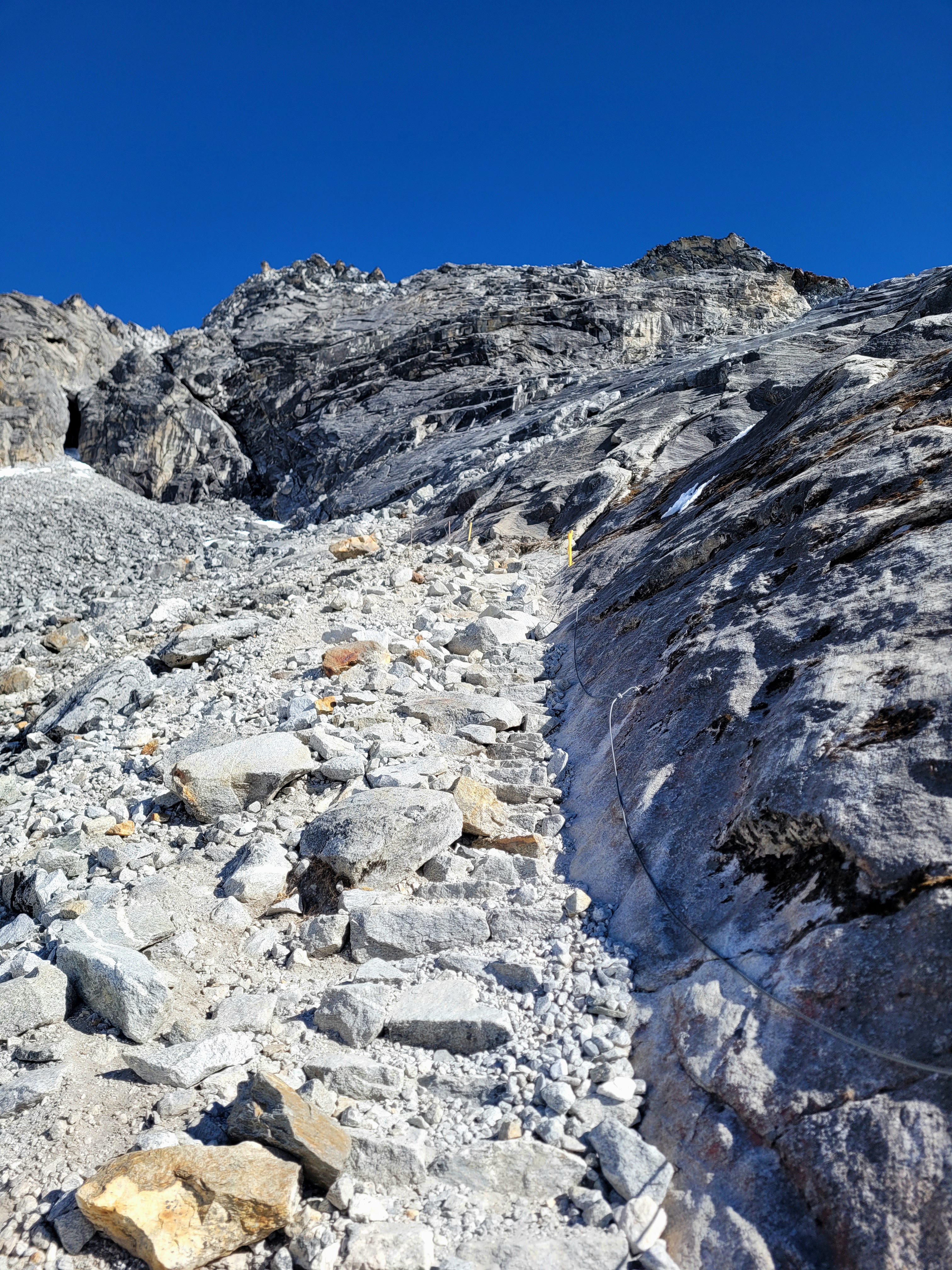
From there, we could already see Cho La Pass. We still had about two kilometres of rolling terrain ahead to reach the stone wall marking the final climb. It took us roughly an hour and a half to cross the valley and reach the wall, and another hour and a half to get to the pass itself. By the time we arrived at the wall, we were both low on energy, so we took a longer break before starting the ascent.
The final push was only about 500 metres, but it was steep. Steel ropes were fixed along the mountainside, so we packed away our trekking poles and used those instead. Early on, we met a group of four guys coming down—it was the end of the icy section for them, but the start for us, which meant it was time to put on microspikes. The climb was tough, almost entirely covered in ice, but with the ropes, careful steps, and short breaks, we slowly made progress. The microspikes were absolute saviours—we wouldn’t have made it without them.
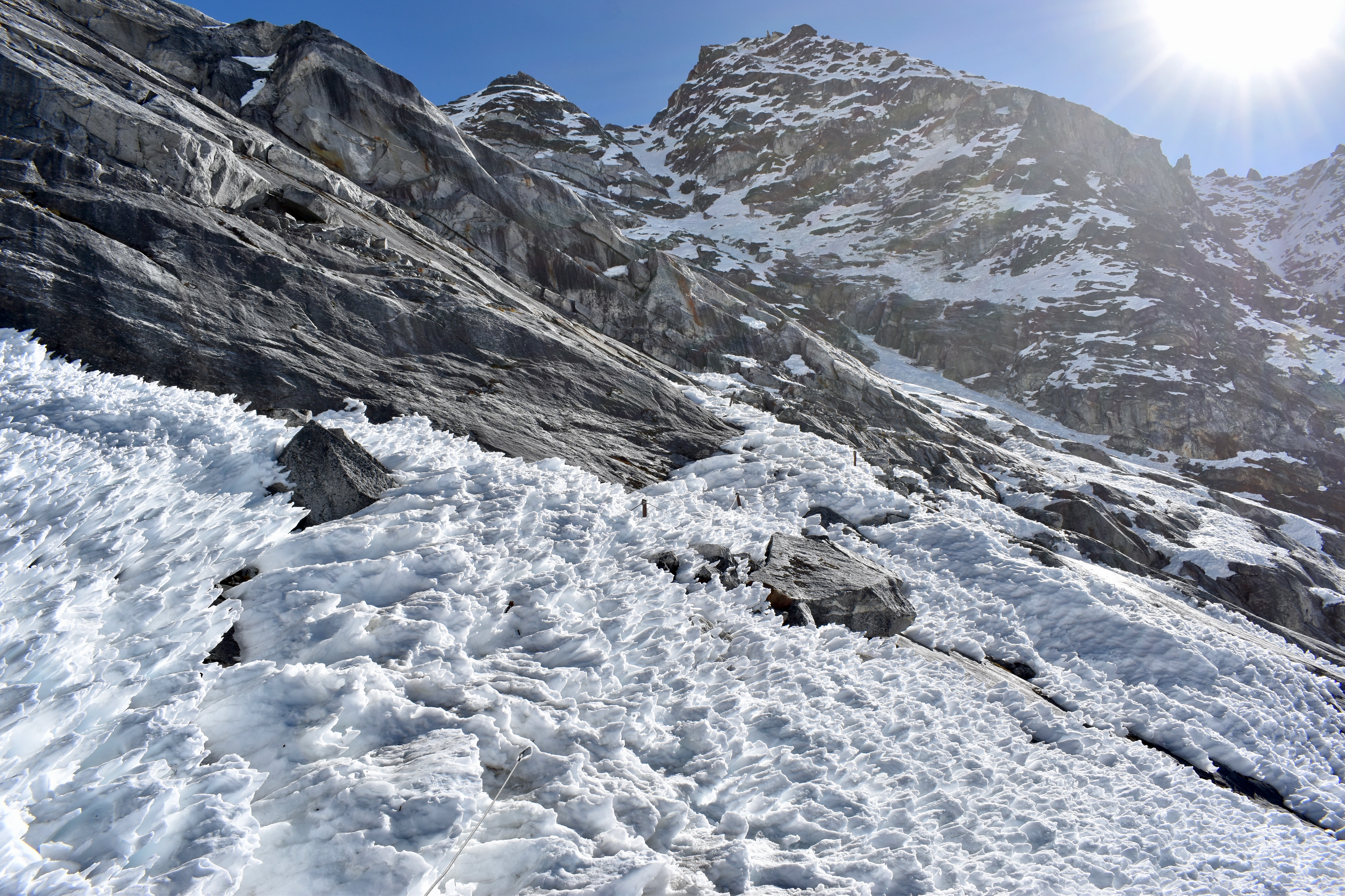
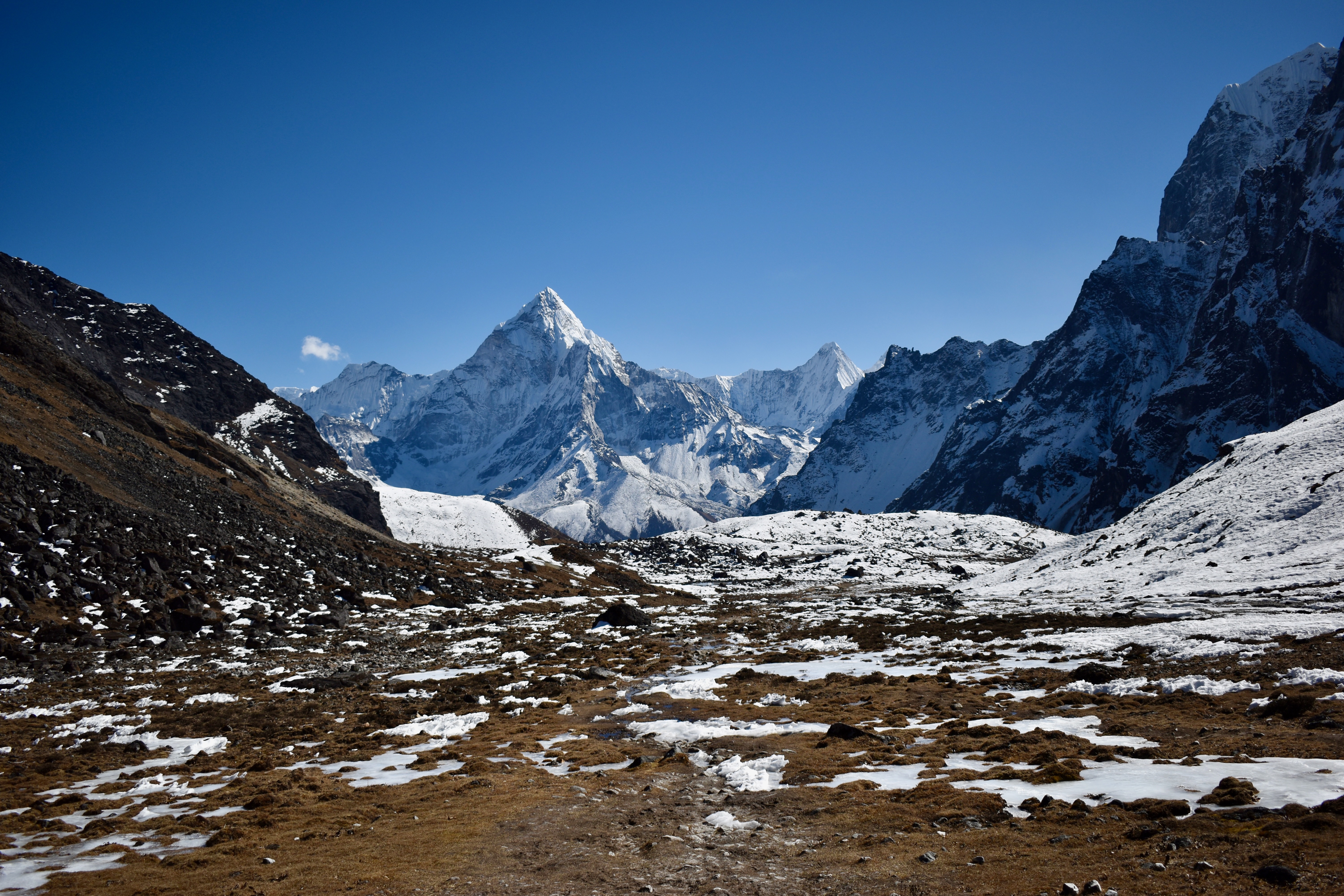
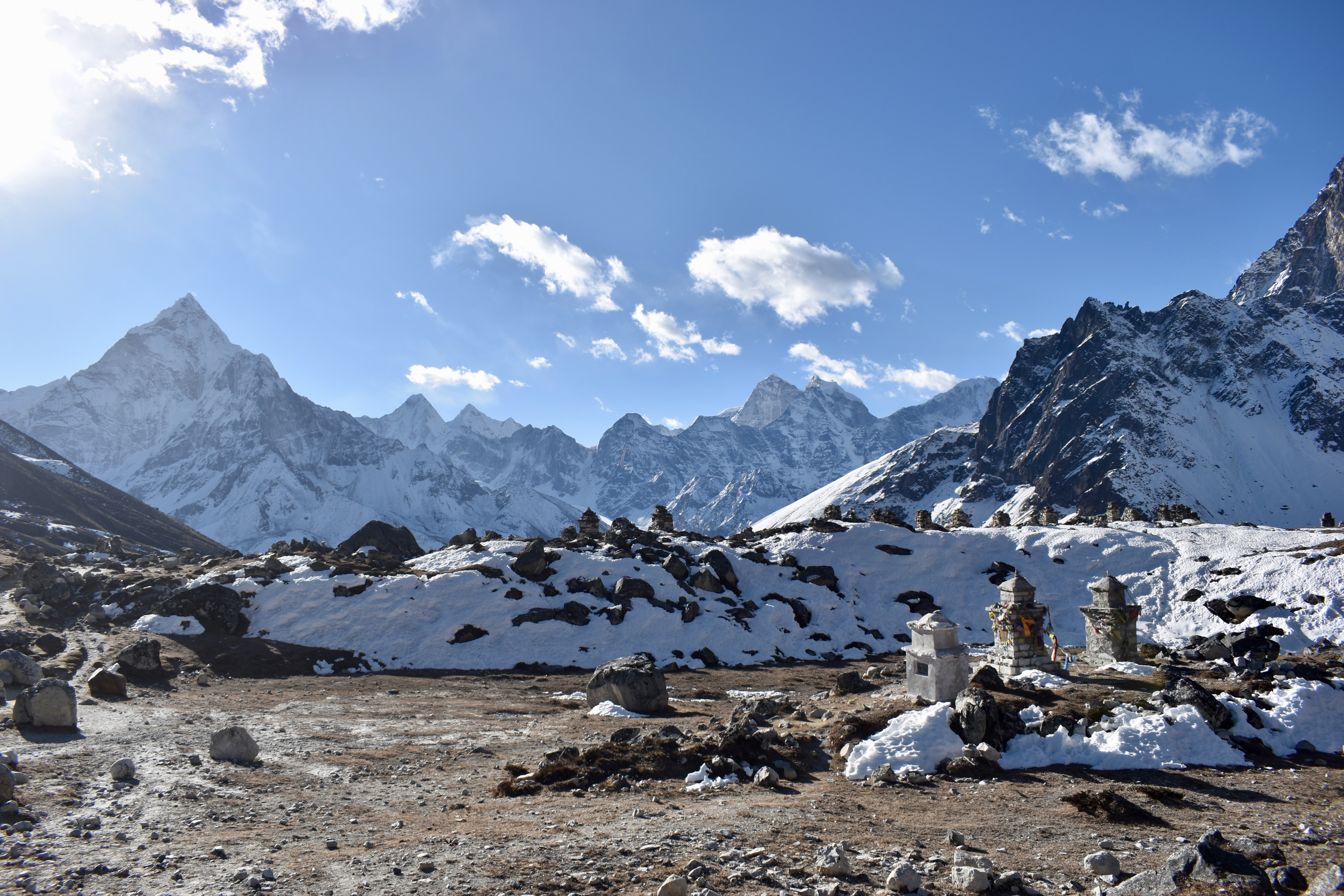
After a total of four hours of hiking from the lodge, we reached the top of Cho La Pass at 5,360 metres. From Dragnag, we’d gained roughly 1,100 metres in elevation.
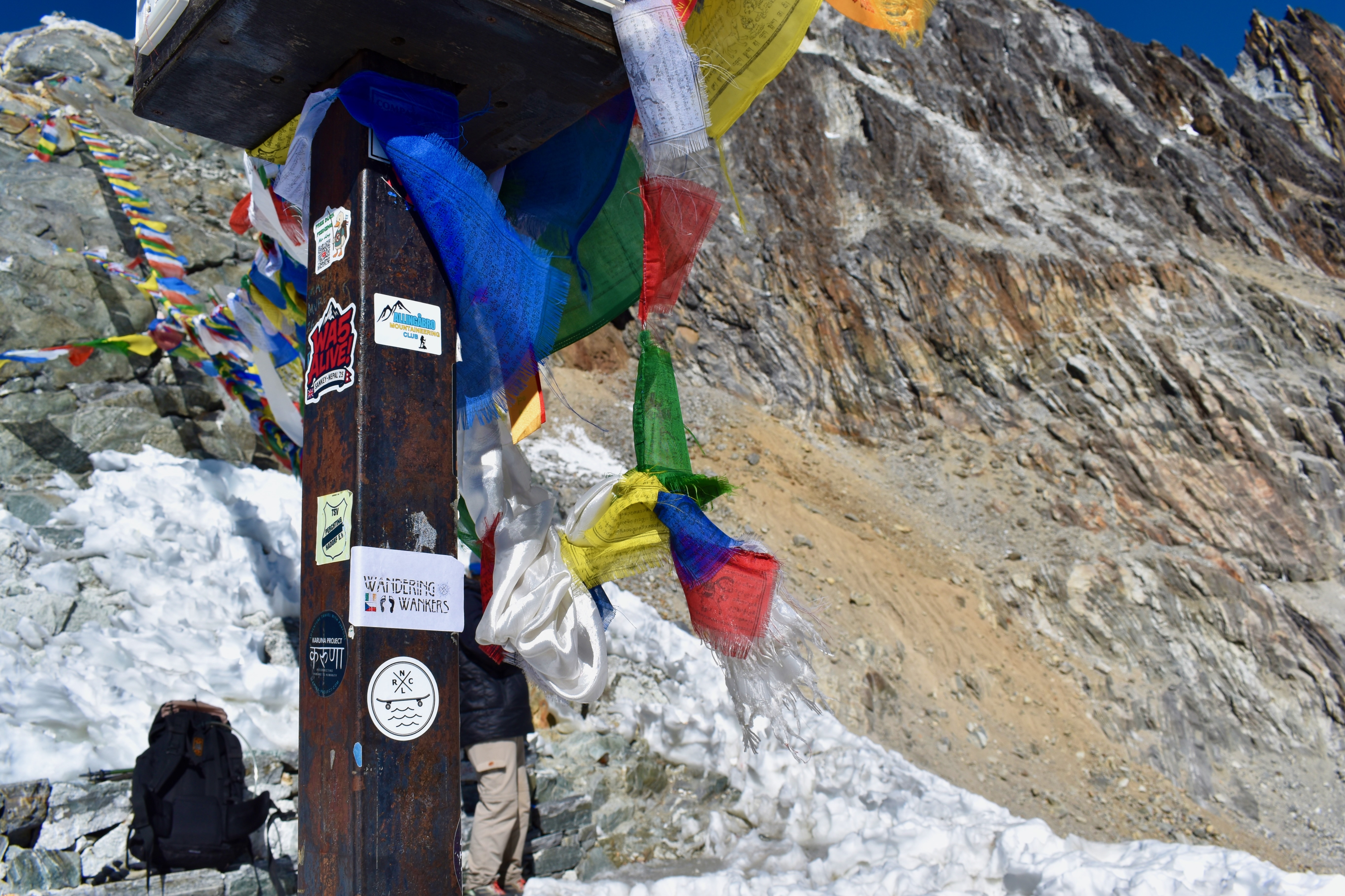
Cho La was far less windy than Renjo La, so we could properly enjoy the views of the glacier and valley below while eating snacks. We even left a Wandering Wankers sticker up there—so if you ever pass through, keep an eye out. There was an option to climb a bit higher, but we’d had enough, and it wasn’t the place to push our luck on a frozen mountainside.

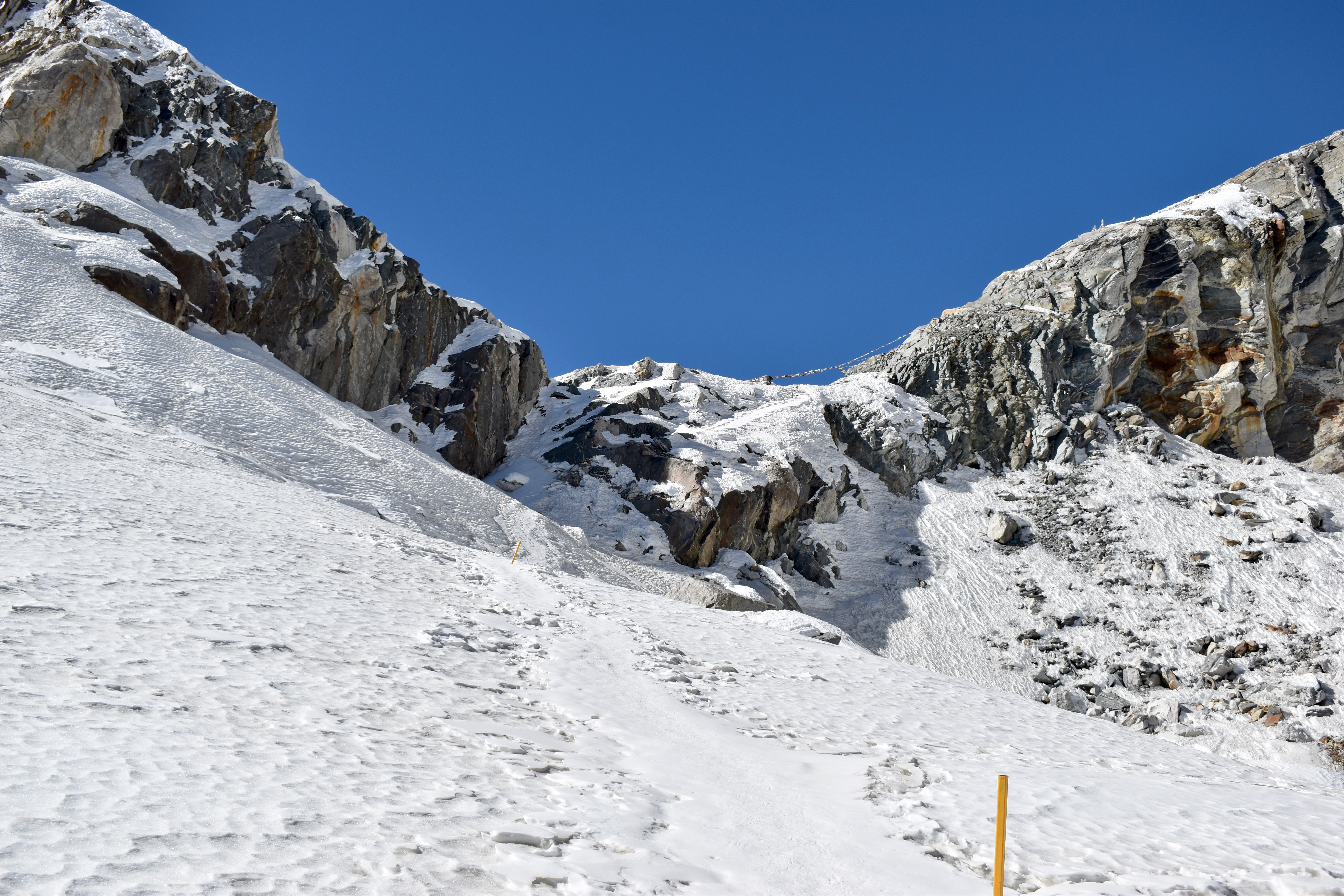
After a 15–20 minute break, we started the descent. We’d been a bit worried about this side because it involved crossing a glacier, but from the top it was clear that the route was well marked with yellow poles. The initial descent was very icy, but it didn’t last long, and soon we were following the glacier. Because the microspikes hurt my knee, I took them off as soon as I thought I could—only to put them back on again a few metres later.
Once across the glacier, we continued down the valley. It warmed up quickly, so we stopped to change layers. About two hours later, we reached the village of Dzongla. We ordered a medium pot of coffee, had some snacks, and chatted with a German guy who was staying there for the night.
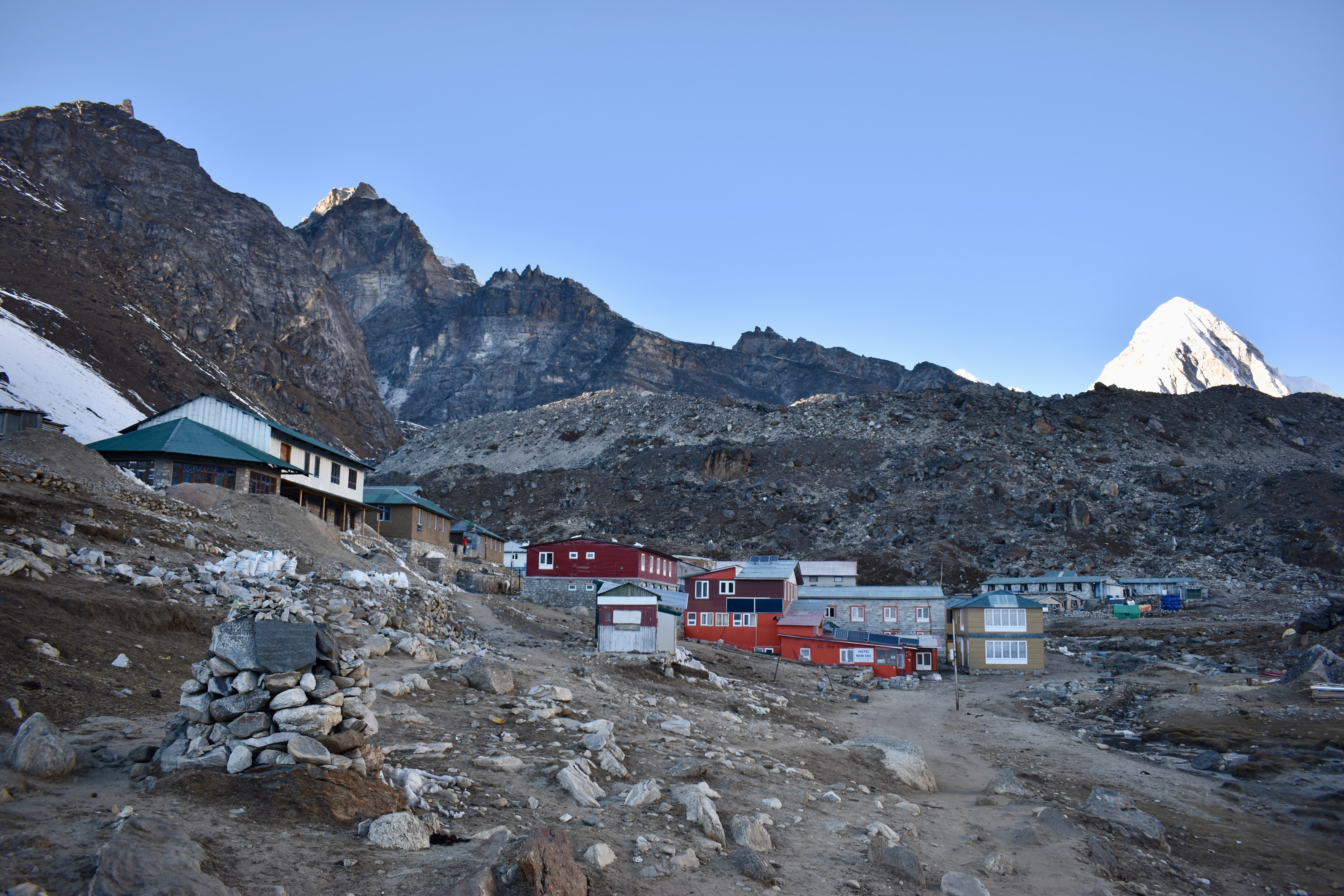
We could’ve stayed too, but wanted a head start for the next day. Since it was only around 2 pm, we decided to push on to Lobuche. We were already tired after six hours of hiking, but the path wasn’t too difficult—mostly a traverse with gentle ups and downs. About two hours later, we arrived in Lobuche and stayed at the National Park Lodge. Just before reaching the village, we reconnected with the Everest Base Camp trail for the first time since Namche.
It had been a long day, so after changing we ordered a pot of tea and some snacks—fried potatoes and vegetable pakora—and sorted dinner straight away. We spent the evening resting, playing cards, and watching TV shows. At just under 5,000 metres, it got close to –20 °C overnight, so sleeping bags were definitely needed.

- Day 7: Dragnag to Lobuche via Cho La Pass
- Distance: 16.68 km
- Elevation change: 1,150 m up, 887 m down
- Time: 8:26
Day 10: Absolutely exhausted, but we made it!
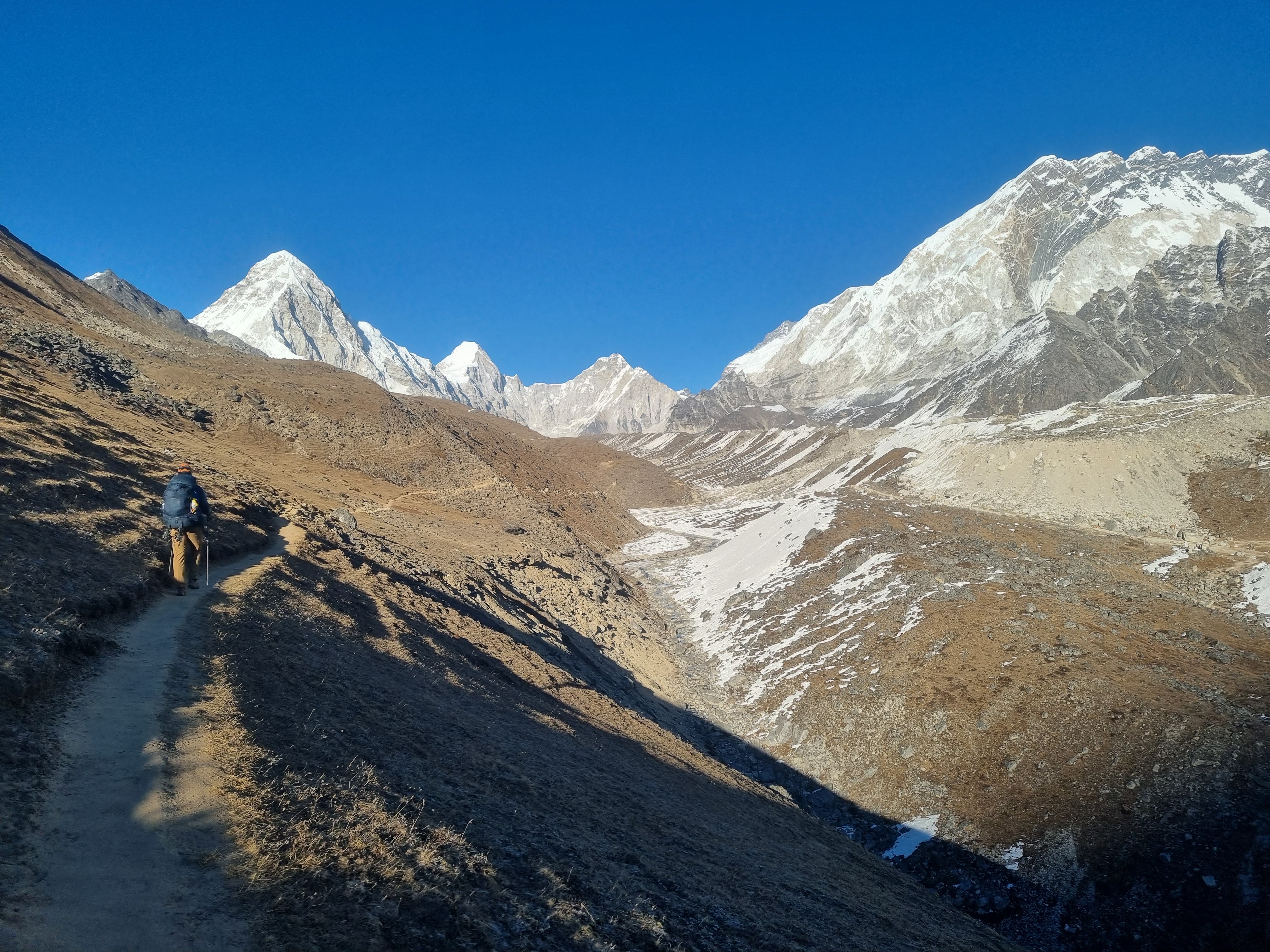
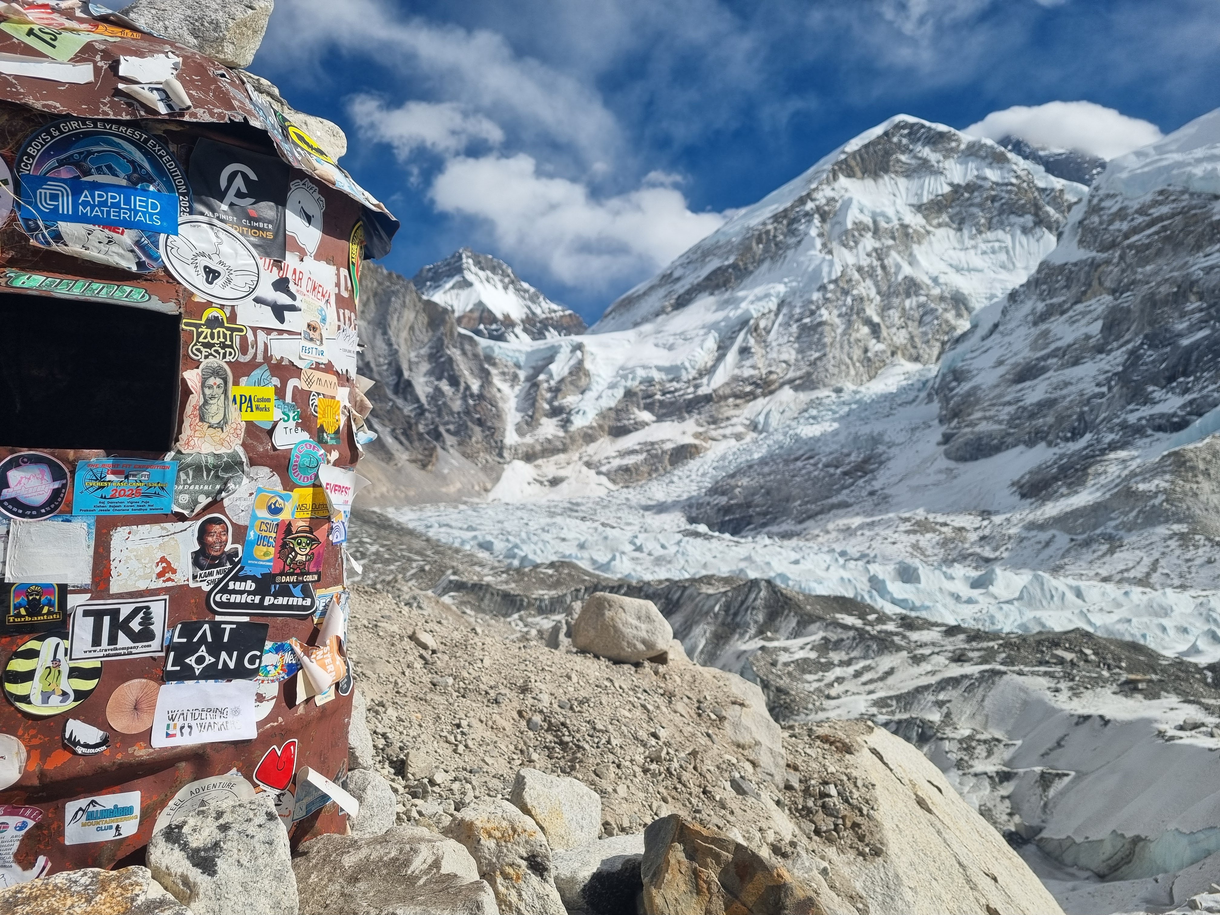
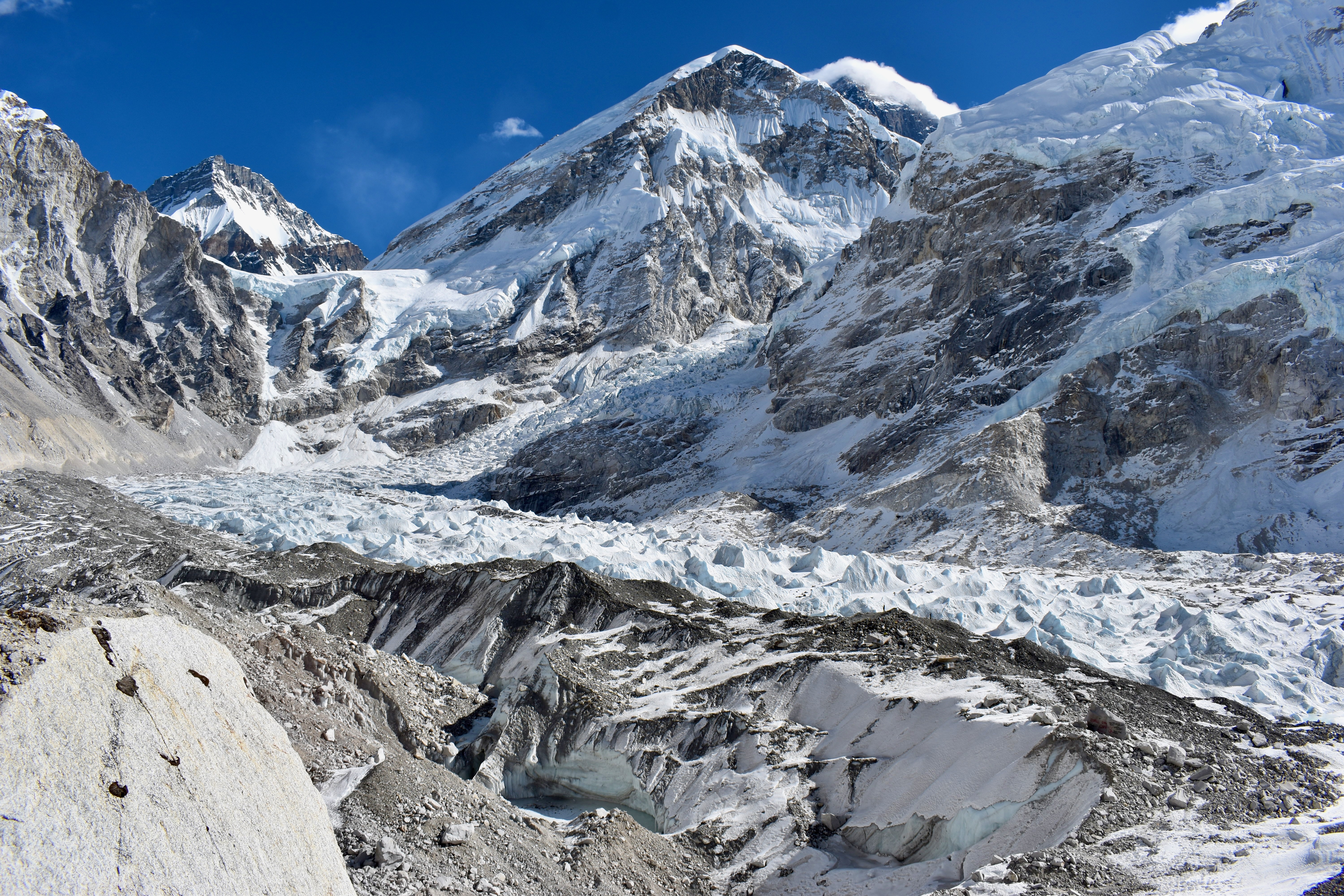
The night before, we decided we’d had enough of moving all our gear around. Instead, we’d do the final push without our packs and return to Lobuche afterward. The only village on the way up was Gorak Shep, about 4.5 km from Lobuche, and from there it was another 3 km to Everest Base Camp.
We left the lodge around 8 am and headed north. The first section was a very gradual incline, but as we approached Gorak Shep, we reached a glacier. One reason we thought this out-and-back plan was manageable—and that we might even squeeze in Kala Patthar—was that Mapy showed only about 230 metres of elevation gain to Gorak Shep. Unfortunately, Mapy isn’t very good with glaciers, and by the time we reached the village, we’d already climbed nearly double that.
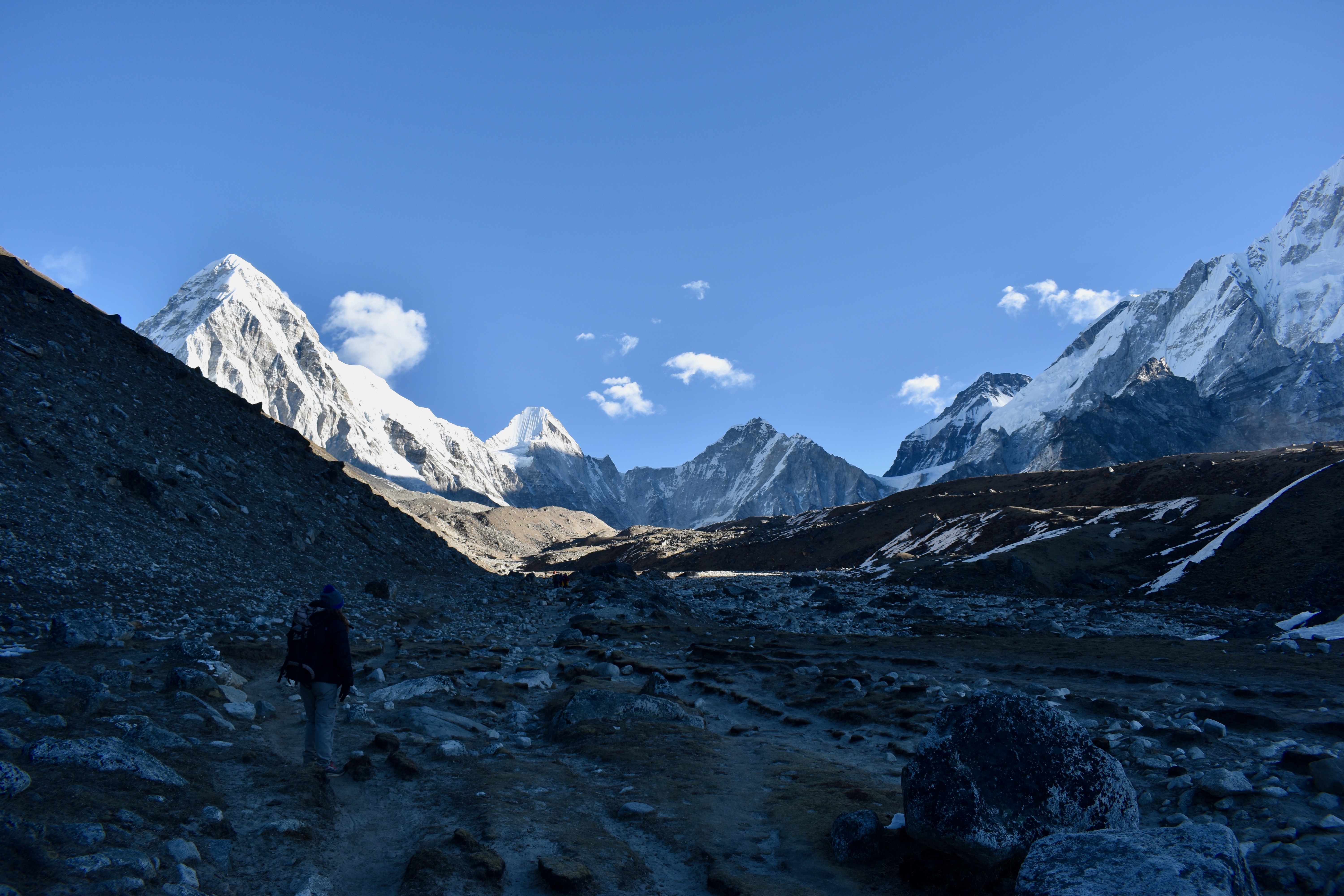
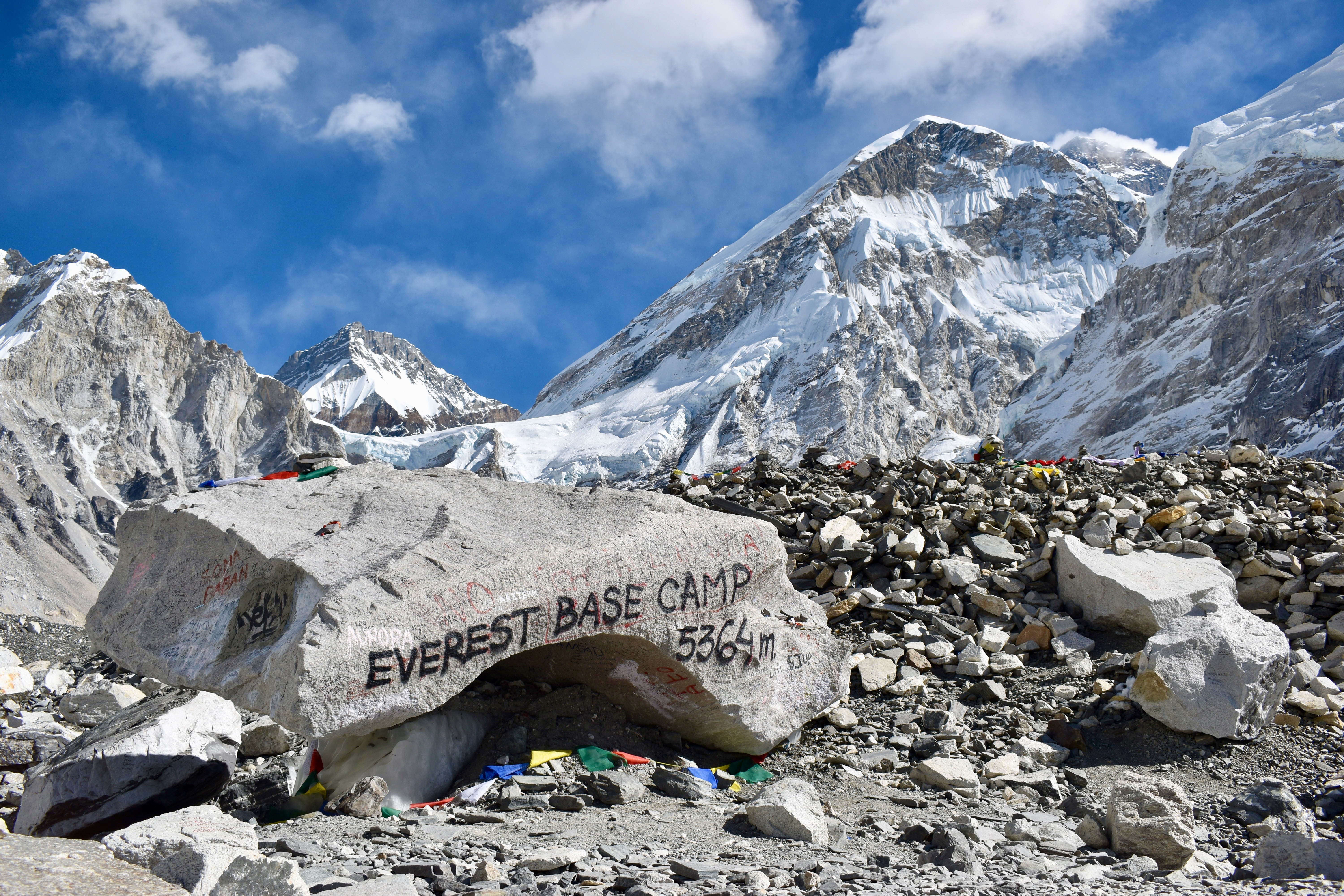
The same thing happened on the next 3 km to Everest Base Camp. We did reach base camp in about three hours as planned, but instead of the expected 350 metres of elevation gain, we’d done closer to 700.
We were also clearly feeling the previous day, which had been long and tough. When we got back to Gorak Shep, neither of us had any interest left in climbing Kala Patthar. We settled for a pot of coffee at one of the lodges and called it there. By the time we finished, it was close to 2 pm, and even with more energy, there wouldn’t have been enough daylight to go up and back safely.
We headed back to Lobuche, and I was personally very happy with that decision—the glacier crossing really took it out of me. Once back at the lodge, we went straight to order food and get some energy back. I was proud that we’d reached Everest Base Camp in eight days via the two passes, but also a bit disappointed about missing Kala Patthar. We’d definitely been a bit too optimistic the day before and trusted Mapy more than we should have.
Note
I forgot to mention how good the food was at National Park Lodge—and how nice the guys working there were. We got about three free lemon teas, and one of them even offered us a Snickers, which we couldn’t accept. It felt like too much.
- Day 8: Lobuche to Everest Base Camp and back
- Distance: 16.82 km
- Elevation change: 782 m up, 788 m down
- Time: 5:48
Day 11: Time to go down the mountain
We took our time in the morning—today we were finally heading down. After a small breakfast and a pot of coffee, we set off around 8:30 am. The trail was gentle, the sun was shining into the valley, and we didn’t even need jackets.
After passing a small village called Thukla, we followed the ridge and started seeing lots of people heading up. About two hours later, we reached Dingboche, which was surprisingly large. We didn’t descend into the village, instead chatting about how we’d originally planned to stay there on the way to Kongma La—the third pass we didn’t have time to cross.
Note
From Thukla, there’s an option to descend further into the valley and follow the Lobuche River to Pheriche, reconnecting with the main trail later. It’s a good way to avoid the crowds.
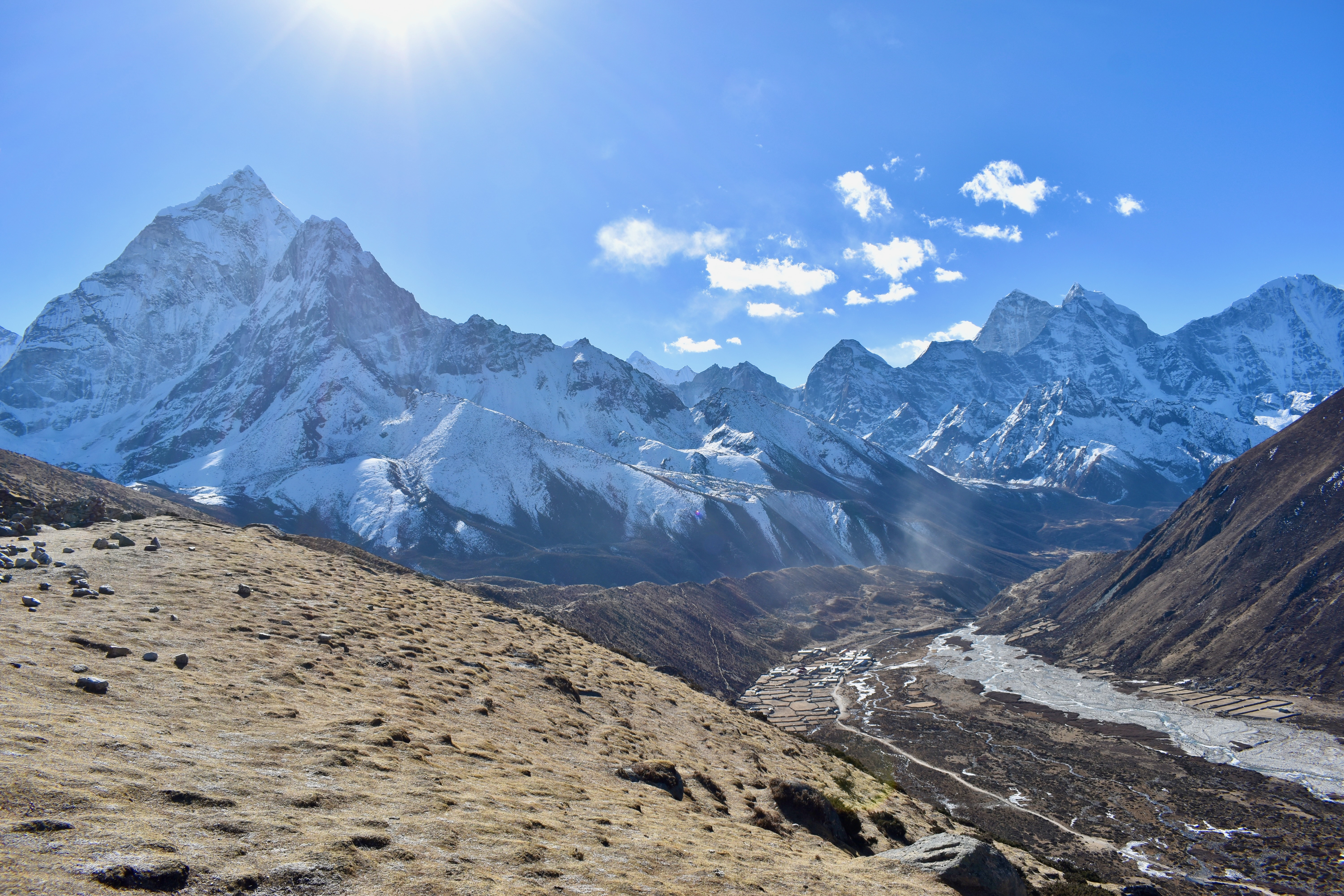
From Dingboche, we followed the river further down and reached the village of Shomare about an hour and a half later. We stopped there for a pot of ginger tea and a rest. Thankfully, my knees behaved themselves, and the descent felt easy.
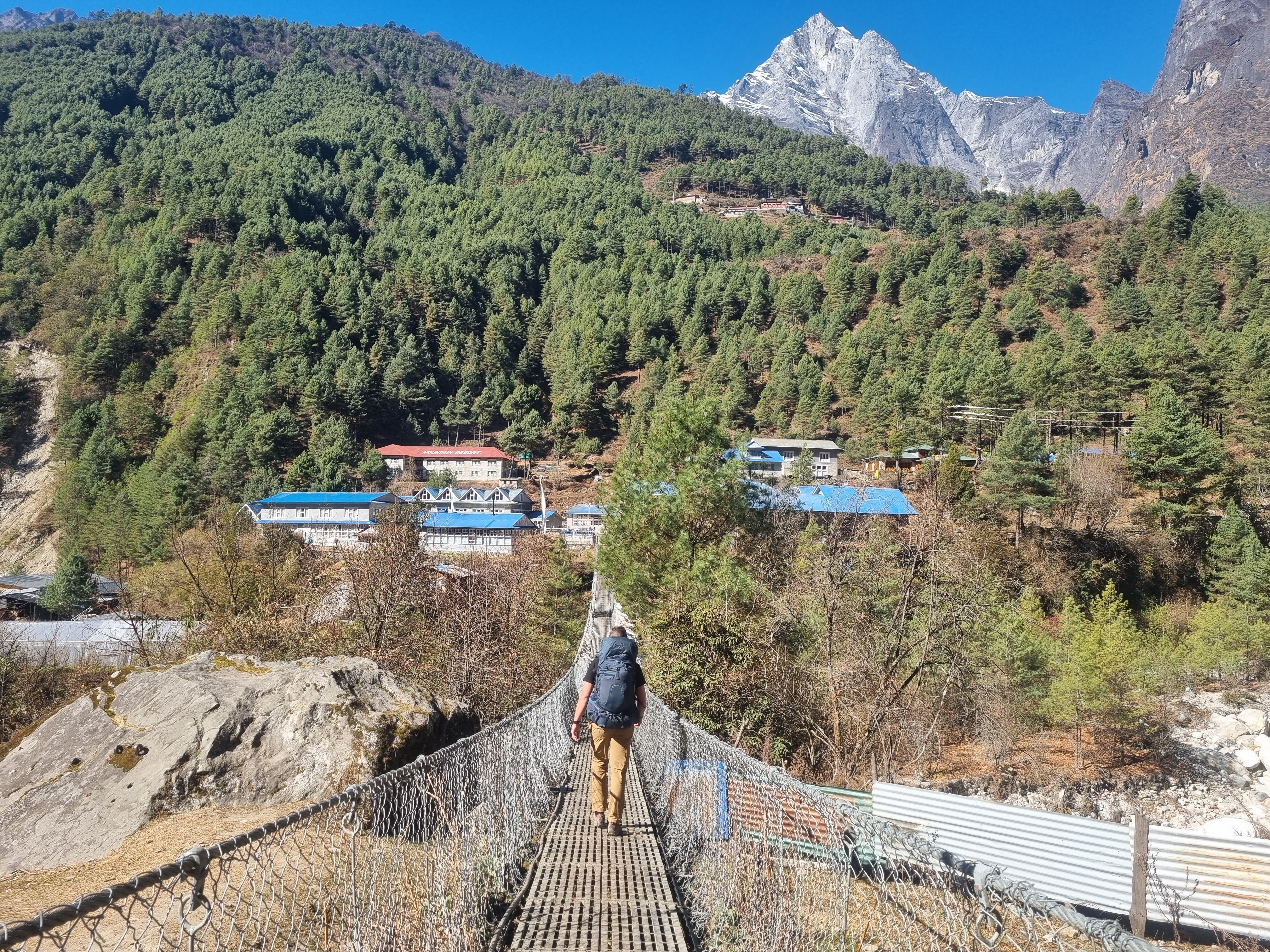
From just before Shomare, we could already see our destination for the day. After passing a few more villages, Tengboche appeared on a hill across the valley. The trail kept descending, except for one short climb of just over 100 metres after crossing the river to reach the village.
Even though we’d been going downhill most of the day, this was day nine of trekking. We’d covered over 18 km in just under five hours, and we were done. We stopped at the first place we saw—Guest House Lodge—and headed straight for the kitchen. They had a lovely terrace, so we ordered aloo paratha and cheese momos and soaked up the sun. We could even see Mount Everest again.
Later, we had two dal bhat for dinner and were happy with how far we’d come down. The plan was an easy 9 km to Namche the next day. However, the night had other ideas.
- Day 9: Lobuche to Tengboche
- Distance: 18.50 km
- Elevation change: 473 m up, 1,534 m down
- Time: 4:57
Day 12: A great day after a rough night
We still don’t know what caused it, since we both ate and drank the same. It wasn’t even past midnight when Clare had to go vomit for the first time. This continued a couple more times during the night. I had a small stomach ache, but nothing major, and just thought it was from the ice-cold water and dal for dinner. But Clare really wasn’t well at all.
Since Clare didn’t sleep much, I killed the morning alarm and went downstairs to cancel breakfast. Luckily, we didn’t have much planned for the day, but it still would have been hard if Clare was fully out of it. When the alarm rang at 7 am, Clare felt completely dead, but she felt a lot better after sleeping until 9. I then went downstairs and got us a pot of lemon-honey tea, and we just chilled in bed for a while.
We left the lodge just after 10 am and walked past the local temple (Gompa) and down into the valley. Since Clare wasn’t feeling great, we split the journey into sections. The first one was a steep descent of about 2.5 km down to the river. We lost around 500 meters of elevation in that short stretch, and it took us about 50 minutes. Clare was doing well, but we decided to take a short break once we crossed to the other side.
Next came the dreaded part. Even though we were heading down from the mountains, there were still some unavoidable climbs. This was one of the bigger ones on the way back. Since we were down by the river, to get back up to the level of Namche Bazaar, we had to climb around 350 meters of elevation in just 2 km. Clare was doing absolutely amazing, and we only took one short break halfway up and another one at the top. I have to say, I wouldn’t have been nearly as strong after a night like the one Clare had. We reached the village of Sanasa and took a proper break there, exactly an hour after starting the climb.
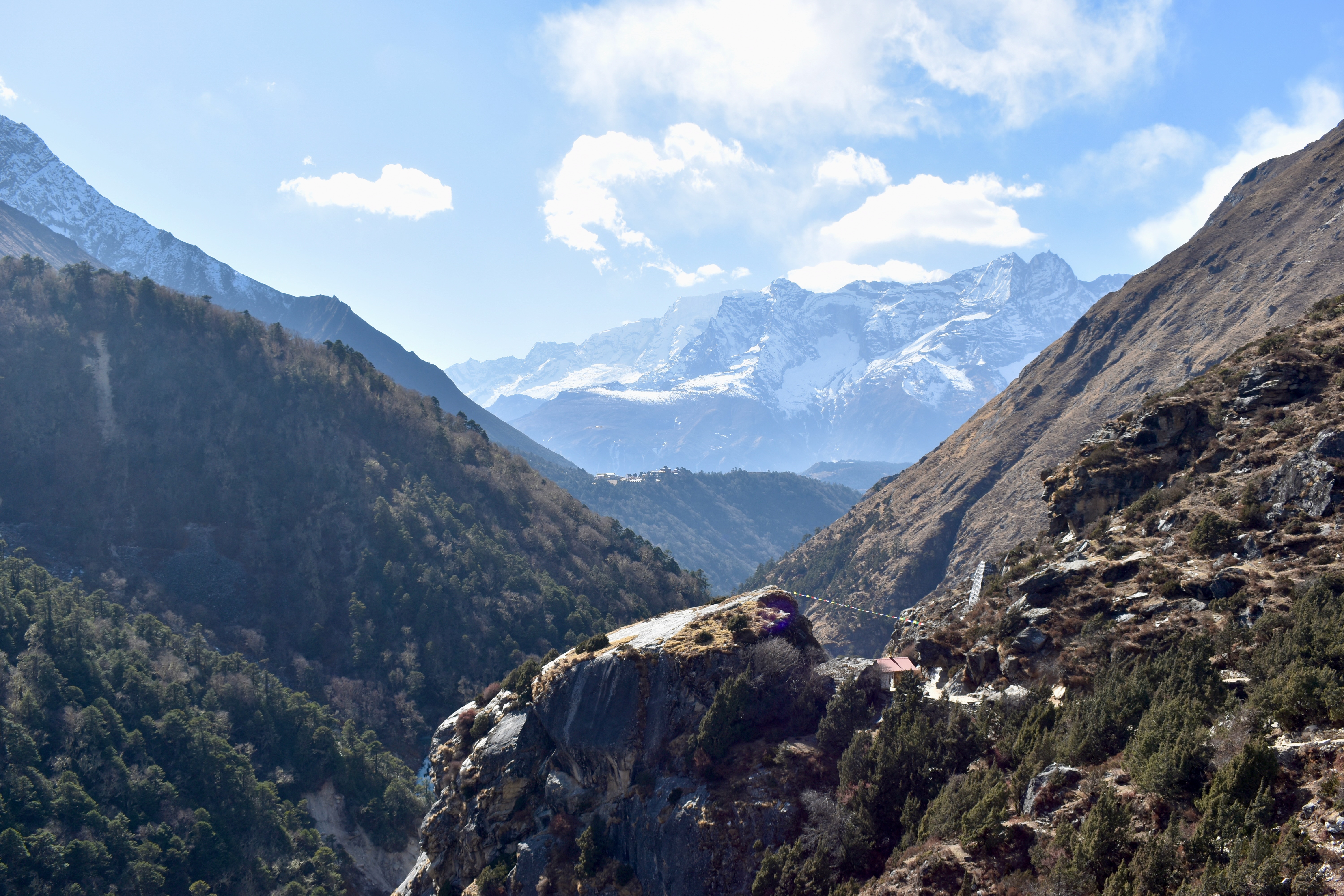
The rest of the hike was a bit easier. There were still occasional ups, but it was mostly flat or gradual. It took another 4.5 km to reach Namche, and there were some nice stupas along the way. Unfortunately, we couldn’t see Mount Everest again due to cloud cover around the peaks.
Even with Clare not feeling great, we reached the centre of Namche in 3 hours and 20 minutes. A lot of lodges were closed at this time of year, but we found the International Foot Rest Lodge (an amazing name) right in the centre of town for 500 rupees per room. We got into our room, pushed the beds together, and went for a well-deserved nap — especially for Clare, though I happily joined.
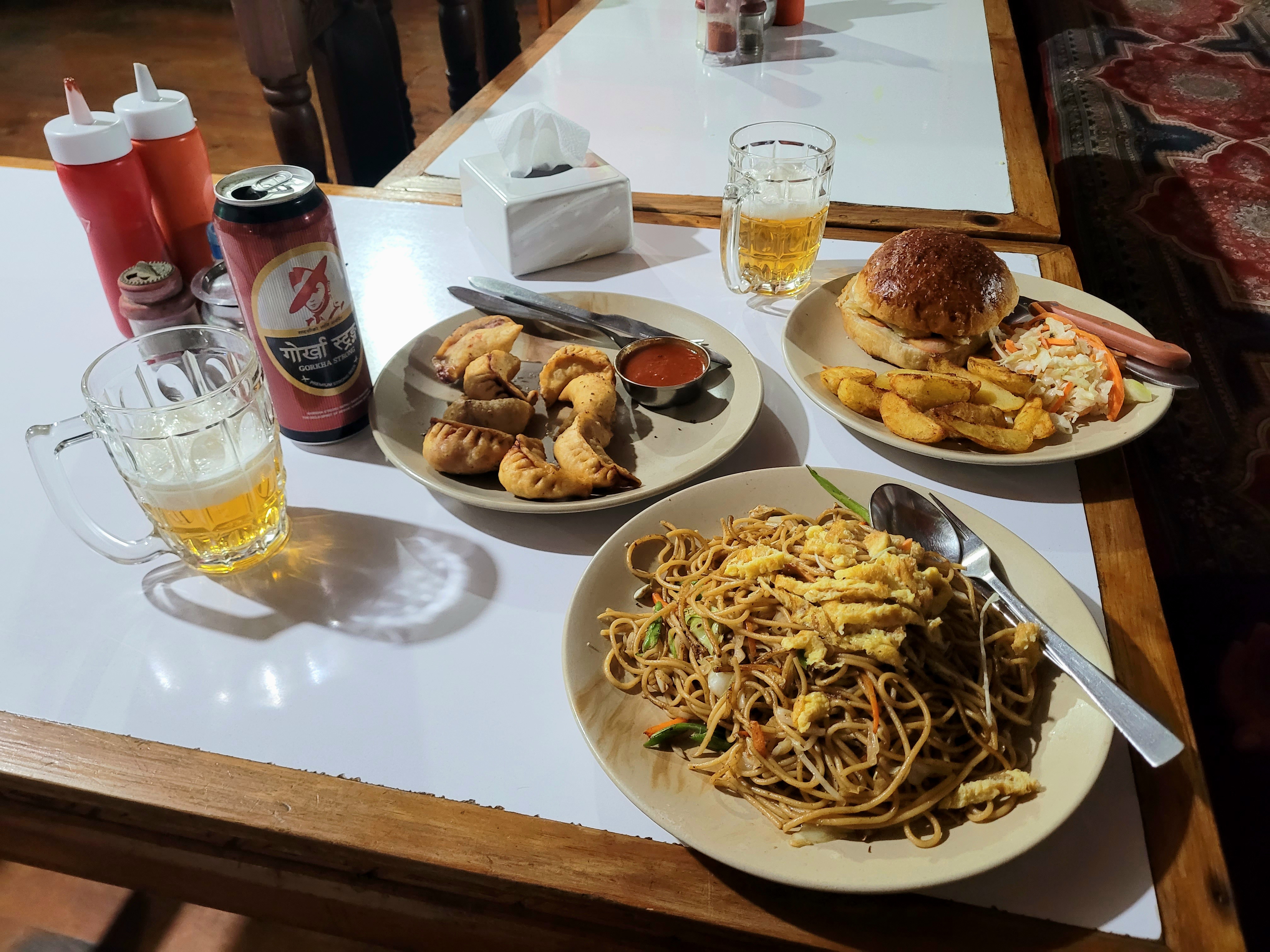
Well rested and with Clare feeling much better, we left the room just before sunset to check out the biggest village on the trek. We didn’t make it far and stopped at a souvenir shop to buy a few things. Then we headed to the Namche Bakery Café and treated ourselves to a caramel latte and some baked goods. The next stop was a must: the highest Irish pub in the world. We each got a Sherpa Brewery beer on draft and played snooker. It was so good that, with Clare feeling much better, we got another beer. The two beers also helped us ignore the large Union Jack hanging on one side of the bar…
Just after 18:30, we were back at our lodge, where we ordered dinner — a burger for Clare and fried noodles for me. We went to sleep early so Clare could (hopefully) get a good night’s rest ahead of one more hard day on the trail.
- Day 10: Tengboche to Namche Bazaar
- Distance: 10.52 km
- Elevation change: 471 m up, 887 m down
- Time: 3:34
Day 13: Back to Lukla
We were up and downstairs for breakfast around 7:30. We had our last day of hiking ahead of us, but it wasn’t going to be an easy one, so we started strong with Tibetan bread with omelette and a pancake with honey.
The first part was similar to the day before — a steep descent into the valley. This time, it was even more dramatic, with about 700 meters of elevation loss. We were familiar with it, as this was the only part of our trek (apart from around Base Camp) that we walked both ways. The descent started almost immediately, with a short stop along the way to get our permits checked as we left Namche. The downhill section ended near the Hillary Bridge, after which the trail became a mix of ups and downs along the river, with several bridge crossings.
We pushed on to the village of Phakding, where we stopped for a longer break at an Irish bar we had missed the first time through (it looked nothing like an Irish pub, inside or out). We got a pot of coffee and a donut for some energy. The guy running the place was very grumpy and almost seemed annoyed that we stopped there, but at least he didn’t take the piss with the price, even if the coffee was very weak.
We then continued towards Lukla with the final climb in mind. We still remembered how surprised we were by how much we had to go down from Lukla at the start of the trek, so we weren’t exactly looking forward to climbing it all back up. Mapy showed around 350 meters of elevation gain ahead, but “luckily” there were so many smaller ups along the way that by the time we reached the final hill, it didn’t feel quite as bad. That said, we were already 11 days into the trek and had walked nearly 17 km that day, so the final climb was still a push, and we were pretty exhausted by the end. Looking back, though, it was a great way to finish the trek.
We walked through Lukla and stopped at Paradise Lodge at the edge of the airport, which had been recommended to us earlier. We dropped our bags, changed, and went for food. It was our last meal in the mountains, so Yak Sizzler was a must. We stayed for a bit playing cards, but went back to the room early. We were still a bit peckish later, so I went out and bought some chocolate bars, Coke, and crisps. We spent the rest of the night organising our bags for the flight and watching Better Call Saul, which we had gotten into during the trek.
- Day 11: Namche Bazaar to Lukla
- Distance: 18.70 km
- Elevation change: 779 m up, 1,355 m down
- Time: 5:19 (not including the break in Phakding)
Day 14: Early rise and late New Year’s
Just before we went to sleep, I received an email saying we should be at the airport at 6:15 am for our flight back to Kathmandu. We set the alarm for 5:30, as the airport was only about a five-minute walk from the lodge.
We got a small surprise in the morning. Our room was in an extended building accessed via a courtyard, and to leave, we had to pass through the main building. Of course, it was locked at 6 am, even though we’d told the staff about our early flight and had paid the night before. Luckily, there was a small fence we could climb over to get onto the road, so it wasn’t a real problem in the end — just a bit stupid.
We had to wait at the airport for a while, and I’m not sure if my shoes had gotten wet the day before, but my feet were freezing the whole time. Clare, on the other hand, was wearing flip-flops and was absolutely fine. The plane was full, and we were seated in the last row with the flight attendant.
The flight back felt far less adventurous, but it was still a nice way to wrap up the trek. Once we landed, we had a small issue getting a taxi because the Wi-Fi refused to work, but once we managed it, we went straight to the hotel. We were hoping for an early check-in, but the room wasn’t ready yet. We were both starving, and Clare was craving biryani. It must have been fate, because after taking a random turn off one of Thamel’s main streets, we found ourselves in what felt like an Arabic quarter. The fellas there had everything — biryani, curry, paratha — so we stopped there. We also bought some incense on the way back, and by the time we reached the hotel, our room was ready. We really needed a proper shower after 11 days in the mountains.
We had the whole afternoon free, but didn’t feel like doing much. Since it was New Year’s Eve, we also wanted to be rested for the night, so we had a nap. Later, I went out to grab some fried food, which we ate in bed while watching TV, before getting ready to head out.
We didn’t have a clear plan, but shisha and beer sounded good. We barely left the hotel before spotting the Czech Pub and had to stop for one. Unfortunately, they didn’t have any Czech beer on tap. The town was buzzing, and everywhere was packed. We tried another place, but once we realised it was a full-on club with everyone dressed up, we left. Eventually, we found a place called Fat Monk’s Bar. It was perfect — not too crowded, live music, and most importantly, shisha.
I don’t know if it was exhaustion from the trek, the crowds (which we don’t really enjoy), or just being out of practice, but after three beers, I couldn’t even think about another one. Midnight came quickly. We tried to get some bubbles, but after chatting with the bartender for five minutes, the best I could do was white wine. On the way home, we stopped for ice cream at Baskin-Robbins and later grabbed some street momos and biryani.
Day 15: A trip from Kathmandu and a hellish night
We still had two nights left in Nepal before our flight home, and instead of spending them in the city, we decided to visit the Namobuddha monastery and the surrounding area.
Note: Originally, we wanted to spend the extra days in the mountains. However, there were no flights from Lukla after New Year’s until the 3rd, which was when we were flying home. We couldn’t risk getting stuck due to bad weather.
After breakfast and another long, hot shower, we took a taxi to the Patlekhet Eco Farmhouse, which Clare found online. They offered a room plus three meals a day for about $30, which sounded perfect for a bit of rest and exploring. The taxi ride took a long time — around 2.5 hours — due to traffic in the city and all the construction outside it.
We were greeted with tea and snacks on the farmhouse terrace. With no real plans for the day, we just went for a short walk to watch the sunset. Later, we met the owner and chatted about their land, family, and life over dinner. Everything was homemade, vegetarian, and mostly made from produce grown on their farm.
Then came the night. Clare’s stomach hadn’t been great during the day, but we assumed it was from the drinks the night before. I thought I was just starting to feel something after dinner. At first, I only needed the toilet, but I knew it wouldn’t be painless. By the third time, I realised I was in trouble and ended up puking everything out. This happened about three more times before I managed to get some very questionable “sleep.”
Day 16: A rest day since we barely could get out of bed
It was no surprise that we couldn’t do much after that night. In the morning, the only thing I managed was climbing the three flights of stairs to the kitchen to let the staff know we had to skip breakfast. Even that small task completely wiped me out. Clare wasn’t doing much better, so we stayed in bed, napping and watching shows.
The plan had been to visit the Namobuddha monastery and nearby villages, but that was clearly off the table. Later in the afternoon, we at least made it upstairs to sit in the sun, ask for tea, and get more water to rehydrate. We even managed some dinner later on, but gave up on the idea of going for a walk.
The people at the Patlekhet Eco Farmhouse were incredibly kind and checked on us several times throughout the day to see if we were okay.
Day 17: We made it to Namobuddha
The night before, we mentioned to the owner that we wanted to visit Namobuddha, and he suggested we go there the next morning before leaving. His friend — who was also our taxi driver back to Kathmandu — would pick us up there. We were both feeling much better and had slept well, so we packed our things, had breakfast, and set off.
It wasn’t a long walk — only about 5 km — but first we had to climb to the top of the hill. There was a road or path the entire way, so it didn’t take as long as expected. Once at the top, we saw a sign pointing to the monastery along the road, which didn’t look particularly enjoyable or safe. Luckily, Mapy rerouted us onto a path running parallel through the forest, which was absolutely class and reminded me of some hikes we’d done in the Czech. We even met another Westerner hiking there.
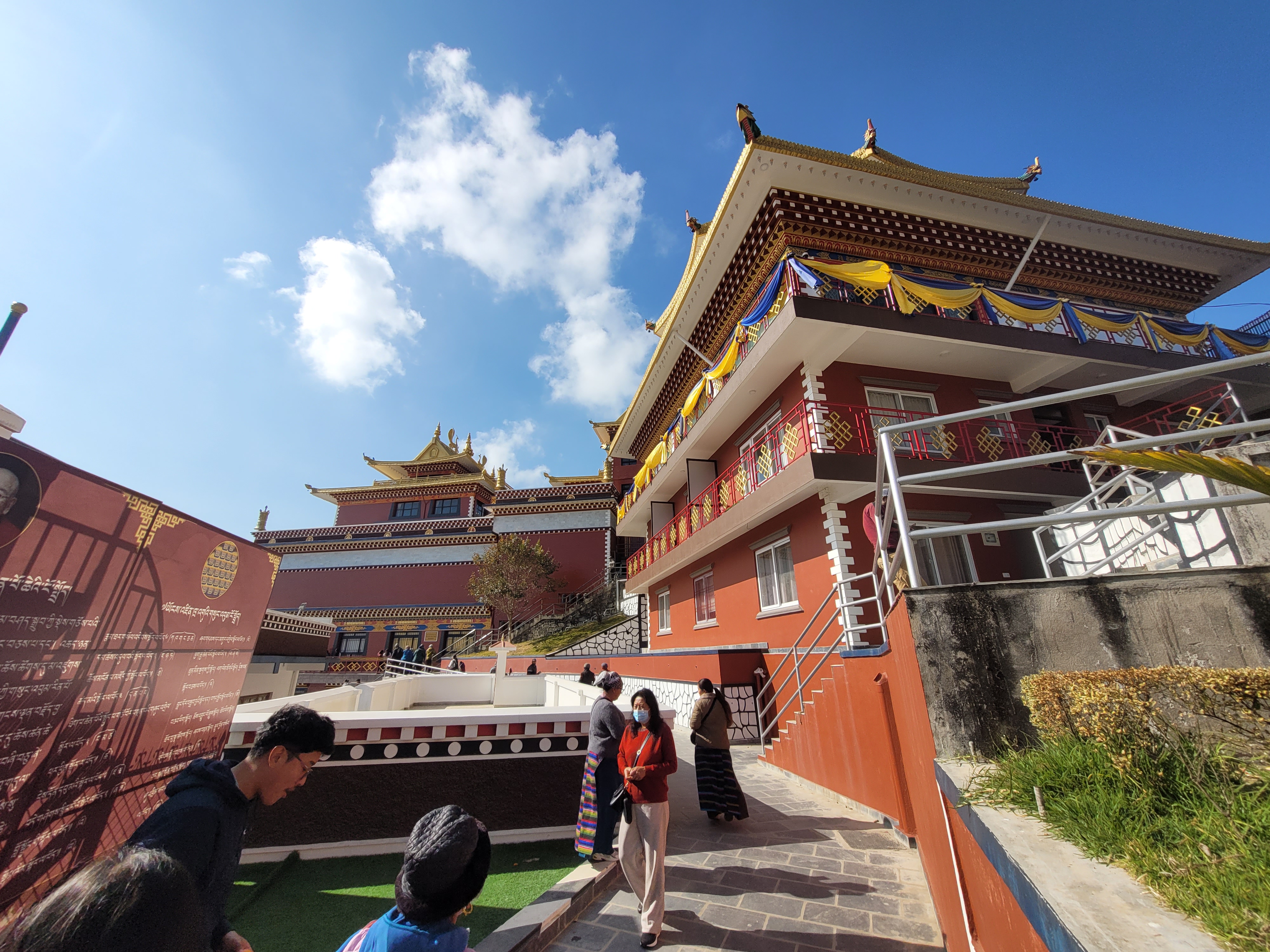
We reached the monastery just over an hour after setting off. Entry is free, and it was surprisingly busy with local visitors. The Namo Buddha Monastery (officially the Thrangu Tashi Yangtse Monastery) is a large complex with temples, stupas, and a school for young monks. Most areas were open to visitors, though some sections were reserved for monks only.

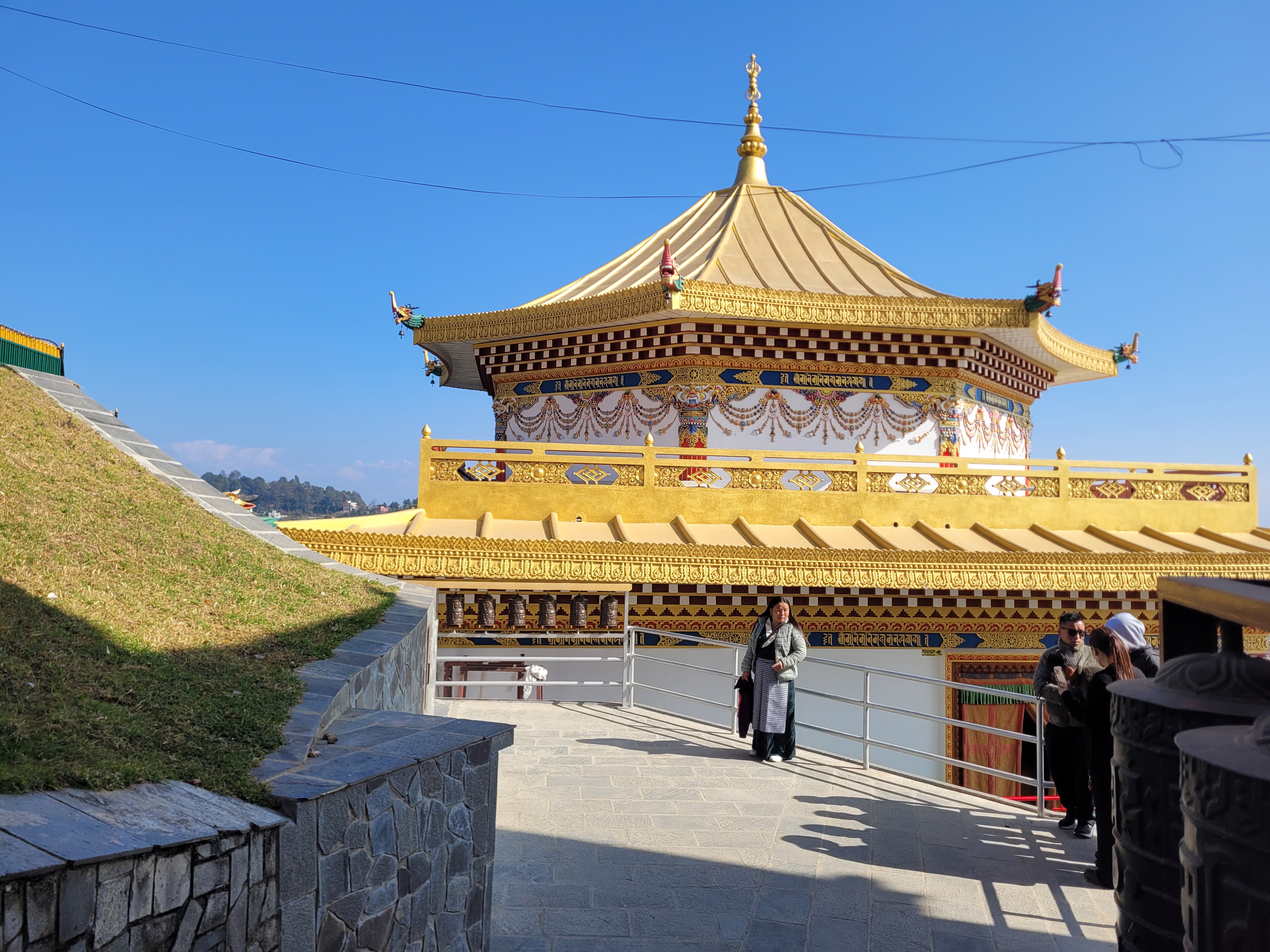
We didn’t have loads of time, but enough to explore the temples and take photos from the stupa at the top. Our driver was due to pick us up around 11 am and take us back to the farmhouse for lunch and our bags. We weren’t sure how we’d recognise him, but we figured he’d find us — we were the only foreigners there. He was a bit late, but that gave us time for one last cup of masala tea.
We had Dal Bhat on the balcony back at the farmhouse and then headed towards the airport around 1 pm. Before leaving, we were gifted a traditional Nepali scarf, known as a khata. The drive took over two hours, but since the airport is on the east side of Kathmandu, we didn’t have to go back into the city and reached it in about an hour and a half.
We checked in our bags and, with about three hours to spare, hoped to go out for some food. It turned out that leaving Kathmandu airport once you’ve entered is not easy. Luckily, there was a currency exchange with a reasonable rate, and after security, a small food and coffee stand with some bits and bobs.
Since our first visit in 2021, we knew we wanted to come back to Nepal, and the Everest Base Camp trek felt like the perfect excuse. We might not have done everything we originally planned, but since we tend to push ourselves, we actually ended up doing more than expected and enjoyed every bit of it. We would absolutely recommend the Renjo La and Cho La passes to anyone wanting to escape the busy EBC trail and experience a quieter side of the Himalayas without leaving the safety of the teahouses.
I hope this wasn’t our last visit to Nepal’s stunning mountains. My parents are already asking when we’re taking them with us — so maybe next time isn’t too far away!