Pakistan
Visited: June 2025
Day 1: We got a driver!
You wouldn’t think getting to the airport in Doha would be difficult. It’s a pretty straightforward route with signs everywhere, but somehow, our driver had no clue where the airport was. Eventually, he said he figured it out, but I could tell right away he was taking us to the Air Cargo terminal.
The airport was packed, and the check-in counter scared us a bit. They had to call three different people to verify our visas, but it all worked out in the end. The lounge had a huge line, but it moved quickly, so we were able to get some dinner and wine. I have to apologize to the Hamad Airport Al Maha Lounge—it’s not that bad.
Note
Pakistan now has an eVisa system, and it’s free for many countries. We heard it could take forever to get approved, but we were lucky—it came through in 24 hours. Once approved, you have 90 days to enter Pakistan.
Our flight was short and easy, but I can’t hold back: Qatar Airways is garbage! The planes are old, the flights are expensive, and the “award-winning service” is… well, shit. We flew with Etihad just a few months ago, and it was so much better.
We landed in Islamabad at 2 am, and by 3 am, we were through customs and had our bags. From there, we went upstairs to the domestic departures area for our flight to Skardu. It was closed for the night, so we were sent downstairs to the Visitors Gallery. There’s nothing there, but there’s a lot of floor space, so we found a cozy spot, laid out our sleeping bags, and crashed.
Side Note
Our original flight was to Gilgit, but it got canceled two weeks before, so we had to find an alternative. Skardu worked out perfectly.
We slept surprisingly well and woke up just before 7 am. The whole area is guarded by about 10 policemen, which made it easier to keep an eye on our stuff. We went back to departures to find an exchange office, but the only one was at international departures, and we couldn’t get in. Fortunately, a guy stopped me and asked if we needed an exchange. We were unsure if he was trying to rip us off, but we asked around, and someone told us to trust him. We exchanged $300 for 260 rupees per dollar, which wasn’t the best rate but still better than what we would have gotten in Qatar.
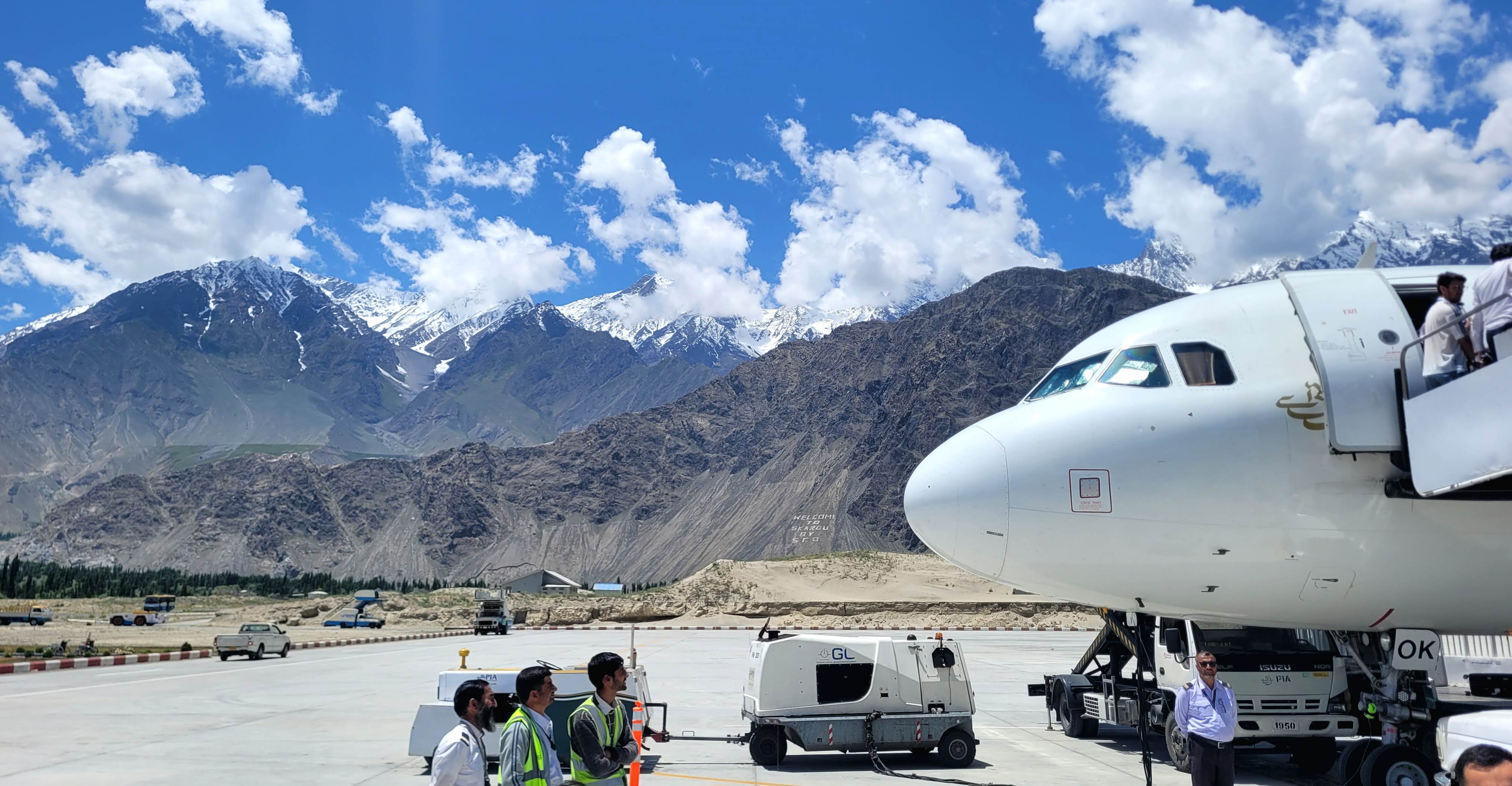
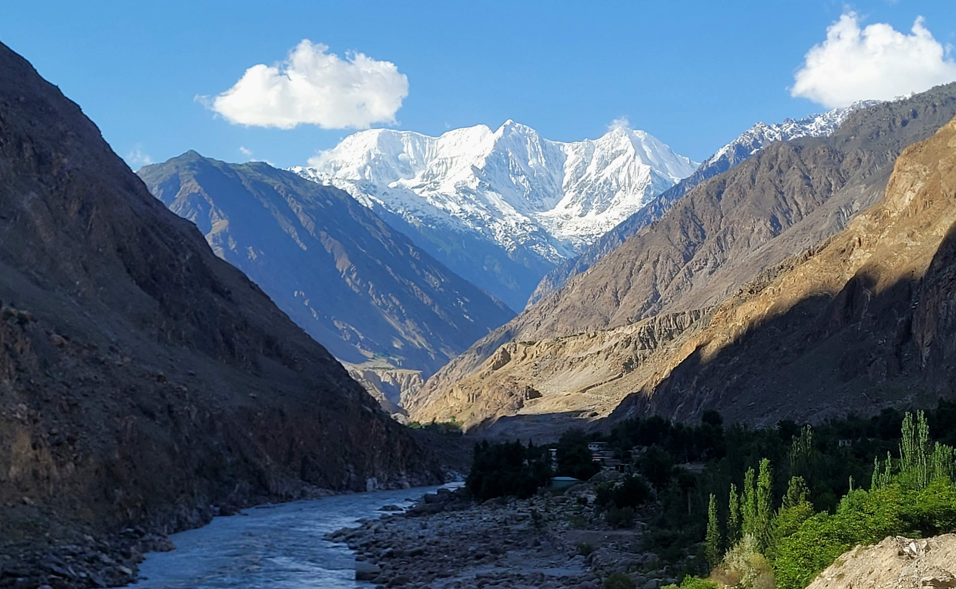
The flight to Skardu was unreal! The plane flew right next to Nanga Parbat, an 8,126-meter mountain that towers over everything else. Then we flew into a valley surrounded by 4,000–5,000-meter peaks to reach Skardu. The pilot even had to make a few circles around the airport to slow down!
We landed before noon, and as we were exiting the plane, we found out that the Pakistani guy behind us lives in Prague. We spent some time chatting while waiting for our bags, and he offered to arrange a car for us. However, this was his first time back home after doing Umrah (a pilgrimage to Mecca), and he was greeted by many people, so he kind of forgot about us…
At that point, about 10 drivers were trying to get money out of us. Our original plan was to take a bus, but that would’ve meant going in the opposite direction and back. One guy quoted us 15,000 rupees, which we’d been told was about right. We knew we’d be paying a premium as foreigners, but that was fine. Then the original guy was told by other drivers to leave us, claiming it wasn’t his turn (at least that’s what they said). We didn’t mind since they all quoted us the same 15,000 rupees.
Just as we were about to make a deal, another guy came to ask if we would like to share a car, and suddenly we were in the middle of a heated argument. Even the police had to step in, and an army officer came over to talk to us.
At this point, we just wanted to leave, so we agreed to go with whoever. But then the original driver claimed he had never said 15,000 rupees—he said it was 50,000! All the other drivers backed him up. One driver then offered us a ride for 35,000 if we shared the car with two others. The whole thing had already taken at least 30 minutes, so we were pretty fed up. We told them all the discussion was over—we didn’t even have 50,000—and that we’d take a taxi to the town and a bus further.
We walked away, and the original driver followed us. Once we were alone in the car, we agreed to 17,000 rupees for the ride to Minapin. He drove off in the opposite direction at first, pretending to take us to the bus, so the others wouldn’t chase us.
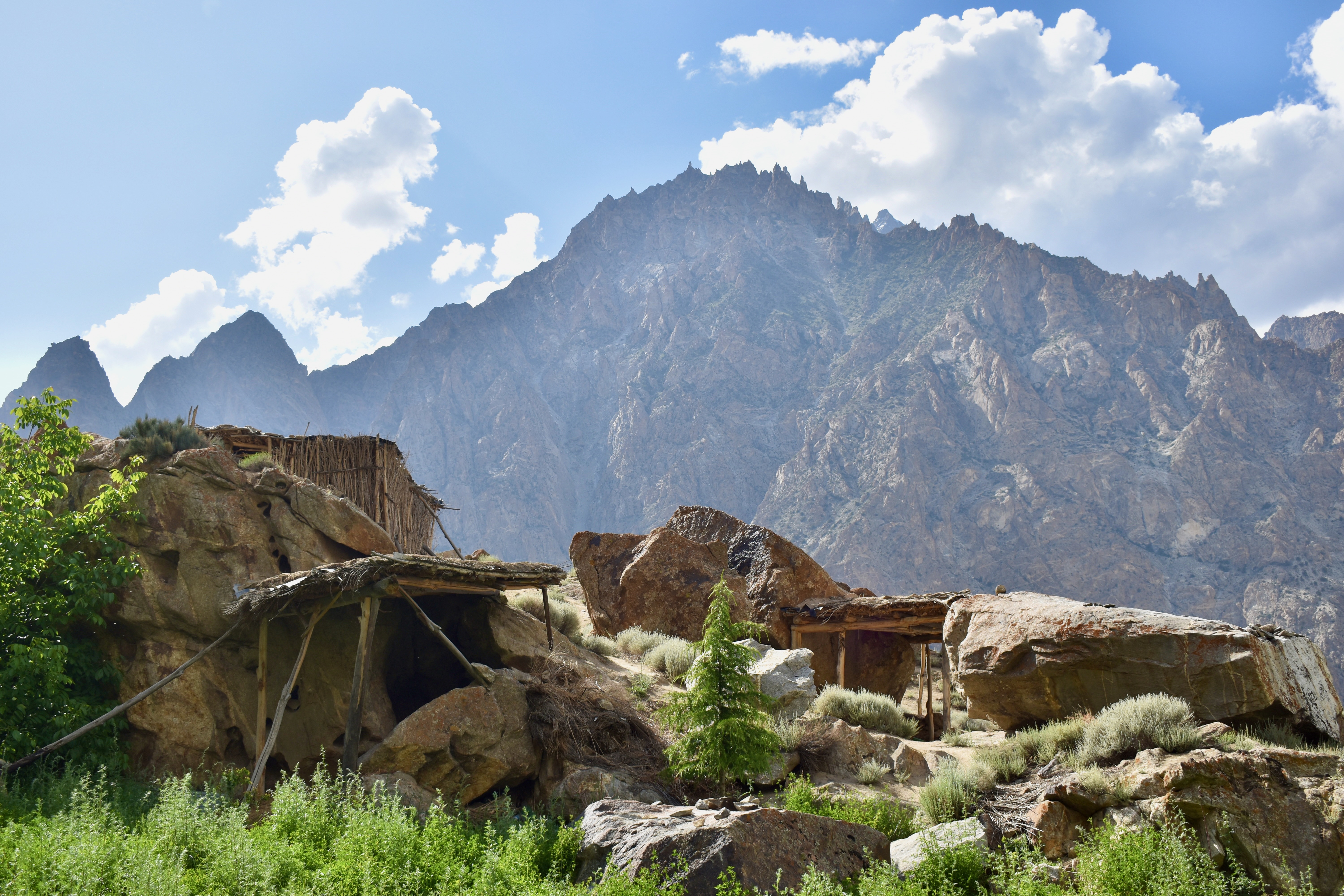
We made a quick stop at the driver’s house so he could change clothes. His name is Mehdi, and he runs a company called Skardu on Wheels with his father. He treated us to tea and fresh mulberries from his garden. We’d never had mulberries before, and they were absolutely delicious. We hit the road just after 1 pm.
Mehdi was a great driver who gave us an amazing price and a hassle-free service. He kept us safe and stopped wherever we needed. He spoke broken English, but enough to arrange anything.

+9203420018776
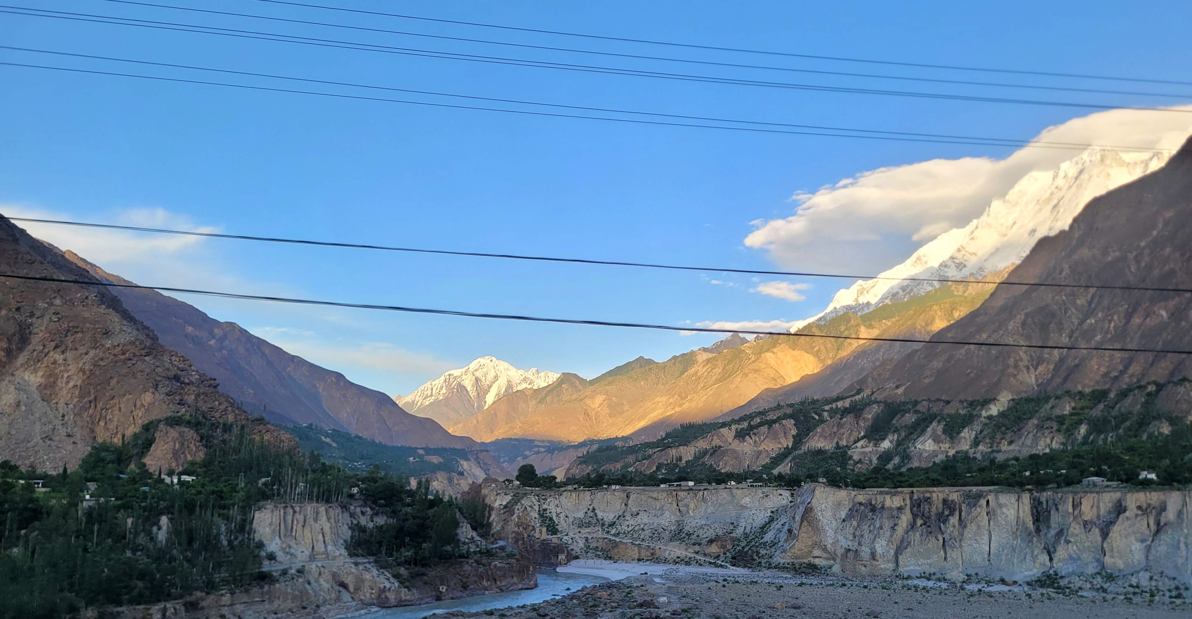
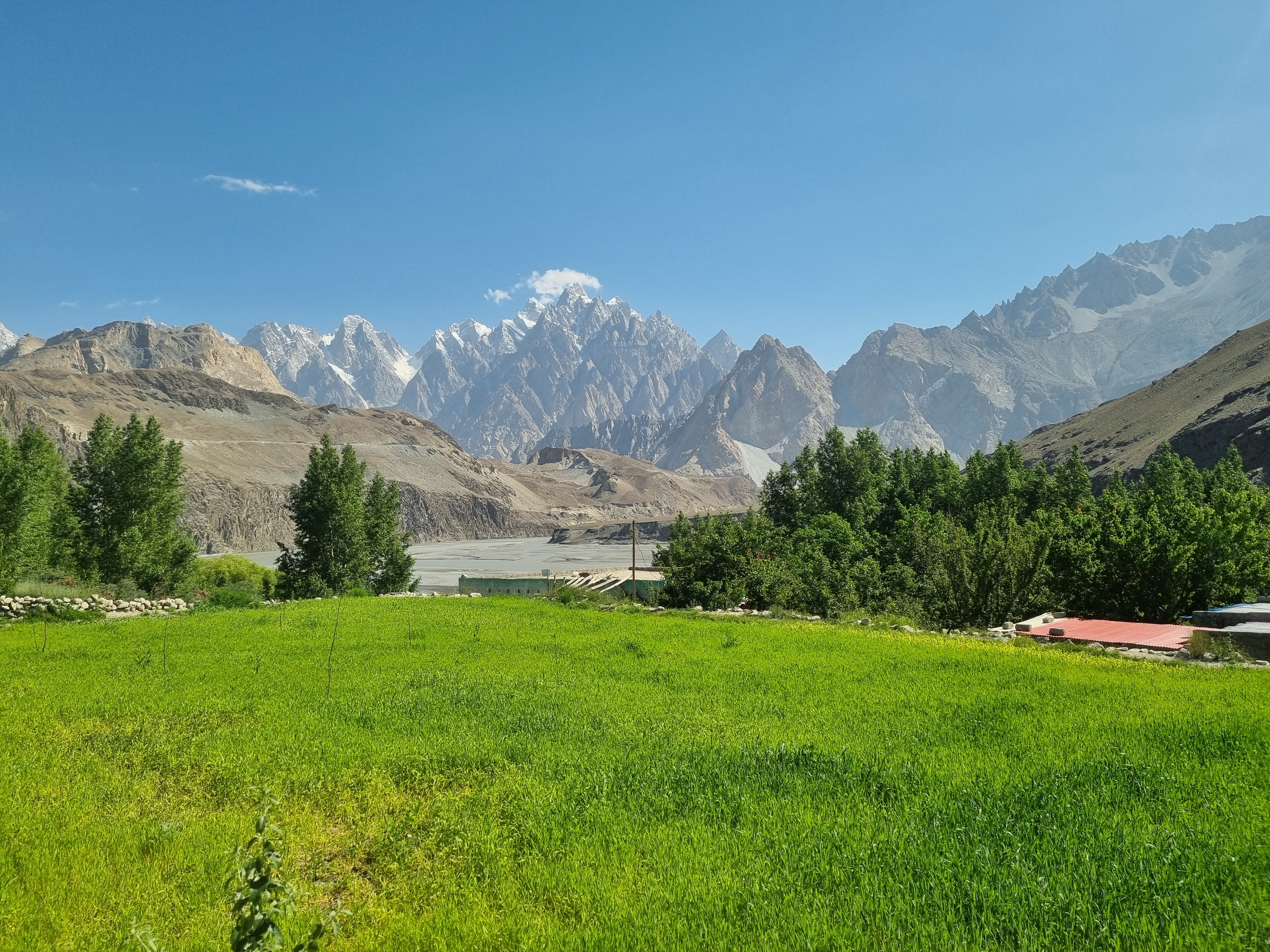
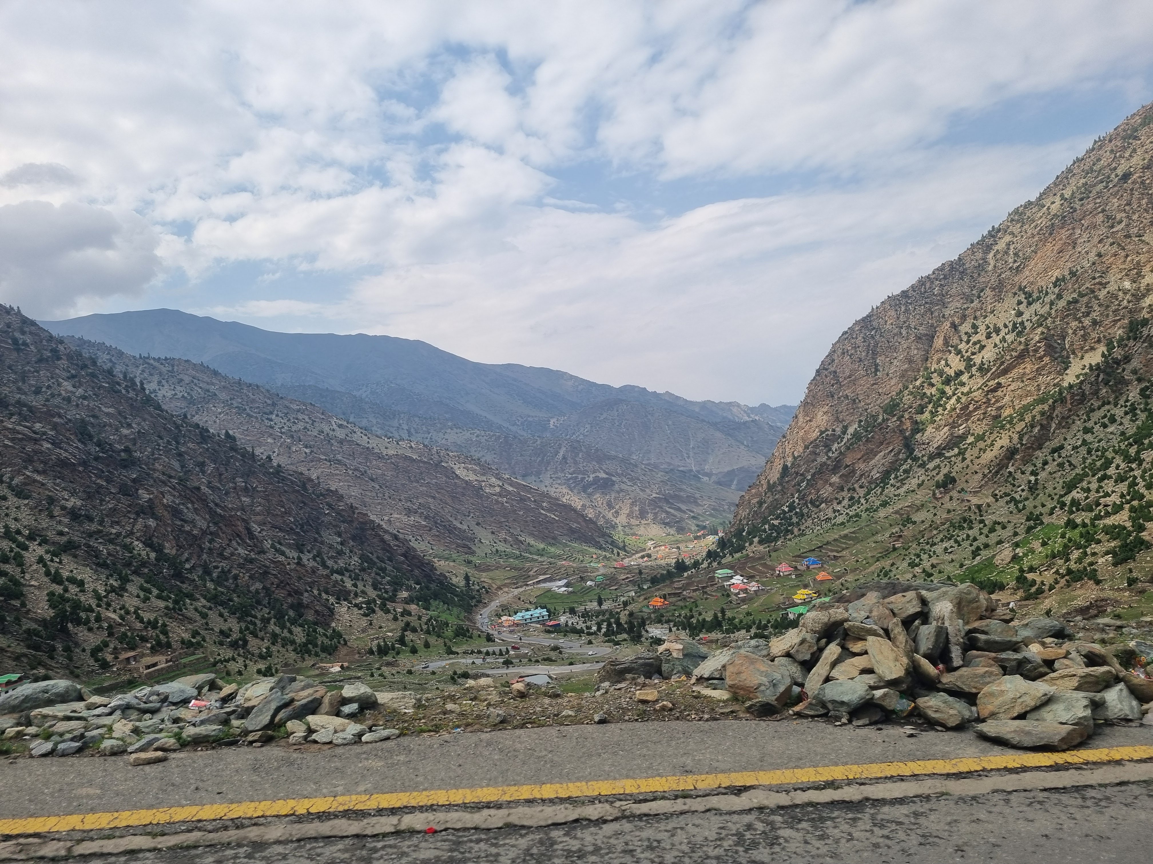
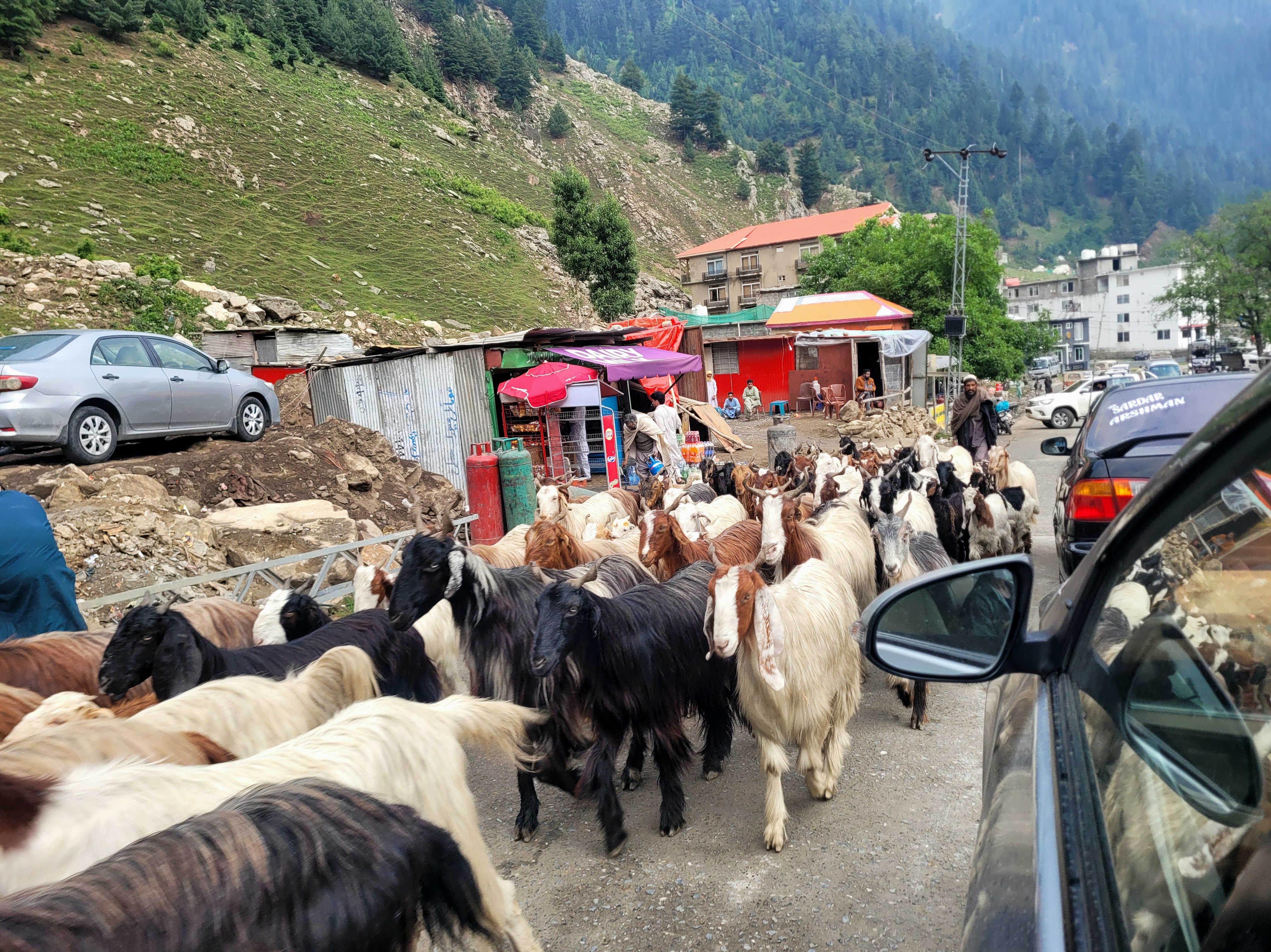
The drive was long but incredibly beautiful as we wound through the valley. Snow-covered peaks appeared around every corner. We drove through villages, saw landslides (including one massive one that had wiped out the road two weeks prior), and even watched kids riding on the roof of school buses. One village appeared deserted until hundreds of people suddenly emerged as a local volleyball game wrapped up.

After about 4 hours, we stopped in Gilgit to change money. Unfortunately, the exchange office had no cash, and they claimed they were the only exchange in the region. Luckily, a guy from a nearby shop stepped in and offered to withdraw some money from an ATM and exchange $200 for us. The rate was a little worse—260 rupees per dollar instead of 270—but at least we got some cash.
By the time we left Gilgit, it was already late, and the drive to Minapin took another hour and a half. From there, it was another 20-30 minutes to our hotel, since Minapin doesn’t have any paved roads.
Before we checked in, we arranged with Mehdi to be our driver for the rest of the trip. It wasn’t the cheapest option, but since we were on a tight schedule, it made sense. Mehdi asked for just under $20 a day + petrol, which we thought was a bargain.
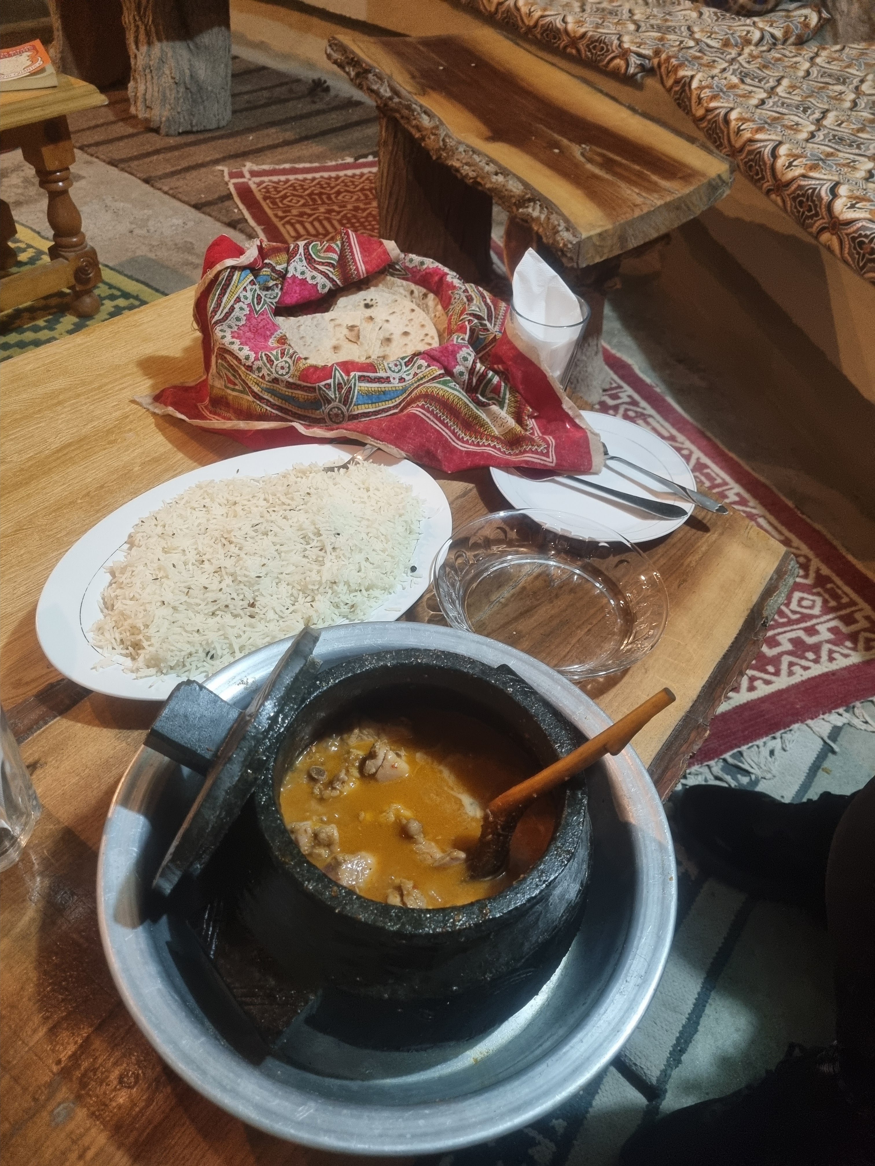
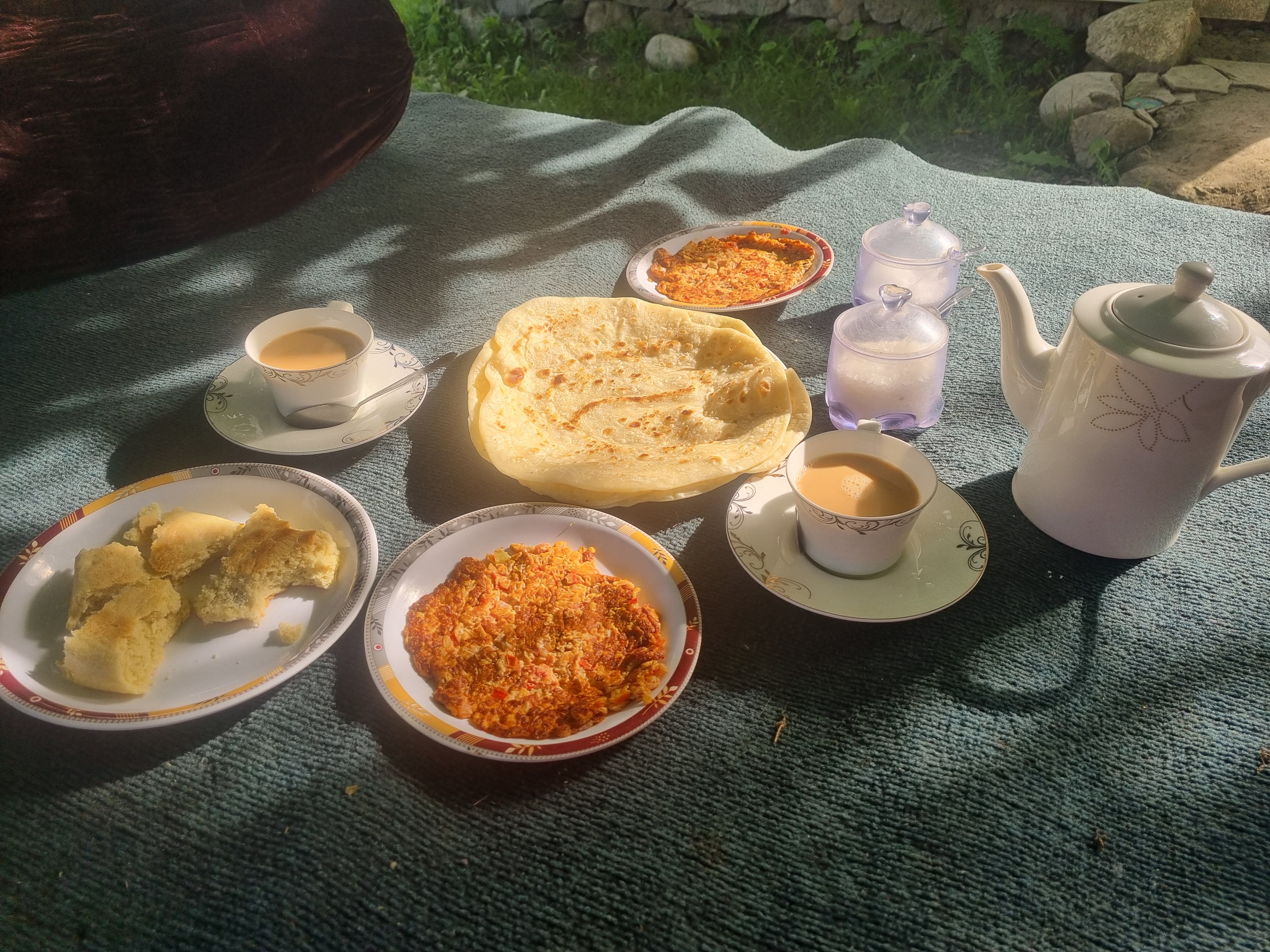
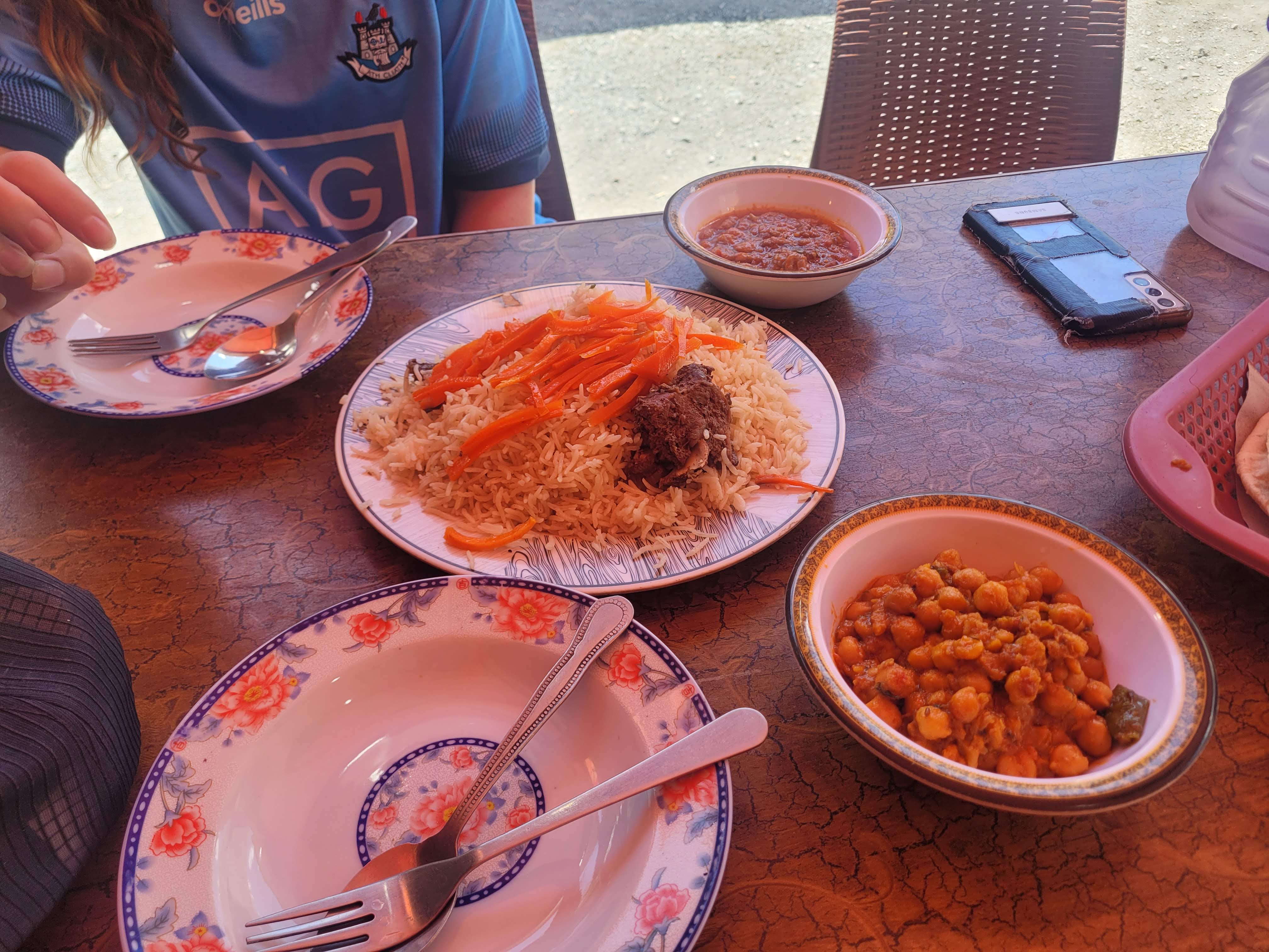
We checked into the Manokur-e-Basa Hotel. The staff greeted us with tea, and we immediately ordered dinner since we hadn’t eaten all day. We had Beef Gorlon (a meat curry cooked in a stone pot), rice, and chapati—all for 3000 rupees. It was delicious, and we ate every bit of it. After dinner, we showered and packed for tomorrow’s hike.
Day 2: Painted-like Minapin Glacier and Rakaposhi Base Camp
We slept like babies and had our alarm set for 7 am. We started getting ready for the trek, and soon after, a big group of other trekkers arrived at the hotel to use it as their starting point. They were off around 8 am, and we hadn’t even finished our coffee or breakfast — we’re definitely slow starters.

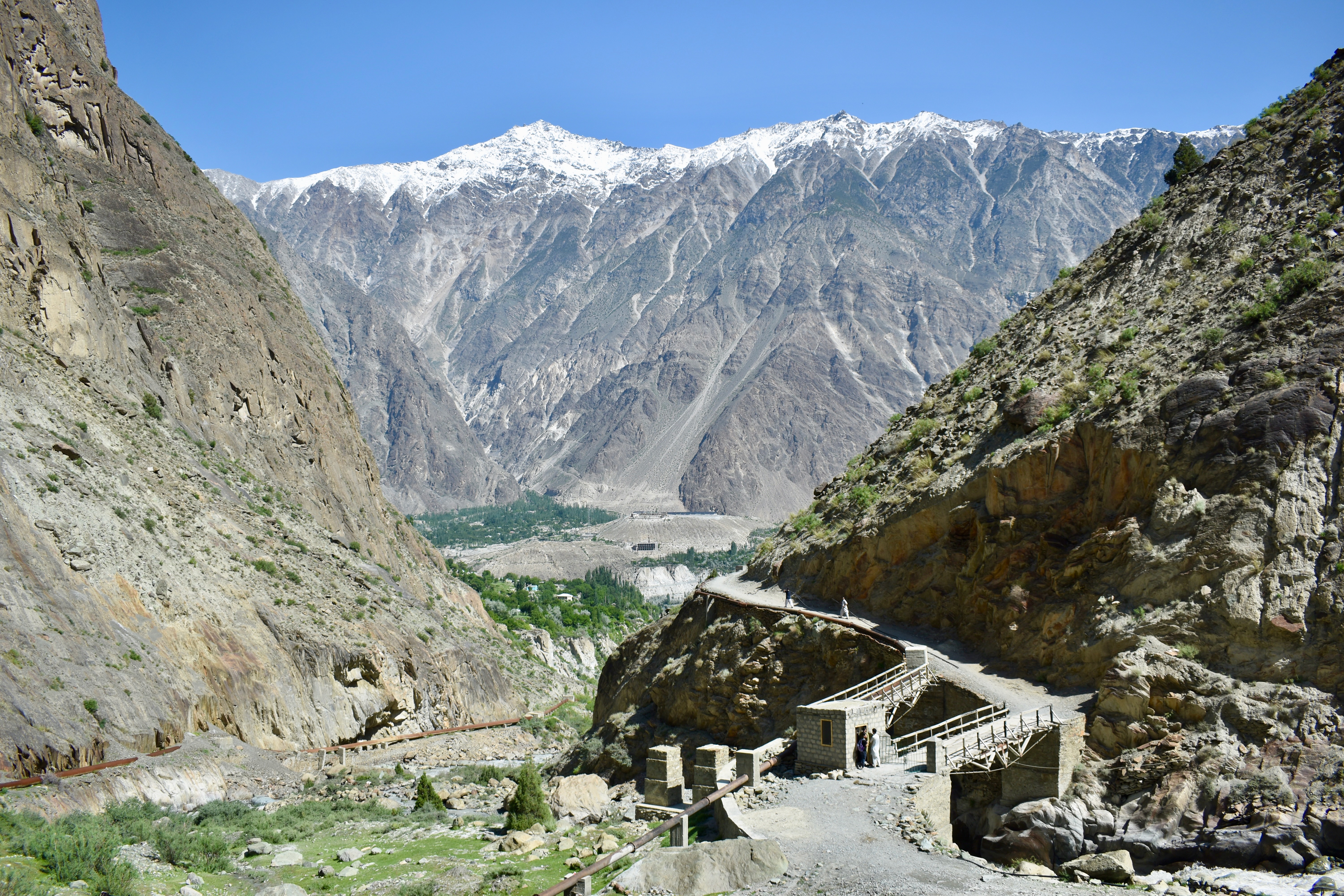
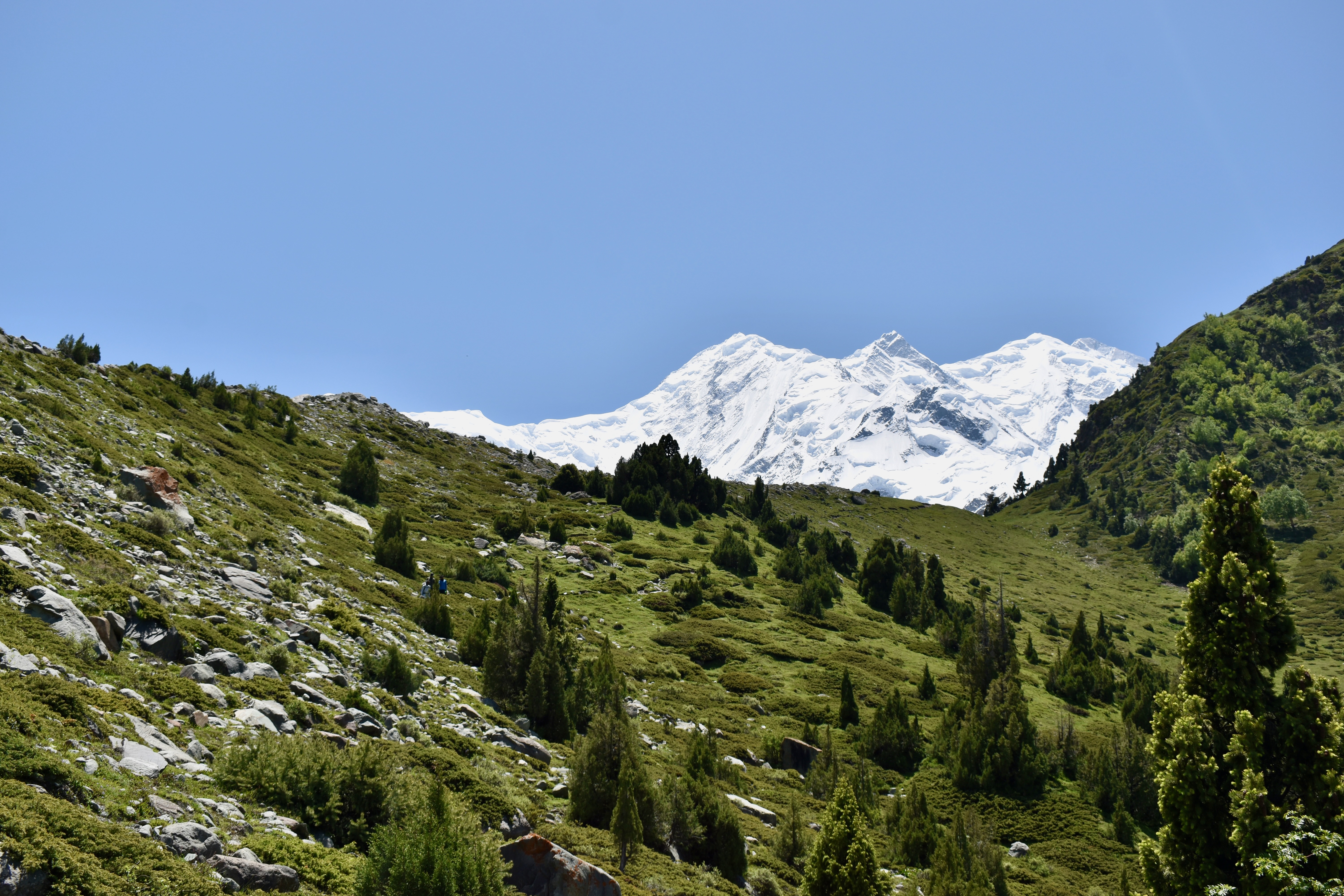
We left just after 9 am and, after about 500 meters, reached a bridge across the river where we had to pay 300 rupees each for the park fee. From there, the trail started zigzagging up pretty steeply, and we got our first view of Ultar Mountain, towering at 7,388 meters. The initial incline then flattened out as we reached the tree line.
We continued for a couple more kilometers until we reached the first meadow. This was about an hour and a half into the hike, and we’d already caught up with the large group, who were taking a break there. After the meadow, it was just one more steep slope, and we arrived at Hakapun. The hike was about 6 km with 800 meters of elevation gain, and we did it in 2 hours.
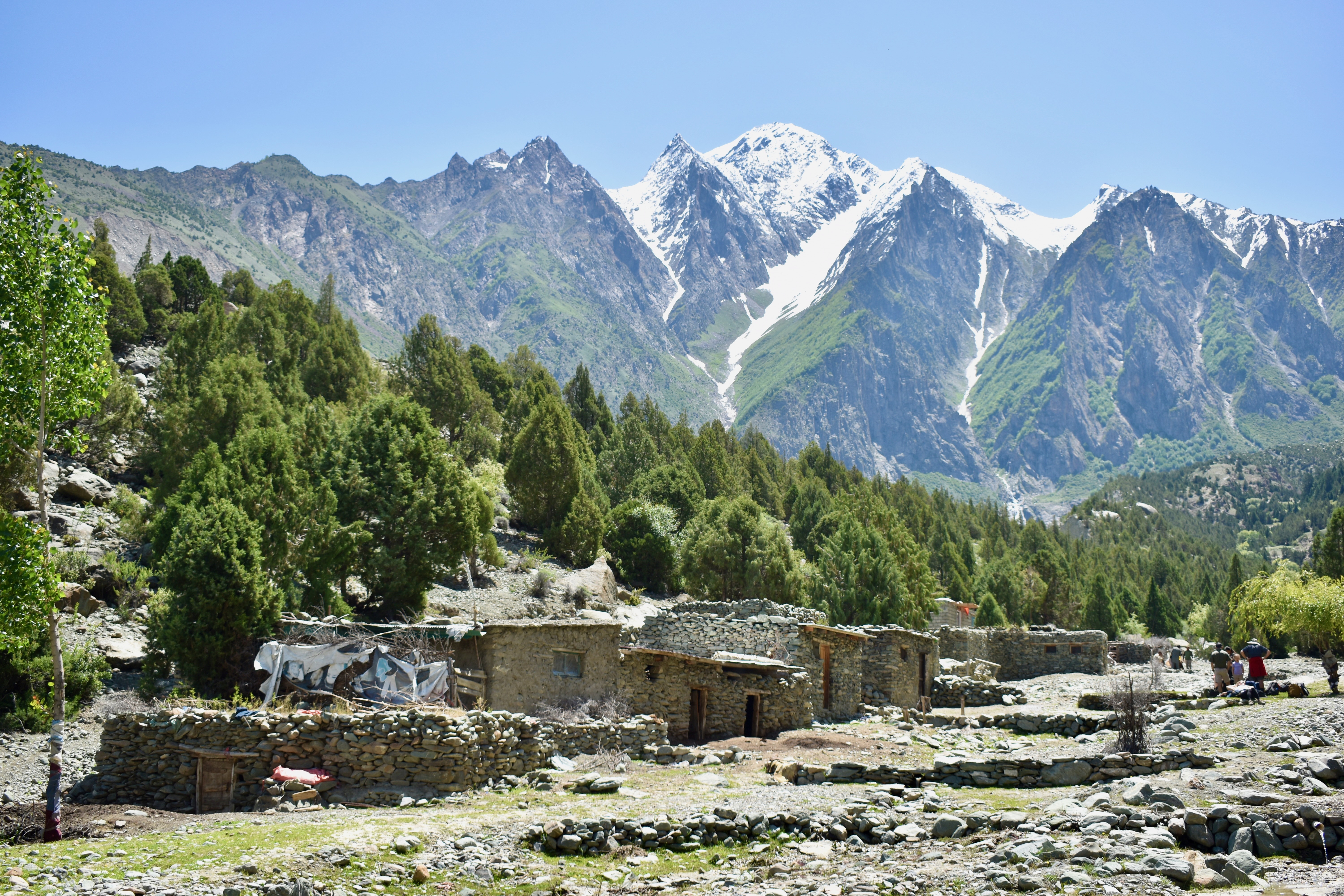
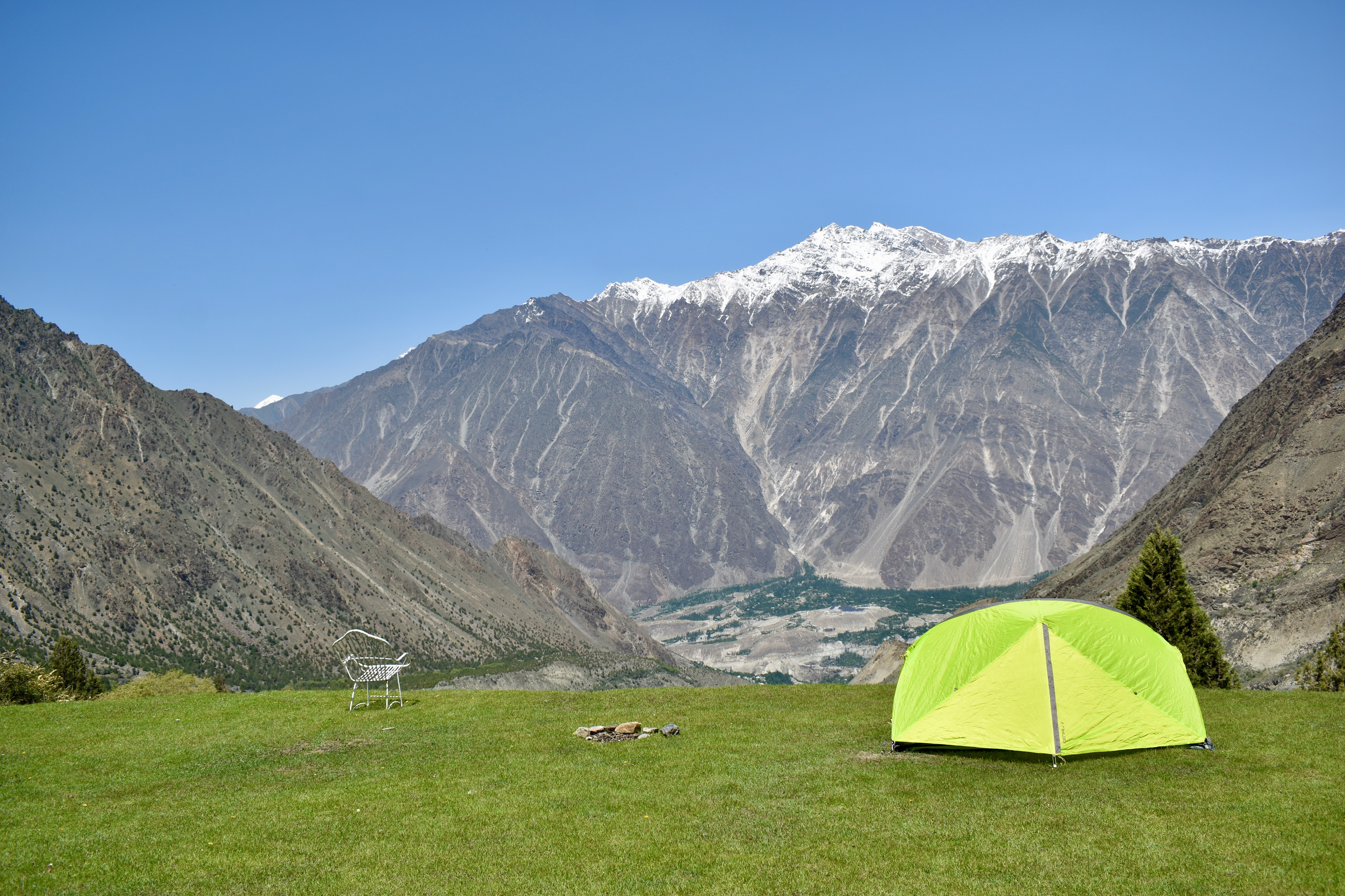
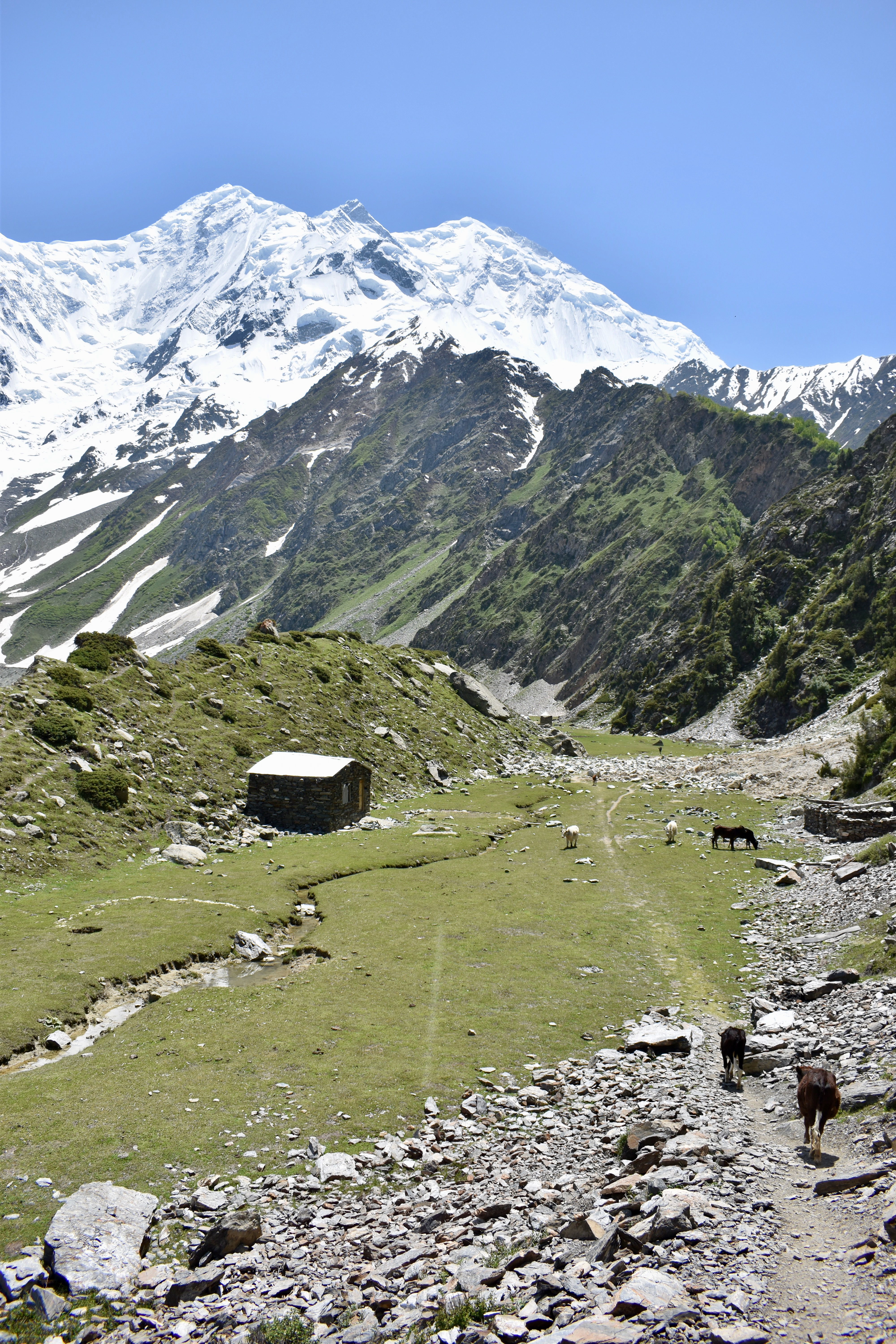
We walked straight to the first campsite on the left and arranged dinner, breakfast, and a camping spot for only 4,000 rupees. We pitched the tent, left everything we didn’t need inside, and continued hiking up to Rakaposhi Base Camp.
The next section of the hike was definitely the steepest. The first ~700 meters were just up, up, up. Then the trail shifted into a more gradual incline, with some steeper parts again near the end. I was feeling tired and had to take a few short breaks, but Clare kept me going all the way to the top.
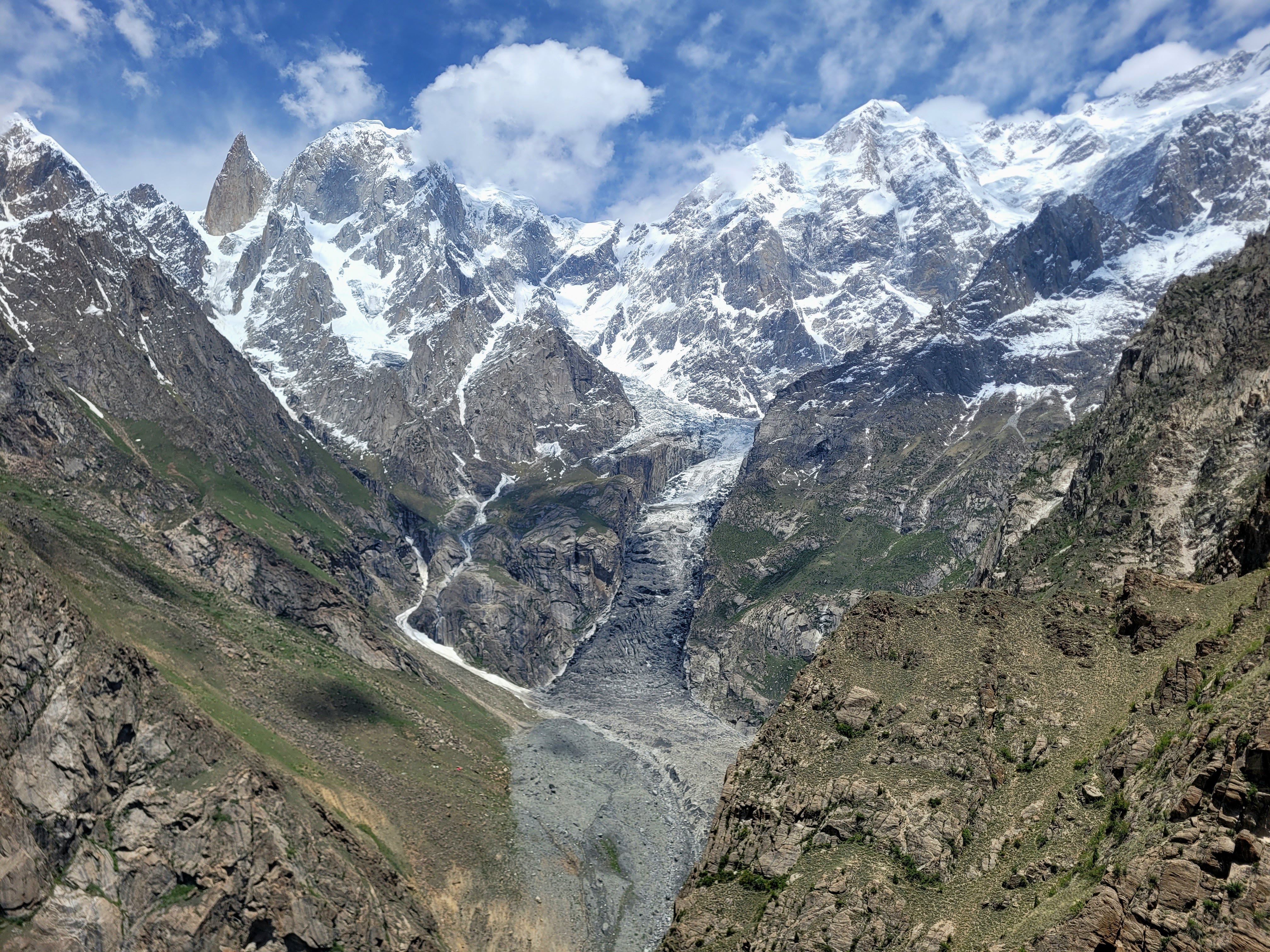
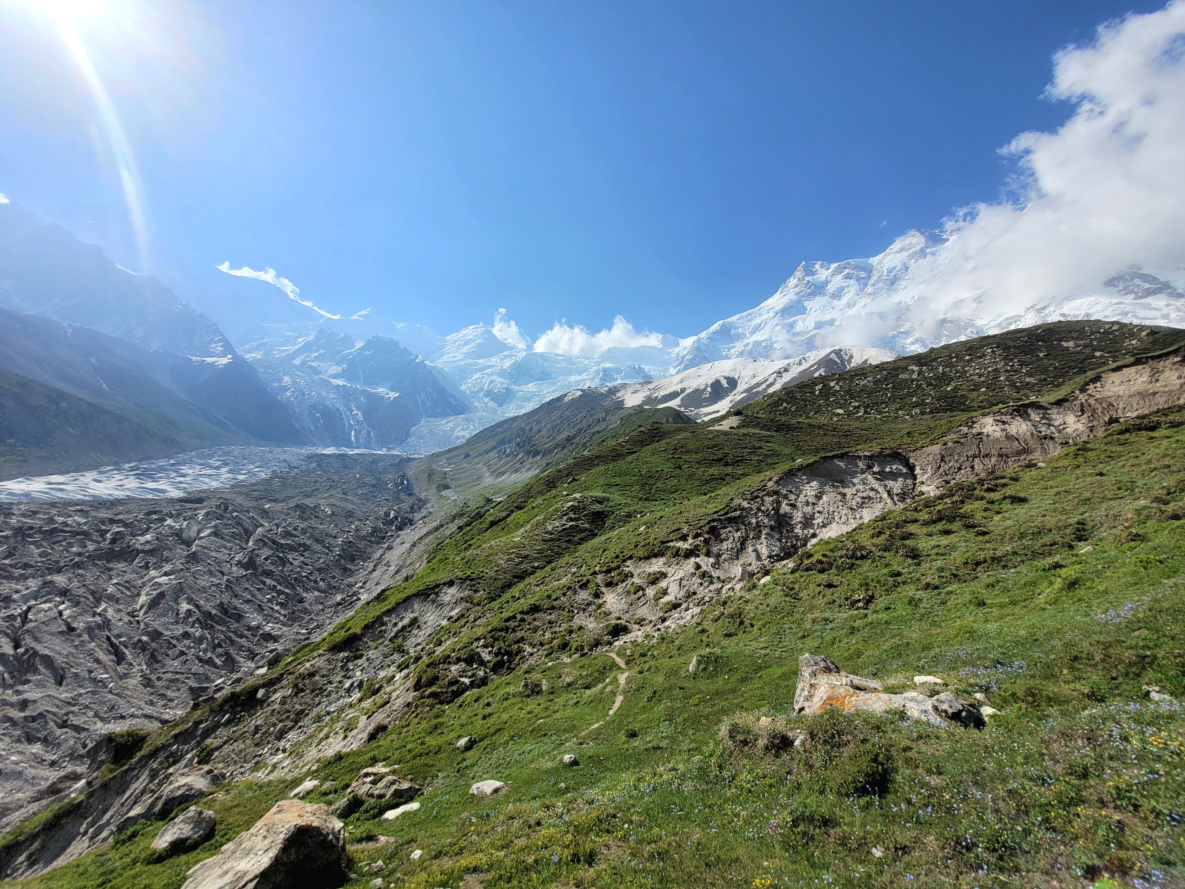
The view from the ridge was absolutely mesmerizing! We were welcomed by a massive glacier in the valley, with the towering 7,788-meter Rakaposhi on the right. It got really windy up there, so we put our jackets on and spent a few minutes just soaking it all in.
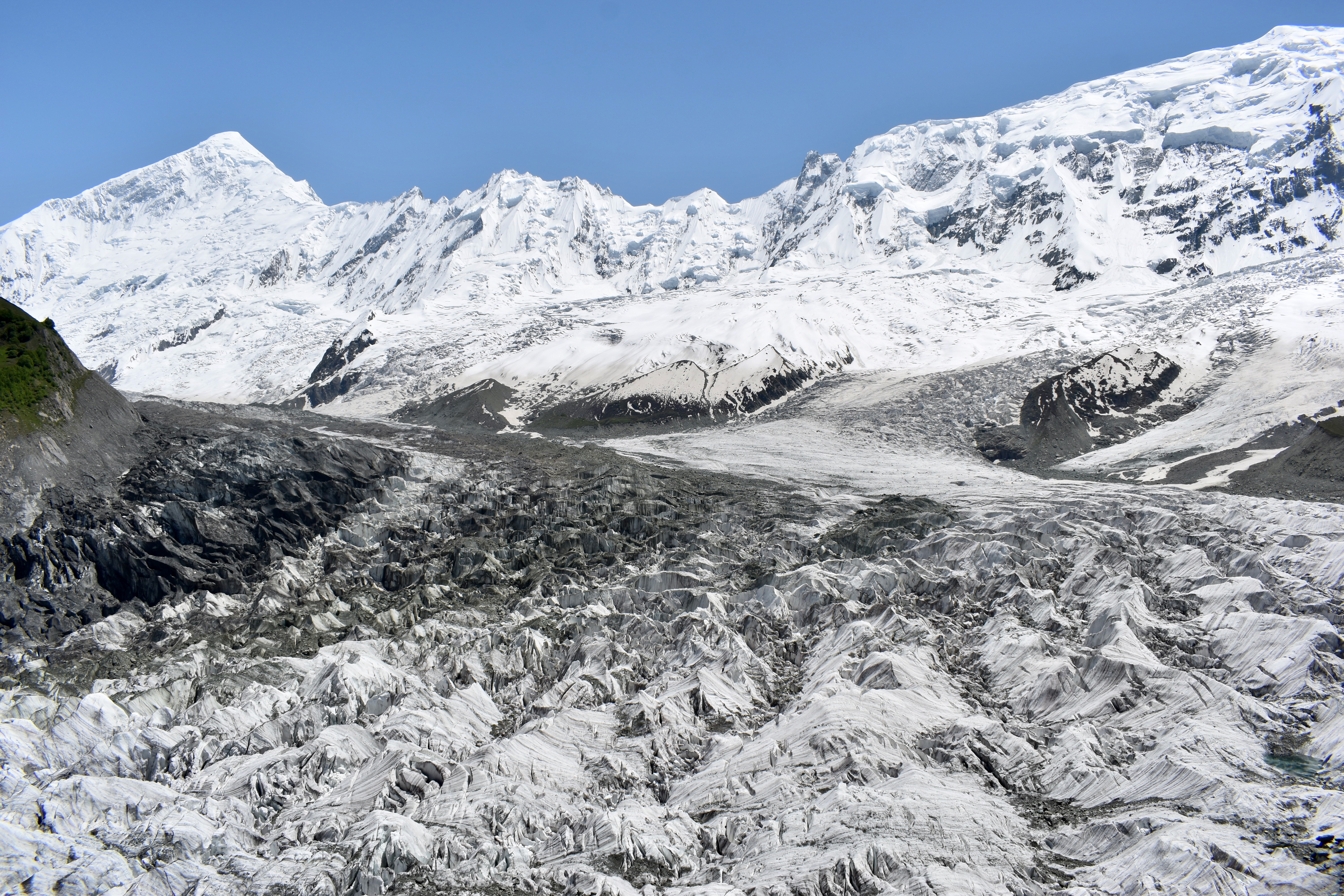
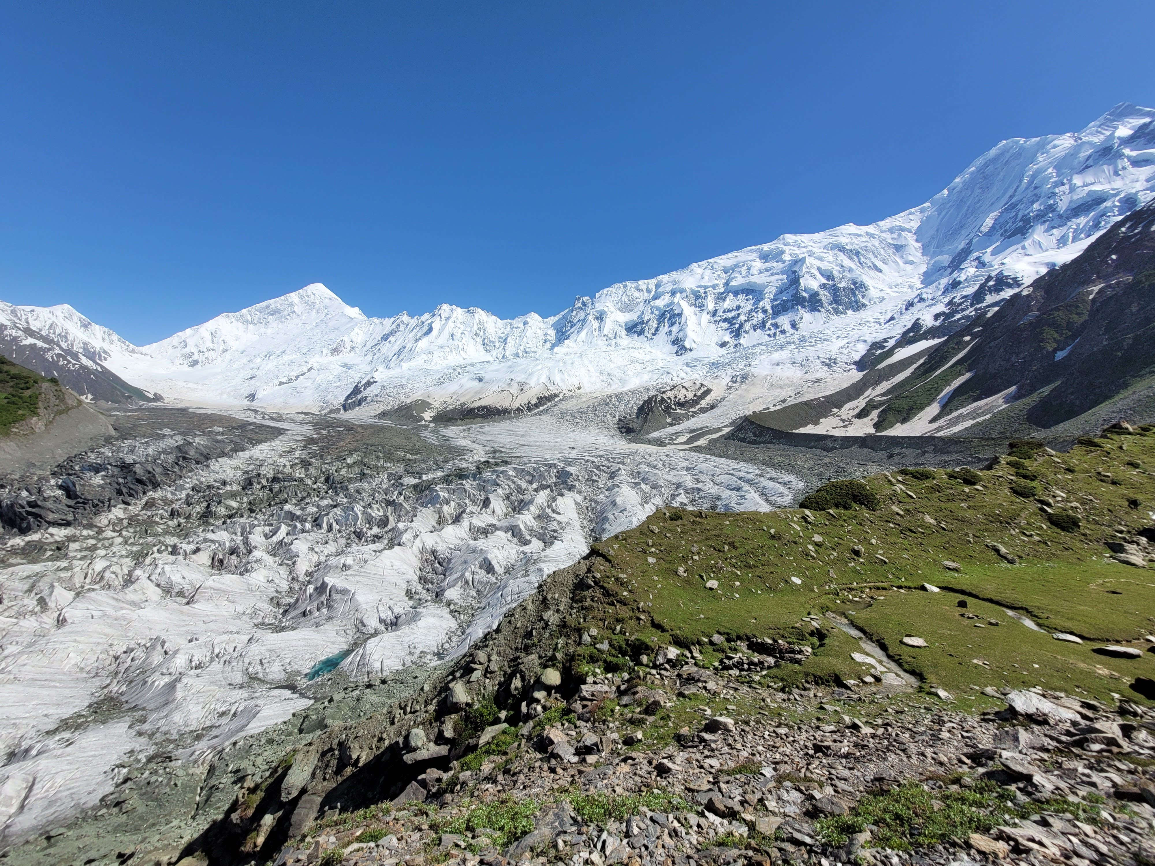
It took us 2 hours to reach the glacier viewpoint, and the Rakaposhi Base Camp was just about 5 minutes further. We stopped there for a coffee and then set off to find water. A stream ran through the camp, but it was pretty dirty, so we had to walk the length of the valley (about 0.5 km) to find the source — meltwater emerging from under the snow. Since we were already there, we climbed the ridge on the other side of the valley to get another view of the glacier.
We then headed slowly back down, taking short breaks to make sure my knee survived the descent. Everything went fine, and we were back in Hakapun in about 2 hours. It was 5 pm by then, so we just grabbed two camping chairs and spent the rest of the afternoon and evening staring at the view.
We had a cup of tea and then dinner around 6 pm — dal with rice. It was pretty windy, so we moved our tent to a more sheltered spot, layered up, and when it got too cold, we crawled into our sleeping bags. We lay facing out of the tent so we could enjoy every bit of the beautiful view.
We went to sleep quite early, but the night wasn’t great. Even though there were only about five other people in the camp, they were pretty loud. Our tent was also pitched on a bit of a slope, so we kept sliding and ending up on top of each other.
Day 3: The Kingdom Capital of Hunza
We were ready for a cold night, but it turned out to be quite warm. A T-shirt and jacket were more than enough. We were up at 6 am and slowly started packing the tent and everything away. We asked for some hot water for our coffee, and they brought us breakfast around 8 am — an egg each and two paratha breads.
We started heading down just before 9 am, and when we reached the last part of the descent (the zigzag), we were surprised at how steep it actually was. We got to our hotel in just under 2 hours, had tea, and our driver was already waiting there. We also met an Australian named Nellie and gave her a lift to Aliabad on our way to Karimabad. She was a teacher living there and had just finished a solo 4-day trek to Kacheli Lake.
We couldn’t find our accommodation in Karimabad (the pin on Mapy.cz was wrong), so I had to ask in a few places, but eventually we found the Fortyard Cottages. We left our things there, changed, and went to explore the town.
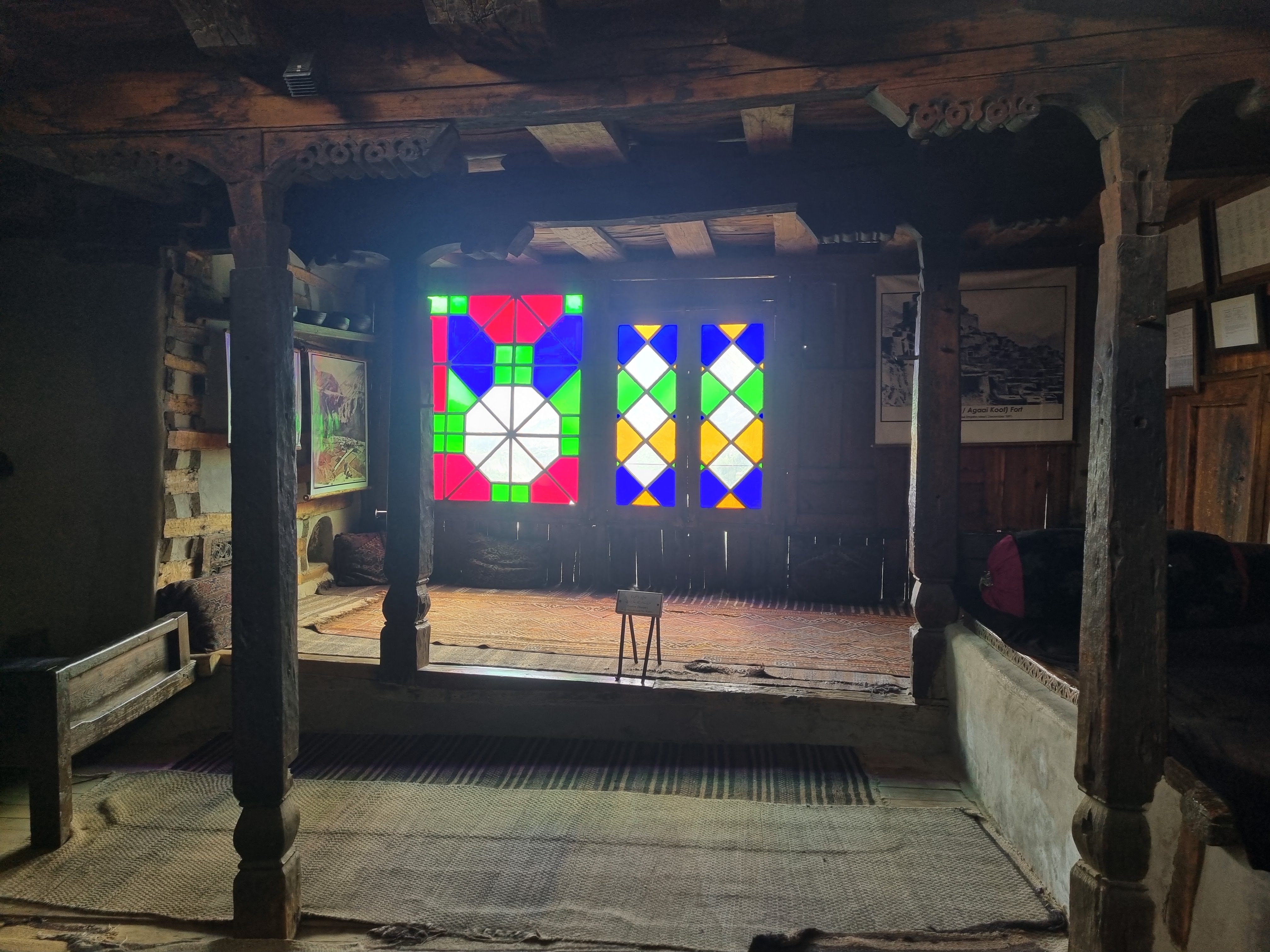
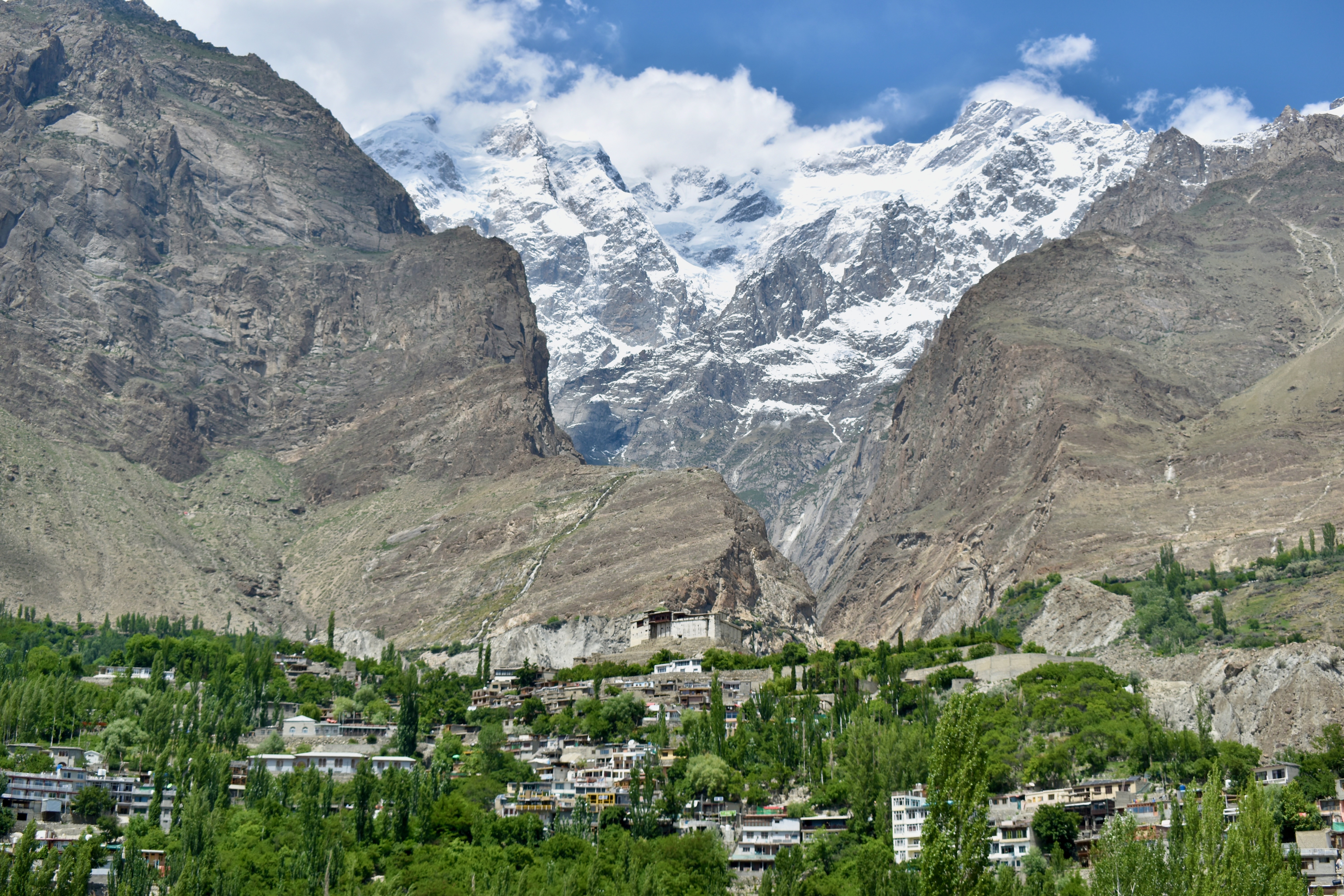
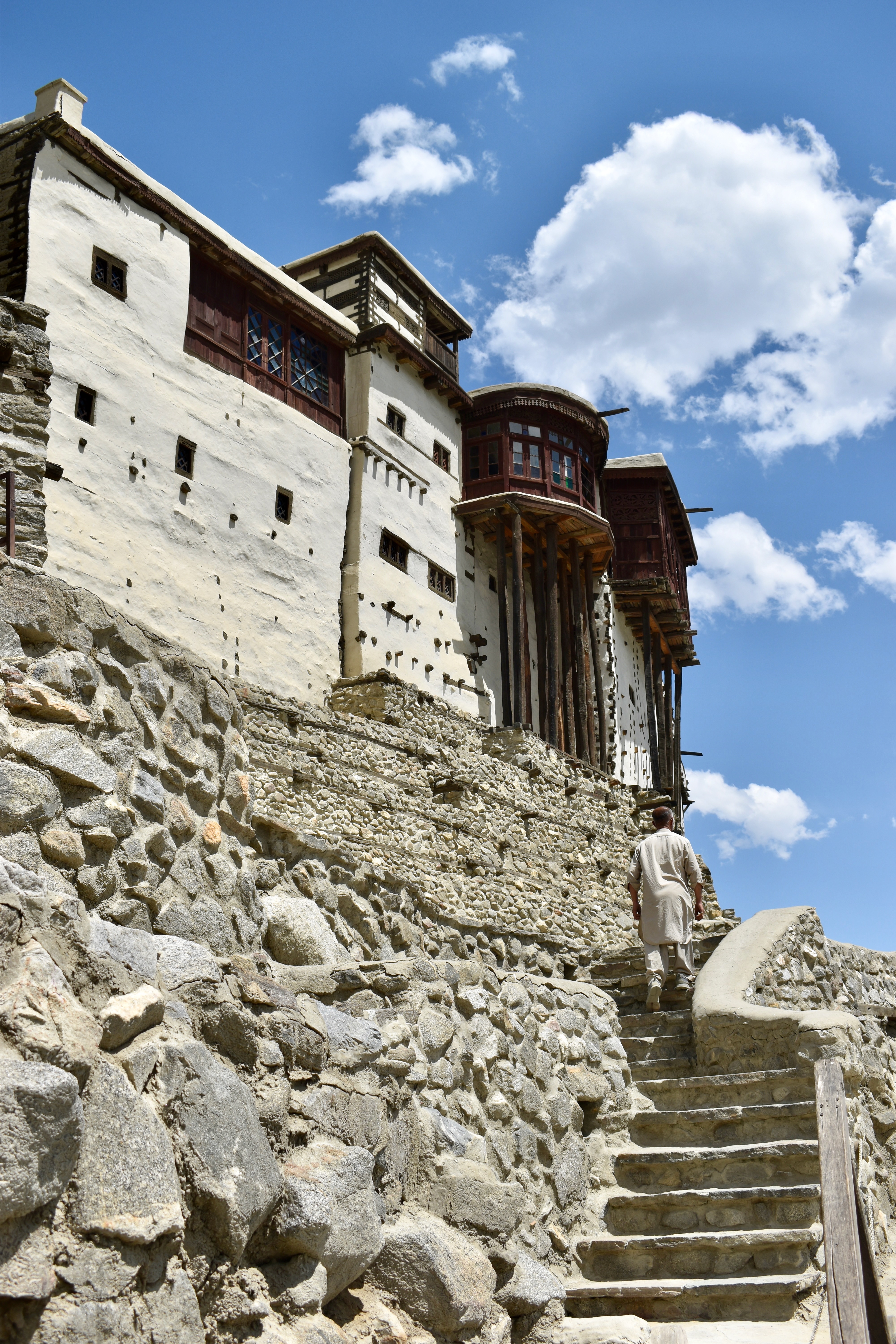
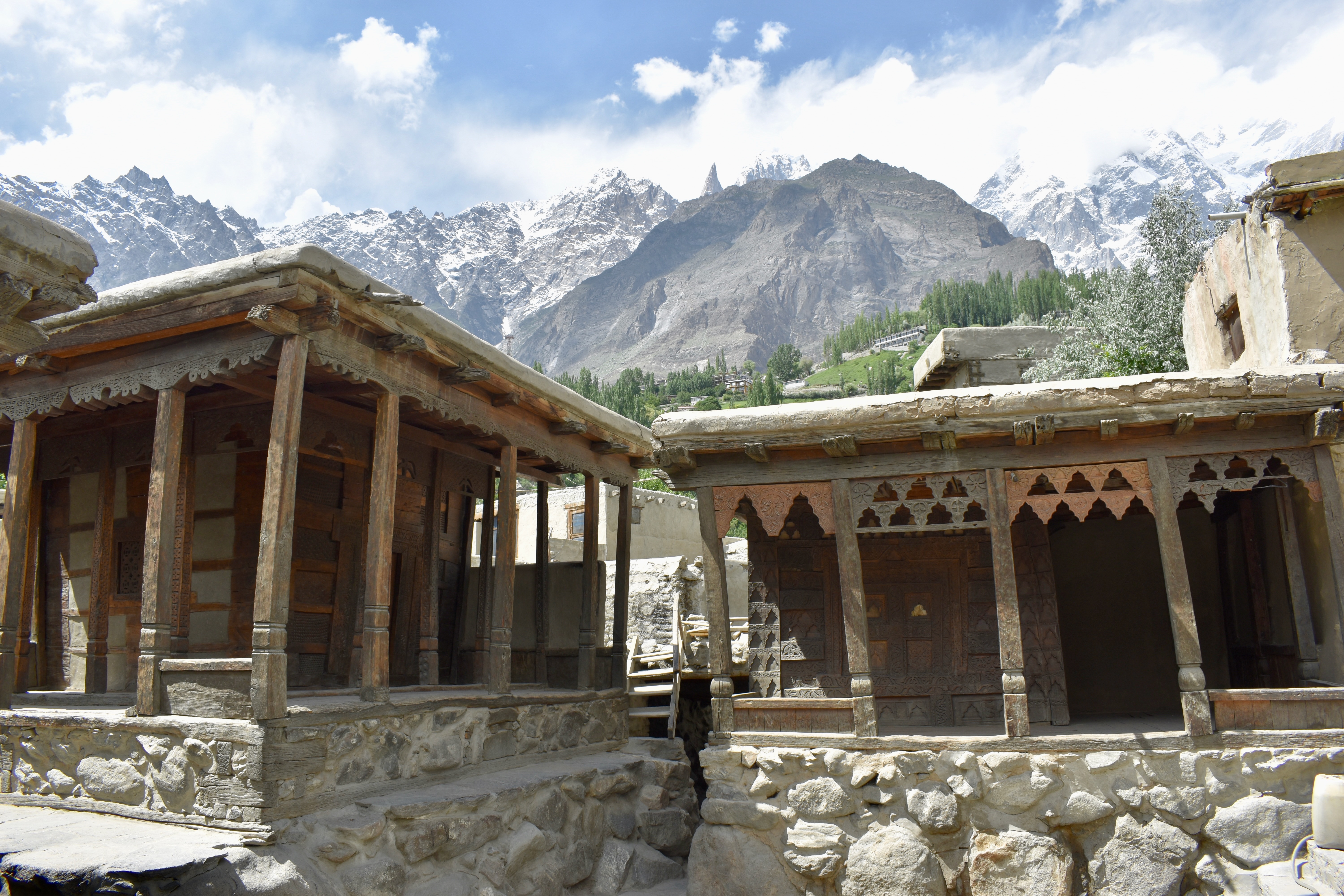
The town was built on a hill, and we were almost at the bottom, so we asked Mehdi to drop us near the Baltit Fort, which is at the top. We then walked through the surrounding streets up to the fort. We got tickets to go inside for 2,000 rupees each.
Note
The ticket booth is way before the fort, but you don’t need to get a ticket if you don’t want to go inside. That said, it’s pretty nice inside and we learned a lot about the history of the Hunza Kingdom.
It was time for lunch, so we stopped at a place called the Food Pavilion and got Yak Chap Shuro (Hunza meat cake), Burutz Berikutz (fresh cheese chapati), and Hoilo Garma (Hunza spinach pasta). They were all really good and all local Hunza dishes.
Our next stop was the other fort in Karimabad — Altit Fort. It took us some time to walk there, but it gave us a good chance to see more of the town. On the way, we stopped for a cone of ice cream… two for a dollar! When we reached the Altit Fort, the surroundings felt a bit more touristy than the part of town we had just walked through. We decided that one fort was enough and skipped going inside.
We then walked back towards our cottage and stopped for tea at a nearby hotel to use their WiFi. We were a bit too focused on our phones and both of us ended up putting salt in our tea. After that, we stopped at a shop to buy water, some treats, and a street samosa. We spent the rest of the evening relaxing on our porch and later got a nice surprise: a gift dinner from our host, cooked at home. We had Yak stew, rice, and salad.
Day 4: Ladyfinger Viewpoint and Attabad Lake
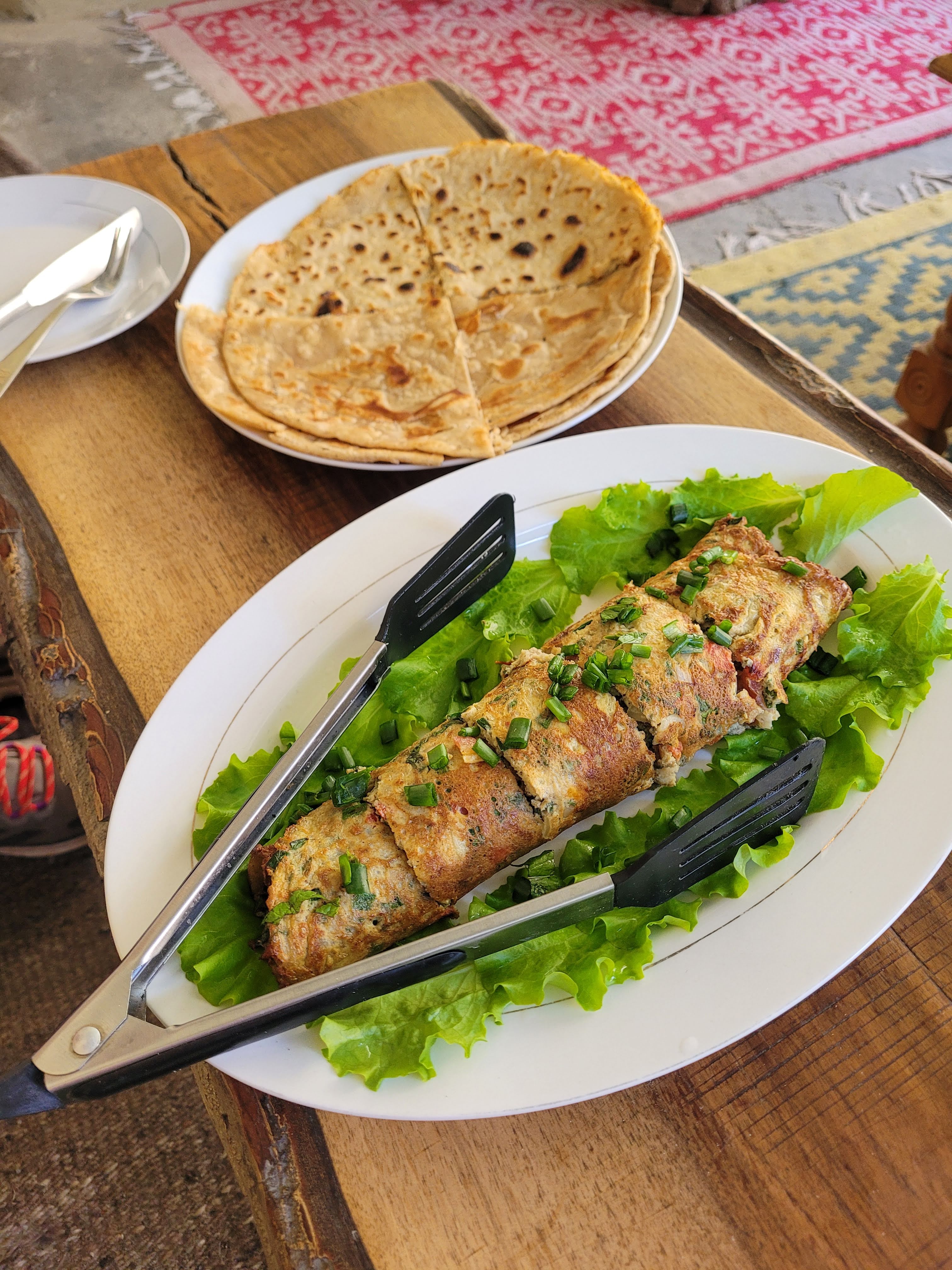
We packed our day packs, and before we left, we enjoyed what was probably the best included breakfast — a veggie omelet, paratha, homemade shortbread, watermelon, and tea.
Yesterday, we had to decide which hike to do. We had two options: the Ultar Mountain Base Camp or the Ladyfinger Viewpoint. I secretly wished for the base camp hike because it looked way easier than the viewpoint, and I felt pretty weak going up Rakaposhi. But I knew the second option would give us better views. We decided on the Ladyfinger and asked Mehdi to take us to the top of the village, to a place called Eagle’s Nest.
Note
The Eagle’s Nest is a good viewpoint that doesn’t require any hiking, but the Ultar Mountain and glacier can’t be seen from there. Sometimes it’s listed online as the Ladyfinger Viewpoint, but the actual viewpoint is much higher up the mountain.
We packed enough water and set off. The hike started with a gradual incline leading to a short wall we had to scale — just a brief scramble. After that, we reached a plateau, then a steeper climb past an old house and a garden, up to some big rocks. The viewpoint is actually on the right, but the trail seemed to go left (probably since there were some caves near the rocks) which made it a bit confusing.
Up to the rocks, the path was easy to follow. But from there, we had to traverse under the viewpoint, and it got tricky. The whole slope was crisscrossed with goat and cow trails, and we had no idea which one to follow. Then a cow appeared and we decided to follow it. By the time we reached where the cow had been, she was gone. And we never saw her again. This was a huge open mountainside, and we are still convinced she was a magic cow sent to guide us.
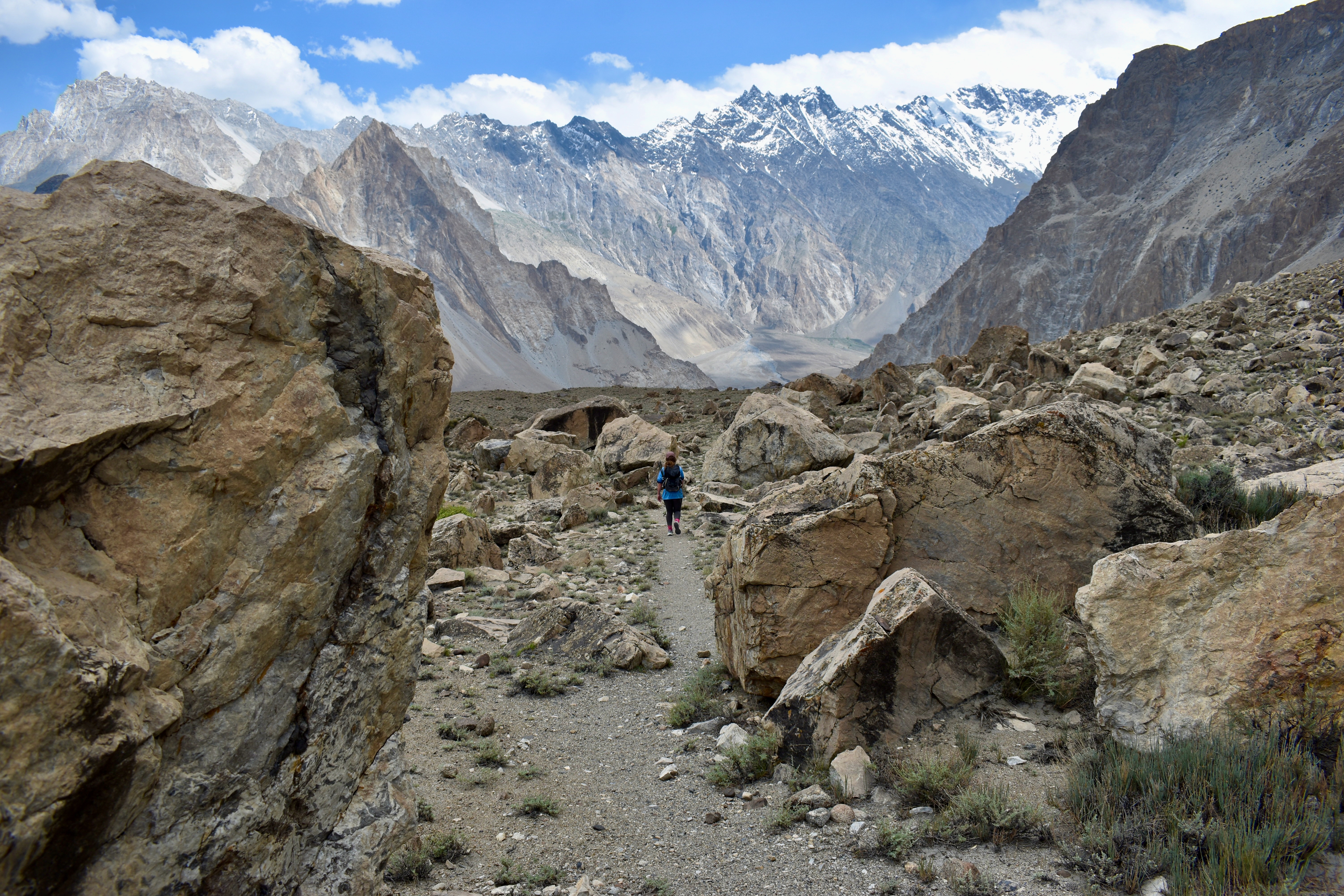
The traverse wasn’t the most fun part, and the trails weren’t clear, but we managed. Once we got directly under the viewpoint (about 200 meters in elevation below), we found a visible path and scrambled up. It was steep (at points, we were on all fours) but easy enough to follow. We reached the Ladyfinger / Ultar Mountain Viewpoint in 2 hours and 20 minutes: 750 meters of elevation gain in just 3 km. It was hot, with no shade, and definitely the steepest hike we did in Pakistan.
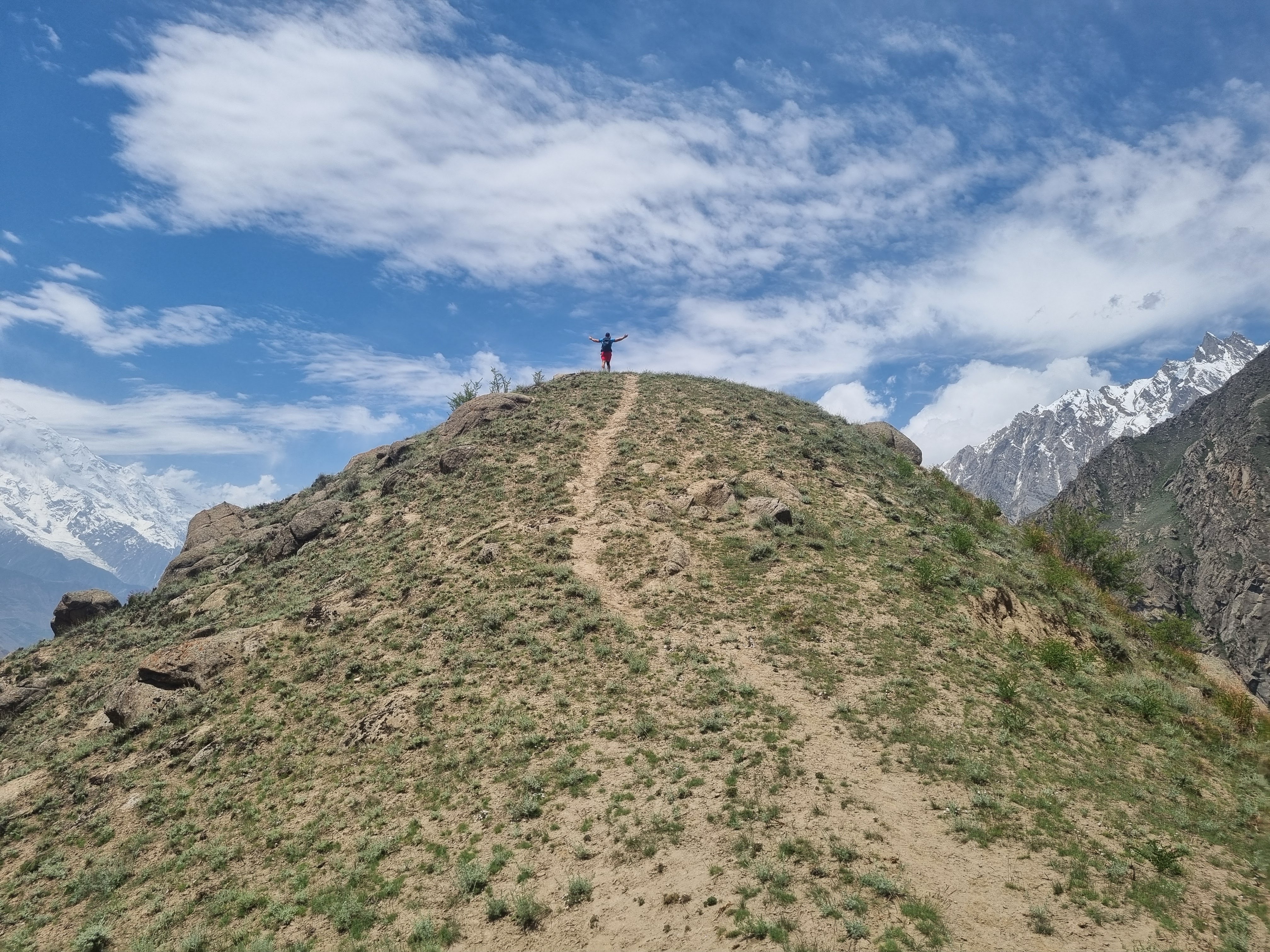


The views were incredible in every direction. We had a full view of the Ultar Glacier and could even spot the base camp below. I felt surprisingly good on the way up, but now came the dreaded descent. We didn’t use walking poles at first because the top section was so steep. Once we reached the traverse again, we got them out — and instead of backtracking to the stones, we went straight down a scree slope. It was loose rock, so Clare led the way and we just “skied” down until we reached the old house. From there, it was easy, and my knee held up well. We saved ourselves about 0.5 km and half an hour on the way down. Mehdi was already waiting with the car, and we just grabbed some cold drinks before heading down the hill.
We made a short stop in the village of Ganish. We didn’t know what to expect and mainly just wanted to snap a photo. It looked closed at first. No one was charging tickets, and there was some construction at the entrance path. We were about to give up when a man approached us. He turned out to be a doctor who runs the local charity hospital. He took us in through the back entrance, showed us the hospital, and then introduced us to the local guide for the village.
The guide was from one of the original Ganish families. He told us about the village’s history — the first settlement in the Hunza Valley, over 1,000 years old. He showed us around and explained the purpose of each remaining building. Due to past floods and the construction of the Karakoram Highway (KKH), the village is now only about 10% of its original size. Ganish was once a key stop for travelers along the Silk Road.
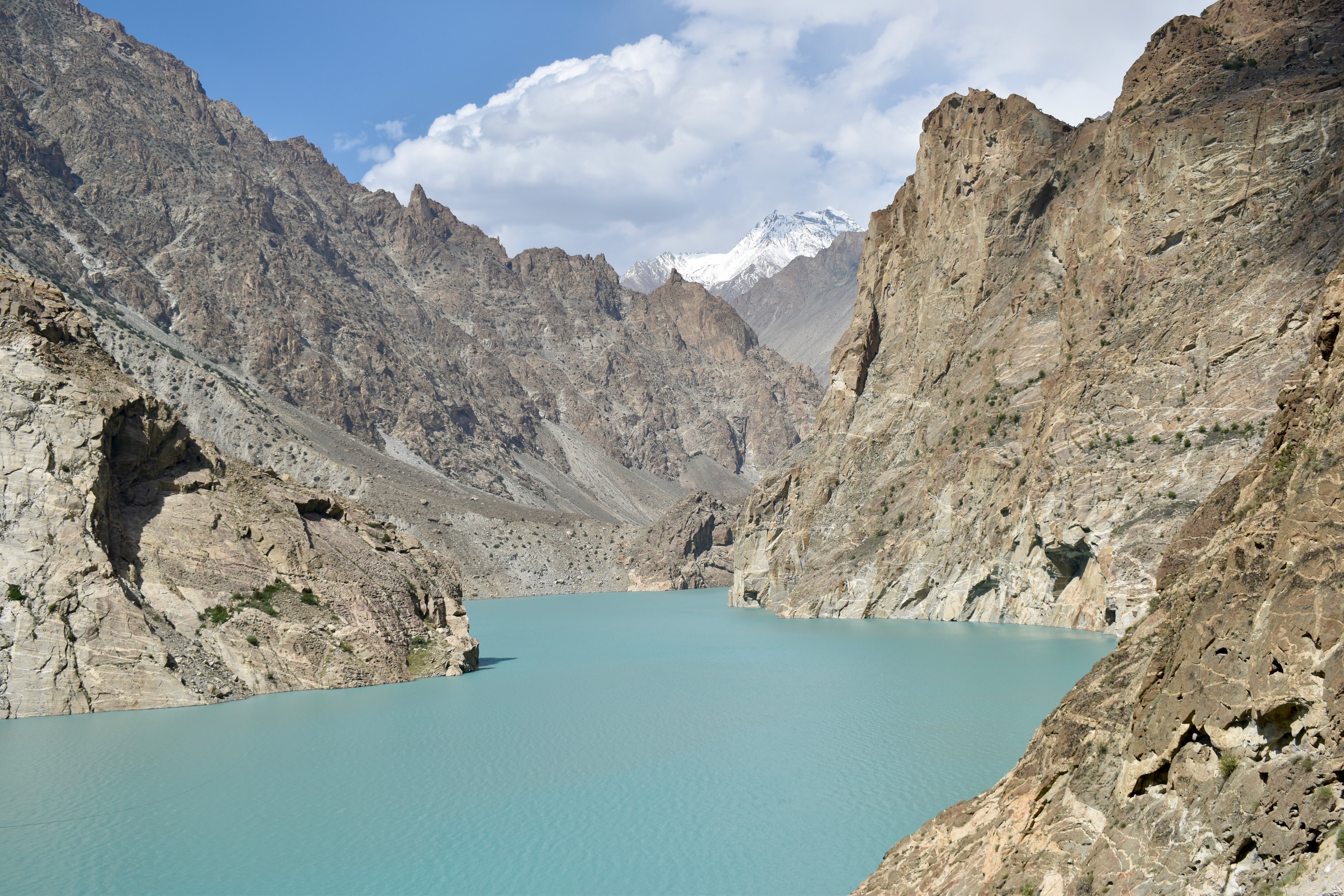
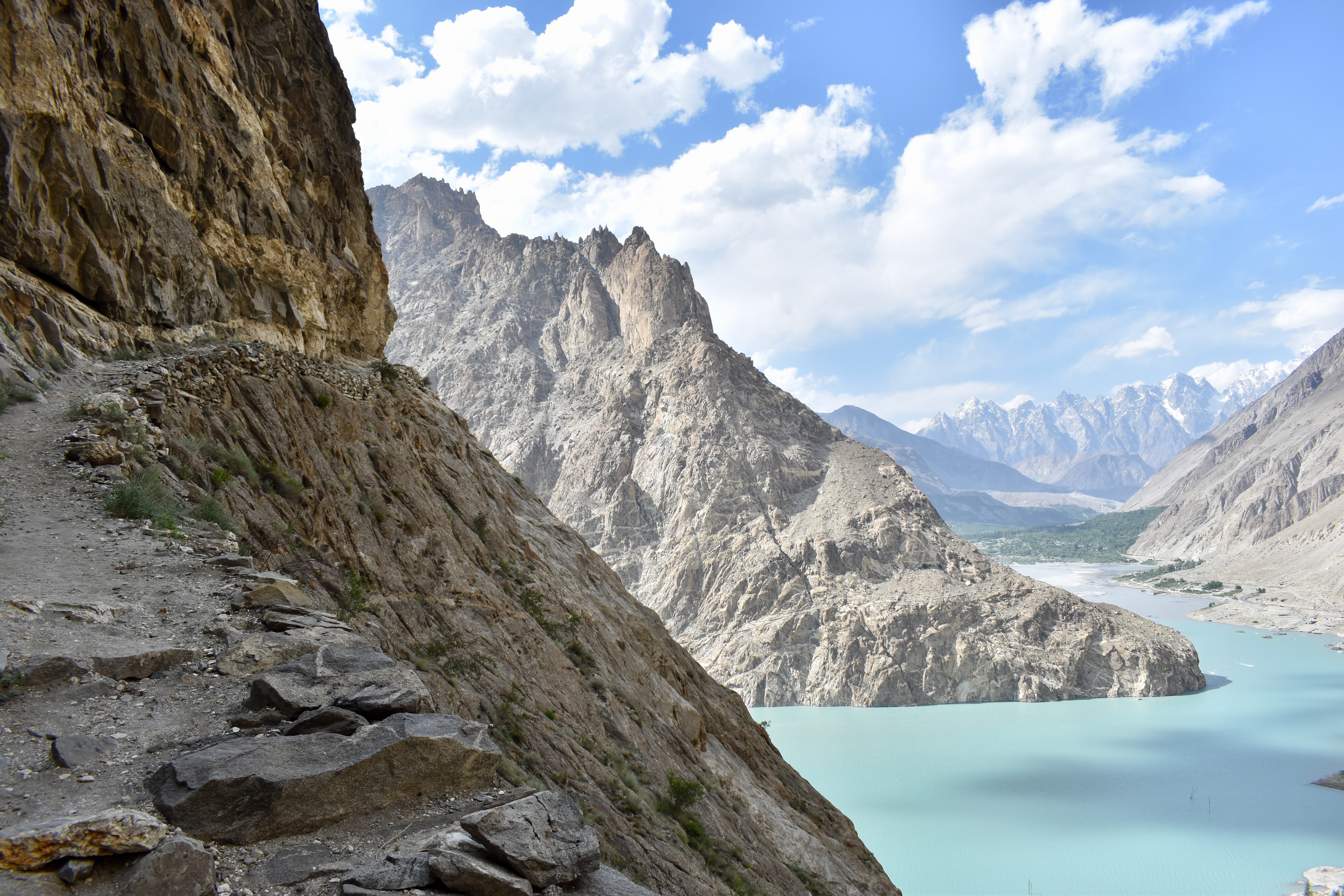
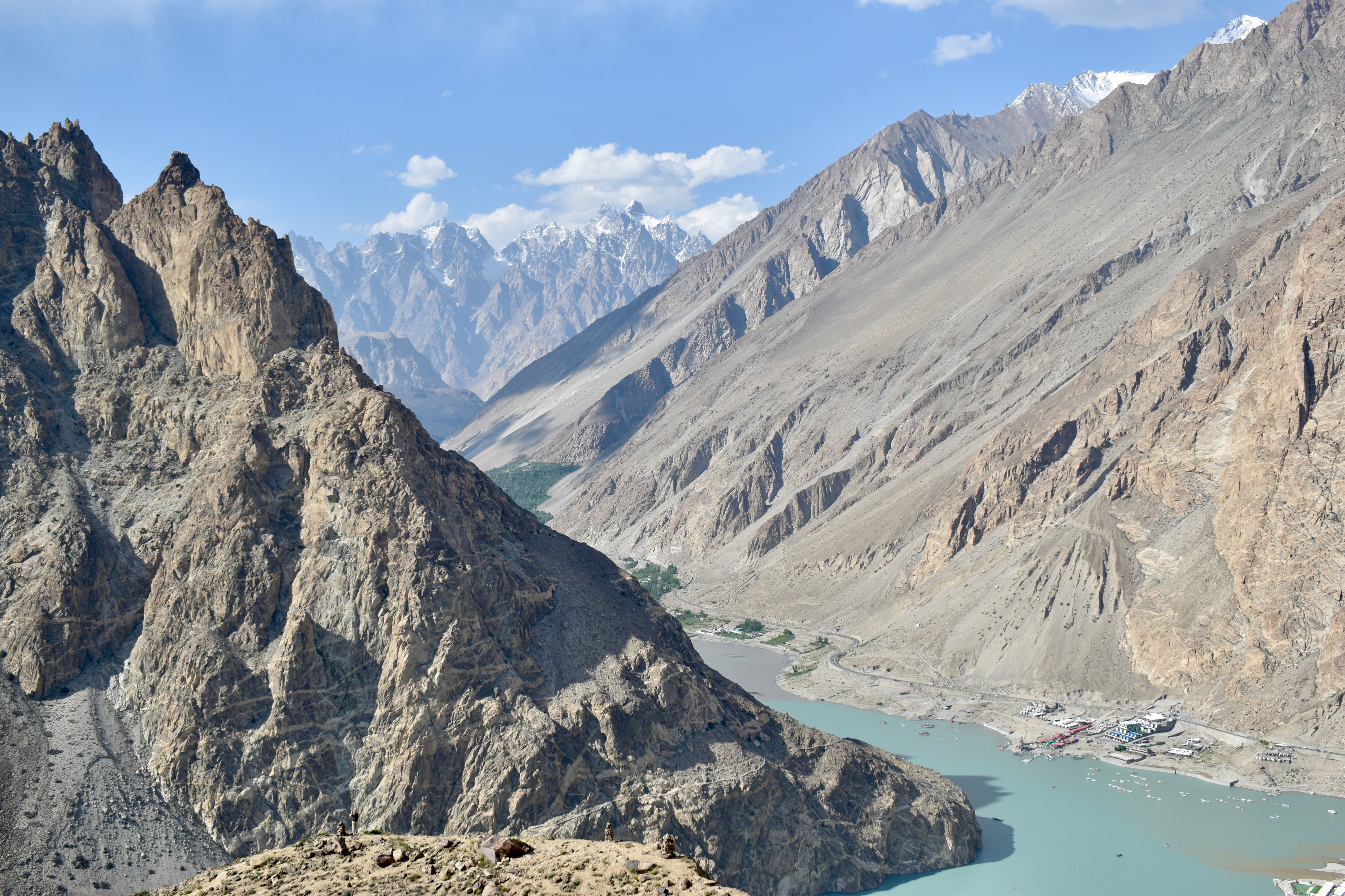
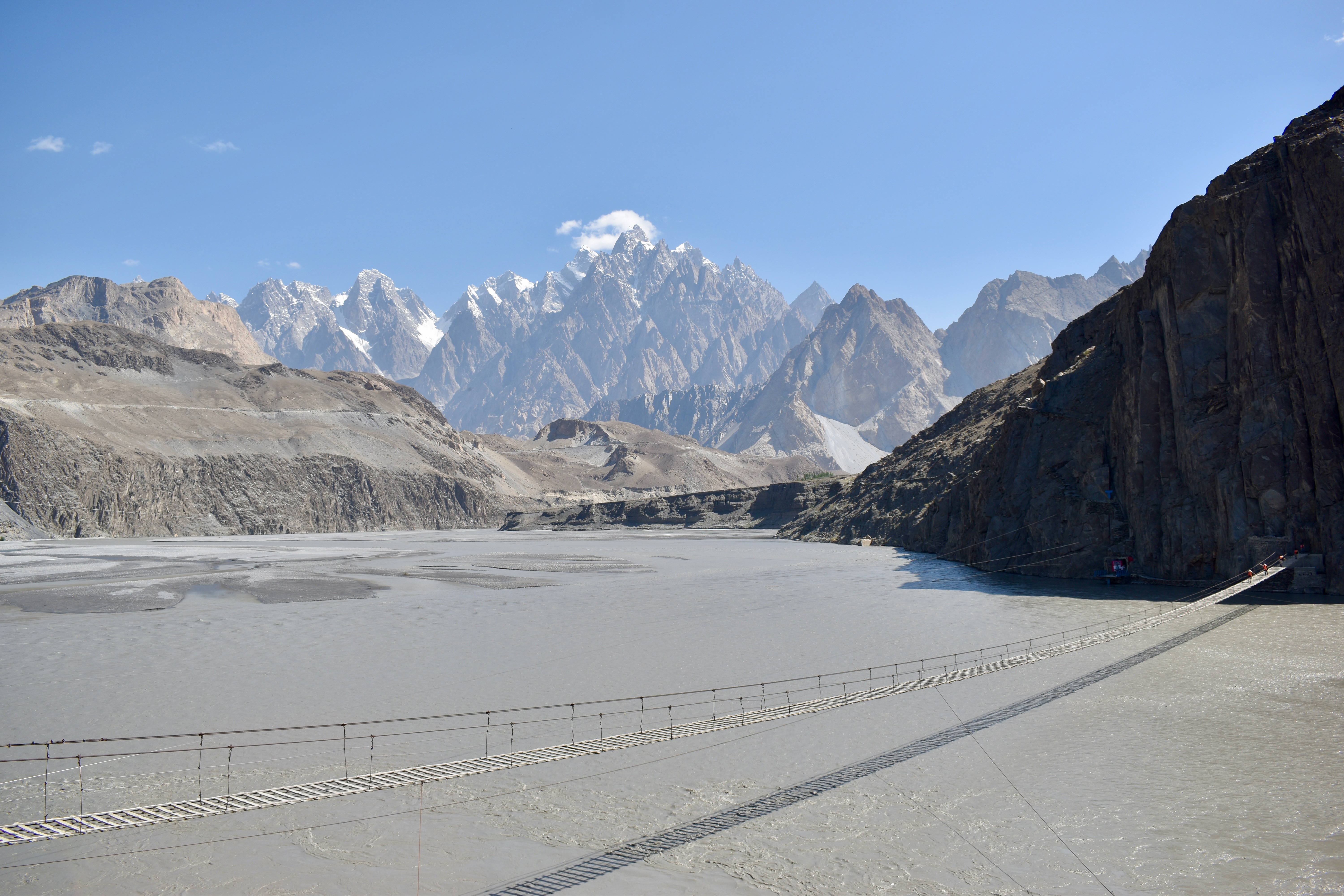
Our next stop was Attabad Lake. We hadn’t planned on hiking there, but since we had time, we thought — why not? We didn’t read much beforehand and expected a short walk to a viewpoint. It turned out to be a 2 km climb up stairs built into the mountainside. The trail is called the Baskochi Trek (viewpoint) and it starts from the Leopard Cave Restaurant after the second long tunnel from Karimabad. The hike is just 2 km one way but with 400 meters of elevation gain. With a short break at the top, the round trip took us 2 hours. It was tough but absolutely worth it — amazing views, a big waterfall along the way, and a little oasis at the top.

Interesting Fact
On January 4th, 2010, a massive landslide blocked 19 kilometers of the KKH and killed 20 people. This blocked the flow of the Hunza River for several months, causing a lake to grow behind the landslide, and creating the Attabad Lake. The Upper-Hunza villages were only accessible by boat until the KKH was restored in September 2015.
We didn’t do any water activities at the lake and instead drove straight to our accommodation in Gulmit — Karakorum Family Guest House Hunza. The place was nothing special but it was clean, had WiFi, included breakfast, and cost just $10 per night. We had a booking for two nights.
After a quick shower, we set out to find food (we hadn’t eaten since breakfast). Just above our guesthouse was a place called Gulmit Food Hut, where we got Dondon soup (noodle soup) and Ghilmindi (bread with cheese). We kept looking for more food and tried Biryani House, but they had already run out. We passed the Gilmit Old House (a museum of local life and culture) with a café but didn’t stop, expecting it to be pricey. Eventually, with everything else closed and darkness setting in, we went back and gave it a shot. The lady there offered us fries and 12 Momo dumplings for 800 rupees — a great deal. She even made everything from scratch. We had to leave her a tip.
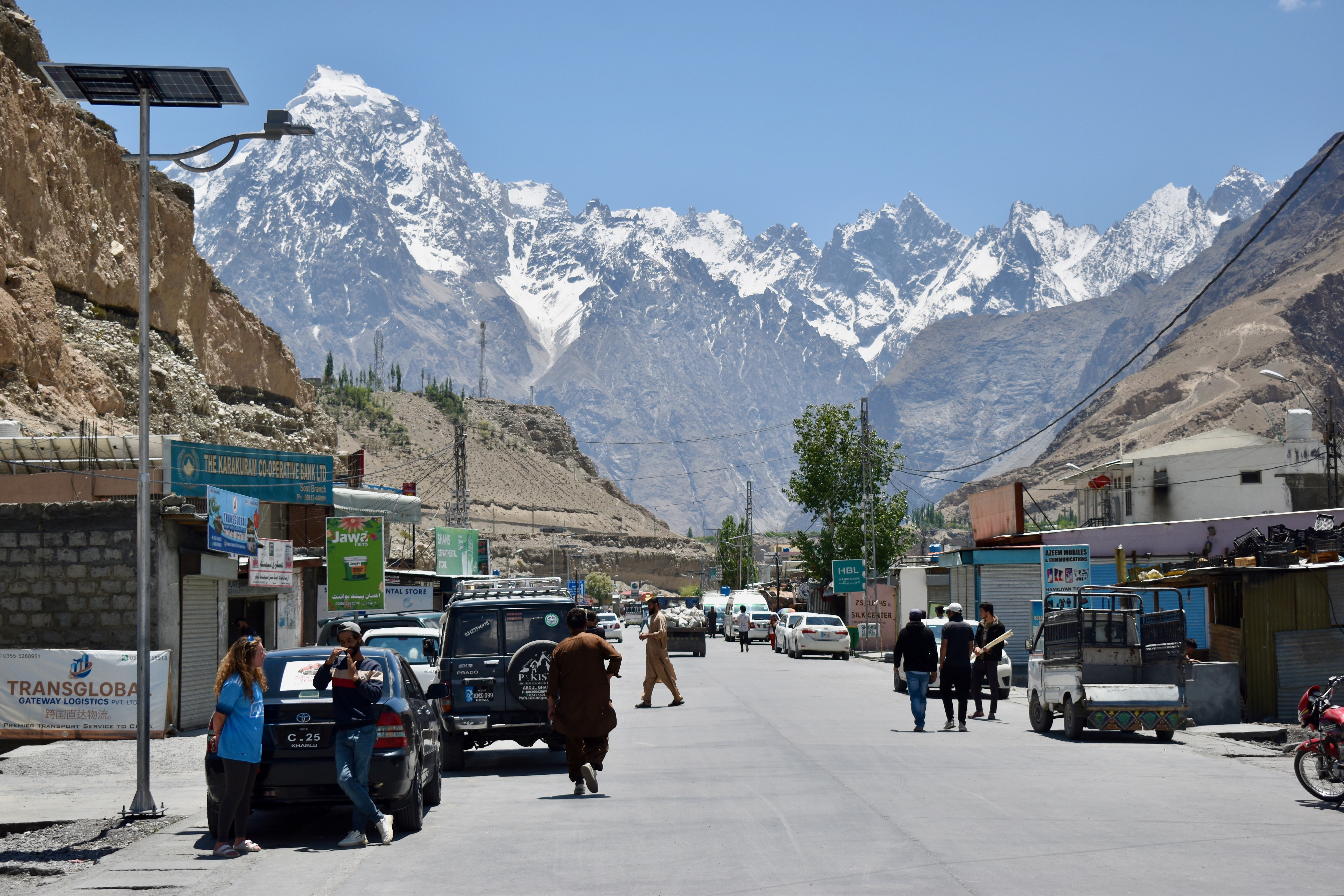
Day 5: Almost the China Border and the Passu Glacier
We started our morning with a change of plans. Instead of hiking, we decided to drive the stretch of the Karakoram Highway all the way to the Chinese border.
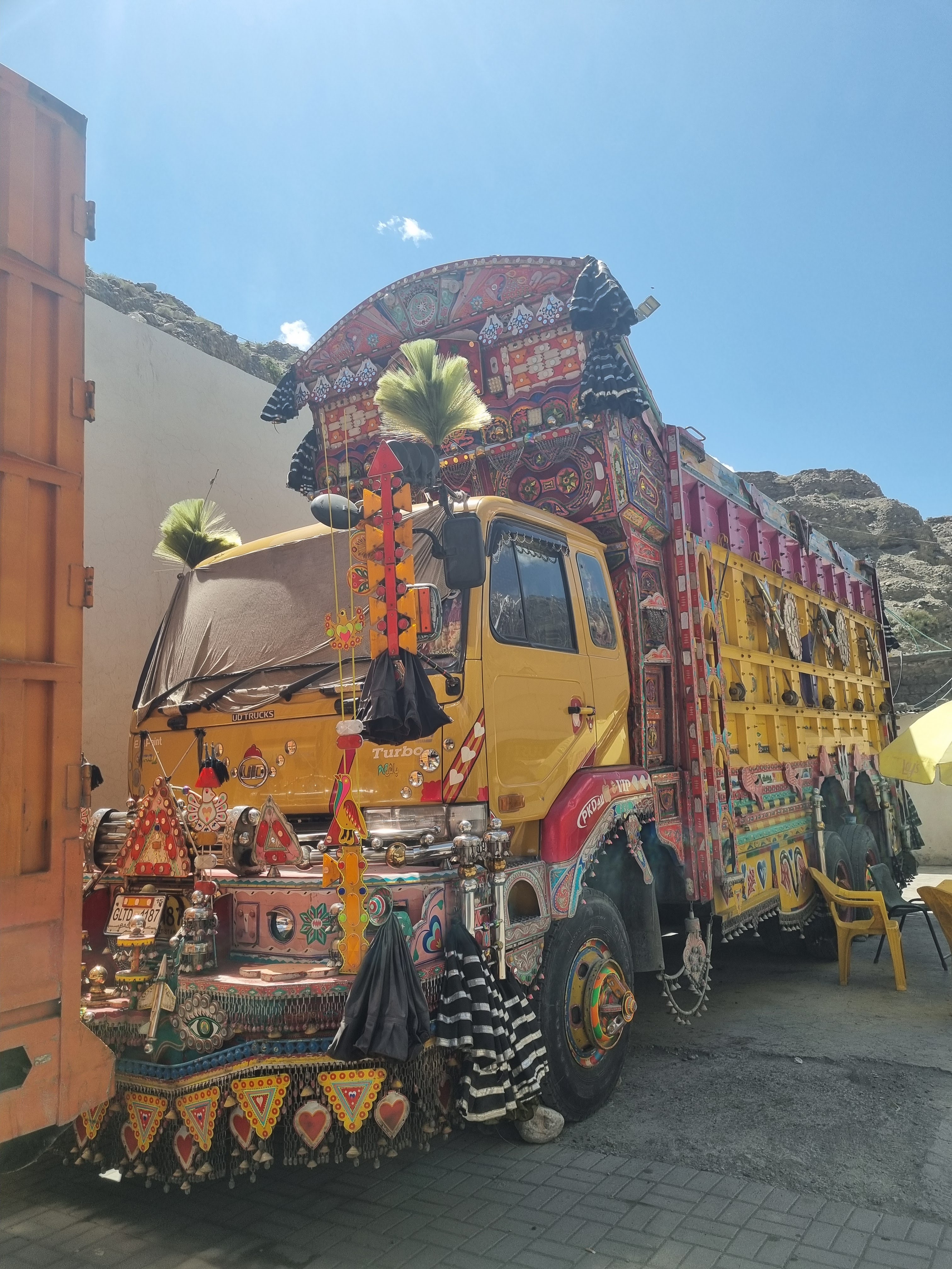
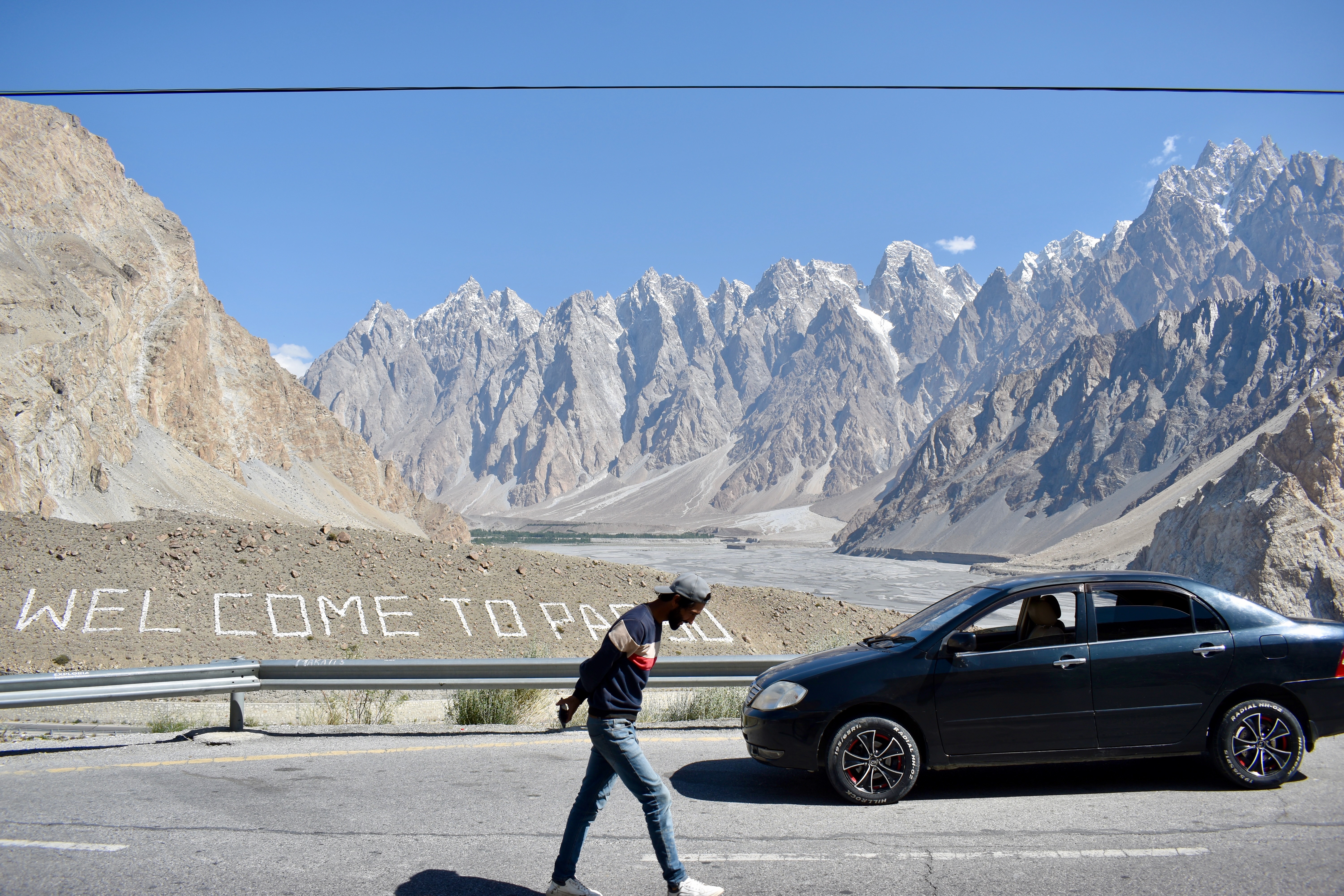
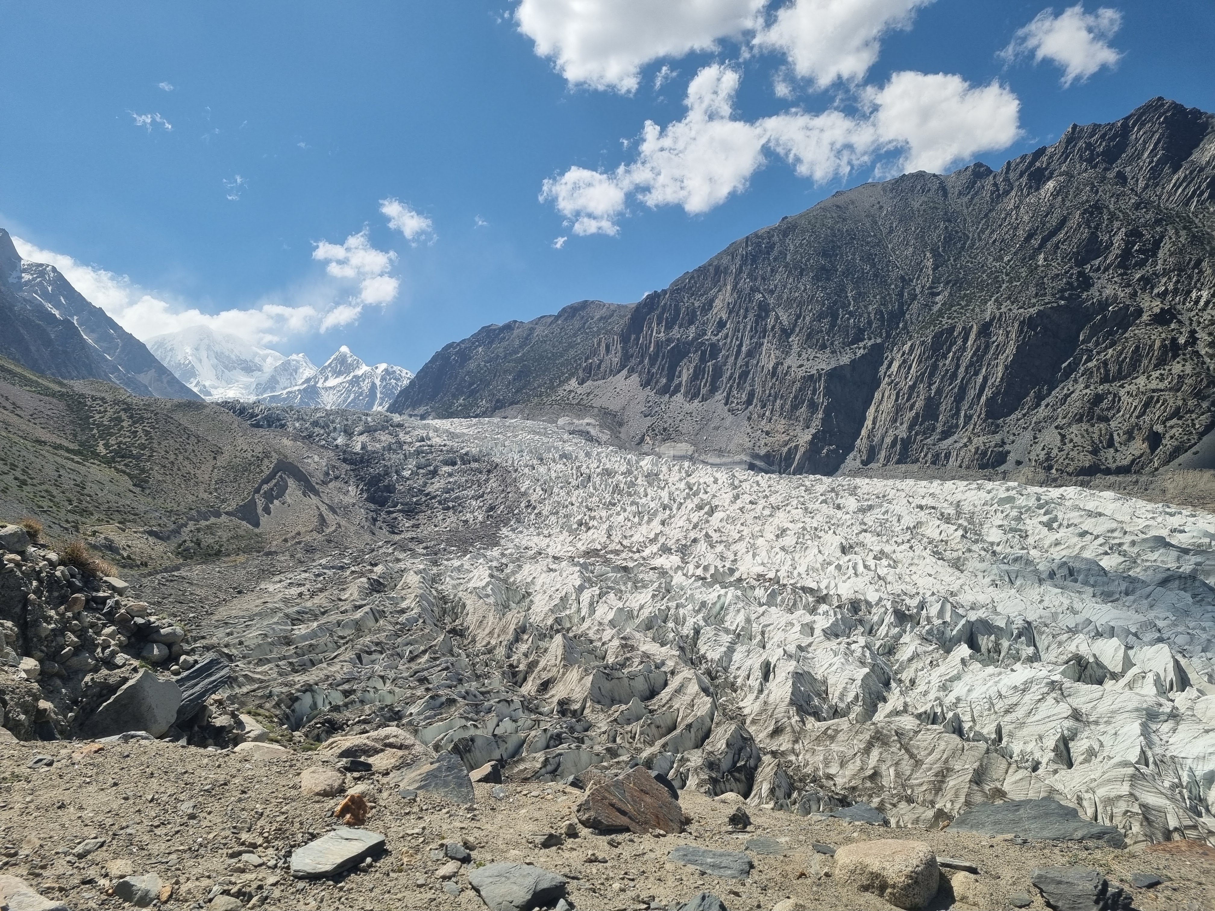
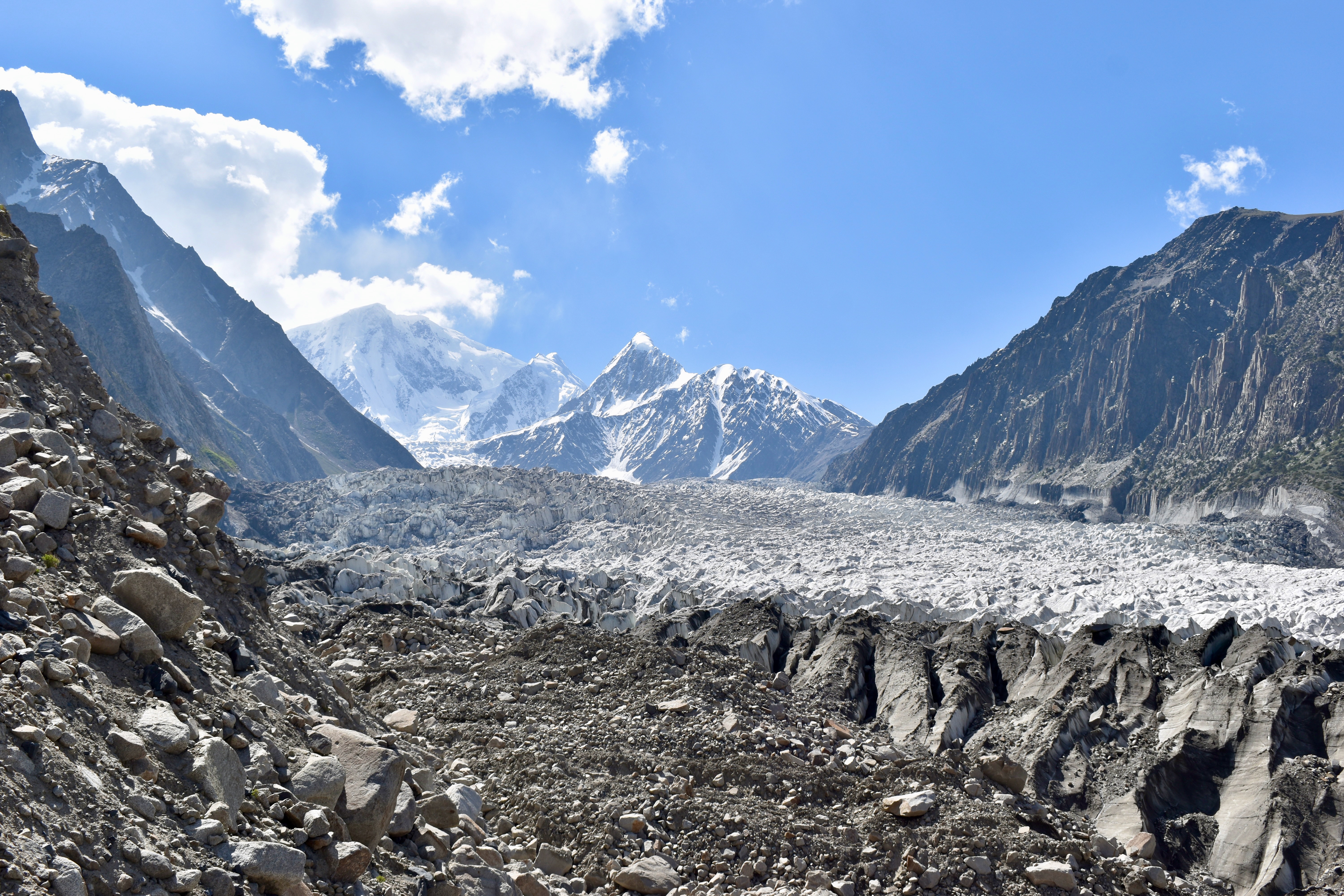
We set off around 9 am after breakfast and stopped at a few viewpoints along the way, including the Passu Glacier and Passu Cones. We also saw some waterfalls and stopped for petrol, where we had a chance to check out some of the famous Pakistani painted trucks.


The last 50 km of the drive runs through Khunjerab National Park, which leads right up to the Chinese border. We hadn’t researched this part because we weren’t planning to hike — just snap a photo at the border. When we reached the park entrance, we thought we just needed to register, like we had at other checkpoints. But this time, they asked for 8,000 rupees (around $30) per person for entry. That completely caught us off guard. It felt like way too much money for a border photo, so we didn’t have any other option than to turn around and head back.
On the way back, we stopped in Sost, the last town before the border, for lunch. We got Palau rice, bean curry, and channa for 1,100 rupees. Afterward, we continued back down to Borit Lake, just above Passu.
On our Rakaposhi hike, we met a Pakistani guy who told us Borit Lake was “boring.” We’re not sure if he meant the lake itself or the hike to Passu Glacier from there, because the hike was anything but boring. It may not have been the best, but it started with stairs built into a cliffside overlooking the glacier, followed by two steep inclines, and in between them a narrow scree traverse that had our hearts racing — it genuinely felt like one wrong step could send us 20+ meters down to the glacier’s edge. The views at the end were stunning, and we could even see where the Patundas Trek continued from there. From the hut the hike was 4.6 km long with some 650 meters of elevation gained. It took us an hour and 50 minutes there and about an hour and a half back.
Note
We were told by several people to do the Patundas Trek. When we looked it up, it seemed expensive and required a guide for the glacier crossing. Later in Pakistan, we found out it actually wasn’t that expensive, but by then it was too late — we didn’t have enough time to complete the entire trek without pushing it too much.
At the start of the hike, we noticed two other Westerners (we didn’t speak to them, but they spoke German). They showed up, talked briefly with the guy at the hut, and then turned around. We thought: “Oh no, maybe it’s a pricey entry fee or permit-only hike because this is the start of the Patundas Trek.” But it turned out to be just 500 rupees (less than $2) per person. We figured they might’ve forgotten cash or were on a tight backpacker budget. But later, when we were heading back, we ran into them again. After we finished and stopped at the hut for a Coke, the guy and our driver told us they had come back, refused to pay, and just walked on.
We get that paying to walk can feel weird and yes, sometimes it’s a scam — but in this case, the guy literally ran inside his hut to write us an official receipt. He let them go, but you could tell he was frustrated. It was understandable — we foreigners show up and decide we don’t want to pay even a symbolic fee. Sure, in Germany, Switzerland, or Austria (wherever they were from) hiking might be free, but you can bet there’s at least a €20 parking fee at the trailhead…
After getting back to our accommodation, we decided to explore Gulmit a bit more. We visited the Old House and stumbled upon something unexpected — the Ondra Poygah, the longest and highest staircase in Pakistan. We hadn’t heard of it before, so we hadn’t set aside any time. It’s a site built and preserved by the local community, with an entrance fee of 500 rupees. There are about 1,700 steps leading to the remains of an old fort at the top.
We arrived too late to actually climb it but stayed to chat with the man running a small restaurant there. He made us tea and we waited for a local-style pancake called Gral. While we waited, he told us about the local people. They speak a language called Wakhi, which he said is similar to Russian. I noticed some Wakhi words on the Ondra Poygah sign used the letter “ž”, which we use in Czech. He also told us that the local community is Ismaili Muslim, a branch of Shia Islam. Interestingly, in their community, there’s a cultural preference for girls to attend school before boys. He shared stories about his family, his farm, and what daily life is like in Hunza.
We ended up chatting for almost an hour. We had long finished our tea, so Clare finally asked, if the pancake was coming. That’s when we found out there had been a misunderstanding — he thought we only wanted tea and had canceled the food. It was nearly 9 pm by then, and we hadn’t eaten anything since lunch in Sost.
We left and found the first place with lights still on. They only had fries left, so we got a big plate. With no other options, we returned to the Old House Café, and the kind lady made us more Momo dumplings. This time she already had some ready, so we didn’t feel as bad for keeping her late like the night before.
Note
Fries are everywhere in Hunza — potatoes are their main crop.
Day 6: Yunz Pass, Batura Glacier, and a Night in “Prison”
We packed up and left our accommodation after breakfast, heading straight for one of the region’s most famous attractions—the Husseini Suspension Bridge. You can spot it from the road, and reaching it is just a short walk down a small hill, with a modest 200-rupee entry fee. At the river, a few people were already crossing. The guy managing the bridge collected our tickets, and off we went—life jackets are available free of charge if you’re feeling unsure.
The bridge didn’t sway too much, and there were ropes to hold onto (though be warned—Clare got a small cut from one of them). That said, the bridge was slightly tilted to the right due to too many people using only one side. The wooden planks were small and spaced out in places, giving me a slight vertigo. On the other side, a short but steep stone staircase leads up the cliff for better views.
Note
The fella managing the bridge asked if we were doing the full hike. You can cross the Husseini Bridge, walk about 5 km on the other side of the river, and cross again via the Passu Bridge—which is reportedly a much bigger challenge, with no safety ropes or supervision.
We saw a few people opting for the zipline across the river instead before heading back up the hill. Mehdi was waiting, and after grabbing some overpriced water (150 rupees a bottle – seriously?), we drove just 10 minutes to the trailhead for our hike.
The night before, we debated whether to stay in Passu or head elsewhere (possibly to the Hopper Glacier). In the end, the decision to hike here won. I had found a trail on Mapy.cz and was worried it might be just a waste of time, but our research later confirmed that this route—Yunz Pass (also known as part of the Batura Trek) – was actually a must-do. So we stuck with it.
Note
Online, you might find this route labeled either Yunz Pass or Batura Trek. Some variations of the Batura Trek avoid the pass by starting from a different point, saving some effort and exposure.
We didn’t start perfectly – we ended up following the first path we saw from the road instead of the actual trailhead. That mistake cost us two stream crossings, scratched legs from trees, and some frustration. Luckily, stone cairns eventually pointed us in the right direction. There was an early fork in the trail—one way headed to Passu Lake, the other up the hillside and along the mountain – we took this one.
After the initial incline, the trail flattened—but also became more exposed. It narrowed drastically in places, with just enough room for one foot at a time and a 50-meter drop off the edge. Not a scree slope—this was a straight drop. It was slow going, but the section finally ended, and we emerged onto a plateau.
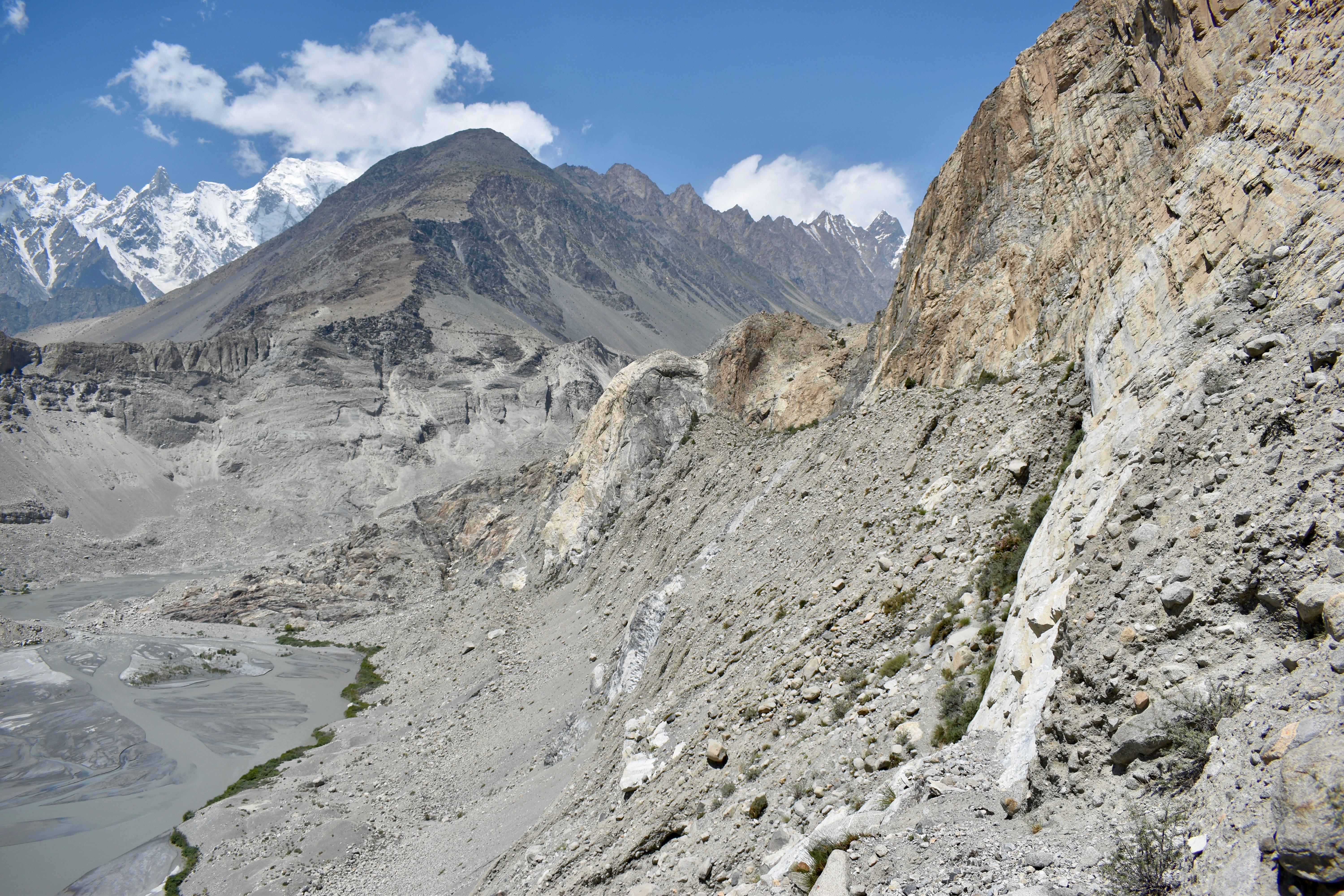
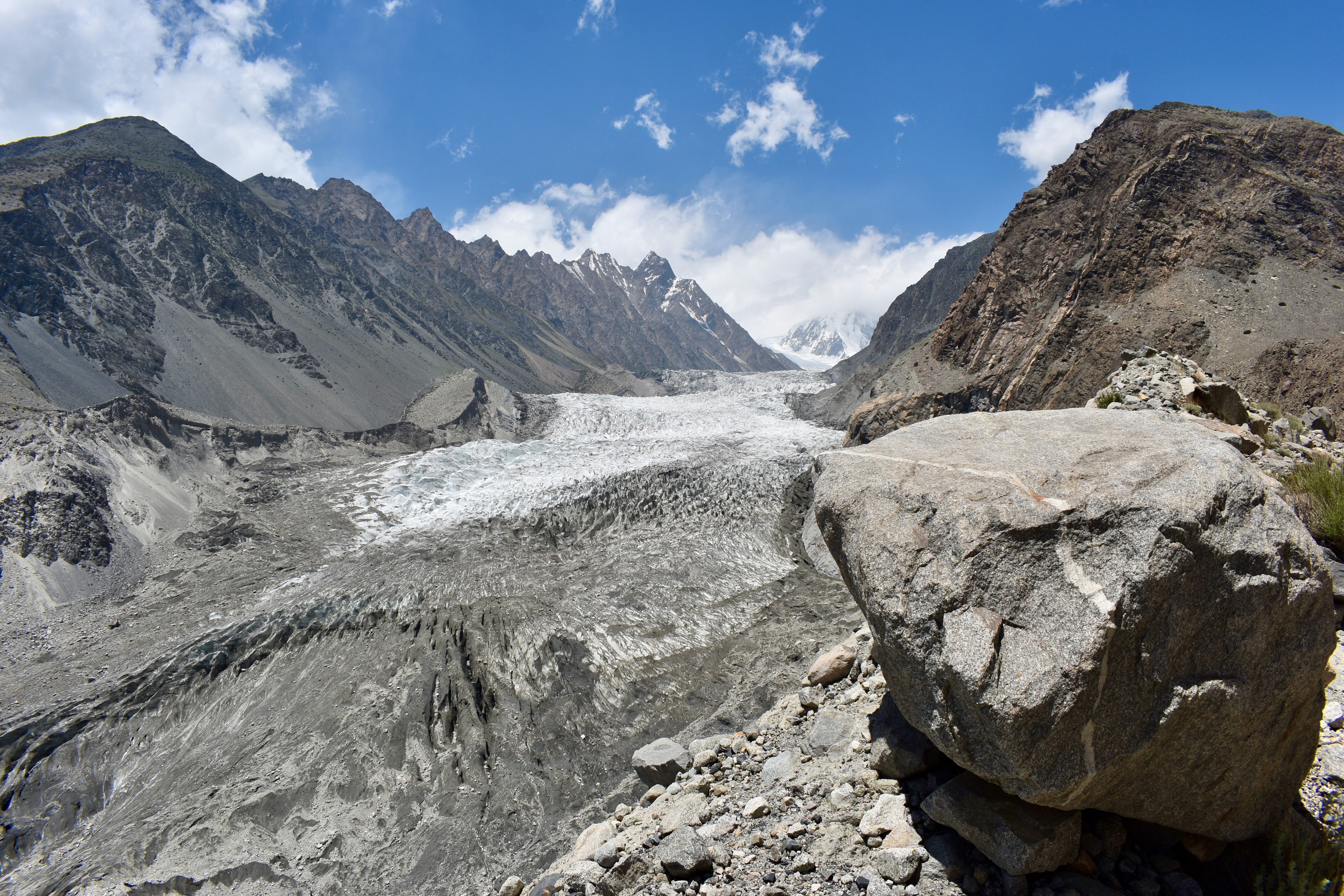
From there, it was an easy walk up to a curved ridge path with the mountain on one side and a sweeping glacier view on the other. We had the Passu Glacier in full view—just from the opposite side than the day before.
Note
At the plateau, we noticed another set of stone cairns heading down to Passu Lake, suggesting there is an alternate route up that avoids the scary ledge walk.
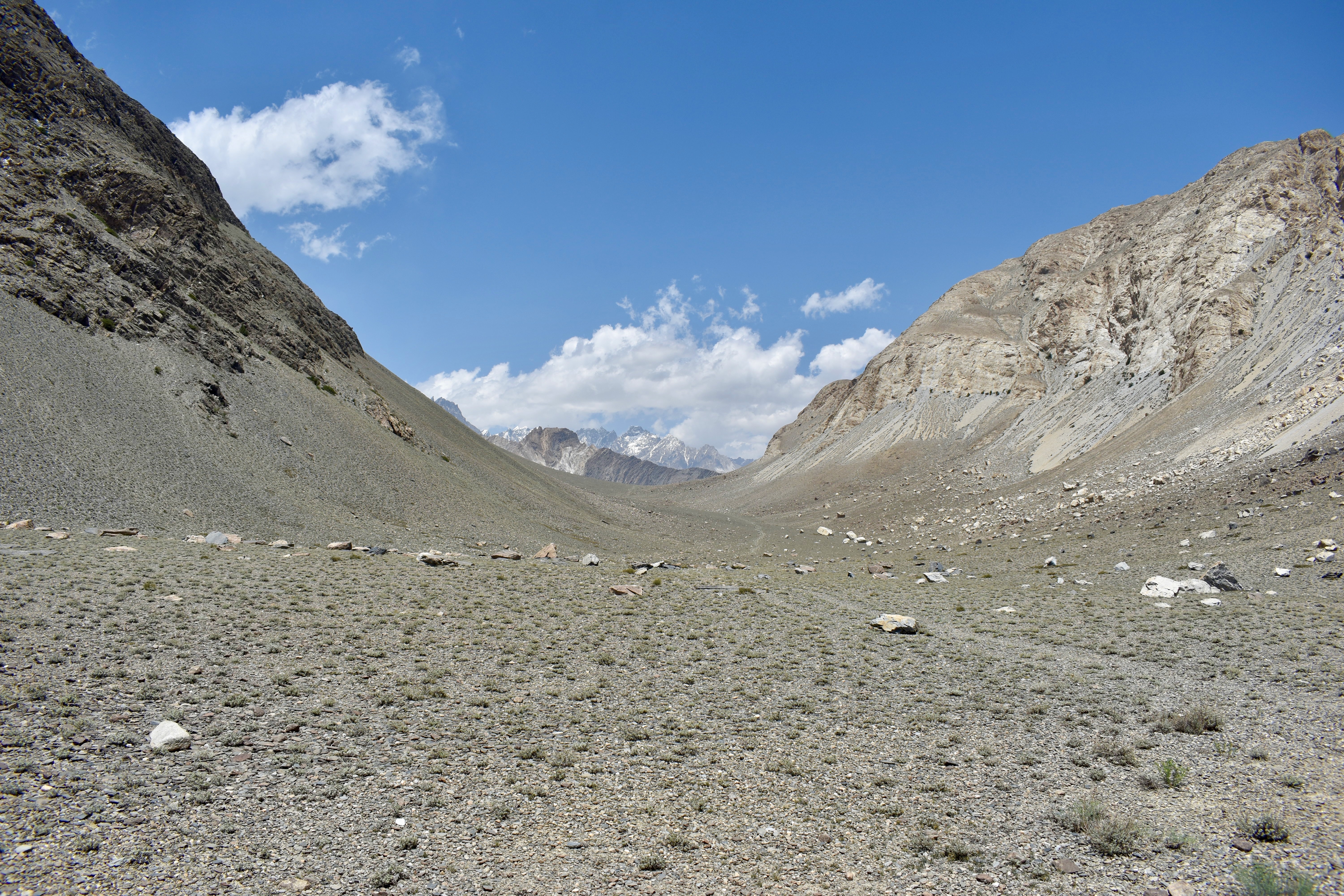
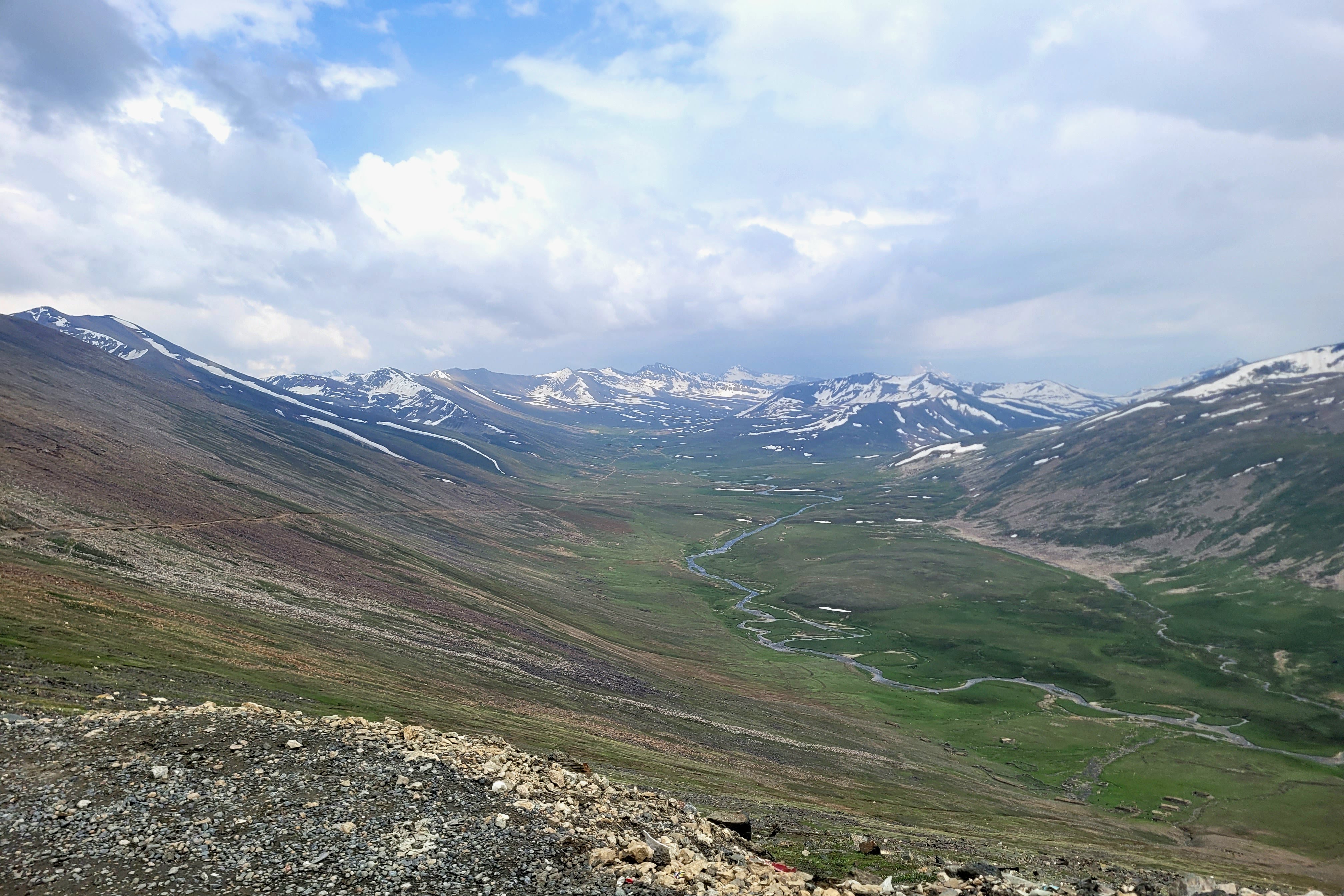
We pressed on toward Yunz Pass, climbing through a steep wadi filled with loose rocks. When we reached the top, the view opened into a wide alpine saddle. This was one of those places that might not look like much in photos but feel epic in person—vast, remote, and quiet.
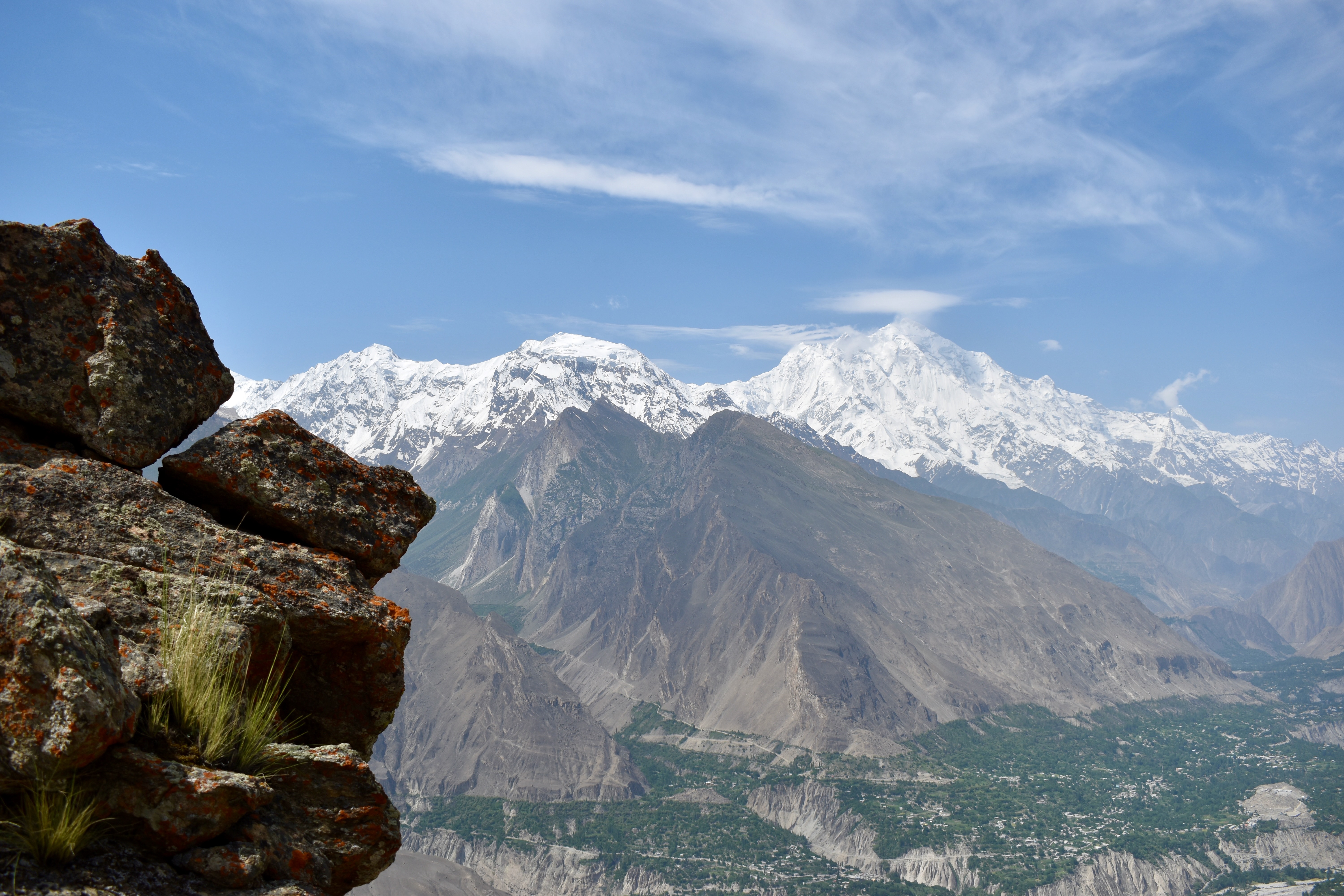
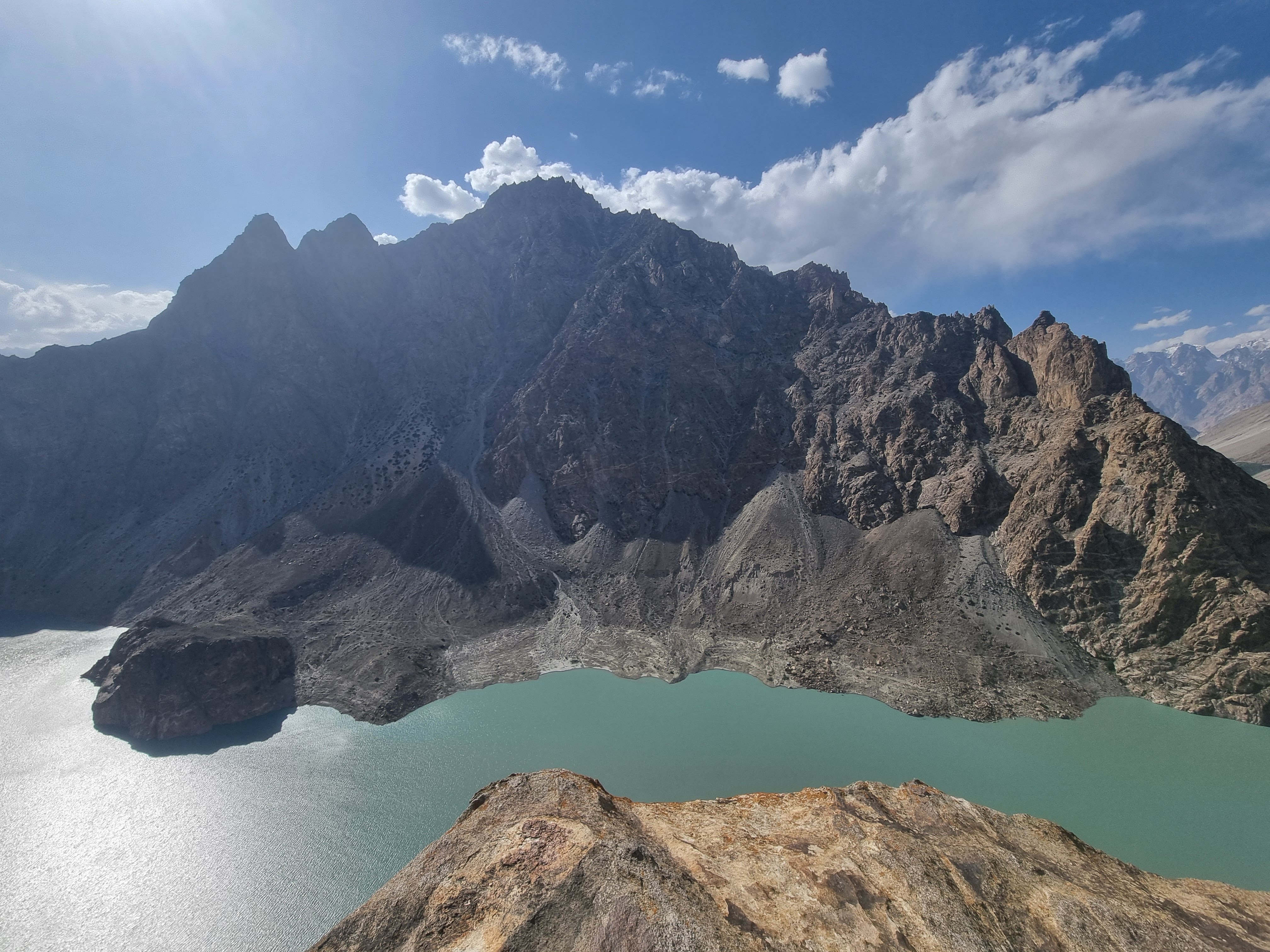
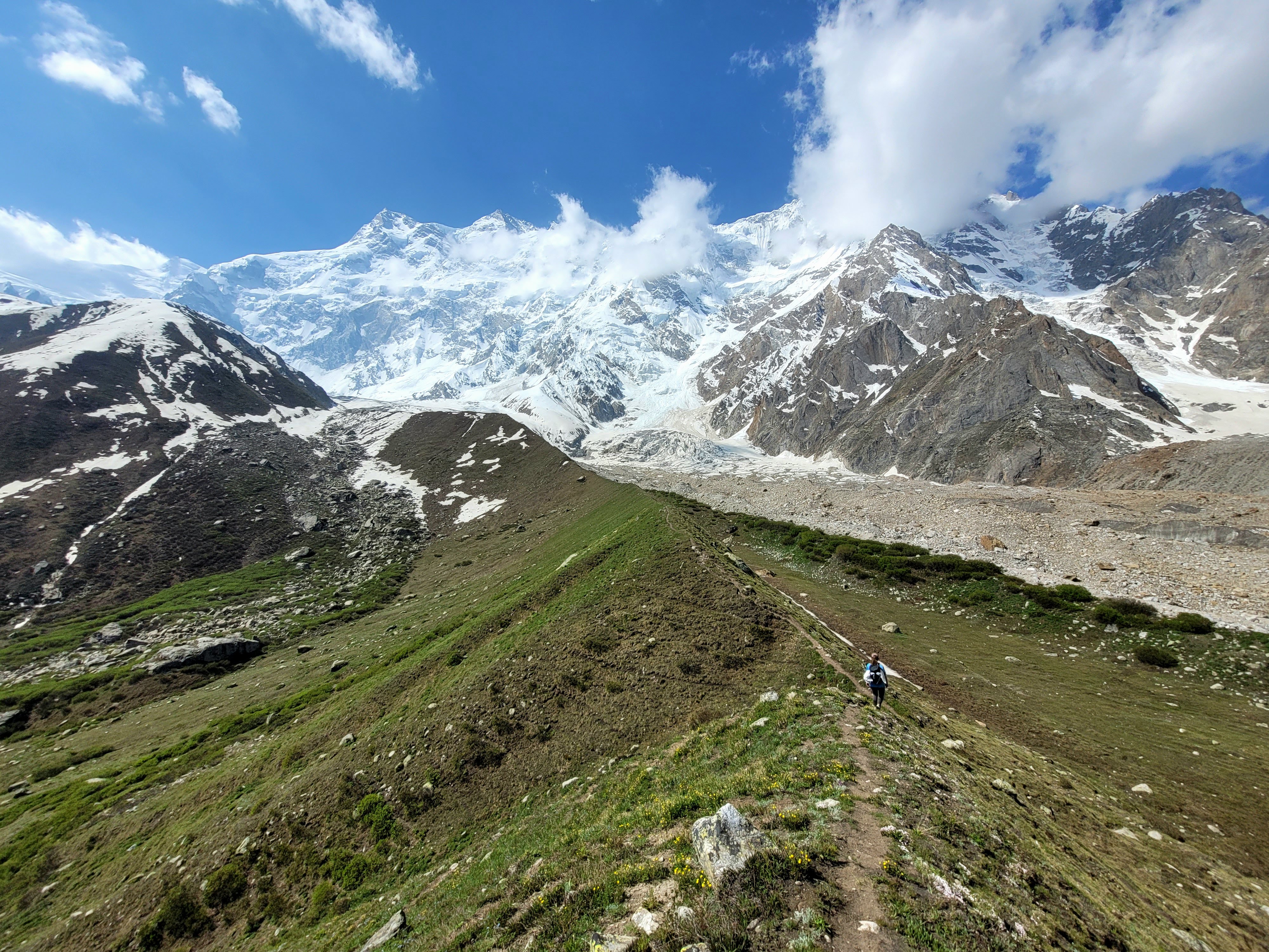
The path looked flat but was deceptively uphill—we later saw we’d gained another 150 meters in elevation. Finally, we reached the far end of the pass and got our first glimpse of the mighty Batura Glacier, the fifth-longest glacier outside the polar regions at 57 kilometers long.
From here, the descent began. The first section was steep and tricky—sometimes the trail just disappeared. Eventually, we reached a hut. One trail continued deeper into the valley, requiring a glacier crossing and a multi-day trek. Instead, we turned right to loop back toward the KKH (Karakoram Highway).

We descended a rough 2 km before reaching a dirt track, but it wouldn’t lead us to where Mehdi was waiting. So we followed a smaller rocky path along the mountainside, which eventually turned into a pleasant trail, and then a gradual walk down leading to the KKH near the Passu Cones viewpoint and Ambassador Hotel.
Exactly five hours and 13.5 km after we started, we hit the pavement—but no sign of Mehdi. The hotel owner tried calling him with no success but remembered spotting a black Skardu car parked up the road. We walked to check, and yes—it was him. Crisis averted.
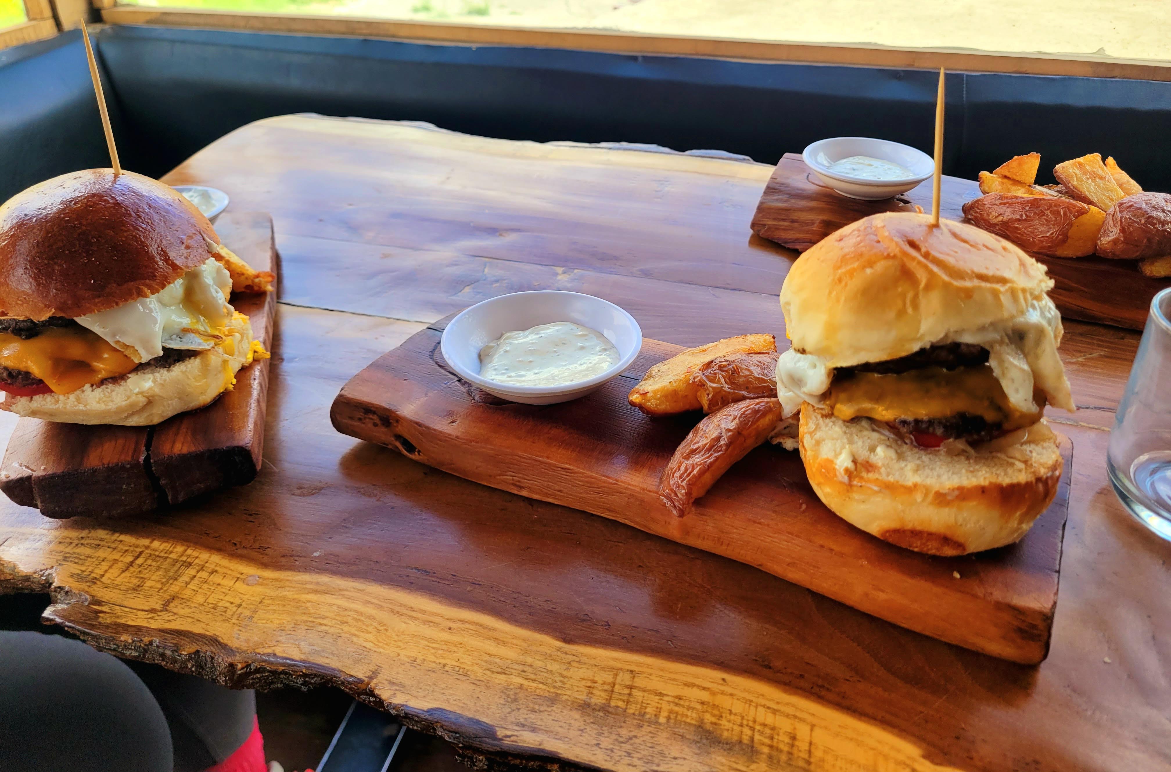
We jumped in and drove only about 2 minutes back to where we started and to the Yak Grill on the other side of the road. We read about this restaurant beforehand and Mehdi also mentioned it when we passed it the other day. We got a Yak Burger each and potato wedges for Mehdi (we asked but he didn’t want a burger). It was a bit pricier but a good bit of meat.
From there, we had a long drive—nearly three hours back to Gilgit. Our stop for the night was Zia Guest House in the small village of Minawar. We knew it wasn’t going to be glamorous—at $5 a night, we couldn’t expect much—but the place had 9.5/10 on Booking.com and 4.8/5 on Google, so we gave it a shot.
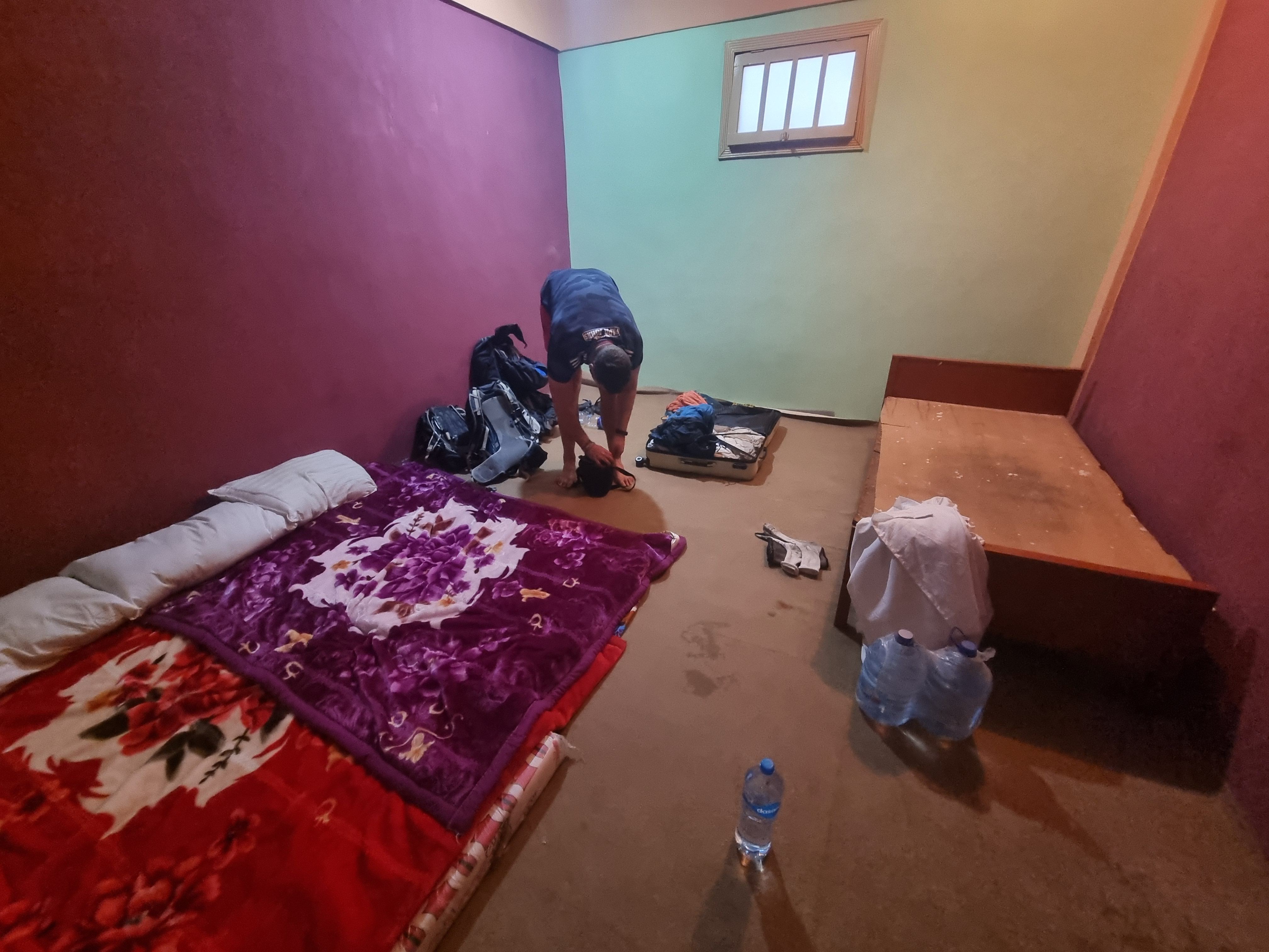
Well… we got what we paid for. The room had two mattresses and only one sheet—which unfortunately featured a massive urine stain. Two of the pillows had red stains that looked suspiciously like blood. The guy running the place gave us new pillows, but no covers, so we used our camping ones instead. We laid the mattresses side-by-side and used the blankets (which were surprisingly clean) as sheets. It was so hot we didn’t need to cover up anyway.
Dinner became a bit of a struggle. I had told the guy we would go out to eat, so he didn’t prepare anything. We walked to the other side of Minawar, only to find that the local hotel didn’t have a restaurant. On top of that, a pushy “tour guide” wouldn’t take the hint, and a coughing kid blew germs straight into Clare’s face. We headed back, hungry and mildly annoyed.
Fortunately, the guesthouse guy agreed to cook for us last minute. We had fried okra with onions, rice, and chapati—a basic but tasty meal. We took a bucket shower, repacked our bags for the Fairy Meadows trek the next day, and went to sleep. There were some noises early on that had us worried about mice, but they must have been outside. We slept okay—but the place definitely had a bit of a “sleeping in a prison” feel.
Day 7: Camping at Fairy Meadows
We got up quite early as we were told by Mehdi to leave around 7 am When I spoke to the guesthouse fella last night, I asked him for breakfast. However, he was nowhere to be found in the morning—and we couldn’t even pay him. We ended up leaving 2,000 rupees on the bed for the night and dinner.
We drove for about 45 minutes before stopping at a town called Jaglot. There, we got breakfast—two fried eggs, paratha with omelet, and paratha with cheese. We only ordered two of those dishes, but we didn’t argue when he brought us more. They were also kind enough to get us hot water since they didn’t sell coffee. My stomach was upset, probably from the heat or something we ate the day before, so I was happy to find a communal toilet nearby.
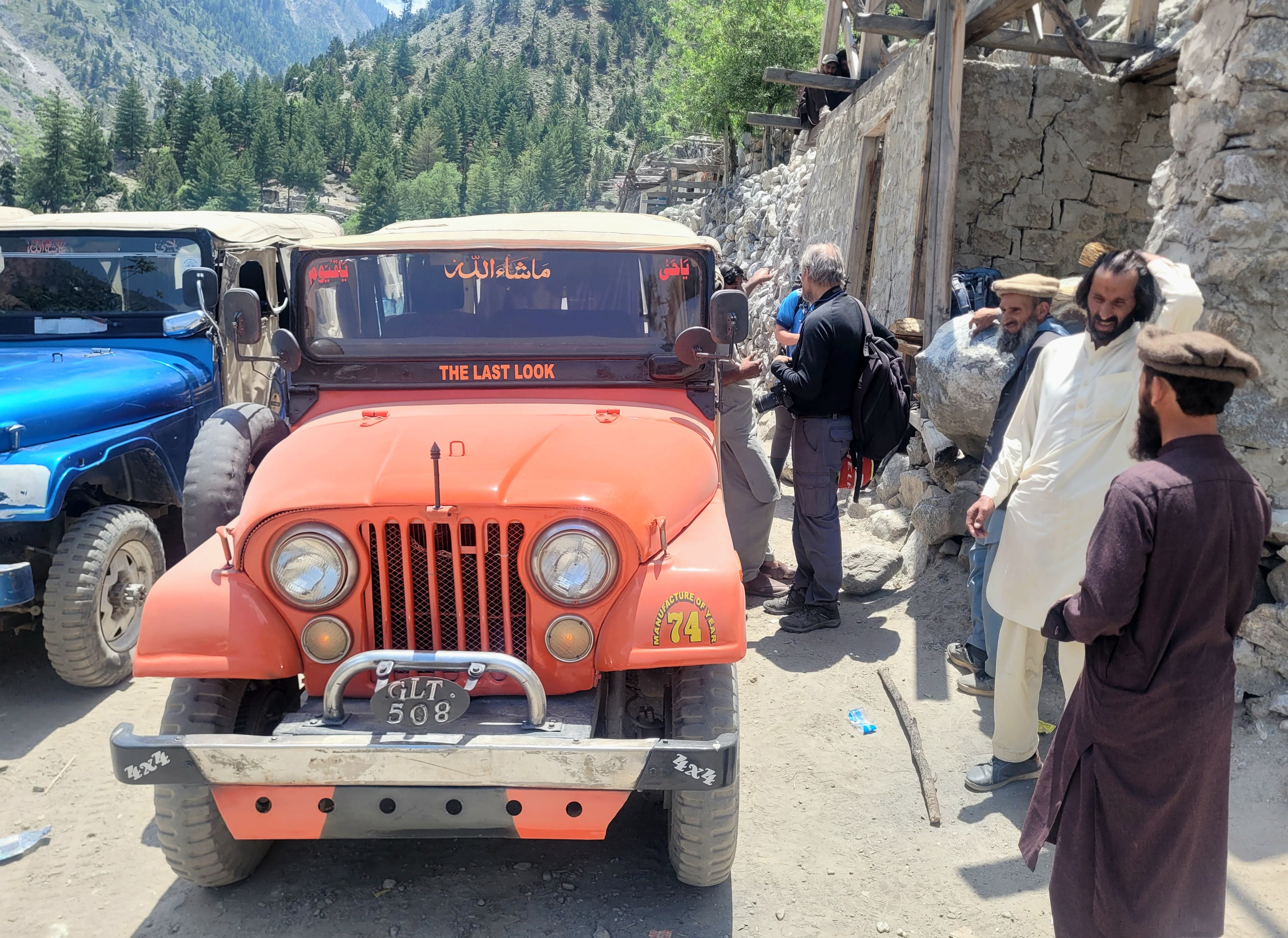
It took another hour or so to arrive at the Raikot Bridge. This was as far as Mehdi could take us toward Fairy Meadows. From here, it’s non-negotiable: you have to get a 4×4 jeep up the mountain. We packed our bags, left some stuff in the car, and went to bargain for the jeep ride. We knew it wouldn’t be cheap, but we didn’t want to cover the whole cost ourselves.
Note
The jeep ride was 8,000 rupees per car (up to 6 passengers) in 2025—one way. It’s not possible to share the ride with Pakistanis, only with other foreigners. You must go up and down with the same driver and arrange the return time on the spot.
Almost immediately, a Pakistani tourist asked if we wanted to share with his group. We confirmed the price with the drivers and agreed to split it: 4,000 up and 4,000 down each. They said they were also coming back at 3 pm the next day. But then we had to register with the local police, and that’s where things got complicated.
The police officer, Abdullah, was very friendly but strict. He told us that foreigners and Pakistanis couldn’t share jeeps and that we’d have to wait for other foreigners. He explained it was for our safety—since some local tourists don’t always stick to the agreed return times.
We waited for about 20 minutes — during which Abdullah showed us some family photos, registered us, and told me about other Czech travelers—until a Spanish guy named Joseph (José) showed up on his motorcycle. Unfortunately, he planned to go up and back down on the same day, so we couldn’t share a return jeep.
Just as we gave up on sharing, another officer appeared and said, “No problem. You can share.” They came up with a plan: all three of us would go up together and pay 10,100 rupees total (the extra 100 was for a guy at the entrance), and then Joseph and we would each pay 6,000 rupees for our separate return journeys. That worked for us!
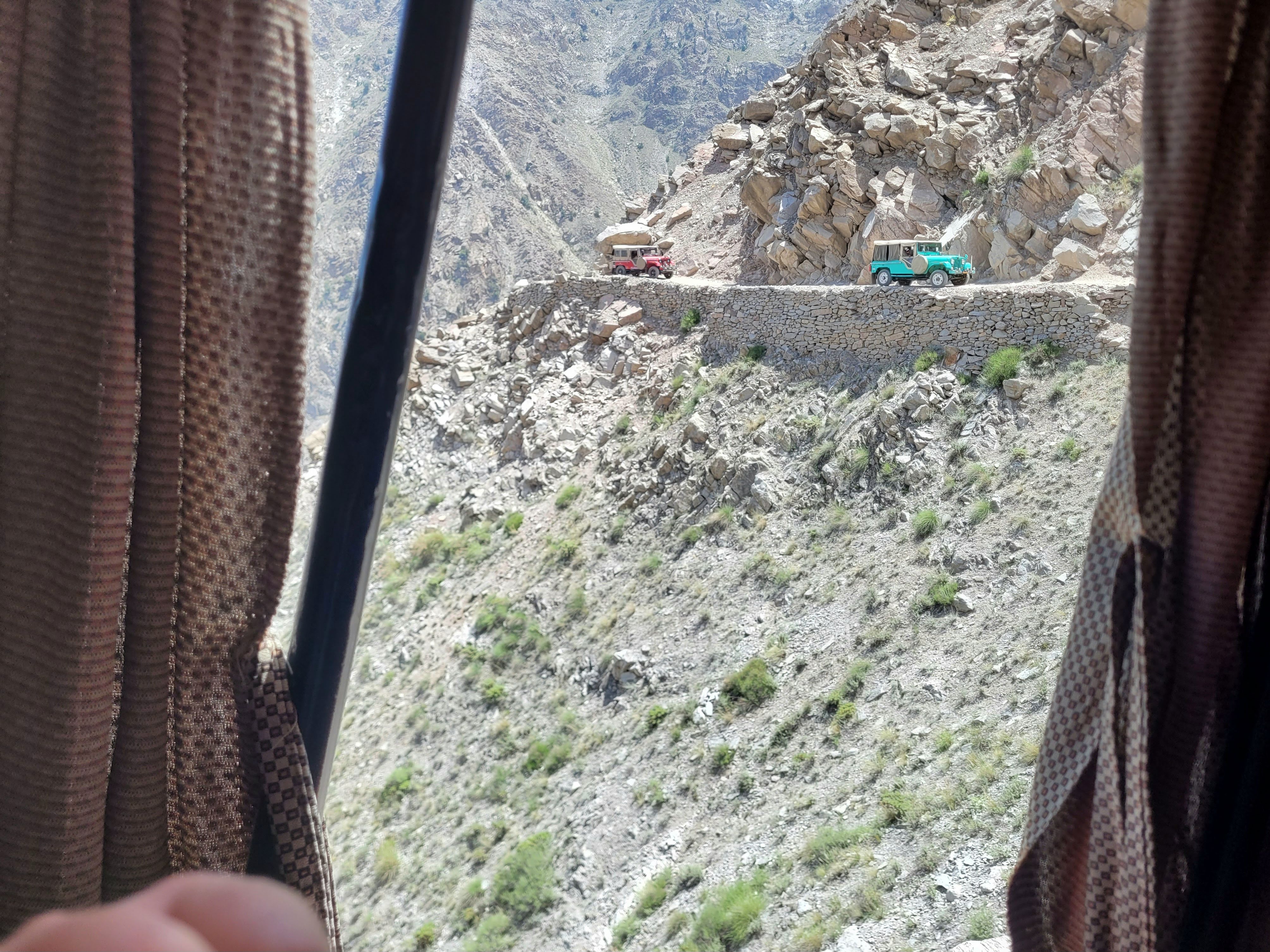
We set off immediately. The first part of the drive was just bumpy but manageable. But about 20 minutes in, we were on the mountainside, and that’s when things got interesting. The road was narrow, carved into a cliff, with only a meter or two between us and a sheer drop. It got especially intense when jeeps came from the opposite direction—our driver casually reversed or squeezed past them just inches from the edge. The whole ride took 1.5 hours, and we can’t imagine what it would have been like with three more people in the jeep. We passed a few packed ones and they looked like clown cars.
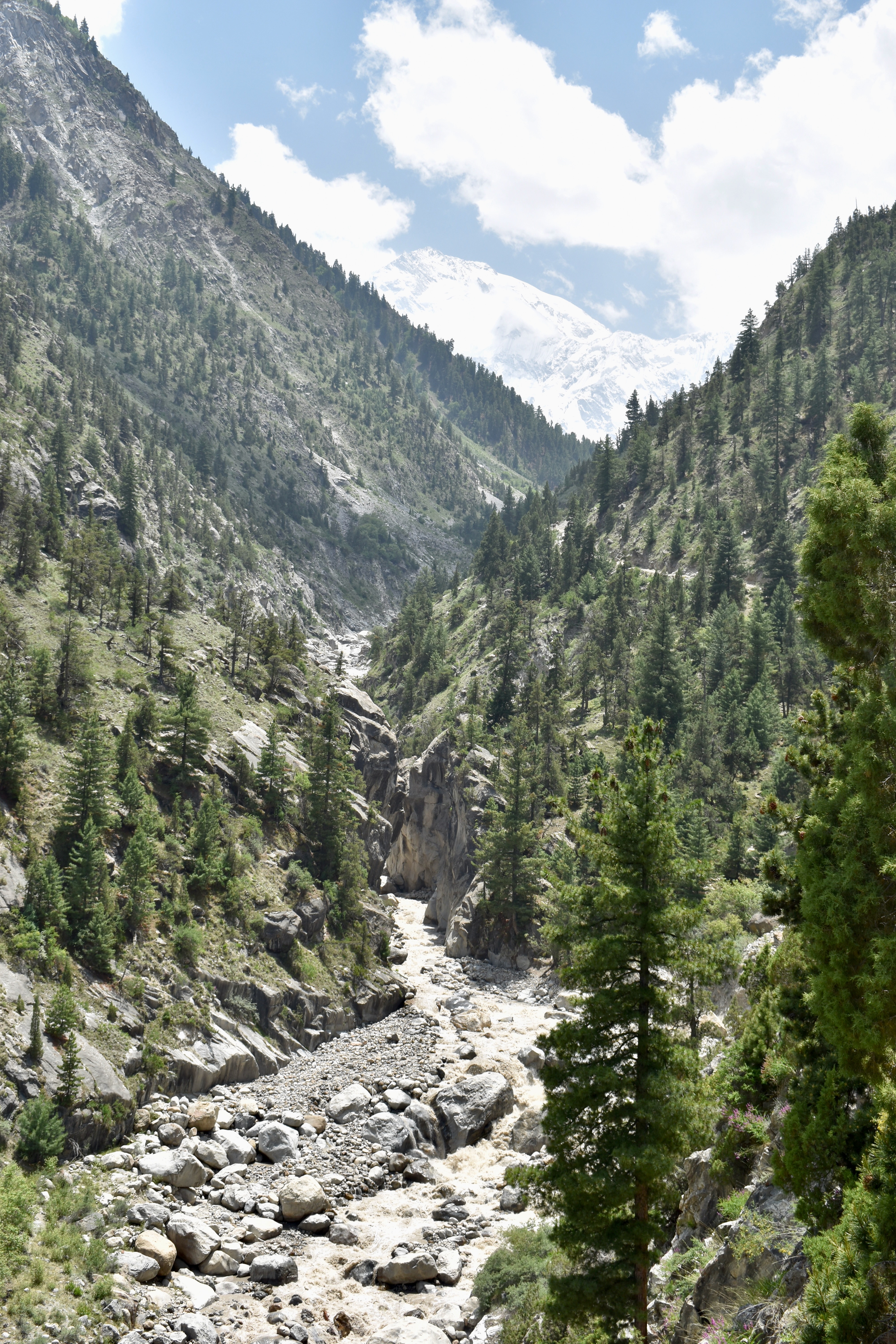
We stopped at Fairy Point, from where it was 5.5 km to Fairy Meadows. The path was easy to follow with many rest stops offering drinks and snacks. There were several streams along the way too (filter recommended). Clare was in the lead, so no stopping allowed—Don’t stop ’til you get all up (a little Michael Jackson remix that plays in my head on hikes – a gift from Clare).
We ran into lots of people asking where we were from—the busiest trail we’d done in Pakistan so far. The hike ended with a steep forested incline, and we reached the edge of the meadows in 1 hour 40 minutes, which amazed us, considering we carried all our camping gear and climbed over 700 meters.

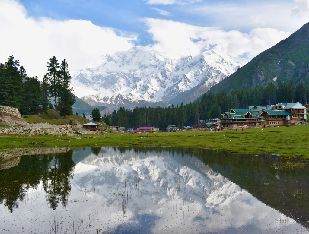
We started looking for a camp spot. The first place we tried, on the southern side of the meadow, was confusing—no one knew who was in charge, and the people I asked just wanted selfies. Meanwhile, Clare was chased down by a guy from Fairy Meadows Greenland Resorts and Camping right next door. He only charged 1,000 rupees to pitch the tent and had food available—perfect. He led us to the tent spot, and it was absolutely stunning, with a view of Nanga Parbat. Before we even set up, he brought us a welcome pot of green tea, which we enjoyed on a bench overlooking the peak.

It was only around 3 pm, so we took our time setting up the tent and organizing bags for tomorrow. We asked for hot water for coffee and bought a Coke (200 rupees with the “mountain surcharge”). We ordered dinner for 7 pm and went to explore.
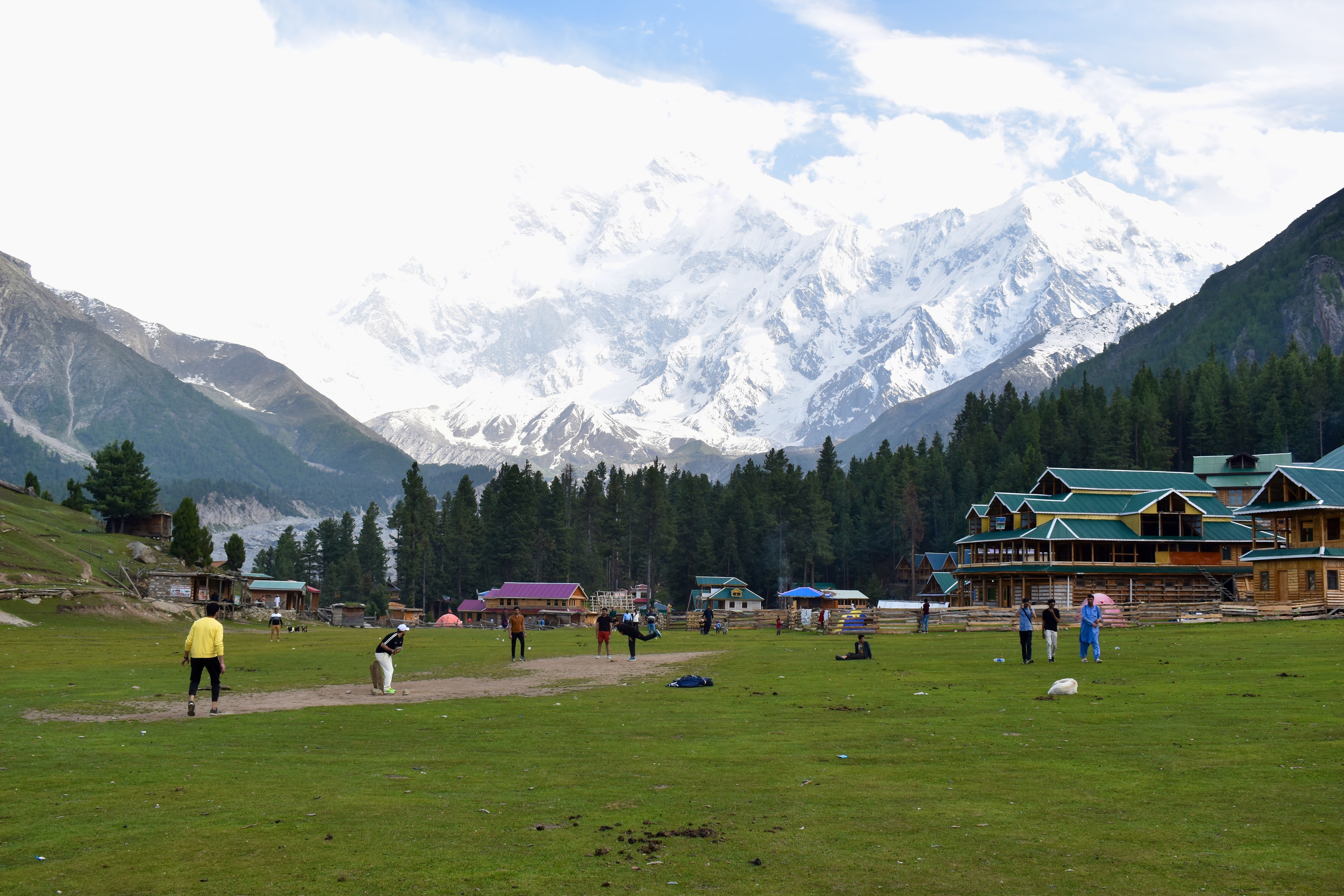
There’s a large green field in the middle of the village where guys were playing cricket, so we watched for a bit. We also walked to the Reflection Pool for photos. Somehow, Nanga Parbat looked twice as massive from here than from our camp. The view from the center of the meadow was incredible.
We wandered a bit more, collected a few mosquito bites, chatted with some Pakistanis, and returned to camp before dinner. The main cabin served up a giant plate of chicken biryani, chana, and chapati. As usual in Pakistan, the portion was big enough for both of us to share.

After dinner, we filtered water, finished packing, and spent more time soaking in the view. We went into the tent after sunset and watched a show before falling asleep. The night was warm, like at Rakaposhi, and we only got disturbed a couple of times—probably by people walking past the viewpoint (not sure what they were looking at in the dark…).
Day 8: Race to Nanga Parbat Base Camp and back to Gilgit
The reason we were in our sleeping bags early last night was because we had an alarm set for 5 am We needed to leave the camp by 6 am at the latest to have enough time for the hike. A few people had warned us—maybe even tried to scare us off—that we’d need two nights at Fairy Meadows to reach the Nanga Parbat Base Camp, as the hike supposedly takes five hours one way. But after checking Mapy.cz, we estimated we could make it in three hours and then take at most the same time back. That would give us a 6-hour hiking window. Our jeep was scheduled to pick us up at 3 pm, and we also needed time to pack up the tent and hike back down later. We started walking just before 6, and since the sun was still hidden behind the peaks, the morning was chilly.
Our first checkpoint was the only other camp on the mountain—Beyal Camp—sometimes referred to as Base Camp #1. The trail led us through a beautiful forest and across a few streams. It really looked like a fairyland. We passed old abandoned cottages half-taken by vegetation that looked like they belonged in a storybook. We made it to Beyal Camp in one hour, already 20 minutes ahead of schedule. We didn’t stop there and continued across a green field filled with large rocks toward the next checkpoint—a place we hadn’t even known existed beforehand.


Just before we got there, we took off a layer as the sun was finally warming us and we were out of the forest. This spot was called Eagle’s Nest—yes, that name again. A hut sat beside a massive stone terrace where we got our first close look at the Rakhiot Glacier. From there, the path led us down along a loose rock scree near the receding glacier. We had to cross two rivers coming from the right, likely fed by the Ganalo Glacier.

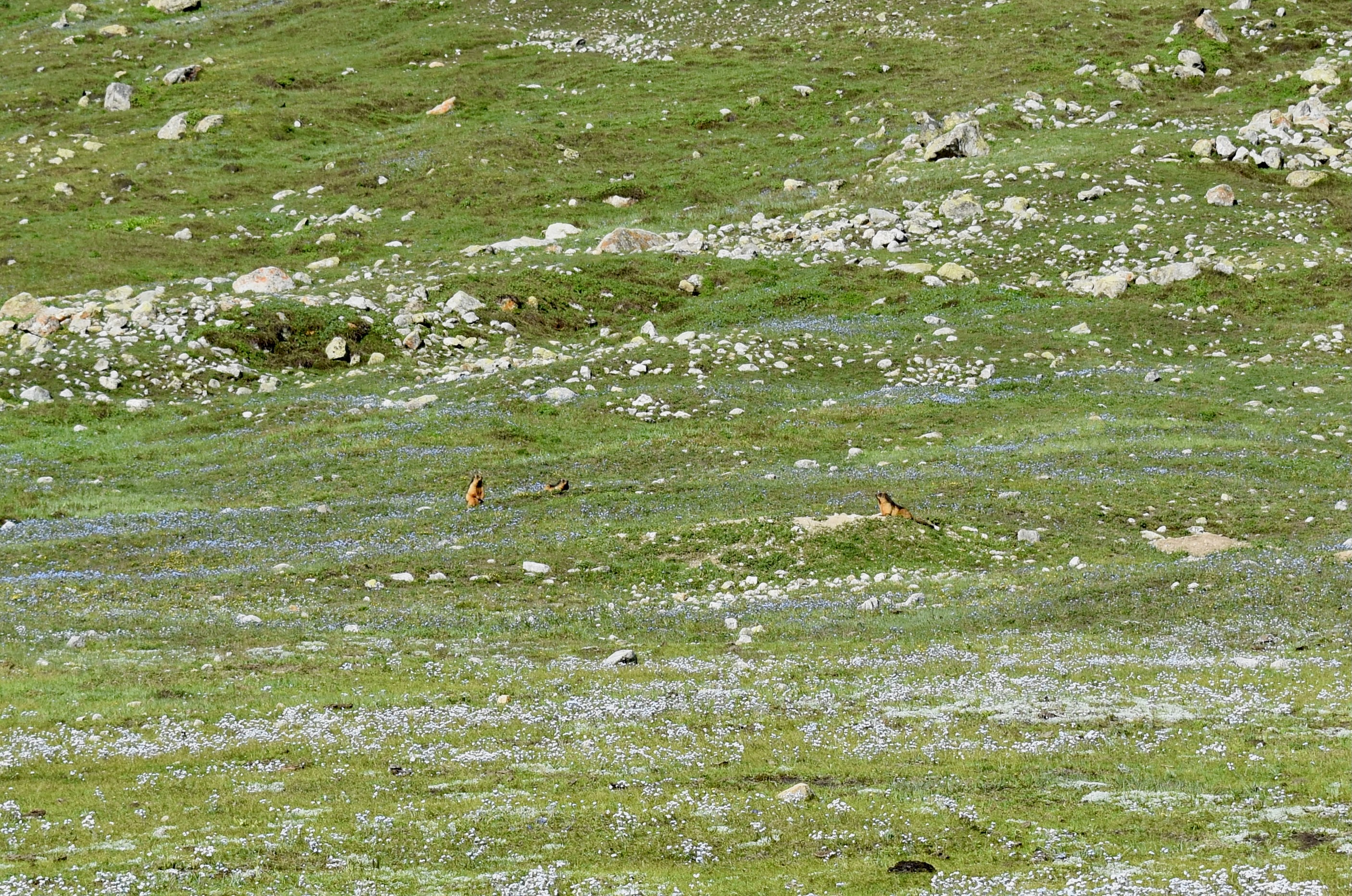
Once past the rivers, the trail went steeply uphill, following a small stream—probably the only other freshwater source aside from Beyal Camp. The climb ended in a bowl-like grassy meadow, one of the most peaceful places we’d seen. Right away, we spotted two yaks lounging on the far side and about five or six marmots (the exact phrase Clare Googled was “Pakistan mountain big squirrels”) staring at us.
We still had one steep hill to climb out of the meadow. At the top, we saw a hut where we had planned to stop for tea, but it was closed. I initially thought this was the base camp, but then we saw hikers in the distance with big rucksacks (they must have camped at the base camp), and when I checked Mapy, I realized the base camp was still 500 meters further.
The actual Nanga Parbat Base Camp was on a wide green field just under the mountain, with some protection from a small adjacent hill. We made it in 2 hours 30 minutes, covering 8.5 km and climbing around 850 meters. We wanted to take a break and soak it all in—we were completely alone there. We decided to climb a bit higher toward the Ganalo Glacier for a better view. We went west up a ridge—there was no path, but the grass was easy to walk on, and cow and horse tracks helped. We gained another 50–100 meters of elevation and found a quiet spot to relax. The view of the glacier wasn’t that great in the end, but it didn’t matter. The weather was perfect—sunny, no wind, and it felt like the right moment to sit down, chill, and eat some oat bars.
Then came my “great” idea: try a different way back by crossing the bottom of the Ganalo Glacier instead of following the scree below. Both paths met again at Eagle’s Nest, and I thought maybe those hikers we saw had gone that way. But once we descended to the glacier, it was obvious how wrong I was—no tracks in the snow, the path was barely visible and broken right from the start. Since this would mean actually crossing the glacier, we made the sensible call to go back up and return the same way we came. That detour, along with the ridge climb, added about an hour to our hike.
Once we were back at the bowl-like meadow, the rest of the hike was easier. We finally met the first group of hikers heading toward the base camp, and after Eagle’s Nest, we met several more—some going to the camp, others just to the viewpoint, and many hanging around Beyal Camp. We took loads of photos and talked to a bunch of people, which was nice—though eventually a little annoying since we were trying to be back by noon to have time for packing and lunch.
The path was gentle and downhill, so we arrived back at our camp with time to spare. The total hike: 18.5 km in 5 hours and 50 minutes. The first thing we did was order lunch and then packed up our tent. We got two fried eggs each, chapati, and hot water for coffee.
We were on our way down around 1 pm A lot of people were hiking up—possibly busier than the day before. Toward the end, we saw two large groups of Pakistanis beginning their hike and even a family with 4 soldiers carrying machine guns escorting them.
We got to the jeeps around 2:30 pm but had to wait as our driver wasn’t there yet. He arrived after about 20 minutes, and we were off—on another nerve-wracking journey. This time felt even worse: I was sitting on the edge of the cliff, and our driver was literally insane. He drove so fast he overtook at least three other jeeps—by honking until they moved, and then squeezing past them just inches from the edge.
Since you’re reading this, we obviously survived. We reached the bottom just after 4 pm, and Mehdi was already waiting for us. We gave a lift to one fella headed to Jaglot, then continued back to Gilgit.
On the way, I asked Mehdi for a hotspot so we could message home that we were okay and check our flight for the next day. We were a bit nervous because flights from Gilgit are known to be frequently canceled and there were rumors of bad weather, but thankfully all looked good—even the forecast.
We arrived in Gilgit around 6 pm and made a quick stop at the exchange office to get some more rupees to pay Mehdi. This time, they had cash and gave an even better rate—275 rupees per USD. We exchanged $150 and went to our hotel, Indus Lodges Gilgit.
We checked in, and I went to pay Mehdi. The final price came to:
- 17,000 PKR for Minapin
- 30,000 PKR for 6-day car rental
- 17,000 PKR for petrol for those 6 days
- → Total: 64,000 PKR (~$250)
We added a tip and petrol money for his return to Skardu and took a photo for his website since we were his first clients for Skardu on Wheels.
The next step was obvious: shower and feast. The hotel had a terrace on the roof overlooking the river, and we could smell BBQ all the way from our room. We ordered a mixed BBQ platter for two, chicken curry, and a bowl of chana mash. The waiter came back and said the manager thought it was too much food for two people. We told him not to worry.
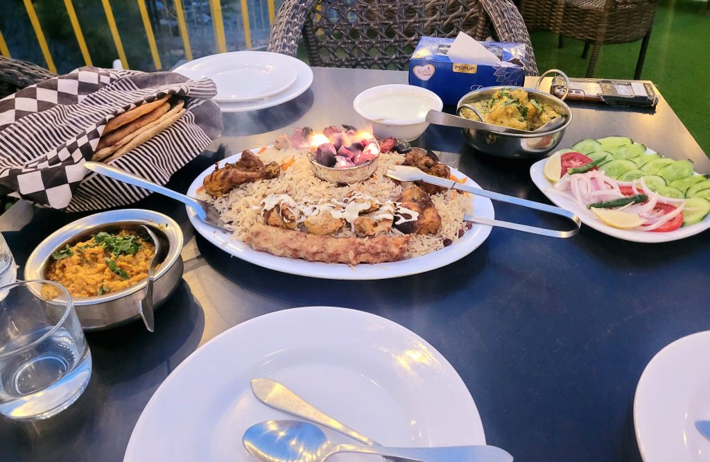
It really was a lot of food, but aside from the Palau rice, we left nothing on the plates. Afterward, we rested our sore legs and full bellies—and left packing for the next day.
Day 9: I think Gilgit Airport is just a scam!
We woke up quite early, with about three hours to spare before we had to leave for the airport—but at least we had loads of time to repack. While we were sorting our stuff, I went to get some hot water upstairs and noticed a few raindrops, but the sky was otherwise clear and there wasn’t even any wind. We checked the internet again—the flight was still scheduled, nothing to worry about. We had another coffee when we were done packing.
Oh, I forgot to mention—our room, otherwise really nice and probably the best stay in Pakistan, had a forgotten piece of meat in an unplugged fridge, and I can’t even describe the smell when I opened it.
Our flight wasn’t until just after 1 pm, but we left the hotel at 10 am and walked to the airport. One last check—the flight still showing as scheduled, all good. It wasn’t far, but the road wasn’t fully paved, and since we still had one rucksack stuck in the Czech Republic, we had to travel with one suitcase. We reached the airport in about 20 minutes and went to look for check-in.
Almost immediately, a soldier in charge of airport security approached us to say that the flight had been canceled. When we got on Wi-Fi, we saw the email—sent five minutes earlier—confirming it. At this point, we were honestly pretty panicked—we had a morning flight the next day from Islamabad to Doha, and now we were stuck in Gilgit. But from here, things actually went surprisingly smoothly.
The soldier helped us contact a taxi company and arranged a driver who would take us all the way to Islamabad. He arrived in about 15 minutes and told us the trip would cost 28,000 rupees (around 100 USD) and take about 12 hours, depending on traffic. We were happy with that and asked to be dropped off straight at the airport since it made no sense to go to our pre-booked accommodation and then mess around with taxis again. Clare even managed to cancel the booking.
We had to make a quick stop at the exchange office again because we only had about 10,000 rupees left. Thankfully, they were open—even on a Friday—and exchanged another $55 for us. There was one more short stop at the taxi company office, where we confirmed the price with the boss, got a receipt, and paid half the fare. One last petrol stop and we were out of Gilgit.
Our driver (ach, what was his name?!) spoke good English, so we chatted while heading back toward Raikot Bridge (Fairy Meadows). The road continued south for about another hour and a half before we turned toward the mountain pass. It was sweltering hot in the valley, so we waited until we were about halfway up the mountainside before stopping for lunch.
The area was busy with cars—this route is a shortcut to Islamabad and a popular holiday spot—but also visibly poor. Kids were selling things, washing cars by the roadside, and so on. We had chicken biryani, chicken karahi, dal, and some bread before getting back on the road.
The road got very twisty near the top of the pass—Babusar Top—and there was still snow on the sides. People were everywhere, taking photos and generally making it feel like an adventure park. Even our driver said he had never seen it so busy, and it might cause problems on the way down.
Note
Babusar Top sits at 4,173 meters above sea level and is the highest point in the Kaghan Valley accessible by road.
We got through quickly and began descending. The southern side wasn’t as steep as the Gilgit side, and the views of the valley and river below were just stunning.
There were more cars now, and the road was often too narrow for two vehicles—especially when we ran into trucks or buses. It felt like we were barely cutting any distance from our long journey. Then came the next complication.
We had hoped to be out of the pass before sunset, but around 7 pm, we reached a queue of cars. We thought there must be an accident or a tight spot on the road, but it turned out to be a bridge bottleneck in a town called Mahandri. The worst part? We were 5 km away from it—and the line wasn’t moving.
And this was Pakistan—so one thing you can always count on: people won’t wait in a queue. The army and police were managing the bridge traffic, but cars kept overtaking via the opposite lane and then getting stuck when the oncoming traffic had nowhere to go. The whole road jammed up repeatedly. Even our driver did it once and got us completely stuck on the wrong side.
This ordeal took about 4 hours. But once we cleared the bridge, we were flying.
One thing I forgot to mention: our driver was a pro. He drove fast, but we never felt unsafe—unlike with Mehdi. We made a quick stop in a town called Balakot for dinner. Clare was so tired she just stayed asleep in the car. I got a plate of chicken biryani and another one to go for her.
Balakot was at the end of the Babusar Pass, so it didn’t take long to reach the M-15 motorway (with the best access road—a dirt field road for 10 km!). I fell asleep soon after we got on the highway and basically woke up an hour later—already near Islamabad.
It took a bit longer to get to the airport, but by 4 in the morning, we were there! It had been almost 18 hours since we found out our flight was canceled, but we made it.
We paid our driver, headed straight to the international terminal, ate biryani, had a coffee and cake, and just hoped our flight to Doha wouldn’t get canceled after all that driving.
Pakistan was just class! We never imagined visiting a place like this and it took our breath away. The nature and the mountains were just beautiful and the people were friendly. We will definitely think about coming back if we get the chance to see more of Pakistan or to do the Patundas Trek.